|
Temescal Butterfield Stage Station
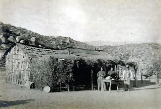
The Temescal Butterfield stage station is the site where the Butterfield Overland Mail stagecoach stopped to deliver mail and get fresh horses in what is now Riverside County, California. The Temescal Butterfield stage station was designated a California Historic Landmark (No.188) on June 20, 1935. The site of the Temescal Butterfield stage station is currently near the City of Corona along Temescal Canyon Road. The first stagecoach with mail and passengers departed Tipton, Missouri on September 15, 1858. The stagecoach stopped at the Temescal Butterfield stage station and arrived at the Butterfield Overland Mail Company Los Angeles Building on October 7, 1858. The Butterfield Overland Mail Company closed in 1861. The Temescal Butterfield stage station was built north of the Temescal Hot Springs, north of Rancho La Laguna station and south of the Chino Rancho station. The Temescal Butterfield stage station was "at the foot of the Temescal hills, a splendid place to camp, w ... [...More Info...] [...Related Items...] OR: [Wikipedia] [Google] [Baidu] |
Bethel Coopwood
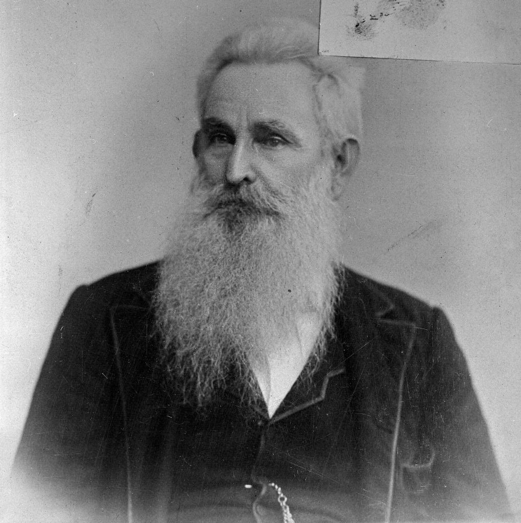
Bethel Coopwood (1827–1907) was born in Alabama, and moved to Texas and was a soldier in the Mexican–American War and an officer in the Confederate Army in the American Civil War. He was a lawyer, judge, and later a historian. Early life, Alabama, Texas Bethel Coopwood was born on May 1, 1827, in Lawrence County, Alabama, son of an early settler, planter and slave holder in that county, David E. Coopwood, and Elfida Crews Coopwood. Following the death of his father in 1846, he moved to Texas. In 1847, he enlisted in Bell's cavalry detachment, of Hay's Regiment of Texas Mounted Volunteers, that served along the Rio Grande frontier in the Mexican–American War. By 1850 his brother Benjamin had settled in Tyler County, Texas. By 1852 his brother David Coopwood had moved to Tyler County also. Southern California In 1854 he, and his two brothers Benjamin and David and their wives, left Texas moving to El Monte in California, where he was admitted to the bar, practicing i ... [...More Info...] [...Related Items...] OR: [Wikipedia] [Google] [Baidu] |
Corona, California
Corona (Spanish for "Crown") is a city in Riverside County, California, United States. At the 2020 census, the city had a population of 157,136, up from 152,374 at the 2010 census. The cities of Norco and Riverside lie to the north and northeast, Chino Hills and Yorba Linda to the northwest, Anaheim to the west, Cleveland National Forest and the Santa Ana Mountains to the southwest, and unincorporated Riverside County along the rest of the city's borders. Downtown Corona is approximately southeast of Downtown Los Angeles and north-northwest of San Diego. Corona, located along the western edge of Southern California's Inland Empire region, is known as the "Circle City" due to Grand Boulevard's circular layout. It is one of the most residential cities in the Inland Empire, but also has a large industrial portion on the northern half, being the headquarters of companies such as Fender Musical Instruments Corporation, Monster Beverage Corporation, and supercar manufacturer ... [...More Info...] [...Related Items...] OR: [Wikipedia] [Google] [Baidu] |
Temescal Valley, California
Temescal Valley (''Temescal'', Spanish for "sweat lodge") is a census-designated place in Riverside County, California. Temescal Valley sits at an elevation of . The 2010 United States census reported Temescal Valley's population was 22,535. History Rancho Temescal Temescal Valley takes its name from the Rancho Temescal established by Leandro Serrano. Serrano received the written permission of the priest of the Mission San Luis Rey de Francia, or of the military commander of San Diego, to occupy the five square league Rancho Temescal on land belonging to Mission of San Luis Rey. He took possession in about 1818 or 1819 under a grant given by Governor José María de Echeandía to Leandro Serrano. The Serrano Boulder (California Historical Landmark (#185), marks the site of the first house erected by Leandro Serrano about May 1824. The grant extended along the Temescal Valley south of present day Corona and encompassed El Cerrito and Lee Lake. The Serrano family held the la ... [...More Info...] [...Related Items...] OR: [Wikipedia] [Google] [Baidu] |
Landmarks Of Riverside County, California
A landmark is a recognizable natural or artificial feature used for navigation, a feature that stands out from its near environment and is often visible from long distances. In modern use, the term can also be applied to smaller structures or features, that have become local or national symbols. Etymology In old English the word ''landmearc'' (from ''land'' + ''mearc'' (mark)) was used to describe a boundary marker, an "object set up to mark the boundaries of a kingdom, estate, etc.". Starting from approx. 1560, this understanding of landmark was replaced by a more general one. A landmark became a "conspicuous object in a landscape". A ''landmark'' literally meant a geographic feature used by explorers and others to find their way back or through an area. For example, the Table Mountain near Cape Town, South Africa is used as the landmark to help sailors to navigate around southern tip of Africa during the Age of Exploration. Artificial structures are also sometimes built to a ... [...More Info...] [...Related Items...] OR: [Wikipedia] [Google] [Baidu] |
California Historical Landmarks
A California Historical Landmark (CHL) is a building, structure, site, or place in California that has been determined to have statewide historical landmark significance. Criteria Historical significance is determined by meeting at least one of these criteria: # The first, last, only, or most significant of its type in the state or within a large geographic region ( Northern, Central, or Southern California); # Associated with an individual or group having a profound influence on the history of California; or # An outstanding example of a period, style, architectural movement or construction; or is the best surviving work in a region of a pioneer architect, designer, or master builder. Other designations California Historical Landmarks numbered 770 and higher are automatically listed in the California Register of Historical Resources. A site, building, feature, or event that is of local (city or county) significance may be designated as a California Point of Historical Interest ... [...More Info...] [...Related Items...] OR: [Wikipedia] [Google] [Baidu] |
List Of California Ranchos
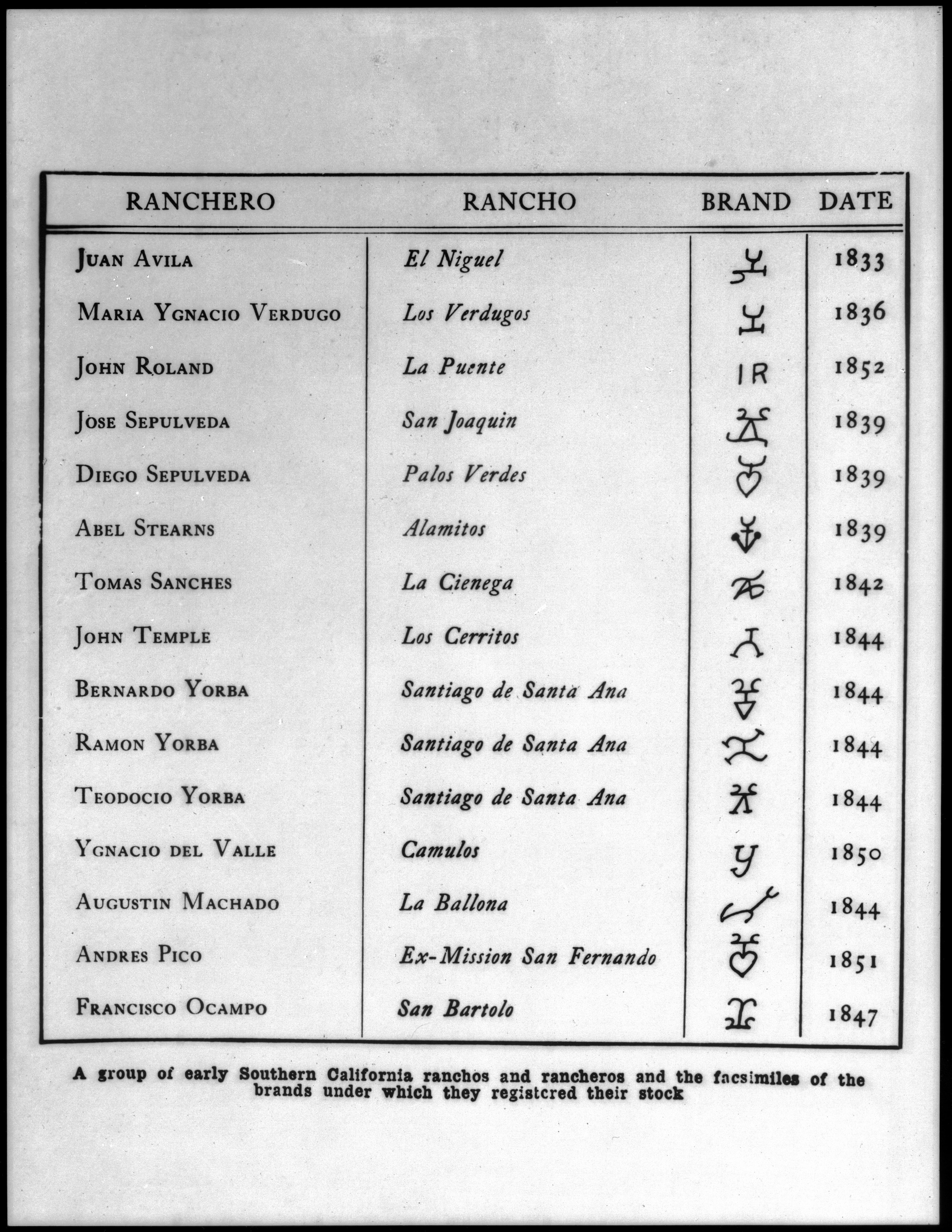
These California land grants were made by Spanish (1784–1821) and Mexican (1822–1846) authorities of Las Californias and Alta California to private individuals before California became part of the United States of America.Shumway, Burgess M.,1988, ''California Ranchos: Patented Private Land Grants Listed by County'', The Borgo Press, San Bernardino, CA, Under Spain, no private land ownership was allowed, so the grants were more akin to free leases. After Mexico achieved independence, the Spanish grants became actual land ownership grants. Following the Mexican–American War, the 1848 Treaty of Guadalupe Hidalgo provided that the land grants would be honored. Alta California ranchos in Mexico From 1773 to 1836, the border between Alta California and Baja California was about 30 miles south of the Mexico–United States border drawn by the Treaty of Guadalupe Hidalgo that ended the Mexican–American War in 1848. Under the Siete Leyes constitutional reforms of 1836, the Alt ... [...More Info...] [...Related Items...] OR: [Wikipedia] [Google] [Baidu] |
California Historical Landmarks In Riverside County, California
List table of the properties and districts listed on the California Historical Landmarks within Riverside County, southern California. :*Note: ''Click the "Map of all coordinates" link to the right to view a Google map of all properties and districts with latitude and longitude coordinates in the table below.'' Listings See also *List of California Historical Landmarks *National Register of Historic Places listings in Riverside County, California References External links NoeHill Travels in California: Historic Sites in Riverside Countyfor a listing of NRHP and California landmarks {{DEFAULTSORT:California Historical Landmarks *List of California Historical Landmarks * Landmarks Landmarks A landmark is a recognizable natural or artificial feature used for navigation, a feature that stands out from its near environment and is often visible from long distances. In modern use, the term can also be applied to smaller structures or f ... .< ... [...More Info...] [...Related Items...] OR: [Wikipedia] [Google] [Baidu] |
San Bernardino County
San Bernardino County (), officially the County of San Bernardino, is a county located in the southern portion of the U.S. state of California, and is located within the Inland Empire area. As of the 2020 U.S. Census, the population was 2,181,654, making it the fifth-most populous county in California and the 14th-most populous in the United States. The county seat is San Bernardino. While included within the Greater Los Angeles area, San Bernardino County is included in the Riverside– San Bernardino–Ontario metropolitan statistical area, as well as the Los Angeles–Long Beach combined statistical area. With an area of , San Bernardino County is the largest county in the contiguous United States by area, although some of Alaska's boroughs and census areas are larger. The county is close to the size of West Virginia. This vast county stretches from where the bulk of the county population resides in three Census County Divisions (Fontana, San Bernardino, and Victorvi ... [...More Info...] [...Related Items...] OR: [Wikipedia] [Google] [Baidu] |
Stage Station
A stage station or relay station, also known as a staging post, a posting station, or a stage stop, is a place where exhausted horses could be replaced by fresh animals, since a long journey was much faster without delays when horses needed rest. Stage is the space between the places known as stations or stops—known to Europeans as posts or relays. Organised long-distance land travel became known as staging or posting. Stagecoaches, post chaises, private vehicles, individual riders and the like followed the already long-established system for messengers, couriers and letter-carriers. Through metonymy the name stage also came to be used for a stagecoach alone. Posting and staging Purpose Until well into the 19th century an overland traveller anxious to reach a destination as fast as possible depended on animals. Systems of arranging a supply of fresh horses to expedite travel along a particular route had been in use at least as far back as the ancient Romans when they were ... [...More Info...] [...Related Items...] OR: [Wikipedia] [Google] [Baidu] |
Rancho Santa Ana Del Chino
Rancho Santa Ana del Chino was a Mexican land grant in the Chino Hills and southwestern Pomona Valley, in present-day San Bernardino County, California. It was granted to Antonio Maria Lugo in 1841 by Mexican Alta California Governor Juan Bautista Alvarado. The name literally means "Santa Ana of the Fair Hair," though there have been statements that the ranch was named for a mission mayordomo, or foreman, who had curly hair, "chino" being also a Spanish word for "curly". The rancho site included the present day cities of Chino and Chino Hills. History In 1841, Antonio Maria Lugo was granted rights the Rancho Santa Ana del Chino on what had been part of the San Gabriel Mission lands used for grazing mission horses and cattle until the California missions were secularized by the Mexican government in the mid-1830s and their lands made available for private settlement. Almost immediately after taking possession and building an adobe house on what is now Boys' Republic in the ... [...More Info...] [...Related Items...] OR: [Wikipedia] [Google] [Baidu] |
Rancho La Laguna (Manriquez)
Rancho La Laguna was a Mexican land grant in present-day Riverside County, California given in 1844 by Governor Manuel Micheltorena to Julian Manriquez. The rancho lands are included in the present day city of Lake Elsinore and Wildomar. At the time of the US Patent, Rancho Laguna was a part of San Diego County. The County of Riverside was created by the California Legislature in 1893 by taking land from both San Bernardino and San Diego Counties. History Julian Manriquez received the land grant in 1844. His adobe ranch house lay at the north end of the west side of the lake. He sold the land to Abel Stearns in 1851. With the cession of California to the United States following the Mexican-American War, the 1848 Treaty of Guadalupe Hidalgo provided that the land grants would be honored. As required by the Land Act of 1851, a claim for Rancho La Laguna was filed with the Public Land Commission in 1852, and the grant was patented to Abel Stearns in 1872. Stearns subsequently s ... [...More Info...] [...Related Items...] OR: [Wikipedia] [Google] [Baidu] |


.jpg)
.jpg)
