|
Tell Bir Dakoue
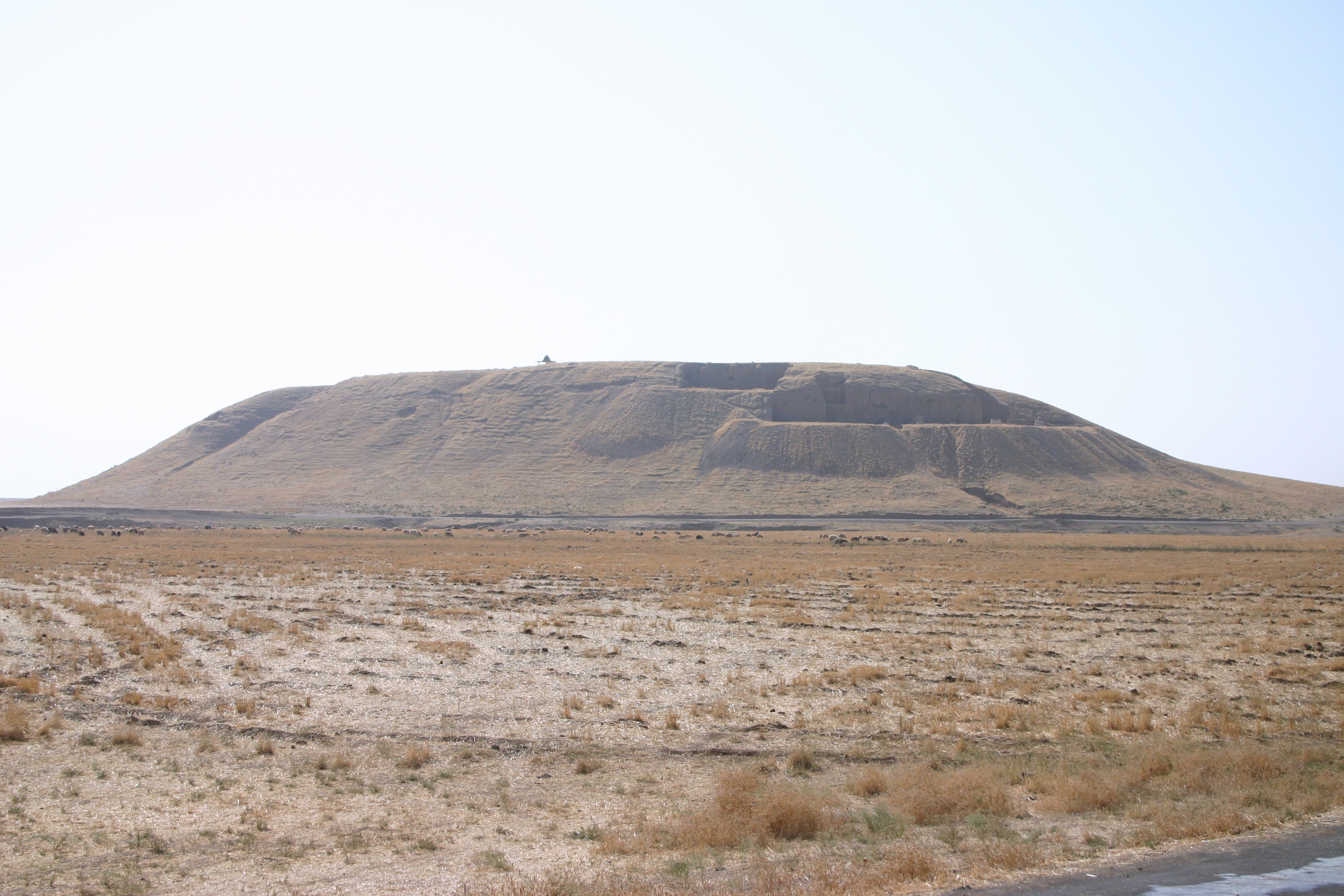
Tell Bir Dakoue is an archaeological site at the junction of the road between Dakoue and Hoch Harime, 1 km north of the spring in the Beqaa Mohafazat A governorate is an administrative division of a state. It is headed by a governor. As English-speaking nations tend to call regions administered by governors either states or provinces, the term ''governorate'' is often used in translation from ... (Governorate). It dates at least to the Early Bronze Age. References {{Portal, Lebanon, History, Asia Baalbek District Bronze Age sites in Lebanon ... [...More Info...] [...Related Items...] OR: [Wikipedia] [Google] [Baidu] |
Dakoue
Dakoue (also spelled Dakoueh, or Dekweh) is a village located southwest of Mejdel Anjar, Lebanon. It is predominantly inhabited by shepherds and farmers. Heavy Neolithic site of the Qaraoun culture There is a Heavy Neolithic archaeological site of the Qaraoun culture located northwest of the village where plentiful Heavy Neolithic flint adzes, axes, debitage and waste material were found along with large amounts of Paleolithic materials. Roman temple Behind the village there are the ruins of a Roman temple that still retains a central courtyard and a front colonnade composed of three columns. The temple was converted into a church and a chapel can be accessed via an opening in the west wall. There is a path leading from the temple to an ancient graveyard with tombs and sarcophagi. George Taylor noted the temple was aligned to the south west and classified it as a Prostylos temple. He noted that the decoration of the window, cornice and capital Capital may refer to: Common ... [...More Info...] [...Related Items...] OR: [Wikipedia] [Google] [Baidu] |
Hoch Harime
Hoch or Höch is a surname. Notable people with the surname include: *Adolf Hoch (1910–1992), Austrian architect * August Hoch (1868–1919), Swiss-born American psychiatrist *Beverly Hoch (born 1951), American opera singer * Daniel Hoch (born 1979), Swedish soccer player * Daniel K. Hoch (1866-1960), American politician * Danny Hoch (born 1970), American actor and writer * Edward D. Hoch (1930–2008), American writer *Edward W. Hoch (1849–1925), American politician *Eva-Maria Hoch (born 1984), Austrian tennis player * Gottfried Höch (1800–1872), German official * Hannah Höch (1889–1978), German artist *Harry Hoch (1887–1981), American baseball player *Heinrich Theodor Höch (1845–1905), German businessman *Homer Hoch (1879–1949), American politician *Hugó Hoch (fl. 1900), Hungarian fencer *James Hoch, microbiologist *James Hoch (poet), American poet *Johann Otto Hoch (1855–1906), German-born American murderer *Joseph Hoch (1815–1874), German lawyer *Lambert An ... [...More Info...] [...Related Items...] OR: [Wikipedia] [Google] [Baidu] |
Bekaa Valley
The Beqaa Valley ( ar, links=no, وادي البقاع, ', Lebanese ), also transliterated as Bekaa, Biqâ, and Becaa and known in classical antiquity as Coele-Syria, is a fertile valley in eastern Lebanon. It is Lebanon's most important farming region. Industry also flourishes in Beqaa, especially that related to agriculture. The Beqaa is located about east of Beirut. The valley is situated between Mount Lebanon to the west and the Anti-Lebanon Mountains to the east. It forms the northeasternmost extension of the Great Rift Valley, which stretches from Syria to the Red Sea. Beqaa Valley is long and wide on average. It has a Mediterranean climate of wet, often snowy winters and dry, warm summers. The region receives limited rainfall, particularly in the north, because Mount Lebanon creates a rain shadow that blocks precipitation coming from the sea. The northern section has an average annual rainfall of , compared to in the central valley. Nevertheless, two rivers o ... [...More Info...] [...Related Items...] OR: [Wikipedia] [Google] [Baidu] |
Tell (archaeology)
In archaeology, a tell or tel (borrowed into English from ar, تَلّ, ', 'mound' or 'small hill'), is an artificial topographical feature, a species of mound consisting of the accumulated and stratified debris of a succession of consecutive settlements at the same site, the refuse of generations of people who built and inhabited them, and of natural sediment. (Very limited snippet view).Matthews (2020)Introduction and Definition/ref> Tells are most commonly associated with the ancient Near East, but they are also found elsewhere, such as Southern and parts of Central Europe, from Greece and Bulgaria to Hungary and SpainBlanco-González & Kienlin, eds (2020), 6th page of chapter 1, see map. and in North Africa. Within the Near East, they are concentrated in less arid regions, including Upper Mesopotamia, the Southern Levant, Anatolia and Iran, which had more continuous settlement. Eurasian tells date to the Neolithic,Blanco-González & Kienlin, eds (2020), 2nd page of chapter 1 ... [...More Info...] [...Related Items...] OR: [Wikipedia] [Google] [Baidu] |
Early Bronze Age
The Bronze Age is a historic period, lasting approximately from 3300 BC to 1200 BC, characterized by the use of bronze, the presence of writing in some areas, and other early features of urban civilization. The Bronze Age is the second principal period of the three-age system proposed in 1836 by Christian Jürgensen Thomsen for classifying and studying ancient societies and history. An ancient civilization is deemed to be part of the Bronze Age because it either produced bronze by smelting its own copper and alloying it with tin, arsenic, or other metals, or traded other items for bronze from production areas elsewhere. Bronze is harder and more durable than the other metals available at the time, allowing Bronze Age civilizations to gain a technological advantage. While terrestrial iron is naturally abundant, the higher temperature required for smelting, , in addition to the greater difficulty of working with the metal, placed it out of reach of common use until the end of ... [...More Info...] [...Related Items...] OR: [Wikipedia] [Google] [Baidu] |
Godefroy Zumoffen
Reverend Father Godefroy Zumoffen (1848 in France – 1928) was a French Jesuit archaeologist and geologist notable for his work on prehistory in Lebanon. He is known particularly for pioneering Lebanese archaeology, and for discovering several sites including the Antelias cave Antelias Cave was a large cave located east of Antelias, northeast of Beirut close to the wadi of Ksar Akil. It was discovered by Heidenborg in 1833. Godefroy Zumoffen made an excavation in 1893, finding an Aurignacian industry amongst large qua .... He produced the first geological map of Lebanon and authored a book about its prehistory, ''La Phénicie avant les phéniciens: l'âge de la pierre''. Notes References External links Biography (in French) - Lebanese Museum of Prehistory, Saint Joseph University Website {{DEFAULTSORT:Zumoffen, Godefroy 20th-century French Jesuits French Roman Catholic missionaries French archaeologists 1848 births 1928 deaths French geologists 19th-century ... [...More Info...] [...Related Items...] OR: [Wikipedia] [Google] [Baidu] |
Lorraine Copeland
Lorraine Copeland (born Elizabeth Lorraine Adie, 1921April 2013) was a British archaeologist specialising in the Palaeolithic period of the Near East. She was a secret agent with the Special Operations Executive during World War II. Early life In 1921, Copeland was born as Elizabeth Lorraine Adie in Edinburgh, Scotland. Her father was a neurosurgeon on Harley Street in London, and she was privately educated at Wycombe Abbey girls' school in Buckinghamshire. Special Operations Executive Copeland worked for British Intelligence during the Second World War, in the Special Operations Executive. She met her American husband, Miles Copeland, Jr., during this period, when he was based in the UK undertaking counter-intelligence for the US Army Counter Intelligence Corps. They married on 25 September 1942 and soon afterwards Miles' work took them to the Near East, particularly Syria, Lebanon and Egypt, and it was whilst in this area that Copeland first developed her interest in archaeo ... [...More Info...] [...Related Items...] OR: [Wikipedia] [Google] [Baidu] |
Beqaa Governorate
Beqaa ( ') is a governorate in Lebanon. Districts Since 2014, Beqaa Governorate contains three districts: * West Beqaa * Rashaya * Zahle A law was passed in 2003 to separate Baalbek District and Hermel District from Beqaa Governorate to form a new governorate, Baalbek-Hermel Governorate french: Baalbek-Hermel , settlement_type = Governorate , image_skyline = Baalbek (4594513263).jpg , image_caption = Baalbek , image_flag = , image_seal = , image_shield = , image .... Implementation of Baalbek-Hermel began in 2014 with the appointment of its first governor. Demographics According to voter registration data, the governorate is approximately 41% Christian to 52% Muslim to 7% Druze (313505 voters). In the district (qadaa) of Zahlé (meaning an area much greater than that of the city proper), Christians form a majority of 55% of voters (172555 in total). In the district of West Beqaa-Rashaya (the two are co ... [...More Info...] [...Related Items...] OR: [Wikipedia] [Google] [Baidu] |
Mohafazat
A governorate is an administrative division of a state. It is headed by a governor. As English-speaking nations tend to call regions administered by governors either states or provinces, the term ''governorate'' is often used in translation from non-English-speaking administrations. The most common usage are as a translation of Persian "Farmandari" or the Arabic ''Muhafazah''. It may also refer to the '' guberniya'' and '' general-gubernatorstvo'' of Imperial Russia or the '' gobiernos'' of Imperial Spain. Arab countries The term governorate is widely used in Arab countries to describe an administrative unit. Some governorates combine more than one ''Muhafazah''; others closely follow traditional boundaries inherited from the Ottoman Empire's ''vilayet'' system. With the exception of Tunisia, all translations into the term governorate originate in the Arabic word ''muhafazah''. *Governorates of Bahrain *Governorates of Egypt *Governorates of Iraq (official translation, someti ... [...More Info...] [...Related Items...] OR: [Wikipedia] [Google] [Baidu] |
Baalbek District
Baalbek District ( ar, قضاء بعلبك) is an administrative district in the Baalbek-Hermel Governorate of the Republic of Lebanon, having the city Baalbek as its capital. It is by far the largest district in the country comprising a total of . Major towns of the district are Hallanieh, Temnin el Fawka, Chmestar, Duris, Jdeide, Kasarnaba and Bodai Bodai ( ar, بوداي) is a Lebanese town in Baalbek District, Baalbek-Hermel Governorate, situated west of the Litani River in the foothills of Mount Lebanon. Bodai is located 15 km (9 miles) northwest of the ancient city of Baalbek an ... Districts of Lebanon {{lebanon-geo-stub ... [...More Info...] [...Related Items...] OR: [Wikipedia] [Google] [Baidu] |


