|
Telaga Waja River
The Telaga Waja is a river which is situated in eastern Bali, Indonesia. It rises on the slope of Mount Abang and passes through towns and wilderness slopes along the region of Rendang Village, reaching the sea in Klungkung Regency. Hydrology The Telaga Waja river is mainly located at the District of Rendang, Karangasem Regency, eastern part of Bali, the second in length after the Ayung River. The water comes from several springs in the mountains near Mount Agung, the highest mountain in Bali and considered holy by Hindu native people, such as Lipang, Arca and Telaga Waja springs. Also numerous smaller fountains flow into Telaga Waja, like the Yeh Sah River that sprung out of natural springs. The combination of tributaries and springs contributes to a high water debit, which is used by the local government for drinking water supply. Tourist attractions along the river are very popular, in particular, rafting. [...More Info...] [...Related Items...] OR: [Wikipedia] [Google] [Baidu] |
Indonesia
Indonesia, officially the Republic of Indonesia, is a country in Southeast Asia and Oceania between the Indian and Pacific oceans. It consists of over 17,000 islands, including Sumatra, Java, Sulawesi, and parts of Borneo and New Guinea. Indonesia is the world's largest archipelagic state and the 14th-largest country by area, at . With over 275 million people, Indonesia is the world's fourth-most populous country and the most populous Muslim-majority country. Java, the world's most populous island, is home to more than half of the country's population. Indonesia is a presidential republic with an elected legislature. It has 38 provinces, of which nine have special status. The country's capital, Jakarta, is the world's second-most populous urban area. Indonesia shares land borders with Papua New Guinea, East Timor, and the eastern part of Malaysia, as well as maritime borders with Singapore, Vietnam, Thailand, the Philippines, Australia, Palau, and India ... [...More Info...] [...Related Items...] OR: [Wikipedia] [Google] [Baidu] |
Bali
Bali () is a province of Indonesia and the westernmost of the Lesser Sunda Islands. East of Java and west of Lombok, the province includes the island of Bali and a few smaller neighbouring islands, notably Nusa Penida, Nusa Lembongan, and Nusa Ceningan to the southeast. The provincial capital, Denpasar, is the most populous city in the Lesser Sunda Islands and the second-largest, after Makassar, in Eastern Indonesia. The upland town of Ubud in Greater Denpasar is considered Bali's cultural centre. The province is Indonesia's main tourist destination, with a significant rise in tourism since the 1980s. Tourism-related business makes up 80% of its economy. Bali is the only Hindu-majority province in Indonesia, with 86.9% of the population adhering to Balinese Hinduism. It is renowned for its highly developed arts, including traditional and modern dance, sculpture, painting, leather, metalworking, and music. The Indonesian International Film Festival is held every year in Bal ... [...More Info...] [...Related Items...] OR: [Wikipedia] [Google] [Baidu] |
Klungkung Regency
Klungkung Regency is the smallest regency (''kabupaten'') on Bali, Indonesia. It has an area of 315 km2 and had a population at the 2010 Census of 170,543 which increased to 206,925 at the Census of 2020. The administrative centre for the regency (and for Klungkung District within the regency) is in the town of Semarapura. Semarapura town is easily reached from Gianyar via the highway. The regency is famous for its classic Balinese paintings which mostly depict the story of epics such as Mahabharata or Ramayana. These classical style paintings come from the frescoes of the Balinese palaces, and can also be found at Klungkung Palace in the downtown area. Semarajaya Museum is also located in the area. Some 64.4% of the land area of Klungkung is made of the offshore islands of Nusa Penida, Nusa Ceningan, Nusa Lembongan and eleven smaller islands, which together form Nusa Penida District, of which the town of Sampalan is the administrative centre; the other three districts lie ... [...More Info...] [...Related Items...] OR: [Wikipedia] [Google] [Baidu] |
Rough Guides
Rough Guides Ltd is a British travel guide book and reference publisher, which has been owned by APA Publications since November 2017. In addition to publishing guidebooks, the company also provides a tailor-made trips service based on customers’ individual criteria. The Rough Guides travel titles cover more than 200 destinations beginning with the 1982 ''Rough Guide to Greece'', a book conceived by Mark Ellingham, who was dissatisfied with the polarisation of existing guidebooks between cost-obsessed student guides and "heavyweight cultural tomes". Initially aimed at low-budget backpackers, the guidebooks have incorporated more expensive recommendations since the early 1990s, and are now marketed to travellers on all budgets. Since the late 1990s the books have contained colour printing. Much of the books' travel content is also available online. Penguin became responsible for sales and distribution in 1992, acquiring a majority stake in 1996 and buying Rough Guides outrig ... [...More Info...] [...Related Items...] OR: [Wikipedia] [Google] [Baidu] |
Karangasem Regency
Karangasem Regency (Indonesian: ''Kabupaten Karangasem'') is a regency (''kabupaten'') of Bali, Indonesia. It covers the east part of Bali, has an area of 839.54 km2 and had a population of 396,487 at the 2010 Census which rose to 492,402 at the 2020 Census. Its regency seat is the town of Amlapura. Karangasem was devastated when Mount Agung erupted in 1963, killing 1,900 people. Karangasem was a kingdom before Bali was conquered by the Dutch. Administrative districts The regency is divided into eight districts (''kecamatan''), tabulated below with their areas and population totals at the 2010 Census and the 2020 Census. The table also includes the number of administrative villages (rural ''desa'' and urban ''kelurahan'') in each district, and its postal codes. Note: (a) including 6 small offshore islands. Tourism Interesting places include: * The major Pura Besakih Hindu temple, sometimes called the Mother Temple of Besakih. * Mount Agung, the highest peak in ... [...More Info...] [...Related Items...] OR: [Wikipedia] [Google] [Baidu] |
Ayung River
The Ayung River is the longest river on the Indonesian island of Bali. It runs 68.5 km from the northern mountain ranges, passing the Bangli, Badung, Gianyar regencies and the city of Denpasar, before discharging into the Badung Strait at Sanur.Tukad Ayung at Geonames.org (cc-by); Last updated 2012-01-17; Database dump downloaded 2015-11-27 The river is famous for white water rafting.Sungai Ayung tempat Rafting di Bali - Bali Tours Club. Accessed August 2017. Hydrology Thedrainage basin
[...More Info...] [...Related Items...] OR: [Wikipedia] [Google] [Baidu] |
Mount Agung
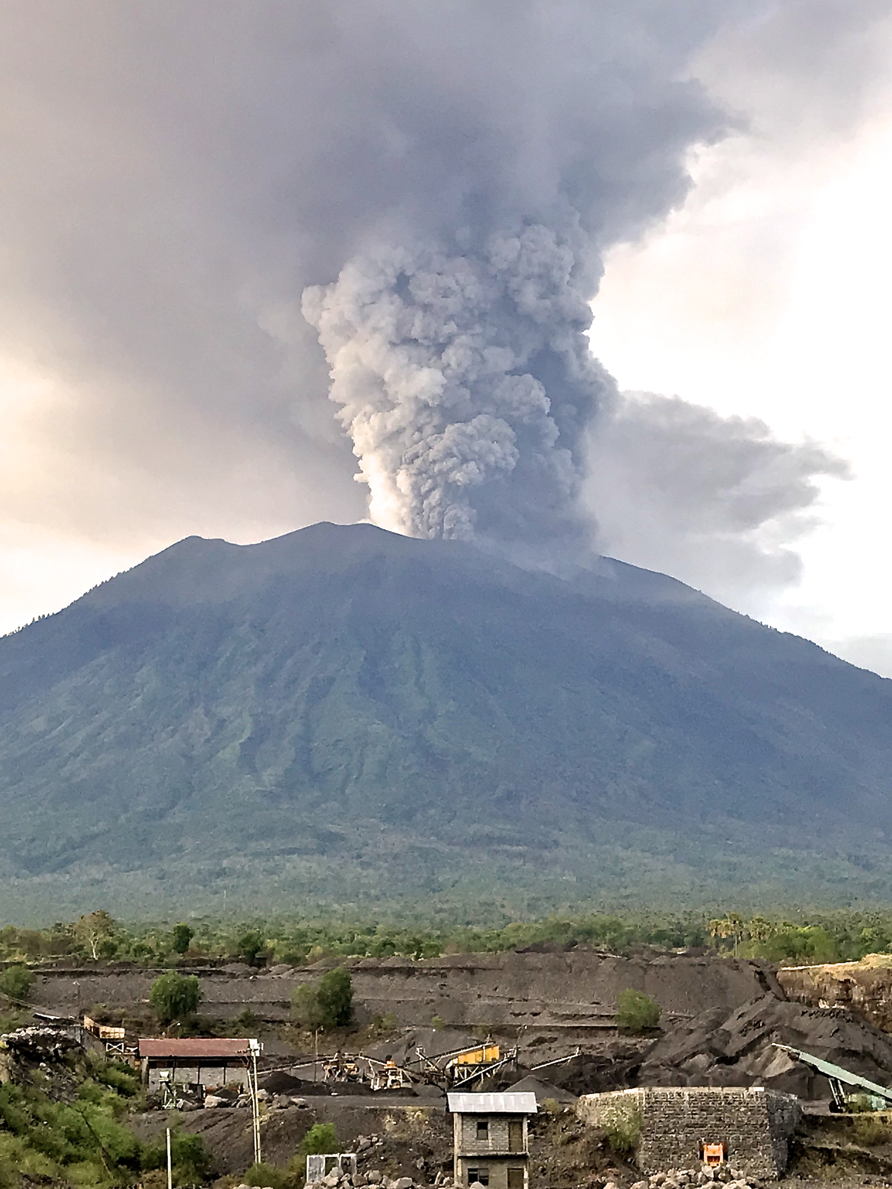
Mount Agung ( id, Parwata Agung; ban, ᬕᬦ ᬆᬕ) is an active volcano in Bali, Indonesia, southeast of Mount Batur volcano, also in Bali. It is the highest point on Bali, and dominates the surrounding area, influencing the climate, especially rainfall patterns. From a distance, the mountain appears to be perfectly conical. From the peak of the mountain, it is possible to see the peak of Mount Rinjani on the nearby island of Lombok, to the east, although both mountains are frequently covered in clouds. Agung is a stratovolcano, with a large and deep crater. Its most recent eruptions occurred from 2017–2019. History of eruptions 1843 eruption Agung erupted in 1843, as recorded in a report by Heinrich Zollinger: 1963–64 eruption The eruption of 1963 was one of the largest and most devastating eruptions in Indonesia's history. On February 18, 1963, local residents heard loud explosions and saw clouds rising from the crater of Mount Agung. On February 24, lava beg ... [...More Info...] [...Related Items...] OR: [Wikipedia] [Google] [Baidu] |
Tropical Rainforest Climate
A tropical rainforest climate, humid tropical climate or equatorial climate is a tropical climate sub-type usually found within 10 to 15 degrees latitude of the equator. There are some other areas at higher latitudes, such as the coast of southeast Florida, USA, and Okinawa, Japan that fall into the tropical rainforest climate category. They experience high mean annual temperatures, small temperature ranges, and rain that falls throughout the year. Regions with this climate are typically designated ''Af'' by the Köppen climate classification. A tropical rainforest climate is typically hot, very humid, and wet. Description Tropical rain forests have a type of tropical climate in which there is no dry season—all months have an average precipitation value of at least . There are no distinct wet or dry seasons as rainfall is high throughout the months. One day in a tropical rainforest climate can be very similar to the next, while the change in temperature between day and night ... [...More Info...] [...Related Items...] OR: [Wikipedia] [Google] [Baidu] |
List Of Rivers Of Bali ...
List of rivers flowing in the island of Bali, Indonesia.''Map of Indonesia''. Peta Indonesia. Wawasan Nusantara. CV. Indo Prima Sarana. Accessed 29 Juli 2017. In alphabetical order See also * List of bodies of water in Bali * List of rivers of Indonesia * List of rivers of Lesser Sunda Islands References {{Rivers in Indonesia Bali Bali Bali () is a province of Indonesia and the westernmost of the Lesser Sunda Islands. East of Java and west of Lombok, the province includes the island of Bali and a few smaller neighbouring islands, notably Nusa Penida, Nusa Lembongan, and ... [...More Info...] [...Related Items...] OR: [Wikipedia] [Google] [Baidu] |
List Of Rivers Of Indonesia
This is a list of rivers in Indonesia.''Map of Indonesia''. Peta Indonesia. Wawasan Nusantara. CV. Indo Prima Sarana. Accessed 29 Juli 2017. By island This list is arranged by island in alphabetical order, with respective tributaries indented under each larger stream's name. Ambon * Sikula Bali Buru * Waeapo Flores Java Kalimantan : ''Below are the rivers in the Indonesian territory of Borneo (Kalimantan)'' Papua Seram Sulawesi * ''Tamborasi River'' Sumatra Sumba Sumbawa West Timor West Timor ( id, Timor Barat) is an area covering the western part of the island of Timor, except for the district of Oecussi-Ambeno (an East Timorese exclave). Administratively, West Timor is part of East Nusa Tenggara Province, Indonesia. The ca ... By province Notes and references Sources *Rand McNally, ''The New International Atlas'', 1993. GEOnet Names Server [...More Info...] [...Related Items...] OR: [Wikipedia] [Google] [Baidu] |
Rivers Of Bali
This is a list of significant lakes and rivers on the island of Bali, Indonesia. A *Ayung River is a river that rises near Penulisan, on the rim of the Batur crater, and flows almost due south, passing west of Ubud in a deep gorge (overlooked by several five-star resorts) and emptying into the Badung Strait just north of Sanur. The Ayung is Bali's longest river, measuring approximately 75 kilometers from source to mouth. It is popular with white-water rafters, but its rapids do not exceed Level III. The Ayung has a relatively small drainage area, as most of its tributaries run in parallel valleys. B * Tukad Balian is a river that rises on the western slopes of Gunung Batukaru and flows in a southward curve to meet the Bali Strait. It has a length of approximately 33 km. * Danau Batur is a crater lake that fills the south-eastern side of the Batur caldera. It is Bali's largest lake and has an area of approximately 18 square kilometers. Just as Gunung Agung is revered b ... [...More Info...] [...Related Items...] OR: [Wikipedia] [Google] [Baidu] |


