|
Teiaiagon
Teiaiagon was an Iroquoian village on the east bank of the Humber River in what is now the York district of Toronto, Ontario, Canada. It was located along the Toronto Carrying-Place Trail. The site is near the current intersection of Jane Street and Annette Street, at which is situated the community of Baby Point. The name means "It crosses the stream." History Percy Robinson's ''Toronto During the French Regime'' shows Teiaiagon as being a jointly occupied village of Seneca and Mohawk. Helen Tanner's ''Atlas of Great Lakes Indian History'' describes Teiaiagon as a Seneca village around the years 1685-1687, although it existed before that time, and as a Mississauga village around 1696. Étienne Brûlé passed through Teiaiagon in 1615. The village was on an important route for the developing fur trade industry, and it was also "surrounded by horticultural fields". Williamson 2008: 51 It was said to be about "a day's journey from the Toronto Lake, our present Lake Simcoe". On ... [...More Info...] [...Related Items...] OR: [Wikipedia] [Google] [Baidu] |
Baby Point
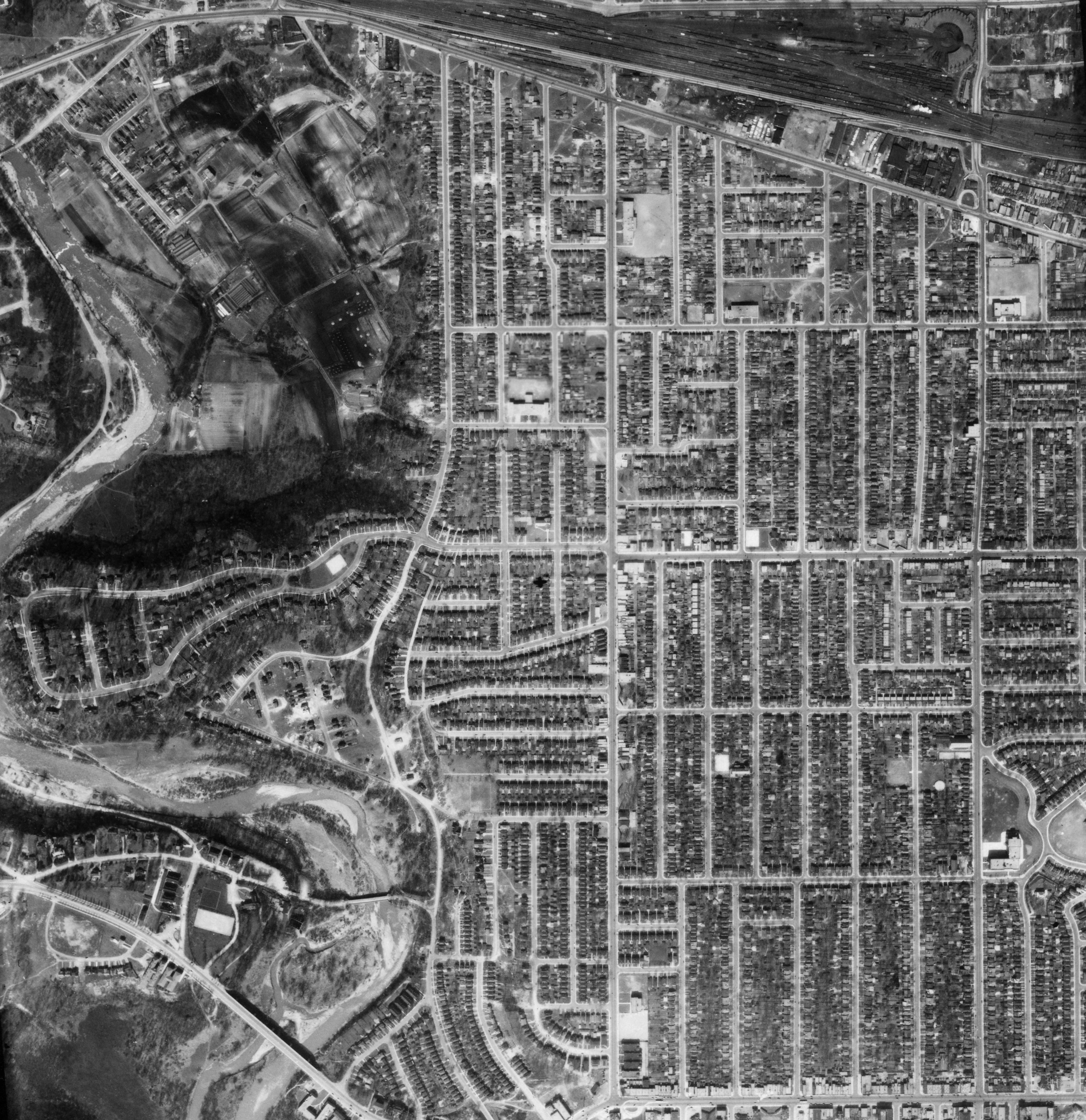
Baby Point is a residential neighbourhood in the York district of Toronto, Ontario, Canada. It is bounded on the west by the Humber River from south of Baby Point Crescent to St. Marks Road, east to Jane Street and Jane Street south to Raymond Avenue and Raymond Avenue west to the Humber. It is within the city-defined neighbourhood of 'Lambton-Baby Point.' Baby Point is within the proximity of Jane station. The neighbourhood was at one time an Iroquois village, called Teiaiagon. The village had a population of 5000 at its peak. The village was burnt to the ground in a French Army attack in 1687. In the 19th century, lawyer James Baby bought the land from the Upper Canada government, which had bought it as part of the Toronto Purchase. The land was developed into the current neighbourhood in the early 20th century. The name is pronounced by locals as "Bobby" or "Babby"to rhyme with tabby or cabbiein an approximation of how James Baby pronounced his surname. History The Baby Poin ... [...More Info...] [...Related Items...] OR: [Wikipedia] [Google] [Baidu] |
York, Toronto
York is a district and former city within Toronto, Ontario, Canada. It is located northwest of Old Toronto, southwest of North York and east of Etobicoke, where it is bounded by the Humber River. The district had a recorded population of 145,662 in 2016. As a separate city, it was one of six municipalities that amalgamated in 1998 to form the current city of Toronto. The City of York was created by the amalgamation of several villages, including the present-day neighbourhoods of Lambton Mills and Weston. The city has a diversified character and is home to a number of Portuguese, Jamaican and Latin American neighbourhoods. History Teiaiagon, settled by the Iroquois on the eastern bank of the Humber River, where Baby Point is now, was the oldest known settlement on the land that would later become York Township. York Township was incorporated by Canada West in 1850 (Canada West later became Ontario in 1867, due to Confederation), bounded in the west by the Humber River, in ... [...More Info...] [...Related Items...] OR: [Wikipedia] [Google] [Baidu] |
Humber River (Ontario)
The Humber River ( oj, Gabekanaang-ziibi, p=Gabekanaang-ziibi, ''meaning: "little thundering waters"'') is a river in Southern Ontario, Canada. It is in the Great Lakes Basin, is a tributary of Lake Ontario and is one of two major rivers on either side of the city of Toronto, the other being the Don River to the east. It was designated a Canadian Heritage River on September 24, 1999. The Humber collects from about 750 creeks and tributaries in a fan-shaped area north of Toronto that encompasses portions of Dufferin County, the Regional Municipality of Peel, Simcoe County, and the Regional Municipality of York. The main branch runs for about from the Niagara Escarpment in the northwest, while another major branch, known as the East Humber River, starts at Lake St. George in the Oak Ridges Moraine near Aurora to the northeast. They join north of Toronto and then flow in a generally southeasterly direction into Lake Ontario at what was once the far western portions of the city. Show ... [...More Info...] [...Related Items...] OR: [Wikipedia] [Google] [Baidu] |
Toronto
Toronto ( ; or ) is the capital city of the Canadian province of Ontario. With a recorded population of 2,794,356 in 2021, it is the most populous city in Canada and the fourth most populous city in North America. The city is the anchor of the Golden Horseshoe, an urban agglomeration of 9,765,188 people (as of 2021) surrounding the western end of Lake Ontario, while the Greater Toronto Area proper had a 2021 population of 6,712,341. Toronto is an international centre of business, finance, arts, sports and culture, and is recognized as one of the most multicultural and cosmopolitan cities in the world. Indigenous peoples have travelled through and inhabited the Toronto area, located on a broad sloping plateau interspersed with rivers, deep ravines, and urban forest, for more than 10,000 years. After the broadly disputed Toronto Purchase, when the Mississauga surrendered the area to the British Crown, the British established the town of York in 1793 and later designat ... [...More Info...] [...Related Items...] OR: [Wikipedia] [Google] [Baidu] |
Toronto Carrying-Place Trail
The Toronto Carrying-Place Trail, also known as the Humber Portage and the Toronto Passage, was a major portage route in Ontario, Canada, linking Lake Ontario with Lake Simcoe and the northern Great Lakes. The name comes from the Mohawk term ''toron-ten'', meaning "the place where the trees grow over the water", an important landmark on Lake Simcoe through which the trail passed. Route From Lake Ontario, the trail ran northward along the eastern bank of the Humber River. It forked at Woodbridge, with one path crossing the east branch of the Humber and running along the west side of the river to the vicinity of Kleinburg, where it crossed the river again. This trail was probably used during the seasons when the water was low enough to ford. The other path of the fork followed the east side of the river and angled cross-country to King Creek, joining the other fork before crossing the river near Nobleton, some north of Lake Ontario. From there it runs north over the Oak Ridges ... [...More Info...] [...Related Items...] OR: [Wikipedia] [Google] [Baidu] |
Lake Simcoe
Lake Simcoe is a lake in southern Ontario, Canada, the fourth-largest lake wholly in the province, after Lake Nipigon, Lac Seul, and Lake Nipissing. At the time of the first European contact in the 17th century the lake was called ''Ouentironk'' ("Beautiful Water") by the native Wendat/Ouendat (Huron) people. It was also known as ''Lake Taronto'' until it was renamed by John Graves Simcoe, the first Lieutenant-Governor of Upper Canada, in memory of his father, Captain John Simcoe of the Royal Navy. In Anishinaabemowin, the ancestral language of the First Nations living around this lake, namely Anishinaabek of Rama and Georgina Island First Nations, Lake Simcoe is called Zhooniyaang-zaaga'igan, meaning "Silver Lake". Toponymy Lake Simcoe's name was given by John Graves Simcoe in 1793 in memory of his father, Captain John Simcoe. Captain Simcoe was born on 28 November 1710, in Staindrop, in County Durham, northeast England, and served as an officer in the Royal Navy, dying of pneu ... [...More Info...] [...Related Items...] OR: [Wikipedia] [Google] [Baidu] |
Longhouse
A longhouse or long house is a type of long, proportionately narrow, single-room building for communal dwelling. It has been built in various parts of the world including Asia, Europe, and North America. Many were built from timber and often represent the earliest form of permanent structure in many cultures. Types include the Neolithic long house of Europe, the Norman Medieval Longhouses that evolved in Western Briton (''Tŷ Hir)'' and Northern France (''Longère)'' and the various types of longhouse built by different cultures among the indigenous peoples of the Americas. Europe *The Neolithic long house type was introduced with the first farmers of central and western Europe around 5000 BCE, 7,000 years ago. These were farming settlements built in groups of six to twelve and were home to large extended families and kin. *The Germanic cattle-farmer longhouses emerged along the southwestern North Sea coast in the third or fourth century BCE and may be the ancestors of sever ... [...More Info...] [...Related Items...] OR: [Wikipedia] [Google] [Baidu] |
Fort Frontenac
Fort Frontenac was a French trading post and military fort built in July 1673 at the mouth of the Cataraqui River where the St. Lawrence River leaves Lake Ontario (at what is now the western end of the La Salle Causeway), in a location traditionally known as Cataraqui. It is the present-day location of Kingston, Ontario, Canada. The original fort, a crude, wooden palisade structure, was called Fort Cataraqui but was later named for Louis de Buade de Frontenac, Governor of New France who was responsible for building the fort. It was abandoned and razed in 1689, then rebuilt in 1695. The British destroyed the fort in 1758 during the Seven Years' War and its ruins remained abandoned until the British took possession and reconstructed it in 1783. In 1870–71 the fort was turned over to the Canadian military, who continue to use it. History Establishment and early use The intent of Fort Frontenac was to control the lucrative fur trade in the Great Lakes Basin to the west and the Ca ... [...More Info...] [...Related Items...] OR: [Wikipedia] [Google] [Baidu] |
Brigantine
A brigantine is a two-masted sailing vessel with a fully square-rigged foremast and at least two sails on the main mast: a square topsail and a gaff sail mainsail (behind the mast). The main mast is the second and taller of the two masts. Older usages are looser; in addition to the rigorous definition above (attested from 1695), the ''Oxford English Dictionary'' has about 1525 definitions of "a small vessel equipped both for sailing and rowing, swifter and more easily manœuvred than larger ships" and "(loosely) various kinds of foreign sailing and rowing vessels, as the galleon, galliot, etc." Modern American definitions include vessels without the square sails on the main mast. Mediterranean brigantines In the Mediterranean Basin during the 13th century, a brigantine referred to a sail- and oar-driven war vessel. It was lateen rigged on two masts and had between eight and twelve oars on each side. Its speed, maneuverability, and ease of handling made it a favourite of Mediter ... [...More Info...] [...Related Items...] OR: [Wikipedia] [Google] [Baidu] |
Récollets
The Recollects (french: Récollets) were a French reform branch of the Friars Minor, a Franciscan order. Denoted by their gray habits and pointed hoods, the Recollects took vows of poverty and devoted their lives to prayer, penance, and spiritual reflection. Today, they are best known for their presence as missionaries in various parts of the world, most notably in early Canada. The order had its origins in the 16th century. Officially named the "Order of Friars Minor Recollect", they used the post-nominal initials ''O.F.M. Rec.'' ( la, Ordo fratrum minorum recollectorum)"Order of Friars Minor Recollect (O.F.M. Rec.) - Récollets" ''GCatholic.org''. Gabriel Chow. Retrieved February 29, 2016 or ''O.M.R.'' (). In 1897, |
Louis Hennepin
Father Louis Hennepin, O.F.M. baptized Antoine, (; 12 May 1626 – 5 December 1704) was a Belgian Roman Catholic priest and missionary of the Franciscan Recollet order (French: ''Récollets'') and an explorer of the interior of North America. Biography Antoine Hennepin was born in Ath in the Spanish Netherlands (present-day Hainaut, Belgium). In 1629, while he was living in the town of Béthune, it was captured by the army of Louis XIV of France. Henri Joulet, who accompanied Hennepin and wrote his own journal of their travels, called Hennepin a Fleming (a native of Flanders), although Ath was and still is a Romance-speaking area found in present-day Wallonia. Hennepin joined the Franciscans, and preached in Halles (Belgium) and in Artois. He was then put in charge of a hospital in Maestricht. He was also briefly an army chaplain. At the request of Louis XIV, the Récollets sent four missionaries to New France in May 1675, including Hennepin, accompanied by René Rob ... [...More Info...] [...Related Items...] OR: [Wikipedia] [Google] [Baidu] |
Upper Canada And The Iroquois Confederacy
Upper may refer to: * Shoe upper or ''vamp'', the part of a shoe on the top of the foot * Stimulant, drugs which induce temporary improvements in either mental or physical function or both * ''Upper'', the original film title for the 2013 found footage film '' The Upper Footage'' See also {{Disambiguation ... [...More Info...] [...Related Items...] OR: [Wikipedia] [Google] [Baidu] |


%2C_which_was_the_portage_route_from_the_Holland_Marsh_to_Lake_Ontario.jpeg)


.jpg)
