|
Tay Forest Park
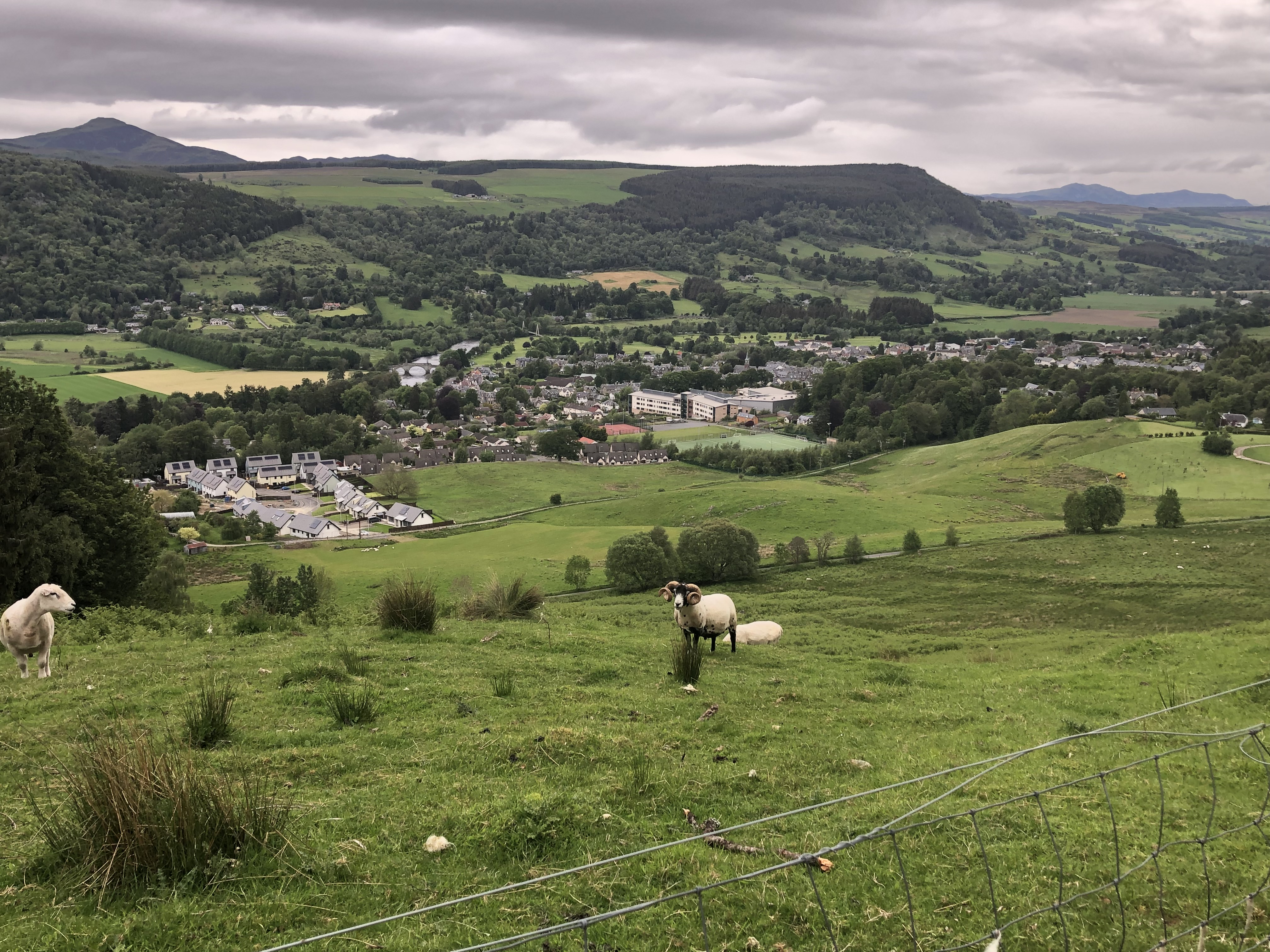
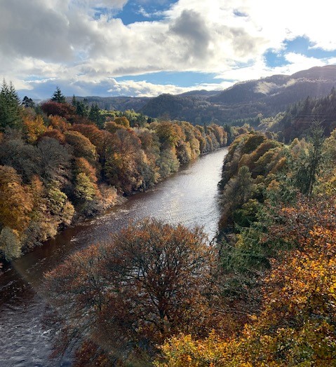
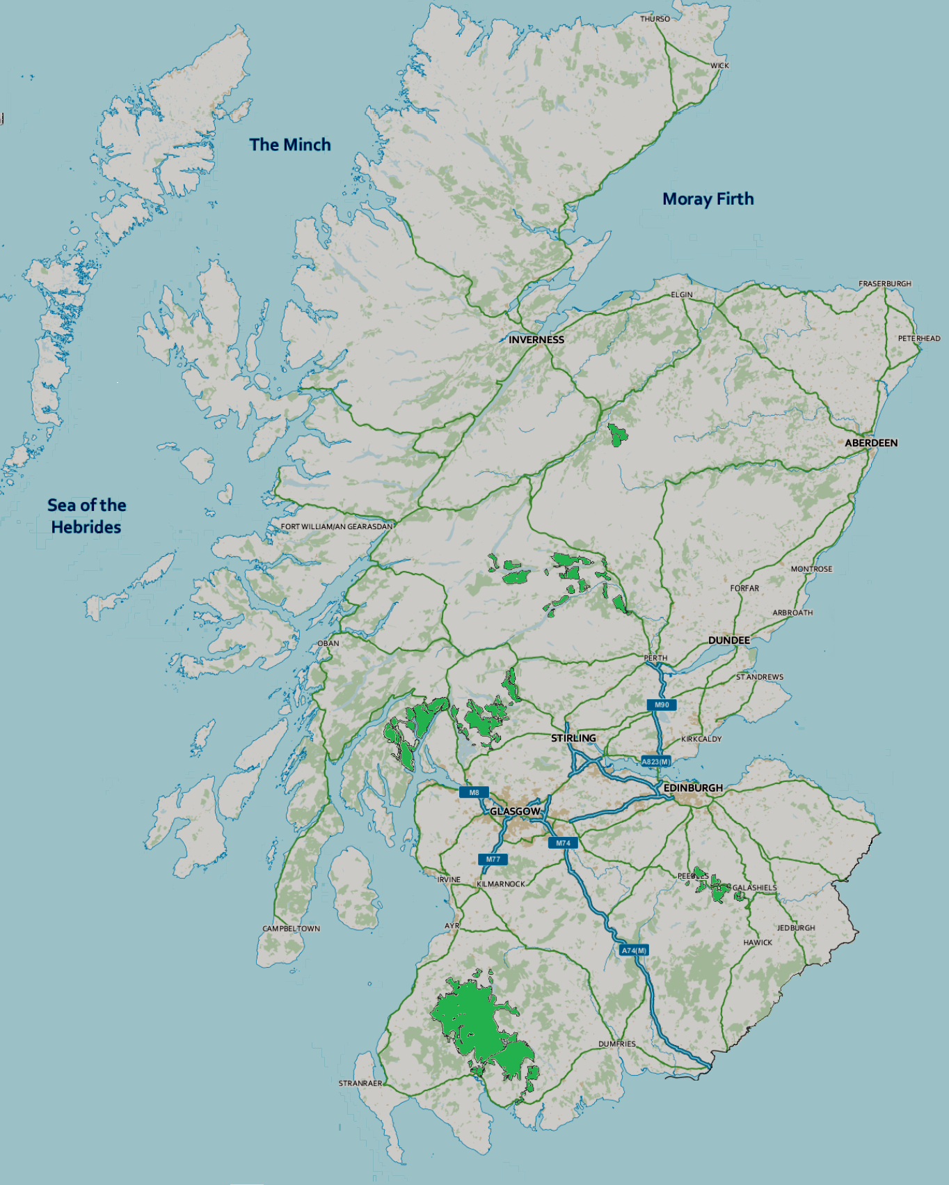
Tay Forest Park is forest park in the council area of Perth and Kinross in Scotland. It consists of a network of forests managed by Forestry and Land Scotland (FLS) that are spread across the Highland parts of Perthshire, and covers 194 km2 in total. The park contains a series of disparate woods that are managed for multiple benefits, with an emphasis on recreation facilities for visitors. The park's main visitor centre is at Queen's View, near Loch Tummel, where there is a café, gift shop and interpretive displays. Other smaller centres are located at the following locations: *Allean, also close to Loch Tummel * Faskally, between Pitlochry and Killiecrankie *Carie on the south side of Loch Rannoch *Grandtully, between Aberfeldy and Ballinluig *Weem, north of Aberfeldy *Drummond Hill on the north side of Loch Tay * Craigvinean, near Dunkeld and Birnam At each location there is a car park and waymarked trails for visitors. Some of the site have more facilities, such as ... [...More Info...] [...Related Items...] OR: [Wikipedia] [Google] [Baidu] |
Perth And Kinross
Perth and Kinross ( sco, Pairth an Kinross; gd, Peairt agus Ceann Rois) is one of the 32 council areas of Scotland and a Lieutenancy Area. It borders onto the Aberdeenshire, Angus, Argyll and Bute, Clackmannanshire, Dundee, Fife, Highland and Stirling council areas. Perth is the administrative centre. With the exception of a large area of south-western Perthshire, the council area mostly corresponds to the historic counties of Perthshire and Kinross-shire. Perthshire and Kinross-shire shared a joint county council from 1929 until 1975. The area formed a single local government district in 1975 within the Tayside region under the ''Local Government (Scotland) Act 1973'', and was then reconstituted as a unitary authority (with a minor boundary adjustment) in 1996 by the ''Local Government etc. (Scotland) Act 1994''. Geographically the area is split by the Highland Boundary Fault into a more mountainous northern part and a flatter southern part. The northern area is a popular to ... [...More Info...] [...Related Items...] OR: [Wikipedia] [Google] [Baidu] |
Loch Rannoch
Loch Rannoch (Scottish Gaelic: ''Loch Raineach'') is a freshwater loch in Perth and Kinross, Scotland. It is over long in a west–east direction with an average width of about , and is deepest at its eastern end, reaching a depth of .Tom Weir. ''The Scottish Lochs''. pp. 69-75. Published by Constable and Company, 1980. The River Tummel begins at its eastern end, where the small village of Kinloch Rannoch can be found, whilst the wild expanse of Rannoch Moor extends to the west of the loch. The area surrounding Loch Rannoch, along with Rannoch Moor itself, was formerly part of the native Caledonian Forest that stretched across much of Northern Scotland. Native forest is now largely absent from much of the area, due partly to logging, and partly to the climate becoming wetter, and Loch Rannoch is now largely surrounded by commercial forestry and open hillsides,Ordnance Survey. ''Landranger'' 1:50000 Sheet 42. Glen Garry and Loch Rannoch. although a small area remains at the Blac ... [...More Info...] [...Related Items...] OR: [Wikipedia] [Google] [Baidu] |
Craigvinean Forest
Craigvinean Forest is located one mile west of Dunkeld, Perth and Kinross, Scotland, on the A9. It is accessed through a track at the foot of Deuchary Hill. The River Braan bisects the forest, which forms part of the Tay Forest Park, one of six forest park in Scotland. The Hermitage is located in a section of the forest. Ossian, a third-century Celtic bard, whose mother was turned into a deer by Fer Doirich, is said to have inhabited a cave which can be found on the north bank of the Braan located upstream from Ossian's Hall of Mirrors Ossian's Hall of Mirrors is a Georgian structure located at The Hermitage in Dunkeld, Scotland. History of the site The original view-house The Hermitage and Ossian's Hall of Mirrors was originally an unremarkable view-house in a position ..., a folly built in 1758 which is replete with Corinthian architrave and cornice. This folly was built on a horse shoe plan facing a waterfall and so amplifies the roaring sound of wat ... [...More Info...] [...Related Items...] OR: [Wikipedia] [Google] [Baidu] |
Loch Tay
Loch Tay ( gd, Loch Tatha) is a freshwater loch in the central highlands of Scotland, in the Perth and Kinross and Stirling council areas. It is the largest body of fresh water in Perth and Kinross, and the sixth largest loch in Scotland. The watershed of Loch Tay traditionally formed the historic province of Breadalbane. It is a long, narrow loch of around long, and typically around wide, following the line of the strath from the south west to north east. It is the sixth-largest loch in Scotland by area and over deep at its deepest. Pre-history and archaeology Between 1996 and 2005, a large scale project was carried out to investigate the heritage and archaeology of Loch Tay, the Ben Lawers Historic Landscape (BLHL) Project. It took place primarily on the National Trust for Scotland’s property but included some local landowners who held the agricultural lands between the head-dyke and the loch-shore. Mesolithic period Before 1996 the earliest known evidence for oc ... [...More Info...] [...Related Items...] OR: [Wikipedia] [Google] [Baidu] |
Weem
WEEM-FM (91.7 FM broadcasting, FM) is a student-run high school radio station of Pendleton Heights High School in Pendleton, Indiana. It broadcasts in the Contemporary hit radio, CHR music format. The station is owned by South Madison Community School Corporation and is operated by students at Pendleton Heights High School. Broadcasting information The station broadcasts with 1.2 kilowatts of both vertical and horizontal power at of height above average terrain serving portions of Hamilton County, Indiana, Hamilton, Hancock County, Indiana, Hancock, Marion County, Indiana, Marion, Madison County, Indiana, Madison, and Henry County, Indiana, Henry counties. Awards 2012: Indiana Association of School Broadcasters Radio School Of The Year 2016: Intercollegiate Broadcasting System National High School Radio Station Of The Year References External linksSouth Madison Community School Corporation [...More Info...] [...Related Items...] OR: [Wikipedia] [Google] [Baidu] |
Ballinluig
Ballinluig (Gaelic: ''Baile an Luig'') is a village in Perth and Kinross, Scotland. It lies on the banks of the River Tummel in Logierait Parish, and is approximately southeast of Pitlochry. It developed with the building of the Highland Railway The Highland Railway (HR) was one of the smaller United Kingdom, British railways before the Railways Act 1921, operating north of Perth railway station, Scotland, Perth railway station in Scotland and serving the farthest north of Britain. Base ..., and sat where a branch line went off to Aberfeldy, both the branch line and Ballinluig station were closed in 1965. References Villages in Perth and Kinross {{PerthKinross-geo-stub ... [...More Info...] [...Related Items...] OR: [Wikipedia] [Google] [Baidu] |
Aberfeldy, Perth And Kinross
Aberfeldy ( gd, Obar Pheallaidh) is a burgh in Perth and Kinross, Scotland, on the River Tay. A small market town, Aberfeldy is located in Highland Perthshire. It was mentioned by Robert Burns in the poem ''The Birks Of Aberfeldy''. Etymology Aberfeldy means 'mouth of the Peallaidh'. The first element of the name is the Pictish word ''aber'' 'river mouth'. The river-name perhaps incorporates the name of a water-sprite known as Peallaidh, which in Gaelic means 'shaggy'. Aberfeldy is recorded in 1526 as ''Abrefrally'' and in 1552 as ''Abirfeldy''. History Beyond its association with Burns, who mentioned Aberfeldy in his poem '' The Birks of Aberfeldy'', the town is known for Wade's Bridge, built in 1733 and designed by architect William Adam, father of Robert Adam. General George Wade considered this bridge to be his greatest accomplishment. Aberfeldy is also mentioned in the traditional "Loch Tay Boat Song". While working in the 1880s as a hired farmhand for Robert Menzies of ... [...More Info...] [...Related Items...] OR: [Wikipedia] [Google] [Baidu] |
Grandtully
Grandtully (''pronounced as "Grantly" and sometimes also spelt "Grantully"'') is a small village in Perthshire, Scotland. It is situated close to the River Tay, about from Pitlochry. It has a population of approximately 750 inhabitants. Parish Church Grandtully has a Church of Scotland parish church; it is now part of Grantully, Logierait and Strathtay Parish (within the Church of Scotland's Presbytery of Dunkeld and Meigle). St Mary's church In Nether Pitcairn, 3.2 km south-west of Grandtully, there is a church built by Alexander Stewart of Grandtully in, or shortly before, 1533. It is a low and outwardly unassuming white washed building that contains a wooden tunnel vault ceiling with tempera paintings from the early 17th century commissioned by William Stewart. The paintings show scenes and persons from the bible intermixed with the coats of arms of kings and noblemen, and in addition an abundance of birds, fruits and angels, all depicted in a renaissance style with ... [...More Info...] [...Related Items...] OR: [Wikipedia] [Google] [Baidu] |
Killiecrankie
Killiecrankie (; ( gd, Coille Chreithnich, meaning aspen wood) is a village in Perth and Kinross, Scotland on the River Garry. It lies at the Pass of Killiecrankie, by the A9 road which has been bypassed since 1986. The village is home to a power station forming part of the Tummel Hydro-Electric Power Scheme. Much of the riverbank is owned by the National Trust for Scotland. The nearby 10 arch railway viaduct, which runs for 109 yards along the north-east bank of the River Garry, was built in 1863 from a design by Joseph Mitchell. History In 1689, during the Jacobite Rebellion, the Battle of Killiecrankie was fought on the northern edge of the village. The Highland charge of the Jacobites took the government forces under General Hugh MacKay by surprise and completely overwhelmed them in only 10 minutes. Donald MacBean, one of William II of Scotland's supporters, having lost the contest, is said to have cleared the pass, from one bank to the other, at "The Soldier's Leap ... [...More Info...] [...Related Items...] OR: [Wikipedia] [Google] [Baidu] |
Forest Parks Of Scotland
Forest parks are areas of forest managed by Forestry and Land Scotland (FLS) that are managed for multiple benefits, with an emphasis on recreation facilities for visitors. There are currently six forest parks in Scotland. The first forest park was the Argyll Forest Park on the Cowal peninsula, which was established in 1935. The largest is the Galloway Forest Park Galloway Forest Park is a forest park operated by Forestry and Land Scotland, principally covering woodland in Dumfries and Galloway. It is claimed to be the largest forest in the UK. The park was granted Dark Sky Park status ("Galloway Forest ..., at . List of forest parks References External links *A guide to Scotland's Forest Parks- Forestry and Land Scotland Lists of protected areas of Scotland {{Scotland-protected-area-stub ... [...More Info...] [...Related Items...] OR: [Wikipedia] [Google] [Baidu] |
Pitlochry
Pitlochry (; gd, Baile Chloichridh or ) is a town in the Perth and Kinross council area of Scotland, lying on the River Tummel. It is historically in the county of Perthshire, and has a population of 2,776, according to the 2011 census.Scotland's 2011 census. (n.p.). Scotland's Census. Retrieved 24 November 2015, from http://www.scotlandscensus.gov.uk/ It is largely a Victorian town, which developed into a tourist resort after Queen Victoria and Prince Albert visited the area in 1842 and bought a highland estate at Balmoral, and the arrival of the railway in 1863. It remains a popular tourist resort today and is particularly known for its Pitlochry Festival Theatre, salmon ladder and as a centre for hillwalking, surrounded by mountains such as Ben Vrackie and Schiehallion. It is popular as a base for coach holidays. The town has retained many stone Victorian buildings, and the high street has an unusual period cast iron canopy over one side. History Pitlochry today dat ... [...More Info...] [...Related Items...] OR: [Wikipedia] [Google] [Baidu] |
Loch Faskally
Loch Faskally (Scottish Gaelic: Loch Faschoille) is a man-made reservoir in Perth and Kinross, Scotland, northwest of Pitlochry. Geography The loch lies between steeply wooded hills and is approximately in length, narrowing to around wide. The loch is retained by the Pitlochry Dam which was built by Wimpey Construction between 1947 and 1950 as part of the North of Scotland Hydro-Electric Board's Tummel Hydro-Electric Power Scheme. The dam incorporates a salmon fish ladder, allowing around 5,400 salmon to ascend annually, and is a popular visitor attraction. The loch is popular with anglers. The water holds a good head of brown trout and the native fish are augmented by a stocking in the 1-5lb range. A 7-pounder was recorded in 2001. Salmon and a few sea trout pass through as they head up the Tummel and Garry systems. 54 salmon were caught in 2001 the best being a fish of 14 ½ lbs, however fish to 28lbs have also been caught. June also sees the arrival of the summer grils ... [...More Info...] [...Related Items...] OR: [Wikipedia] [Google] [Baidu] |


