|
Taqsis
Taqsis ( ar, تقسيس, also known as Zawr az Ziyarah ( ar, زور الزيارة) is a village in northern Syria, administratively part of the Hama Governorate, located south of Hama. Nearby localities include al-Jinan to the north, al-Buraq to the northwest, Tell Qartal to the west, Ghor al-Assi to the southwest, Izz al-Din to the southeast and Taldarah to the east. According to the Central Bureau of Statistics (CBS), Taqsis had a population of 3,343 in the 2004 census. However, towards the end of Khedivate Egyptian rule (1832-1841), Taqsis was among 20 villages along the edge of the Syrian Desert to be repopulated. While most of these small, agricultural places were abandoned during the 1840s due to the pressures of warring nomadic tribes, Taqsis remained occupied. References Bibliography * * * {{Hama Governorate, hama Populated places in Hama District ... [...More Info...] [...Related Items...] OR: [Wikipedia] [Google] [Baidu] |
Al-Buraq, Syria
Al-Buraq ( ar, البراق, also spelled Burak or Braq) is a village in northern Syria, administratively part of the Hama Governorate, located southeast of Hama. Nearby localities include Ayyubiyah and Nisrin to the west, Maarin al-Jabal to the northwest, Surayhin to the north, al-Jinan to the northeast, Taqsis to the southeast and Tell Qartal to the south. According to the Syria Central Bureau of Statistics, al-Buraq had a population of 3,235 in the 2004 census.General Census of Population and Housing 2004 . Syria Central Bureau of Statistics (CBS). Hama Governorate. In 1838 al-Buraq was classified as ''khirba'' ("ruined v ... [...More Info...] [...Related Items...] OR: [Wikipedia] [Google] [Baidu] |
Izz Al-Din, Syria
Izz al-Din ( ar, عز الدين, also spelled 'Az ed-Din) is a village in northern Syria, administratively part of the Homs Governorate, located northeast of Homs. Nearby localities include Ghor al-Assi, Murayj al-Durr and al-Rastan to the west, Deir Ful and al-Zaafaraniyah to the southwest, al-Mishirfeh and Ayn al-Niser to the south, Dunaybah to the southeast, Khunayfis to the east, Salamiyah to the northeast and Taldara to the north. According to the Syria Central Bureau of Statistics (CBS), Izz al-Din had a population of 2,620 in the 2004 census, making it the fifth-largest locality in the al-Rastan ''nahiyah'' ("subdistrict").General Census of Population and Housing 2004 [...More Info...] [...Related Items...] OR: [Wikipedia] [Google] [Baidu] |
Governorates Of Syria
Syria is a unitary state, but for administrative purposes, it is divided into fourteen governorates, also called provinces or counties in English (Arabic ''muḥāfaẓāt'', singular '' muḥāfaẓah''). The governorates are divided into sixty-five districts (''manāṭiq'', singular '' minṭaqah''), which are further divided into subdistricts (''nawāḥī'', singular '' nāḥiyah''). The ''nawāḥī'' contain villages, which are the smallest administrative units. Each governorate is headed by a governor, appointed by the president, subject to cabinet approval. The governor is responsible for administration, health, social services, education, tourism, public works, transportation, domestic trade, agriculture, industry, civil defense, and maintenance of law and order in the governorate. The minister of local administration works closely with each governor to coordinate and supervise local development projects. The governor is assisted by a provincial council, all of who ... [...More Info...] [...Related Items...] OR: [Wikipedia] [Google] [Baidu] |
Syrian Desert
The Syrian Desert ( ar, بادية الشام ''Bādiyat Ash-Shām''), also known as the North Arabian Desert, the Jordanian steppe, or the Badiya, is a region of desert, semi-desert and steppe covering of the Middle East, including parts of southern Syria, eastern Jordan, northern Saudi Arabia, and western Iraq. It accounts for 85% of the land area of Jordan and 55% of Syria. To the south it borders and merges into the Arabian Desert. The land is open, rocky or gravelly desert pavement, cut with occasional wadis. Location and name The desert is bounded by the Orontes Valley and the volcanic field of Harrat al-Shamah to the west, and by the Euphrates to the east. In the north, the desert gives way to the more fertile areas and to the south it runs into the deserts of the Arabian Peninsula. Some sources equate the Syrian Desert with the ''"Hamad Desert"'' while others limit the name ''Hamad'' to the southern central plateau. A few consider the Hamad to be the whole region and ... [...More Info...] [...Related Items...] OR: [Wikipedia] [Google] [Baidu] |
Eli Smith
Eli Smith (born September 13, 1801, in Northford, Connecticut, to Eli and Polly (Whitney) Smith, and died January 11, 1857, in Beirut, Lebanon) was an American Protestant missionary and scholar. He graduated from Yale College in 1821 and from Andover Theological Seminary in 1826. He worked in Malta until 1829, then in company with H. G. O. Dwight traveled through Armenia and Georgia to Persia. They published their observations, ''Missionary Researches in Armenia'', in 1833 in two volumes. Eli Smith settled in Beirut in 1833. Along with Edward Robinson, he made two trips to the Holy Land in 1838 and 1852, acting as an interpreter for Robinson in his quest to identify and record biblical place names in Palestine, which was subsequently published in Robinson's ''Biblical Researches in Palestine''. He is known for bringing the first printing press with Arabic type to Syria. He went on to pursue the task which he considered to be his life's work: translation of the Bible into Arabic. ... [...More Info...] [...Related Items...] OR: [Wikipedia] [Google] [Baidu] |
Orontes River
The Orontes (; from Ancient Greek , ) or Asi ( ar, العاصي, , ; tr, Asi) is a river with a length of in Western Asia that begins in Lebanon, flowing northwards through Syria before entering the Mediterranean Sea near Samandağ in Turkey. As the chief river of the northern Levant, the Orontes was the site of several major battles. Among the most important cities on the river are Homs, Hama, Jisr al-Shughur, and Antakya (the ancient Antioch, which was also known as "Antioch on the Orontes"). Names In the 9th century BCE, the ancient Assyrians referred to the river as Arantu, and the nearby Egyptians called it Araunti. The etymology of the name is unknown, yet some sources indicate that it might be derived from ''Arnt'' which means "lioness" in Syriac languages; others called it ''Alimas'', a "water goddess" in Aramaic. However, ''Arantu'' gradually became "Orontes" in Greek. In the Greek epic poem '' Dionysiaca'' (circa 400 CE), the river is said to have been named after ... [...More Info...] [...Related Items...] OR: [Wikipedia] [Google] [Baidu] |
Noria
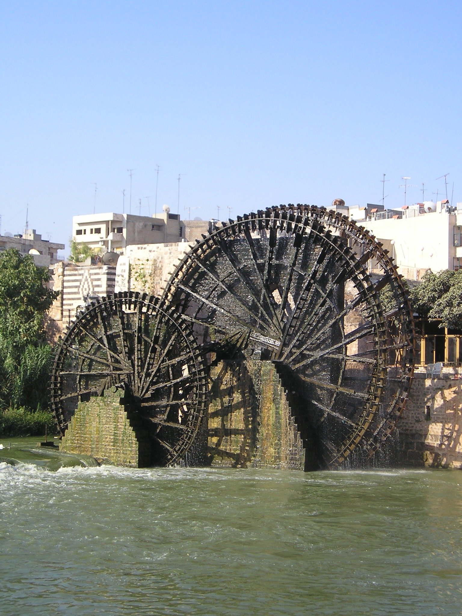
A noria ( ar, ناعورة, ''nā‘ūra'', plural ''nawāʿīr'', from syr, ܢܥܘܪܐ, ''nā‘orā'', lit. "growler") is a hydropowered ''scoop wheel'' used to lift water into a small aqueduct (water supply), aqueduct, either for the purpose of irrigation or to supply water to cities and villages. Name and meaning Etymology The word ''noria'' is derived from Arabic ''nā‘ūra'' (ناعورة), which comes from the Arabic verb meaning to "groan" or "grunt", in reference to the sound it made when turning. ''Noria'' versus ''saqiyah'' The term ''noria'' is commonly used for devices which use the power of moving water to turn the wheel. For devices powered by animals, the usual term is ''saqiyah'' or ''saqiya''. Other types of similar devices are grouped under the name of chain pumps. However, the names of traditional water-raising devices used in the Middle East, India, Spain and other areas are often used loosely and overlappingly, or vary depending on region. Ismail a ... [...More Info...] [...Related Items...] OR: [Wikipedia] [Google] [Baidu] |
Ottoman Empire
The Ottoman Empire, * ; is an archaic version. The definite article forms and were synonymous * and el, Оθωμανική Αυτοκρατορία, Othōmanikē Avtokratoria, label=none * info page on book at Martin Luther University) // CITED: p. 36 (PDF p. 38/338) also known as the Turkish Empire, was an empire that controlled much of Southeast Europe, Western Asia, and Northern Africa between the 14th and early 20th centuries. It was founded at the end of the 13th century in northwestern Anatolia in the town of Söğüt (modern-day Bilecik Province) by the Turkoman tribal leader Osman I. After 1354, the Ottomans crossed into Europe and, with the conquest of the Balkans, the Ottoman beylik was transformed into a transcontinental empire. The Ottomans ended the Byzantine Empire with the conquest of Constantinople in 1453 by Mehmed the Conqueror. Under the reign of Suleiman the Magnificent, the Ottoman Empire marked the peak of its power and prosperity, as well a ... [...More Info...] [...Related Items...] OR: [Wikipedia] [Google] [Baidu] |
Central Bureau Of Statistics (Syria)
The Central Bureau of Statistics (CBS) ( ar, المكتب المركزي للإحصاء) is the statistical agency responsible for the gathering of "information relating to economic, social and general activities and conditions" in the Syrian Arab Republic. The office is answerable to the office of the Prime Minister A prime minister, premier or chief of cabinet is the head of the cabinet and the leader of the ministers in the executive branch of government, often in a parliamentary or semi-presidential system. Under those systems, a prime minister i ... and has its main offices in Damascus. The CBS was established in 2005 and is administered by an administrative council headed by the deputy prime minister for economic affairs. After the Syrian government began reconstructing infrastructure in 2011, the bureau began releasing data from 2011 to 2018. References External links * Government of Syria Syria Government agencies established in 2005 2005 establis ... [...More Info...] [...Related Items...] OR: [Wikipedia] [Google] [Baidu] |
Taldarah
Tall ad Dirrah ( ar, تل الدرة, also spelled ''Tell Dirrah'', ''Tall Derah'', ''Talldarra'' or ''Tell ad-Dura'') is a Syrian village in the Salamiyah Subdistrict in Salamiyah District, located southeast of Hama. According to the Syria Central Bureau of Statistics (CBS), Taldara had a population of 5,986 in the 2004 census. Its inhabitants are predominantly Ismailis. History Tall ad Dirrah was initially founded in 1836 when it was acquired by Muhammad Khurfan Bey, a chief of the Mawali tribe in the Hama region. Prior to that, the village had been vacated. Like other places in the Salamiyah area that the Ottoman authorities encouraged to be repopulated, the settlers of Taldara came from the Mawali, Nu'aym and Uqaydat tribes. However, just two years later, Taldara and all of the other villages of Salamiyah were reported to have been deserted. Tall ad Dirrah was re-established in the late 19th century by Ismaili migrants from other parts of northern Syria who chose to settle ... [...More Info...] [...Related Items...] OR: [Wikipedia] [Google] [Baidu] |
Ghor Al-Assi
Ghawr al-Assi ( ar, غور العاصي) is a Syrian village located in the Hama Nahiyah, Hama Subdistrict of the Hama District in the Hama Governorate. It is situated along the road between Homs and Hama, being 20 kilometers south of the latter. According to the Central Bureau of Statistics (Syria), Syria Central Bureau of Statistics (CBS), Ghawr al-Assi had a population of 2,033 in the 2004 census. Its inhabitants are predominantly Sunni Muslims.Smith, 1841, p. 179. Ghawr al-Assi is the largest village in the Orontes Valley Municipality, which also includes al-Alamein, Syria, al-Alamein, Qubaybat al-Assi and smaller hamlets. The municipality was established in 2004. There are archaeological remains in Ghawr al-Assi, including old mills and water wheels (''norias''). References Bibliography * Populated places in Hama District {{HamaSY-geo-stub ... [...More Info...] [...Related Items...] OR: [Wikipedia] [Google] [Baidu] |


