|
Taganrog Bay
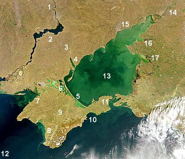
Taganrog Bay (, uk, ąóą░ą│ą░ąĮčĆąŠąĘčīą║ą░ ąĘą░č鹊ą║ą░) is the northeastern arm of the Sea of Azov. It also may be perceived as a flooded estuary of the Don River. Geography The bay serves as a natural boundary between the Kuban coast line in Russia and the northern Azov littoral region in Ukraine and Russia. Since the fall of the Soviet Union, the international boundary here hasn't been established. At its northeast end is the mouth of the Don River. Length: about , width at the mouth: , median depth: about . It may freeze some winters from December to March. Three other rivers, the Kalmius, Mius and the Yeya, flow into the bay. The flow of water into the bay is the chief factor for current development in the Sea of Azov. Landforms Its mouth is marked by the Dolgaya Spit on the south and the Bilosaray Spit (Bilosarayska Spit) on the north. It abounds in sandy spits that partly enclose shallow bays. The bay contains "Sandy Isles" (ą¤ąĄčüčćą░ąĮčŗąĄ ąŠčüčéčĆąŠą▓ą░, ą¤č¢čüč ... [...More Info...] [...Related Items...] OR: [Wikipedia] [Google] [Baidu] |
Taganrog
Taganrog ( rus, ąóą░ą│ą░ąĮčĆąŠą│, p=t╔Ö╔Ī╔Én╦łrok) is a port city in Rostov Oblast, Russia, on the north shore of the Taganrog Bay in the Sea of Azov, several kilometers west of the mouth of the Don River. Population: History of Taganrog The history of the city goes back to the late Bronze AgeŌĆōearly Iron Age (between the 20th and 10th centuries BC), when it was the earliest Greek settlement in the northwestern Black Sea Region and was mentioned by the Greek historian Herodotus as Emporion Kremnoi. In the 13th century, Pisan merchants founded a colony, Portus Pisanus, which was however short-lived. Taganrog was founded by Peter the Great on 12 September 1698. The first Russian Navy base, it hosted the Azov Flotilla of Catherine the Great (1770ŌĆō1783), which subsequently became the Russian Black Sea Fleet. Taganrog was granted city status in 1775. By the end of the 18th century, Taganrog had lost its importance as a military base after Crimea and the entire Sea of Azov w ... [...More Info...] [...Related Items...] OR: [Wikipedia] [Google] [Baidu] |
Bays Of Krasnodar Krai
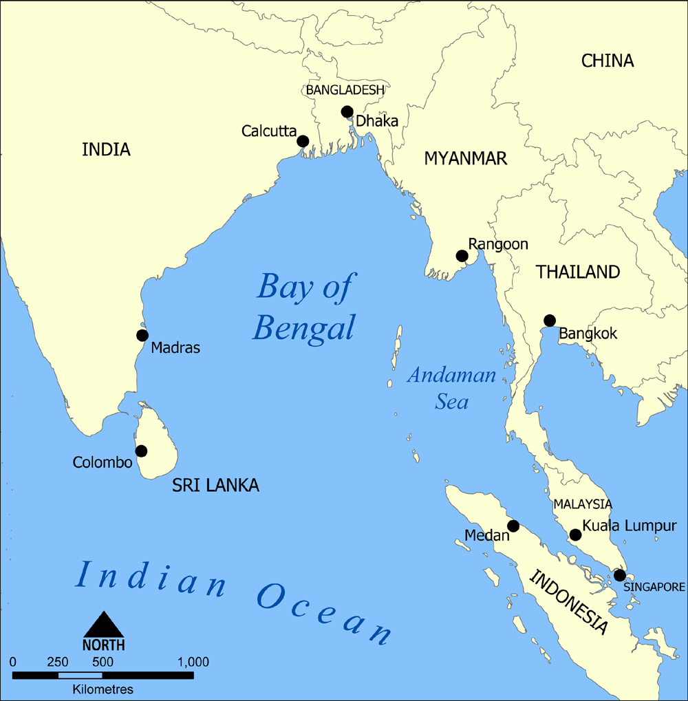
A bay is a recessed, coastal body of water that directly connects to a larger main body of water, such as an ocean, a lake A lake is an area filled with water, localized in a basin, surrounded by land, and distinct from any river or other outlet that serves to feed or drain the lake. Lakes lie on land and are not part of the ocean, although, like the much large ..., or another bay. A large bay is usually called a Gulf (geography), gulf, sea, sound (geography), sound, or bight (geography), bight. A cove is a small, circular bay with a narrow entrance. A fjord is an elongated bay formed by glacial action. A bay can be the estuary of a river, such as the Chesapeake Bay, an estuary of the Susquehanna River. Bays may also be nested within each other; for example, James Bay is an arm of Hudson Bay in Atlantic Canada, northeastern Canada. Some large bays, such as the Bay of Bengal and Hudson Bay, have varied marine geology. The land surrounding a bay often reduces the streng ... [...More Info...] [...Related Items...] OR: [Wikipedia] [Google] [Baidu] |
RussiaŌĆōUkraine Border
The RussiaŌĆōUkraine border is the international state border between the Russian Federation and Ukraine. Over land, the border outlines five oblasts (regions) of Ukraine and five oblasts of the Russian Federation. The modern border issue has been ongoing ever since the fall of the Russian Empire in 1917. Since early 2014, the border has been compromised due to the Russo-Ukrainian War. According to head of the State Border Guard Service of Ukraine Viktor Nazarenko, the country does not control of the border with Russia.State border service, OSCE draft plan to return control over border with Russia if Minsk accords fulfilled , |
Bays Of Ukraine
A bay is a recessed, coastal body of water that directly connects to a larger main body of water, such as an ocean, a lake, or another bay. A large bay is usually called a gulf, sea, sound, or bight. A cove is a small, circular bay with a narrow entrance. A fjord is an elongated bay formed by glacial action. A bay can be the estuary of a river, such as the Chesapeake Bay, an estuary of the Susquehanna River. Bays may also be nested within each other; for example, James Bay is an arm of Hudson Bay in northeastern Canada. Some large bays, such as the Bay of Bengal and Hudson Bay, have varied marine geology. The land surrounding a bay often reduces the strength of winds and blocks waves. Bays may have as wide a variety of shoreline characteristics as other shorelines. In some cases, bays have beaches, which "are usually characterized by a steep upper foreshore with a broad, flat fronting terrace".Maurice Schwartz, ''Encyclopedia of Coastal Science'' (2006), p. 129. Bays were sig ... [...More Info...] [...Related Items...] OR: [Wikipedia] [Google] [Baidu] |
Bays Of The Sea Of Azov
A bay is a recessed, coastal body of water that directly connects to a larger main body of water, such as an ocean, a lake, or another bay. A large bay is usually called a gulf, sea, sound, or bight. A cove is a small, circular bay with a narrow entrance. A fjord is an elongated bay formed by glacial action. A bay can be the estuary of a river, such as the Chesapeake Bay, an estuary of the Susquehanna River. Bays may also be nested within each other; for example, James Bay is an arm of Hudson Bay in northeastern Canada. Some large bays, such as the Bay of Bengal and Hudson Bay, have varied marine geology. The land surrounding a bay often reduces the strength of winds and blocks waves. Bays may have as wide a variety of shoreline characteristics as other shorelines. In some cases, bays have beaches, which "are usually characterized by a steep upper foreshore with a broad, flat fronting terrace".Maurice Schwartz, ''Encyclopedia of Coastal Science'' (2006), p. 129. Bays were sig ... [...More Info...] [...Related Items...] OR: [Wikipedia] [Google] [Baidu] |
:Category:Don Basin
Don river basin ŌĆö a in southern Russia Southern Russia or the South of Russia (russian: ą«ą│ ąĀąŠčüčüąĖąĖ, ''Yug Rossii'') is a colloquial term for the southernmost geographic portion of European Russia generally covering the Southern Federal District and the North Caucasian Federal .... {{Category doc drainage basin Drainage basins of the Sea of Azov Drainage basins of Russia Wikipedia categories named after drainage basins ... [...More Info...] [...Related Items...] OR: [Wikipedia] [Google] [Baidu] |
Rostov Na Donu
Rostov-on-Don ( rus, ąĀąŠčüč鹊ą▓-ąĮą░-ąöąŠąĮčā, r=Rostov-na-Donu, p=r╔É╦łstof n╔Ö d╔É╦łnu) is a port city and the administrative centre of Rostov Oblast and the Southern Federal District of Russia. It lies in the southeastern part of the East European Plain on the Don River, from the Sea of Azov, directly north of the North Caucasus. The southwestern suburbs of the city lie above the Don river delta. Rostov-on-Don has a population of over one million people, and is an important cultural centre of Southern Russia. History Early history From ancient times, the area around the mouth of the Don River has held cultural and commercial importance. Ancient indigenous inhabitants included the Scythian and Sarmatian tribes. It was the site of Tanais, an ancient Greek colony, Fort Tana under the Genoese, and Fort Azak in the time of the Ottoman Empire. In 1749, a custom house was established on the Temernik River, a tributary of the Don, by edict of the Empress Elizabeth, the daug ... [...More Info...] [...Related Items...] OR: [Wikipedia] [Google] [Baidu] |
Yeysk
Yeysk (russian: ąĢą╣čüą║) is a port and a resort town in Krasnodar Krai, Russia, situated on the shore of the Taganrog Gulf of the Sea of Azov. The town is built primarily on the Yeysk Spit, which separates the Yeya River from the Sea of Azov. Population: History In the 14th century, in this area was a Genoese colony with a port called Balzimachi (or Bacinaci), which is mentioned in Pratica della mercatura. Tsutsiev's Atlas shows a Yeyskoye at the head of the Yeya bay for 1763-1785 and a Yeysk somewhat south of the present location from 1829-1839. In 1783 it was involved in the Kuban Nogai Uprising. The town was founded in 1848 by Prince Mikhail Semyonovich Vorontsov in accordance with a royal order from the Tsar of Russia. Administrative and municipal status Within the framework of administrative divisions, Yeysk serves as the administrative center of Yeysky District, even though it is not a part of it.Reference Information #34.01-707/13-03 As an administrative division, i ... [...More Info...] [...Related Items...] OR: [Wikipedia] [Google] [Baidu] |
Ukraine
Ukraine ( uk, ąŻą║čĆą░茹Įą░, Ukra├»na, ) is a country in Eastern Europe. It is the second-largest European country after Russia, which it borders to the east and northeast. Ukraine covers approximately . Prior to the ongoing Russian invasion, it was the eighth-most populous country in Europe, with a population of around 41 million people. It is also bordered by Belarus to the north; by Poland, Slovakia, and Hungary to the west; and by Romania and Moldova to the southwest; with a coastline along the Black Sea and the Sea of Azov to the south and southeast. Kyiv is the nation's capital and largest city. Ukraine's state language is Ukrainian; Russian is also widely spoken, especially in the east and south. During the Middle Ages, Ukraine was the site of early Slavic expansion and the area later became a key centre of East Slavic culture under the state of Kievan Rus', which emerged in the 9th century. The state eventually disintegrated into rival regional po ... [...More Info...] [...Related Items...] OR: [Wikipedia] [Google] [Baidu] |
Mariupol
Mariupol (, ; uk, ą£ą░čĆč¢čā╠üą┐ąŠą╗čī ; russian: ą£ą░čĆąĖčā╠üą┐ąŠą╗čī) is a city in Donetsk Oblast, Ukraine. It is situated on the northern coast (Pryazovia) of the Sea of Azov, at the mouth of the Kalmius River. Prior to the 2022 Russian invasion of Ukraine, it was the tenth-largest city in the country and the second-largest city in Donetsk Oblast, with an estimated population of 425,681 people in January 2022. However, Mariupol has been militarily controlled by Russia since May 2022, and the city's residents are now estimated to number around 100,000, according to Ukrainian authorities. Historically, the city of Mariupol was a centre for trade and manufacturing, and played a key role in the development of higher education and many businesses while also serving as a coastal resort on the Black Sea. From 1948 to 1989, the city was known as Zhdanov, named after Andrei Zhdanov, a high-ranking official of the Communist Party of the Soviet Union; the name was part of a larger ef ... [...More Info...] [...Related Items...] OR: [Wikipedia] [Google] [Baidu] |
Spit (landform)
A spit or sandspit is a deposition bar or beach landform off coasts or lake shores. It develops in places where re-entrance occurs, such as at a cove's headlands, by the process of longshore drift by longshore currents. The drift occurs due to waves meeting the beach at an oblique angle, moving sediment down the beach in a zigzag pattern. This is complemented by longshore currents, which further transport sediment through the water alongside the beach. These currents are caused by the same waves that cause the drift. Hydrology and geology Where the direction of the shore inland ''re-enters'', or changes direction, for example at a headland, the longshore current spreads out or dissipates. No longer able to carry the full load, much of the sediment is dropped. This is called deposition. This submerged bar of sediment allows longshore drift or littoral drift to continue to transport sediment in the direction the waves are breaking, forming an above-water spit. Without the co ... [...More Info...] [...Related Items...] OR: [Wikipedia] [Google] [Baidu] |


2.jpg)
.png)