|
Tadjoura Region
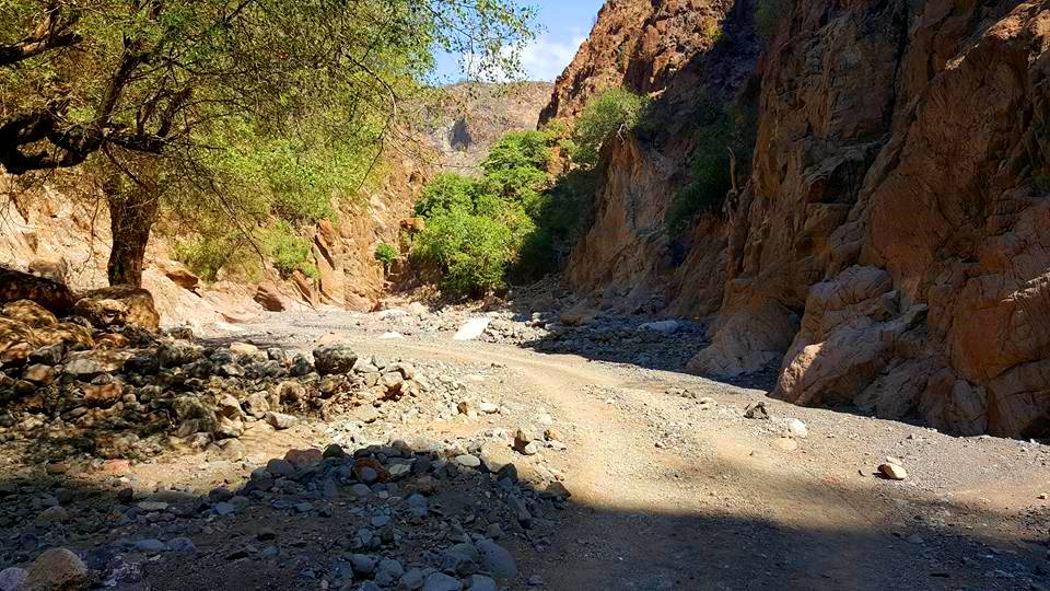
The Tadjourah Region so, Gobolka Tajoora, aa, Rakaakay Tagórri) is a region in north-central Djibouti, the largest of its six regions. With its capital at Tadjourah, it has an area of 7,100 square kilometres (2,700 sq mi). It lies along the Gulf of Tadjoura, and the coastal city of Tadjoura. The region has active salt and fisheries industries, and is served by the Tadjoura Airport. In total area, it is larger than Brunei and smaller than Cyprus. History The boundaries of the present-day Djibouti nation state were established during the Scramble for Africa. The first French establishment in the Horn of Africa, and in 1884 they sign a treaty with the Afar. The poet Arthur Rimbaud became a trader, and lived in Tadjoura from 1885 to 1886. He was the owner of a particular ship carrying weapons to be sold to the King of Shoa, cousin of the father of future Ethiopian Emperor Haile Selassie. In 1883 the French Somaliland (french: Côte française des Somalis) was officially fou ... [...More Info...] [...Related Items...] OR: [Wikipedia] [Google] [Baidu] |
Regions Of Djibouti
The regions of Djibouti are the primary geographical divisions through which Djibouti is administered. History The first administrative division of the territory, in 1914, defined two zones besides the city of Djibouti: the districts "Dankali" and "Issa". With the occupation of the territory at the end of the 1920s, the circles of Tadjoura and " Gobad-Dikkil" are created. In 1939, the circle of Ali Sabieh Ali Sabieh ( so, Cali Sabiix, ar, علي صبيح) is the second largest city in Djibouti. It is situated about Southwest of Djibouti City and north of the border with Ethiopia. It sprawls on a wide basin surrounded by granitic mountains on all ... is extracted from the last. In 1963, Obock's circle was created by division of that of Tadjourah region. In 1967, the circle of Djibouti is transformed into district, then divided into three districts. After independence in 1977, the circles become regions. The last important modification of the administrative map of the territor ... [...More Info...] [...Related Items...] OR: [Wikipedia] [Google] [Baidu] |
Djibouti City
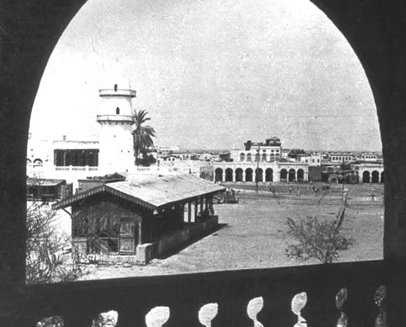
Djibouti (also called Djibouti City and in many early English texts and on many early maps, Jibuti; so, Magaalada Jabuuti, french: link=no, Ville de Djibouti, ar, مدينة جيبوتي, aa, Gabuutî Magaala) is the eponymous capital of Djibouti, and has more people than the rest of Djibouti combined. It is located in the coastal Djibouti Region on the Gulf of Tadjoura. Djibouti has a population of around 600,000 inhabitants, which counts for 54% of the country's population. The settlement was founded in 1888 by the French, on land leased from the ruling Somali and Afar Sultans. During the ensuing period, it served as the capital of French Somaliland and its successor the French Territory of the Afars and Issas. Known as the ''Pearl of the Gulf of Tadjoura'' due to its location, Djibouti is strategically positioned near the world's busiest shipping lanes and acts as a refueling and transshipment center. The Port of Djibouti is the principal maritime port for imports to and ... [...More Info...] [...Related Items...] OR: [Wikipedia] [Google] [Baidu] |
Goda Mountains - National Park Of Forêt Du Day
Goda may refer to: Names * a Lithuanian female name meaning “to have a sense, to perceive". Lithuanian word “goda” also means "honor, glory, respect" * Devin Goda (born 1989), an American male model and former professional football player * a hypocorism of various Germanic given names in ''God-'' ** Goda of England (''Godgifu'') (c. 1004 - c. 1049), 11th-century English princess * a surname derived from a given name in ''God-'', found in Germany and Hungary ** Krisztina Goda (b. 1970), Hungarian film director * Gōda, Japanese surnames 合田 or 郷田 connected to "rice paddies" * a Sanskrit epithet meaning "cattle-giving" ** '' Goda Varma'' "cattle-giver protector", a title given to the firstborn son by the nobility of the south Indian Kingdom of Conchin in the 16th and 17th centuries * Kuno Goda, a pseudonym used by a German artist People * Goda-ikka, a yakuza group * Godha (a Jain caste) Places * Göda, a municipality in Saxony, Germany * Goda, Purba Bardham ... [...More Info...] [...Related Items...] OR: [Wikipedia] [Google] [Baidu] |
Semi-arid
A semi-arid climate, semi-desert climate, or steppe climate is a dry climate sub-type. It is located on regions that receive precipitation below potential evapotranspiration, but not as low as a desert climate. There are different kinds of semi-arid climates, depending on variables such as temperature, and they give rise to different biomes. Defining attributes of semi-arid climates A more precise definition is given by the Köppen climate classification, which treats steppe climates (''BSk'' and ''BSh'') as intermediates between desert climates (BW) and humid climates (A, C, D) in ecological characteristics and agricultural potential. Semi-arid climates tend to support short, thorny or scrubby vegetation and are usually dominated by either grasses or shrubs as it usually can't support forests. To determine if a location has a semi-arid climate, the precipitation threshold must first be determined. The method used to find the precipitation threshold (in millimeters): *multiply by ... [...More Info...] [...Related Items...] OR: [Wikipedia] [Google] [Baidu] |
Lake Assal (Djibouti)
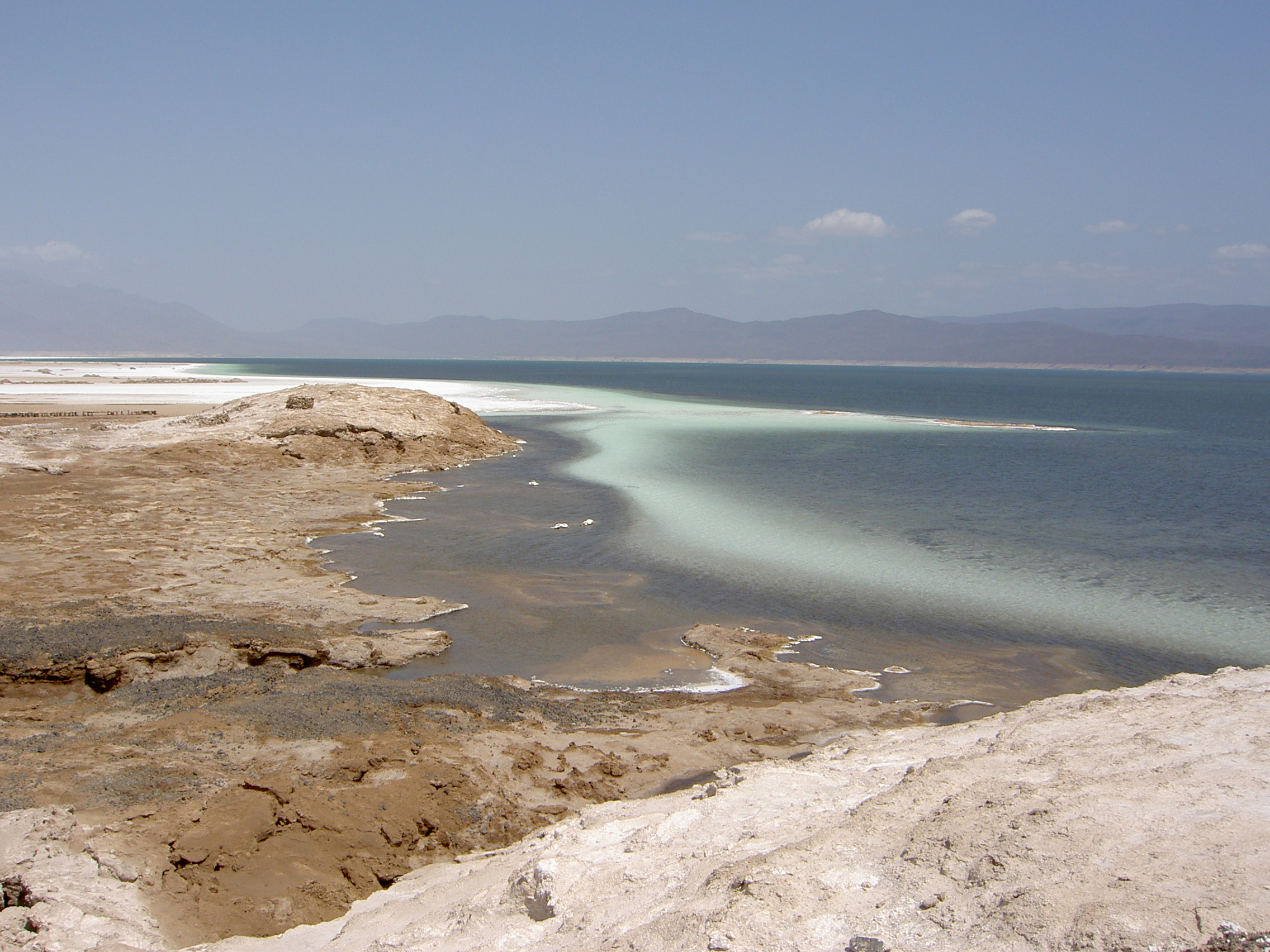
Lake Assal ( ar, بحيرة عسل , lit. “Honey Lake”) is a crater lake in central-western Djibouti. It is located at the western end of Gulf of Tadjoura between Arta Region, and Tadjoura Region, touching Dikhil Region, at the top of the Great Rift Valley, some west of Djibouti city. Lake Assal is a saline lake that lies below sea level in the Afar Triangle, making it the lowest point on land in Africa and the third-lowest point on Earth after the Sea of Galilee and the Dead Sea. No outflow occurs from the lake, and due to high evaporation, the salinity level of its waters is 10 times that of the sea, making it the third most saline body of water in the world behind Don Juan Pond and Gaet'ale Pond. The salt in the lake is exploited under four concessions awarded in 2002 at the southeast end of the lake; the major share of production (nearly 80%) is held by Société d’Exploitation du Lac and Société d’Exploitation du Salt Investment S.A de Djibouti. The lake is a p ... [...More Info...] [...Related Items...] OR: [Wikipedia] [Google] [Baidu] |
Panorama
A panorama (formed from Greek πᾶν "all" + ὅραμα "view") is any wide-angle view or representation of a physical space, whether in painting, drawing, photography, film, seismic images, or 3D modeling. The word was originally coined in the 18th century by the English (Irish descent) painter Robert Barker to describe his panoramic paintings of Edinburgh and London. The motion-picture term ''panning'' is derived from ''panorama''. A panoramic view is also purposed for multimedia, cross-scale applications to an outline overview (from a distance) along and across repositories. This so-called "cognitive panorama" is a panoramic view over, and a combination of, cognitive spaces used to capture the larger scale. History The device of the panorama existed in painting, particularly in murals, as early as 20 A.D., in those found in Pompeii, as a means of generating an immersive "panoptic" experience of a vista. Cartographic experiments during the Enlightenment era prec ... [...More Info...] [...Related Items...] OR: [Wikipedia] [Google] [Baidu] |
Mouddo
Mouddo ( ar, مودو) is a town in the northern Tadjoura region of Djibouti. Mouddo is on the edge of depression Andabba of a flooded plain case (very rare) of rain. It is situated about 90 kilometres (56 miles) north of Tadjoura and 14 km (8 mi) east of the border with Ethiopia. Overview There was a single class school until late 1980. A second class and a dormitory were then built. The civil war of the 1990s led to the closure and the deterioration of the school, which was reopened ten years later. The school Mouddo hosts hundreds of students from the Andabba or Madgoul areas. Climate Mouddo has a hot desert climate (Köppen climate classification The Köppen climate classification is one of the most widely used climate classification systems. It was first published by German-Russian climatologist Wladimir Köppen (1846–1940) in 1884, with several later modifications by Köppen, notabl ... ''BWh''). Mouddo is noted for its very high summer humidity despite being a des ... [...More Info...] [...Related Items...] OR: [Wikipedia] [Google] [Baidu] |
Mousa Ali
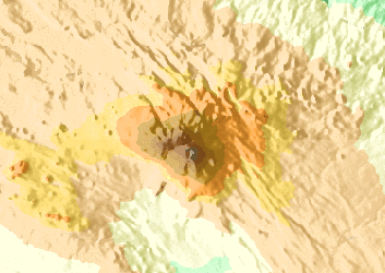
Mousa Ali ( ar, موسى علي) is a stratovolcano located on the tri-point of Ethiopia, Eritrea and Djibouti. The volcano is the highest point in Djibouti. The volcano's summit is truncated by a caldera, which contains rhyolitic lava domes and lava flows. The last known eruption occurred before the Holocene era. Mousa Ali is situated at the tri-point of the Tadjourah Region of Djibouti, the Southern Red Sea Region of Eritrea, and the Afar Region of Ethiopia. Geography The mountain has two distinct summits, the higher being the south one with an elevation of 2,021 metres The north summit in Ethiopia has an elevation of 1,871 metres. Both summits are separated by a large caldera, about 1 km (0.71 mi) wide and 1514 metres deep. Mousa Ali, in the northern part of the Great Rift Valley region, has Eritrea on its northern flank, Ethiopia on the west, and Djibouti the east and south. The Djiboutian town of Dorra is 36 km to the south-southeast, the Ethiopian volca ... [...More Info...] [...Related Items...] OR: [Wikipedia] [Google] [Baidu] |
Gulf Of Tadjourah
The Gulf of Tadjoura (; ) is a gulf or basin of the Indian Ocean in the Horn of Africa. It lies south of the straits of Bab-el-Mandeb, or the entrance to the Red Sea, at . The gulf has many fishing grounds, extensive coral reefs, and abundant pearl oysters. Most of its coastline is the territory of Djibouti, except for a short stretch on the southern shore, which is part of the territory of Somaliland. The Gulf’s other marine habitats include sea grass beds, salt pans and mangroves. History In August 1840, the conclusion of a treaty of friendship and commerce between the Sultan Mohammed bin Mohammed of Tadjoura and Commander Robert Moresby of the Indian Navy is tracking the sale of Moucha Island to Great Britain for ten sacks of rice. The sale will however follow any occupation. In 1887, Britain cedes sovereignty of the island to France at the same time it recognizes the French sphere of influence in the Gulf of Tadjoura, in exchange for the abandonment by France of any right ... [...More Info...] [...Related Items...] OR: [Wikipedia] [Google] [Baidu] |
Lake Asal (Djibouti)
Lake Assal ( ar, بحيرة عسل , lit. “Honey Lake”) is a crater lake in central-western Djibouti. It is located at the western end of Gulf of Tadjoura between Arta Region, and Tadjoura Region, touching Dikhil Region, at the top of the Great Rift Valley, some west of Djibouti city. Lake Assal is a saline lake that lies below sea level in the Afar Triangle, making it the lowest point on land in Africa and the third-lowest point on Earth after the Sea of Galilee and the Dead Sea. No outflow occurs from the lake, and due to high evaporation, the salinity level of its waters is 10 times that of the sea, making it the third most saline body of water in the world behind Don Juan Pond and Gaet'ale Pond. The salt in the lake is exploited under four concessions awarded in 2002 at the southeast end of the lake; the major share of production (nearly 80%) is held by Société d’Exploitation du Lac and Société d’Exploitation du Salt Investment S.A de Djibouti. The lake is ... [...More Info...] [...Related Items...] OR: [Wikipedia] [Google] [Baidu] |
Arta Region
Arta Region ( ar, إقليم عرتا, so, Gobolka Carta) is one of the six regions of Djibouti. It was officially created in 2003 by the regrouping of districts of the regions of Dikhil and Djibouti. It is situated in the south-central of the country, bordering the Tadjoura Region to the north, and the Djibouti Region to the north-east, and Dikhil Region the Ali Sabieh Region to the south, the country of Somaliland lies to the east. The capital of Arta Region is Arta. Other towns include We`a, Damerjog and Loyada. The Hemed mountain is the highest point in the region of Arta. History Nomadic life in the Arta Region dates back at least 2,000 years. During the Middle Ages, the Arta Region was ruled by the Ifat Sultanate and the Adal Sultanate. It later formed a part of the French Somaliland protectorate in the first half of the 20th century. Loyada village has a beautiful beach and a picturesque palm grove and the tombs of great historical leaders of this region. Halfway bet ... [...More Info...] [...Related Items...] OR: [Wikipedia] [Google] [Baidu] |
Dikhil Region
The Dikhil Region ( ar, إقليم دخيل, so, Gobolka Dikhil, aa, Rakaakay Dikhil) is a region in southern Djibouti. It is bordered by the Regions of Tadjoura to the north, Arta to the northeast, Ali Sabieh to the east. To the west and south, it has a long line with the Djibouti-Ethiopia border adjacent to the Ethiopia Regions of Afar Region and Somali Region. Dikhil Region is the largest Region in Djibouti by area, with a mainland area of 7,200 square kilometres (2,800 sq mi), it is about the same size as Sikkim. The Dikhil Region's capital is the town of Dikhil. History During the Middle Ages, the Dikhil Region was ruled by the Ifat Sultanate and the Adal Sultanate. It later formed a part of the French Somaliland protectorate in the first half of the 20th century. While the region is built in "administrative position Gobad Dikkil" from March 25, 1927, it is only December 21, 1927 a detachment from Djibouti to recognize the region "and Dekkel Gobad" led by the Arthur Dide ... [...More Info...] [...Related Items...] OR: [Wikipedia] [Google] [Baidu] |


