|
Swargate
Swargate is an area of Pune, Maharashtra, India. This is one of the busiest areas in Pune. The Swargate connects Pune to various areas like Hadapsar, Fursungi, Dhankawadi, Bibwewadi, etc. The areas under Swargate include Guru Nanak Nagar, Mukund Nagar, and Municipal Colony. The old city of Pune ends here. Geography Swargate has a Major bus stand for Pune. It serves as a BRTS terminal for Katraj – Swargate, and Hadapsar – Swargate bus routes. It is a commercial area with important buildings like Income Tax office, PMC branch (Swargate), and other commercial buildings. Swargate will also serve as a major head for the Pune Metro project. It is well connected to the city and nearby villages by PMPML buses. Swargate also accommodates a large number of auto-rickshaws which ply their trade from the Swargate bus terminus. These auto-rickshaws provide an important cheap alternative transport to the residents of Pune. These three-wheeled transport alternatives are available in both ... [...More Info...] [...Related Items...] OR: [Wikipedia] [Google] [Baidu] |
Pune Metro
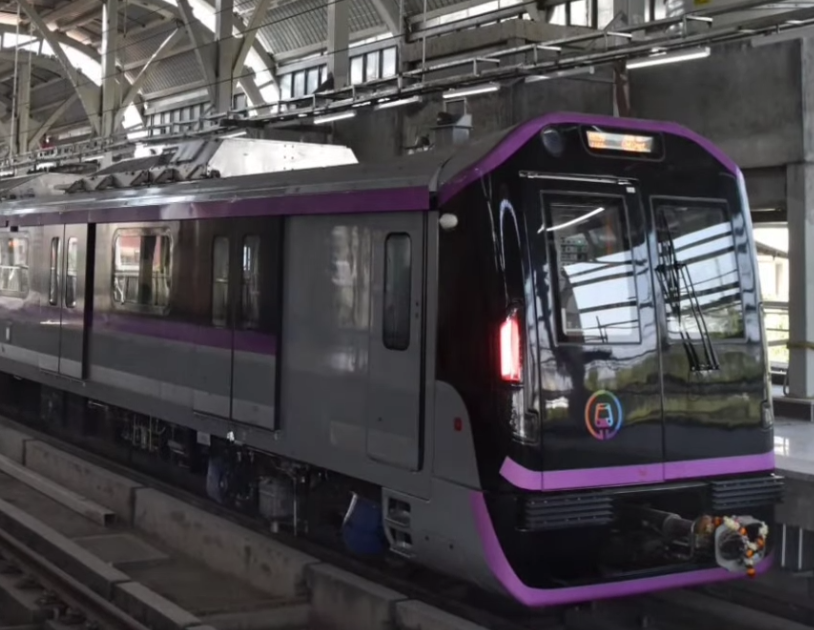
Pune Metro is a mass rapid transit system serving the city of Pune, India. The system comprises 3 lines with a combined length of 54.58 km, of which 12 km on two lines are operational as of March 2022. The 16.59-km Purple line from PCMC Bhavan to Swargate runs on an elevated viaduct between PCMC Bhavan to Range Hills, from where it goes underground. The Aqua line runs from Vanaz to Ramwadi covering a distance of 14.66 km on an elevated viaduct. The 23.33-km elevated Line 3 will run from the Rajiv Gandhi Infotech Park in Hinjawadi via Balewadi to Civil Court. All three lines will align at the Civil Court interchange station. The foundation stone for the Purple and Aqua lines was laid by the Prime Minister of India in December 2016. The two lines with a combined length of 31.25 km and are being implemented by the Maharashtra Metro Rail Corporation Limited (MahaMetro), a 50:50 joint venture of the state and central governments. Sections of the purple (7 km) ... [...More Info...] [...Related Items...] OR: [Wikipedia] [Google] [Baidu] |
PMPML
Pune Mahanagar Parivahan Mahamandal Ltd (PMPML) is the public transport bus service provider for the city of Pune, India. It operates 486 routes around the Pune Metropolitan Region including 51 Rainbow BRT routes that partially ply on the 4 bus rapid transit corridors. As of mid'22, PMPML became the fleet in the country that only runs on Green fuel with CNG and Electric Buses. Since 2019, PMPML has been operating both 9 and 12 m Electric AC Buses at the same fare as regular buses. PMPML is the only fleet in the country to operate near around 400 Electric buses daily, providing all necessary infrastructures and leading towards most reliable public transport service in the country. History Early history Pune Nagarpalika, the predecessor of the Pune Municipal Corporation (PMC), conceived the idea of a public transport system for the city in the 1940s which materialized when the Regional Transport Office gave its nod for M/s. Silver Jubilee Motors to take up the charge. The ser ... [...More Info...] [...Related Items...] OR: [Wikipedia] [Google] [Baidu] |
Bibwewadi
Pune (; ; also known as Poona, ( the official name from 1818 until 1978) is one of the most important industrial and educational hubs of India, with an estimated population of 7.4 million As of 2021, Pune Metropolitan Region is the largest in Maharashtra by area, with a geographical area of 7,256 sq km. It has been ranked "the most liveable city in India" several times. Pune is also considered to be the cultural and educational capital of Maharashtra. Along with the municipal corporation area of PCMC, PMC and the three cantonment towns of Camp, Khadki, and Dehu Road, Pune forms the urban core of the eponymous Pune Metropolitan Region (PMR). Situated {{convert, 560, m, 0, abbr=off above sea level on the Deccan plateau, on the right bank of the Mutha river,{{cite web , last=Nalawade , first=S.B. , url=http://www.ranwa.org/punealive/pageog.htm , title=Geography of Pune Urban Area , publisher=Ranwa , access-date=4 April 2008 , archive-url=https://web.archive.org/web/2007122208 ... [...More Info...] [...Related Items...] OR: [Wikipedia] [Google] [Baidu] |
Pune Swargate
Pune (; ; also known as Poona, ( the official name from 1818 until 1978) is one of the most important industrial and educational hubs of India, with an estimated population of 7.4 million As of 2021, Pune Metropolitan Region is the largest in Maharashtra by area, with a geographical area of 7,256 sq km. It has been ranked "the most liveable city in India" several times. Pune is also considered to be the cultural and educational capital of Maharashtra. Along with the municipal corporation area of PCMC, PMC and the three cantonment towns of Camp, Khadki, and Dehu Road, Pune forms the urban core of the eponymous Pune Metropolitan Region (PMR). Situated {{convert, 560, m, 0, abbr=off above sea level on the Deccan plateau, on the right bank of the Mutha river,{{cite web , last=Nalawade , first=S.B. , url=http://www.ranwa.org/punealive/pageog.htm , title=Geography of Pune Urban Area , publisher=Ranwa , access-date=4 April 2008 , archive-url=https://web.archive.org/web/200712220 ... [...More Info...] [...Related Items...] OR: [Wikipedia] [Google] [Baidu] |
Pune
Pune (; ; also known as Poona, (List of renamed Indian cities and states#Maharashtra, the official name from 1818 until 1978) is one of the most important industrial and educational hubs of India, with an estimated population of 7.4 million As of 2021, Pune Metropolitan Region is the largest in Maharashtra by area, with a geographical area of 7,256 sq km. It has been ranked "the most liveable city in India" several times. Pune is also considered to be the cultural and educational capital of Maharashtra. Along with the municipal corporation area of Pimpri-Chinchwad Municipal Corporation, PCMC, Pune Municipal Corporation, PMC and the three Cantonment Board, cantonment towns of Pune Camp, Camp, Khadki, and Dehu Road, Pune forms the urban core of the eponymous Pune Metropolitan Region (PMR). Situated {{convert, 560, m, 0, abbr=off Height above sea level, above sea level on the Deccan Plateau, Deccan plateau, on the right bank of the Mutha River, Mutha river,{{cite web , last=Nala ... [...More Info...] [...Related Items...] OR: [Wikipedia] [Google] [Baidu] |
Nehru Stadium, Pune
Nehru Stadium, formerly known as ''Club of Maharashtra Ground'', is a multi-purpose stadium in Pune, India. It is mainly used for cricket matches. The stadium was built in 1969 and holds a capacity of 25,000. The ground is home to Maharashtra Cricket Team who represent the state of Maharashtra in Ranji Trophy. International Cricket The stadium has hosted 11 One Day International matches including two in the Cricket World Cup (1987 & 1996), 4 WODI till date. The first ever ODI played on this ground was between India and England in 1984. The ground is yet to host a test match. One of cricket's biggest upsets occurred on this very ground when Kenya beat West Indies in a low scoring encounter in the 1996 Cricket World Cup. List of ODIs List of WODIs Cricket World Cup This stadium has hosted One Day International (ODI) matches when India hosted the Cricket World Cup. # 1987 Cricket World Cup # 1996 Cricket World Cup ;1987 Cricket World Cup * Sri Lanka v/s England: ;19 ... [...More Info...] [...Related Items...] OR: [Wikipedia] [Google] [Baidu] |
Deccan Gymkhana
Deccan Gymkhana is an area in Pune city named for the Deccan Gymkhana Sports Club, which lies in the centre of the city. See also * Shivajinagar *Gymkhana *Swargate *Pune Railway Station *Pune *Pune District *Maharashtra Maharashtra (; , abbr. MH or Maha) is a states and union territories of India, state in the western India, western peninsular region of India occupying a substantial portion of the Deccan Plateau. Maharashtra is the List of states and union te ... References External links {{Pune topics Neighbourhoods in Pune ... [...More Info...] [...Related Items...] OR: [Wikipedia] [Google] [Baidu] |
Saras Baug
Sarasbaug is a major landmark in the city of Pune in India. The place where the park now stands was once occupied by a small lake. However, the lake dried up and was later developed into Sarasbaug. The whole complex is known as Sarasbaug. The Ganesh temple in Saras Baug is also known as Talyatla Ganapati (in Marathi:तळ्यातला गणपती ) which translates as the Ganapati of the lake. History The Construction of the Temple started in 1750 under the direction of Naansaheb Peshwe, the de facto head of the Maratha confederacy. The construction of the temple was completed in 1784 with the idol of Hindu Lord Ganesh in the temple. The temple was built in the lake near the Parvati Temple, which was also the primary residence of the Peshwa family. The inscription in the temple reads: , , देवदेवेश्वर सुतं देवं , सारासोद्यान भूषणं , , , , कल्पद्रुमां त्वां भ� ... [...More Info...] [...Related Items...] OR: [Wikipedia] [Google] [Baidu] |
Shivajinagar, Pune
Shivajinagar (also known as Bhambwade, Bhamburde) is an suburb of the city of Pune, India. History The area has a very long history with the 8th-century Rashtrakuta-era cave temple of Pataleshwar being the oldest manmade structure in Pune. Shivajinagar was earlier a village known as Bhambwade, with the name changing over time to Bhamburde. During the Peshwa era, a handmade paper factory operated in Bhamburde. It is believed that Chhatrapati Shivaji Maharaj visited the Rokdoba temple in the village and stayed at the Shirole family home, Shirole Wada. During the Maratha and British eras, the village Patil (head/chief) came from the Shiledar Shirole ( Patil) family, members of which also served as Shiledar (warriors) in the Maratha army. The Shirole family is now a well-known political family. In the 19th century, Jangali Maharaj, a saint revered mostly by Hindus, established his residence in Bhamburde. A temple with his tomb (samadhi) is located today in Shivajinagar and a m ... [...More Info...] [...Related Items...] OR: [Wikipedia] [Google] [Baidu] |
Hadapsar
Hadapsar is a developed town in eastern Pune City, Maharashtra. After 1990, Hadapsar developed into a major industrial area and is now one of the most densely populated and developed areas of Pune District. It is well connected to all parts of city. Distances to popular city centers is: Pune Railway Station 8 km, Lohegaon Airport 8 km, Koregaon Park 5 km, Swargate Bus Stand 7 km and Shivaji Nagar Railway Station 12 km. History During the second Anglo-Maratha war, a battle was fought between Jaswantrao (Yashwantrao) Holkar and Peshwa (and Scindia) in which Jaswantrao defeated the army of Peshwa and Scindia at Hadapsar in 25 October 1802. Industry Hadapsar is an industrial suburb and part of the Pune Municipal Corporation. Hadapsar is home to corporations such as Serum Institute of India PVT LTD, MMR department, Honeywell, Bharat Forge, Gits Food Products, Indian Hume Pipe Factory, EDP, and Accurate. It is also home to the Hadapsar Industrial Estate. H ... [...More Info...] [...Related Items...] OR: [Wikipedia] [Google] [Baidu] |
Kolhapur
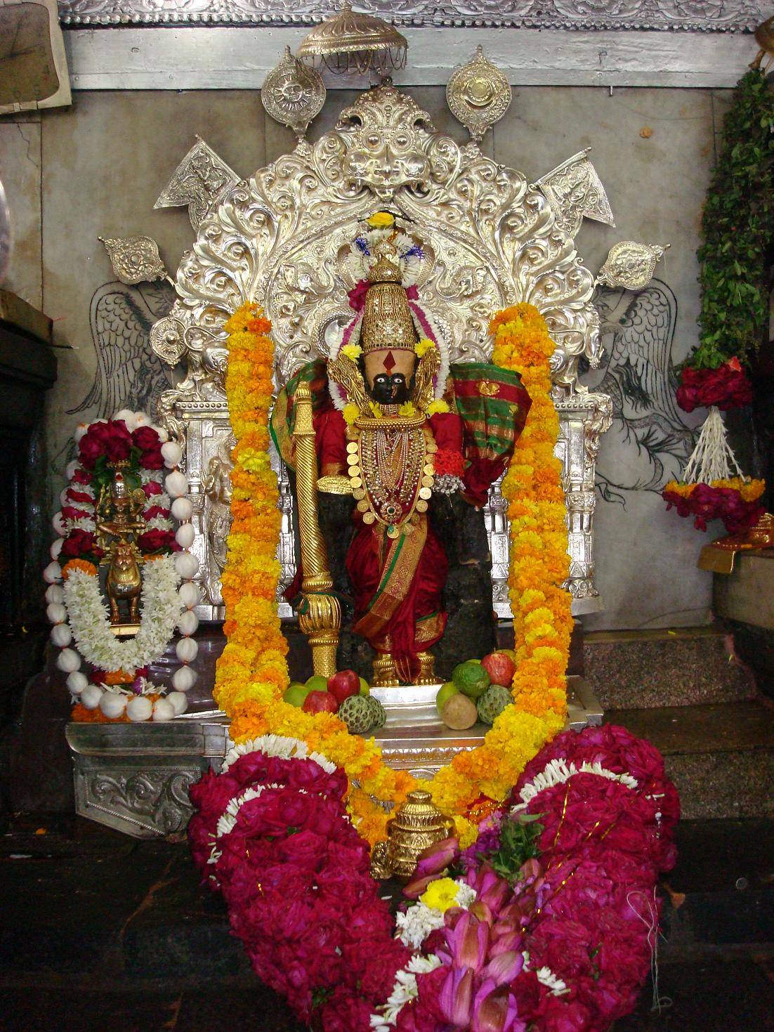
Kolhapur () is a city on the banks of the Panchganga River in the southern part of the Indian state of Maharashtra. It is the administrative headquarter of the Kolhapur district. In, around 2 C.E. Kolapur's name was 'Kuntal'. Kolhapur is known as ''`Dakshin Kashi''' or Kashi of the South because of its spiritual history and the antiquity of its shrine Mahalaxmi, better known as Ambabai. The region is known for the production of the famous hand-crafted and braided leather slippers called Kolhapuri chappal, which received the Geographical Indication designation in 2019. In Hindu mythology, the city is referred to as "''Karvir''." Before India became independent in 1947, Kolhapur was a princely state under the Bhosale Chhatrapati of the Maratha Empire. It is an important center for the Marathi film industry. Etymology Kolhapur is named after Kolhasur, a demon in Hindu History. According to History, the demon Kolhasur renounced asceticism after his sons were killed by God f ... [...More Info...] [...Related Items...] OR: [Wikipedia] [Google] [Baidu] |


