|
Sur Lípez Province
Sur Lípez or Sud Lípez is a province in the Potosí Department in Bolivia. The seat of the province is San Pablo de Lípez. Location Sur Lípez is one of sixteen provinces in the Potosí Department. Also the southwesternmost point of Bolivia is located here, at 22° 49' 41.016" South, 67° 52' 35.004" West, at an elevation of approximately 5,400 m on the northeastern slope of the Licancabur volcano. It is bordered by the Nor Lípez Province in the north and northwest, Enrique Baldivieso Province in the west, the Republic of Chile in the southwest and south, the Republic of Argentina in the southeast and east, and Sud Chichas Province in the northeast. The province extends from the northeast to the southwest, at a length of 230 km and an average width of 100 km. Geography In its southwestern part, the Quetena Grande Canton which lies in the Eduardo Avaroa Andean Fauna National Reserve, the province has a couple of lakes and salt pans, the largest being Laguna Colo ... [...More Info...] [...Related Items...] OR: [Wikipedia] [Google] [Baidu] |
Laguna Verde (Bolivia)
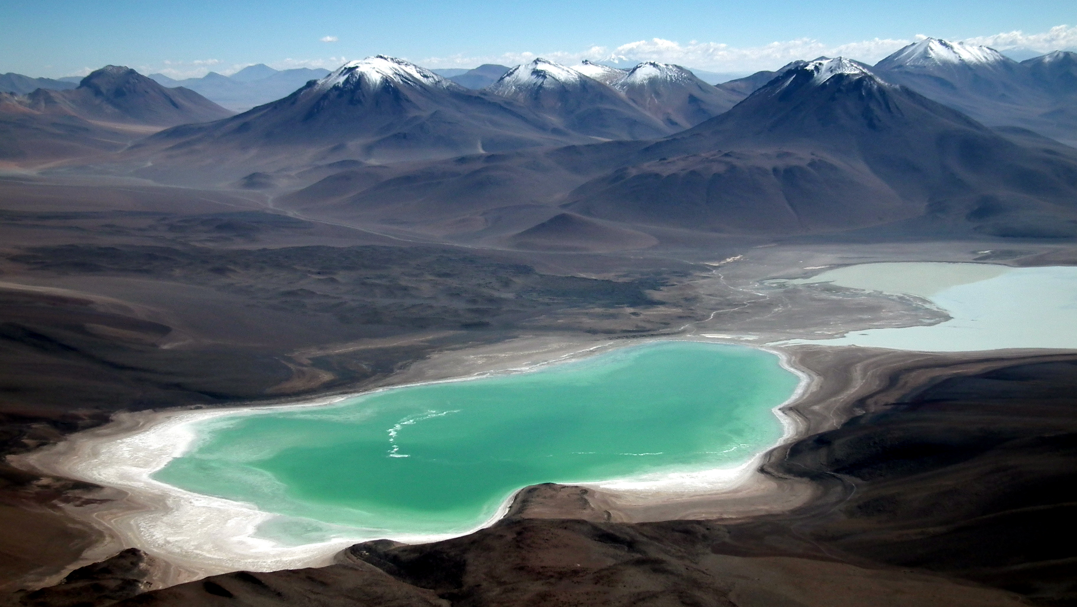
__NOTOC__ Laguna Verde (Spanish for "green lake") is a salt lake in an endorheic basin, in the southwestern Altiplano in Bolivia. It is located in the Sur Lípez Province of the Potosí Department. It is close to the Chilean border, at the foot of the volcano Licancabur. Geography The Laguna Verde is a lake at elevation. It covers an area of and has a depth of , and a narrow causeway divides it into two parts. It is at the southwestern extremity of the Eduardo Avaroa Andean Fauna National Reserve and Bolivia itself. It has mineral suspensions of arsenic and other minerals which renders colour to the lake waters. Its color varies from turquoise to dark emerald depending on the disturbance caused to sediments in the lake by winds. In the backdrop of the lake there is the inactive volcano Licancabur of in elevation, which is a nearly perfect cone. The shorelines west and east of the lake have different characteristics, with the western and southern shores eroded into volcanoes ... [...More Info...] [...Related Items...] OR: [Wikipedia] [Google] [Baidu] |
Eduardo Avaroa Andean Fauna National Reserve
The Eduardo Avaroa Andean Fauna National Reserve (''Reserva Nacional de Fauna Andina Eduardo Avaroa''; Spanish acronym: REA) is located in Sur Lípez Province. Situated in the far southwestern region of Bolivia, it is the country's most visited protected area. It is considered the most important protected area in terms of tourist influx in the Potosí Department. Located at an altitude between and in Bolivia, it extends over an area of and includes the Laguna Colorada National Wildlife Sanctuary. Categorized under IUCN Category IV, it is primarily for the protection of birds that inhabit the different lagoons in the reserve. The reserve protects part of the Central Andean dry puna (oligothermic) ecoregion. The reserve's major attractions are erupting volcanoes, hot springs, geysers, lakes, fumaroles, mountains and its three endemic species of flamingos in particular. History Established in 1973, the national park is named after Eduardo Avaroa (1838–1879), the Bolivian war ... [...More Info...] [...Related Items...] OR: [Wikipedia] [Google] [Baidu] |
Kuntur Wasi (Bolivia)
Kuntur Wasi (Quechua ''kuntur'' condor, ''wasi'' house, "condor house") is a mountain in the Andes of Bolivia. It is situated in the Potosí Department, Sud Lípez Province, San Pablo de Lípez Municipality San Pablo de Lípez Municipality is the first municipal section of the Sur Lípez Province in the Potosí Department in Bolivia. Its seat is San Pablo de Lípez. Geography The highest mountain of the municipality is Uturunku at . Other mountain .... Kuntur Wasi lies north of the Lluch'a Mayu ''(Llucha Mayu)'' east of San Pablo de Lípez. References Mountains of Potosí Department {{Potosí-geo-stub ... [...More Info...] [...Related Items...] OR: [Wikipedia] [Google] [Baidu] |
Juriques
Juriques is a stratovolcano on the border between Bolivia and Chile. It is located immediately southeast of Licancabur volcano. Its summit is at with a crater in its longest diameter. Laguna Verde lies at the foot of this volcano. Gallery File:ALMA Dwarfed by Mountain Peaks.jpg, Stratovolcano Juriques and the Atacama Large Millimeter Array The Atacama Large Millimeter/submillimeter Array (ALMA) is an astronomical interferometer of 66 radio telescopes in the Atacama Desert of northern Chile, which observe electromagnetic radiation at millimeter and submillimeter wavelengths. The .... References * Volcanoes of Antofagasta Region Volcanoes of Potosí Department Stratovolcanoes of Chile Stratovolcanoes of Bolivia Polygenetic volcanoes Five-thousanders of the Andes International mountains of South America Holocene stratovolcanoes {{Antofagasta-geo-stub ... [...More Info...] [...Related Items...] OR: [Wikipedia] [Google] [Baidu] |
Jarellón
Jarellón is a caldera in the Andes, on the border between Bolivia and Chile which was discovered in 1975. It has a diameter of and formed during the Pliocene, with one K-Ar date of 3.6 ± 0.1 million years ago. It has erupted dacite and rhyolite. The caldera and the associated stratovolcano of the same name are an important source of obsidian, which forms several large lava flows. This obsidian is known as the ''Laguna Blanca obsidian'' or ''Zapaleri Zapaleri is a volcano whose summit is the tripoint of the borders of Argentina, Bolivia and Chile. A number of railways are in the area. It is part of Potosí Department (Bolivia), Jujuy Province (Argentina), and Antofagasta Region (Chile). The ... obsidian''. This obsidian was traded regionally. References Pliocene calderas Volcanoes of Chile Volcanoes of Bolivia Calderas of Chile {{Volcanology-stub ... [...More Info...] [...Related Items...] OR: [Wikipedia] [Google] [Baidu] |
Ch'iqu
Ch'iqu (Quechua language, Quechua for workable stone, misleadingly also named ''Volcán Chico'' (Spanish language, Spanish for "little volcano")) is a volcano in Bolivia. It is located in the Potosí Department, Sud Lípez Province, San Pablo de Lípez Municipality. Ch'iqu lies northeast of Qhawana. References {{DEFAULTSORT:Chiqu Volcanoes of Potosí Department ... [...More Info...] [...Related Items...] OR: [Wikipedia] [Google] [Baidu] |
Ch'iqlla
Ch'iqlla (Quechua for tadpole, also spelled ''Chijlla'') is a mountain in Bolivia. It is located in the Potosí Department, Sud Lípez Province, San Pablo de Lípez Municipality. Ch'iqlla lies between the Ch'iqu volcano in the north and Laguna Colorada __NOTOC__ Laguna Colorada (''Red Lagoon'') is a shallow salt lake in the southwest of the altiplano of Bolivia, within Eduardo Avaroa Andean Fauna National Reserve and close to the border with Chile. Contents The lake contains borax islands, ... in the south. References {{DEFAULTSORT:Chiqlla Mountains of Potosí Department ... [...More Info...] [...Related Items...] OR: [Wikipedia] [Google] [Baidu] |
Ch'aska Urqu (Sud Lípez)
Ch'aska Urqu (Quechua ''ch'aska'' tousled / star, ''urqu'' mountain, "tousled mountain" or "star mountain", also spelled ''Chasca Orkho'') is a mountain in the Andes of Bolivia, about high. It is situated in the Potosí Department, Sud Lípez Province, San Pablo de Lípez Municipality San Pablo de Lípez Municipality is the first municipal section of the Sur Lípez Province in the Potosí Department in Bolivia. Its seat is San Pablo de Lípez. Geography The highest mountain of the municipality is Uturunku at . Other mountain .... Ch'aska Urqu lies west of the mountain Muruq'u and north-east of the mountains Palti Urqu and Q'illu Urqu. (unnamed) References Mountains of Potosí Department {{Potosí-geo-stub ... [...More Info...] [...Related Items...] OR: [Wikipedia] [Google] [Baidu] |
Apachita (Potosí)
Apachita (Aymara for the place of transit of an important pass in the principal routes of the Andes; name for a stone cairn in the Andes, a little pile of rocks built along the trail in the high mountains, also spelled ''Apacheta'') is a mountain in the Cordillera Occidental in the Bolivian Andes. It is located in the Potosí Department, Sur Lípez Province, San Pablo de Lípez Municipality, near the Chilean border.Bolivian IGM map 1:250,000 Volcán Juriques SF-19-11 Apachita lies within the borders of the Eduardo Avaroa Andean Fauna National Reserve. Reserva National de Fauna Andina Eduardo Avaroa It is situated east of Michina
Michina (Quechua for pasture) is a ...
[...More Info...] [...Related Items...] OR: [Wikipedia] [Google] [Baidu] |
Uturunku
Uturuncu is a dormant volcano in the Sur Lípez Province of Bolivia. It is high, has two summit peaks, and consists of a complex of lava domes and lava flows with a total volume estimated to be . It bears traces of a former glaciation, even though it does not currently carry glaciers. Volcanic activity took place during the Pleistocene epoch and the last eruption was 250,000 years ago; since then Uturuncu has not erupted but active fumaroles occur in the summit region, between the two summits. The volcano rises within the Altiplano–Puna volcanic complex, a larger province of large volcanoes and calderas which over the last few million years (mya) have emplaced about of ignimbrites in sometimes very large eruptions. Underneath it lies the so-called Altiplano–Puna magmatic body, a large sill formed by partially molten rocks. Starting in 1992, satellite observations have indicated a large area of regional uplift centered on Uturuncu, which has been interpreted as an i ... [...More Info...] [...Related Items...] OR: [Wikipedia] [Google] [Baidu] |
Cordillera De Lípez
The Cordillera de Lípez is a mountain range in northern Potosí, Bolivia, and northern Argentina, part of the Andes. The range covers an area of 23,404 km2 (9,036 sq mi) and runs in a northeast–southwest direction, between the parallels 22 degrees and 23 degrees, helping to form the boundary between Bolivia and Argentina. Thus the Cordillera de Lípez is a transverse range in the Andes, between the Cordillera Oriental and the Cordillera Occidental, creating the southern boundary of the Bolivian Altiplano. The highest peak is Uturunku at 6,008 m (19,711 ft). Other important peaks are Cerro Lípez (5,929 m) sometimes misidentified as Nuevo Mundo; Soniquera (5,899 m) (sometimes misspelled as Soreguera); and Tinte (5,849 m) which is on the Bolivian-Argentine border. Despite the high elevations, there is no current glacier activity in the Cordillera de Lípez, just some semi-permanent snow fields. Notes #Brain, Y. "Climbs and Expeditions: Bolivia" American Alpine ... [...More Info...] [...Related Items...] OR: [Wikipedia] [Google] [Baidu] |
Sol De Mañana
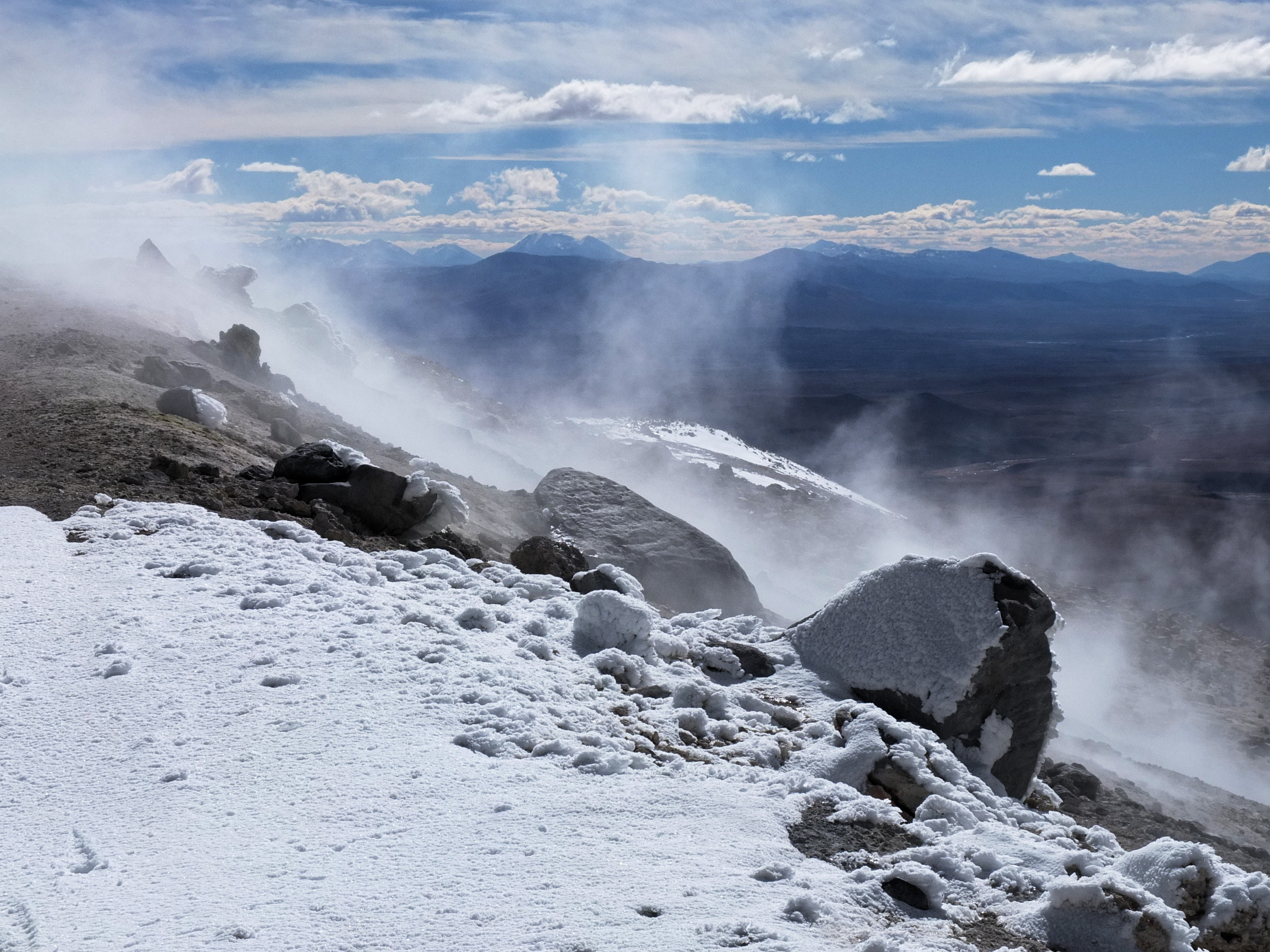
Sol de Mañana ( es, Morning Sun) is a geothermal area in Sur Lípez Province in the Potosi Department of south-western Bolivia. It extends over 10 km2, between 4800m and 5000m in altitude. This area is characterized by intense volcanic activity and the sulphur springs field is full of mud lakes and steam pools with boiling mud. Industrial logging was attempted at the end of the 1980s, but is uneconomic. There are still several wells, one of which emits pressurized steam, visible in the morning up to 50 meters high. The major mud lakes are located at 4850m. The field is seismically active. Sol de Mañana, together with El Tatio, is among the geothermal fields located at high altitude and is associated with the volcanic system of the Altiplano-Puna volcanic complex, as well as with a fault (geology), fault system that connects the two. Sol de Mañana is part of the geothermal system of the Laguna Colorada (caldera), Laguna Colorada caldera; Cerro Guacha and Pastos Grandes have ... [...More Info...] [...Related Items...] OR: [Wikipedia] [Google] [Baidu] |

.jpg)


