|
Stranraer Sheriff Court
Stranraer Sheriff Court is a judicial building in Lewis Street, Stranraer, Dumfries and Galloway, Scotland. The building, which continues to be used as a courthouse, is a Category B listed building. History The first judicial building in Stranraer was a tolbooth which was built on part of the local parish churchyard and dated back to the late 17th century. It was replaced, in 1776, by the old town hall in George Street, which was extended to the rear to accommodate a corn exchange and a courtroom in 1855. However, in the early 1870s, the Commissioners of Supply decided that Stranraer need a dedicated courthouse. A new courthouse was designed by Thomas Brown II and James Maitland Wardrop in the Gothic Revival style, built in red sandstone from Galashiels with buff stone dressings from Hexham and was officially opened on 15 January 1874. The design involved a symmetrical main frontage of three bays facing into Lewis Street. The central bay featured a portico, which incorporated ... [...More Info...] [...Related Items...] OR: [Wikipedia] [Google] [Baidu] |
Stranraer
Stranraer ( , in Scotland also ; gd, An t-Sròn Reamhar ), also known as The Toon, is a town in Dumfries and Galloway, Scotland. It is located in the historical parish of Inch in the historic county of Wigtownshire. It lies on the shores of Loch Ryan, on the northern side of the isthmus joining the Rhins of Galloway to the mainland. Stranraer is Dumfries and Galloway's second-largest town, with a population including the immediate surrounding area of nearly 13,000 inhabitants. Stranraer is an administrative centre for the West Galloway Wigtownshire area of Dumfries and Galloway. It was formerly a ferry port, connecting Scotland with Belfast and Larne in Northern Ireland; the last service was transferred to nearby Cairnryan in November 2011. It lies by road southwest of Glasgow, miles southwest of Ayr and to the west of Dumfries. The name comes from Scottish Gaelic '' An t-Sròn Reamhar'' meaning "the broad headland" or "the fat nose". History The Battle of Loch Ryan was ... [...More Info...] [...Related Items...] OR: [Wikipedia] [Google] [Baidu] |
Sash Window
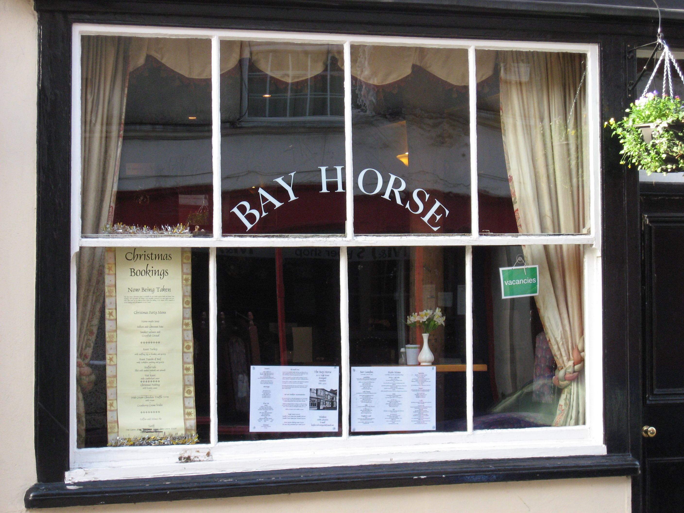
A sash window or hung sash window is made of one or more movable panels, or "sashes". The individual sashes are traditionally paned window (architecture), paned windows, but can now contain an individual sheet (or sheets, in the case of double glazing) of glass. History The oldest surviving examples of sash windows were installed in England in the 1670s, for example at Ham House.Louw, HJ, ''Architectural History'', Vol. 26, 1983 (1983), pp. 49–72, 144–15JSTOR The invention of the sash window is sometimes credited, without conclusive evidence, to Robert Hooke. Others see the sash window as a Dutch invention. H.J. Louw believed that the sash window was developed in England, but concluded that it was impossible to determine the exact inventor. The sash window is often found in Georgian architecture, Georgian and Victorian architecture, Victorian houses, and the classic arrangement has three panes across by two up on each of two sash, giving a ''six over six'' panel window, alth ... [...More Info...] [...Related Items...] OR: [Wikipedia] [Google] [Baidu] |
World War I
World War I (28 July 1914 11 November 1918), often abbreviated as WWI, was one of the deadliest global conflicts in history. Belligerents included much of Europe, the Russian Empire, the United States, and the Ottoman Empire, with fighting occurring throughout Europe, the Middle East, Africa, the Pacific, and parts of Asia. An estimated 9 million soldiers were killed in combat, plus another 23 million wounded, while 5 million civilians died as a result of military action, hunger, and disease. Millions more died in genocides within the Ottoman Empire and in the 1918 influenza pandemic, which was exacerbated by the movement of combatants during the war. Prior to 1914, the European great powers were divided between the Triple Entente (comprising France, Russia, and Britain) and the Triple Alliance (containing Germany, Austria-Hungary, and Italy). Tensions in the Balkans came to a head on 28 June 1914, following the assassination of Archduke Franz Ferdin ... [...More Info...] [...Related Items...] OR: [Wikipedia] [Google] [Baidu] |
Pedestal
A pedestal (from French ''piédestal'', Italian ''piedistallo'' 'foot of a stall') or plinth is a support at the bottom of a statue, vase, column, or certain altars. Smaller pedestals, especially if round in shape, may be called socles. In civil engineering, it is also called ''basement''. The minimum height of the plinth is usually kept as 45 cm (for buildings). It transmits loads from superstructure to the substructure and acts as the retaining wall for the filling inside the plinth or raised floor. In sculpting, the terms base, plinth, and pedestal are defined according to their subtle differences. A base is defined as a large mass that supports the sculpture from below. A plinth is defined as a flat and planar support which separates the sculpture from the environment. A pedestal, on the other hand, is defined as a shaft-like form that raises the sculpture and separates it from the base. An elevated pedestal or plinth that bears a statue, and which is raised from th ... [...More Info...] [...Related Items...] OR: [Wikipedia] [Google] [Baidu] |
Granite
Granite () is a coarse-grained (phaneritic) intrusive igneous rock composed mostly of quartz, alkali feldspar, and plagioclase. It forms from magma with a high content of silica and alkali metal oxides that slowly cools and solidifies underground. It is common in the continental crust of Earth, where it is found in igneous intrusions. These range in size from dikes only a few centimeters across to batholiths exposed over hundreds of square kilometers. Granite is typical of a larger family of ''granitic rocks'', or ''granitoids'', that are composed mostly of coarse-grained quartz and feldspars in varying proportions. These rocks are classified by the relative percentages of quartz, alkali feldspar, and plagioclase (the QAPF classification), with true granite representing granitic rocks rich in quartz and alkali feldspar. Most granitic rocks also contain mica or amphibole minerals, though a few (known as leucogranites) contain almost no dark minerals. Granite is nearly alway ... [...More Info...] [...Related Items...] OR: [Wikipedia] [Google] [Baidu] |
Tam O' Shanter (cap)
A tam o' shanter (in the British military often abbreviated to ToS) or "tammie" is a name given to the traditional Scottish bonnet worn by men. The name derives from Tam o' Shanter, the eponymous hero of the 1790 Robert Burns poem. Description The tam o' shanter is a flat bonnet, originally made of wool hand-knitted in one piece, stretched on a wooden disc to give the distinctive flat shape, and subsequently felted. The earliest forms of these caps, known as a blue bonnet from their typical colour, were made by bonnet-makers in Scotland. By the year 1599 five bonnet-makers' guilds had formed in cities around the country: Edinburgh, Aberdeen, Perth, Stirling and Glasgow. At the end of the 16th century, it was said that the Scottish caps were the normal fashion of men and servants, and they remained so throughout the 17th century. Similar in outline to the various types of flat bonnet common in northwestern Europe during the 16th century, the later tam o' shanter is distinguish ... [...More Info...] [...Related Items...] OR: [Wikipedia] [Google] [Baidu] |
Royal Scots Fusiliers
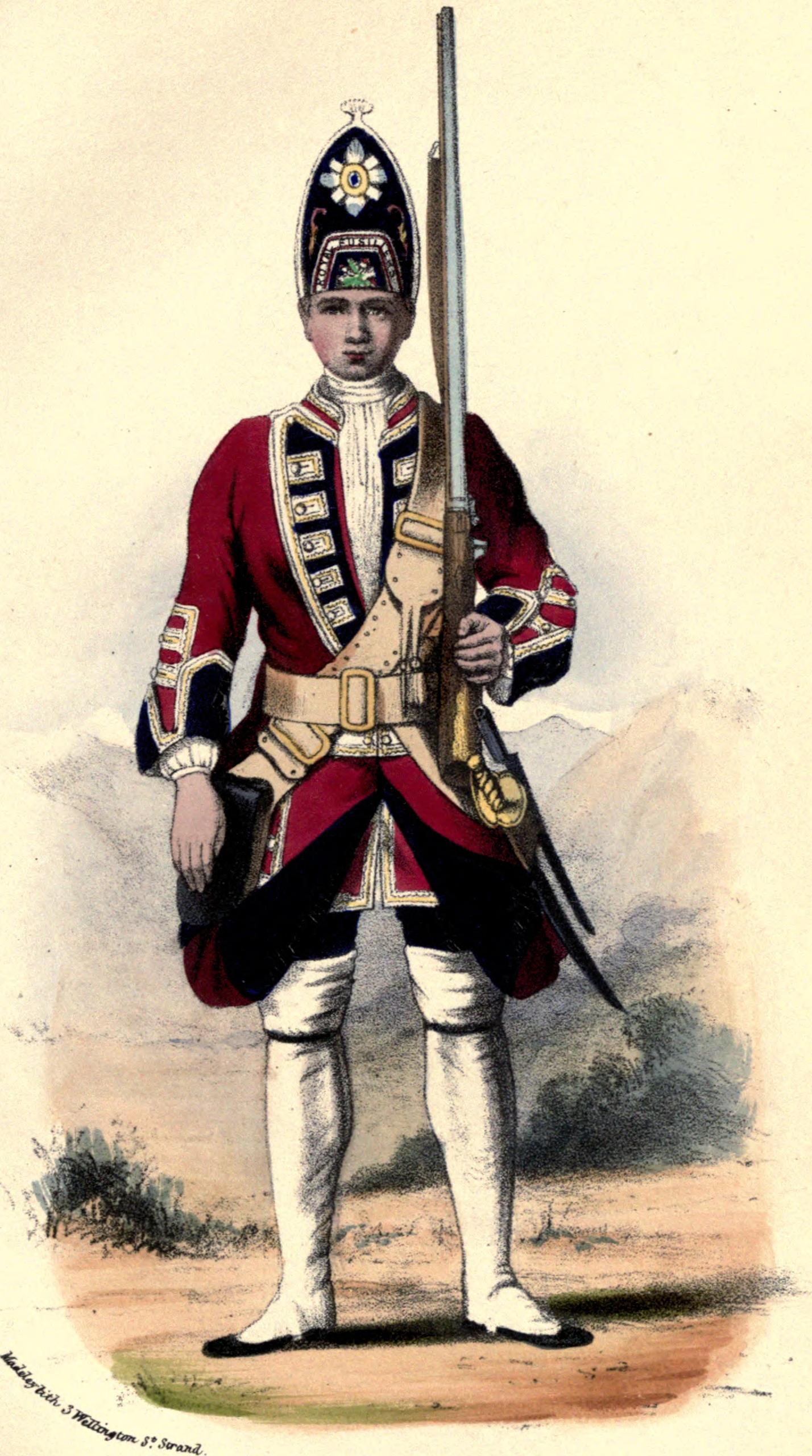
The Royal Scots Fusiliers was a line infantry regiment of the British Army that existed from 1678 until 1959 when it was amalgamated with the Highland Light Infantry (City of Glasgow Regiment) to form the Royal Highland Fusiliers (Princess Margaret's Own Glasgow and Ayrshire Regiment) which was later itself merged with the Royal Scots Borderers, the Black Watch (Royal Highland Regiment), the Argyll and Sutherland Highlanders and the Highlanders (Seaforth, Gordons and Camerons) to form a new large regiment, the Royal Regiment of Scotland. History Naming Conventions In the late 17th century, many English and Scottish politicians viewed standing armies or permanent units as a danger to the liberties of the individual and a threat to society itself. The experience of the Wars of the Three Kingdoms and the use of troops by both the Protectorate and James VII and II to repress political dissent created strong resistance to permanent units owing allegiance to the Crown or State. R ... [...More Info...] [...Related Items...] OR: [Wikipedia] [Google] [Baidu] |
Newton Stewart
Newton Stewart ( Gd: ''Baile Ùr nan Stiùbhartach'') is a former burgh town in the historical county of Wigtownshire in Dumfries and Galloway, southwest Scotland. The town is on the River Cree with most of the town to the west of the river, and is sometimes referred to as the "Gateway to the Galloway Hills". The main local industries are agriculture, forestry and tourism. The town hosts a local market, and a number of services to support the farming industry. There are many mountain biking trails in the area. Newton Stewart lies on the southern edge of the Galloway Forest Park, which supplies many jobs to the town. Newton Stewart is from Scotland's book town Wigtown. History The town was founded in the mid 17th century by William Stewart, fourth and youngest son of the 2nd Earl of Galloway. The "New Town of Stewart" was granted burgh status by charter from King Charles II, allowing a weekly market and two annual fairs to be held. It was on a pilgrimage to the shrine of St N ... [...More Info...] [...Related Items...] OR: [Wikipedia] [Google] [Baidu] |
Wigtown
Wigtown ( (both used locally); gd, Baile na h-Ùige) is a town and former royal burgh in Wigtownshire, of which it is the county town, within the Dumfries and Galloway region in Scotland. It lies east of Stranraer and south of Newton Stewart. It is known as "Scotland's National Book Town" with a high concentration of second-hand book shops and an annual book festival. Wigtown is part of the Machars peninsula. History Name origins W.F.H. Nicolaisen offered two explanations for the place-name Wigtown. One theory was that it meant 'dwelling place', from the Old English 'wic-ton'; however, if it is the same as Wigton in Cumbria, which was 'Wiggeton' in 1162 and 'Wigeton' in 1262, it may be 'Wigca's farm'. Other sources have suggested a Norse root with 'Vik' meaning 'bay', giving the origin as a translation of 'The town on the bay'. Neolithic Age The surrounding area (the Machars peninsula) is rich in prehistoric remains, most notably the Torhousekie Standing Stones, a Neol ... [...More Info...] [...Related Items...] OR: [Wikipedia] [Google] [Baidu] |
Wigtown County Buildings
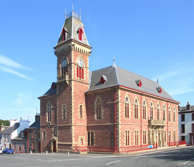
Wigtown County Buildings, also known as Wigtown County Buildings and Town Hall, is a municipal building in The Square, Wigtown, Scotland. The structure primarily served as the meeting place and town hall for Wigtown Burgh Council, but was also used for some meetings of Wigtownshire County Council. It is a Category B listed building. History The first municipal building in Wigtown was a tolbooth which was completed in the 16th century. Two covenanters, Margaret Maclauchlan and Margaret Wilson, were held in a cell in the tolbooth before being executed by Scottish Episcopalians in 1685 by tying them to stakes on the town's mudflats and allowing them to drown with the rising tide: they are remembered as the Wigtown Martyrs. The tolbooth was replaced by a new town hall which was completed in 1756. In the early 1860s, burgh officials decided to demolish the 18th century town hall and to erect a structure more in keeping with the importance of Wigtown as the administrative centre of t ... [...More Info...] [...Related Items...] OR: [Wikipedia] [Google] [Baidu] |
Wigtownshire
Wigtownshire or the County of Wigtown (, ) is one of the historic counties of Scotland, covering an area in the south-west of the country. Until 1975, Wigtownshire was an administrative county used for local government. Since 1975 the area has formed part of Dumfries and Galloway for local government purposes. Wigtownshire continues to be used as a territory for land registration, being a registration county. The historic county is all within the slightly larger Wigtown Area, which is one of the lieutenancy areas of Scotland and was used in local government as the Wigtown District from 1975 to 1996. Wigtownshire forms the western part of the medieval lordship of Galloway, which retained a degree of autonomy until it was fully absorbed by Scotland in the 13th century. In 1369, the part of Galloway east of the River Cree was placed under the control of a steward and so became known as the Stewartry of Kirkcudbright. The rest of Galloway remained under the authority of a sheriff, an ... [...More Info...] [...Related Items...] OR: [Wikipedia] [Google] [Baidu] |
Local Government (Scotland) Act 1889
The Local Government (Scotland) Act 1889 (52 & 53 Vict. c. 50) is an Act of the Parliament of the United Kingdom which was passed on 26 August 1889. The main effect of the act was to establish elected county councils in Scotland. In this it followed the pattern introduced in England and Wales by the Local Government Act 1888. County councils The act provided that a county council should be established in each county, consisting of elected councillors. The term "county" was defined as excluding any burgh, but with provisions that the county council would have powers over burghs which met certain criteria: *All burghs which had a population of less than 7,000 at the 1881 census. *Burghs which had more than 7,000 people in 1881 but did not maintain their own police force. *Royal burghs which had more than 7,000 people in 1881 but did not return or contribute towards a member of parliament. As such, there were a number of burghs which were outside the control of county councils, be ... [...More Info...] [...Related Items...] OR: [Wikipedia] [Google] [Baidu] |
.jpg)

.jpg)


