|
Stansbury Park
Stansbury Park is a census-designated place (CDP) in Tooele County, Utah, United States. The population was 5,145 at the 2010 Census; it was 2,385 at the 2000 census; the 1990 census population was 1,049. Stansbury Park is located in the northern end of Tooele Valley at the base of the Oquirrh Mountains. Traveling by Interstate 80, Stansbury Park is 35 minutes from downtown Salt Lake City. Stansbury Park was proposed by the original developer (Terracor) as a planned community with a lake for sailing and canoeing, an eighteen-hole golf course, clubhouse, swimming pool, and parks. Although the original developer withdrew from the scene in the 1980s due to bankruptcy, that plan has generally been followed. The parks throughout Stansbury Park include baseball diamonds, soccer fields, basketball courts, tennis courts, play areas for children, skateboard park, and an astronomical observatory. A large park northwest of Utah State Route 138 is being developed. A natural lake (The Mill ... [...More Info...] [...Related Items...] OR: [Wikipedia] [Google] [Baidu] |
Census-designated Place
A census-designated place (CDP) is a concentration of population defined by the United States Census Bureau for statistical purposes only. CDPs have been used in each decennial census since 1980 as the counterparts of incorporated places, such as self-governing cities, towns, and villages, for the purposes of gathering and correlating statistical data. CDPs are populated areas that generally include one officially designated but currently unincorporated community, for which the CDP is named, plus surrounding inhabited countryside of varying dimensions and, occasionally, other, smaller unincorporated communities as well. CDPs include small rural communities, edge cities, colonias located along the Mexico–United States border, and unincorporated resort and retirement communities and their environs. The boundaries of any CDP may change from decade to decade, and the Census Bureau may de-establish a CDP after a period of study, then re-establish it some decades later. Most unin ... [...More Info...] [...Related Items...] OR: [Wikipedia] [Google] [Baidu] |
Interstate 80 In Utah
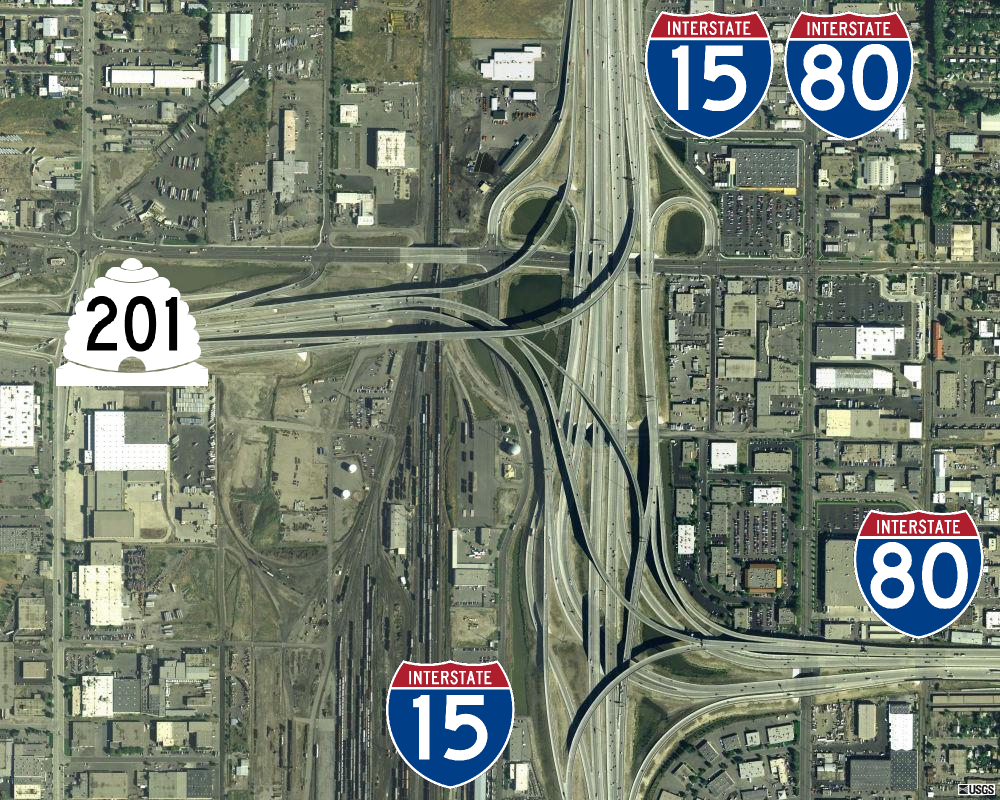
Interstate 80 (I-80) is a part of the Interstate Highway System that runs from San Francisco, California, to Teaneck, New Jersey. The portion of the highway in the US state of Utah is long through the northern part of the state. From west to east, I-80 crosses the state line from Nevada in Tooele County and traverses the Bonneville Salt Flats—which are a part of the larger Great Salt Lake Desert. It continues alongside the Wendover Cut-off—the corridor of the former Victory Highway— US Route 40 (US-40) and the Western Pacific Railroad Feather River Route. After passing the Oquirrh Mountains, I-80 enters the Salt Lake Valley and Salt Lake County. A short portion of the freeway is concurrent with I-15 through Downtown Salt Lake City. At the Spaghetti Bowl, I-80 turns east again into the mouth of Parleys Canyon and Summit County, travels through the mountain range, and intersects the eastern end of I-84 near Echo Reservoir before turning northeast toward the Wyo ... [...More Info...] [...Related Items...] OR: [Wikipedia] [Google] [Baidu] |
Kennecott Utah Copper
Kennecott Utah Copper LLC (KUC), a division of Rio Tinto Group, is a mining, smelting, and refining company. Its corporate headquarters are located in South Jordan, Utah. Kennecott operates the Bingham Canyon Mine, one of the largest open-pit copper mines in the world in Bingham Canyon, Salt Lake County, Utah. The company was first formed in 1898 as the Boston Consolidated Mining Company. The current corporation was formed in 1989. The mine and associated smelter produce 1% of the world's copper. History Utah Copper Company had its start when Enos Andrew Wall realized the potential of copper deposits in Bingham Canyon, southwest of Salt Lake City, Utah in 1887. He acquired claims to the land and started underground mining. In the mid-1890s, metallurgist Daniel C. Jackling and mining engineer Robert C. Gemmell inspected the property and liked the prospects. Both men examined Wall's properties and recommended open-pit mining. In 1898, Samuel Newhouse and Thomas Weir formed the ... [...More Info...] [...Related Items...] OR: [Wikipedia] [Google] [Baidu] |
Spring (hydrosphere)
A spring is a point of exit at which groundwater from an aquifer flows out on top of Earth's crust (pedosphere) and becomes surface water. It is a component of the hydrosphere. Springs have long been important for humans as a source of fresh water, especially in arid regions which have relatively little annual rainfall. Springs are driven out onto the surface by various natural forces, such as gravity and hydrostatic pressure. Their yield varies widely from a volumetric flow rate of nearly zero to more than for the biggest springs. Formation Springs are formed when groundwater flows onto the surface. This typically happens when the groundwater table reaches above the surface level. Springs may also be formed as a result of karst topography, aquifers, or volcanic activity. Springs also have been observed on the ocean floor, spewing hot water directly into the ocean. Springs formed as a result of karst topography create karst springs, in which ground water travels throu ... [...More Info...] [...Related Items...] OR: [Wikipedia] [Google] [Baidu] |
Utah State Route 138
State Route 138 is a highway, completely within Tooele County in northern Utah that connects Grantsville to Erda and Stansbury Park. The route runs twenty miles (32 km) and is the old routing of U.S. Route 50 Alternate and U.S. Route 40. Route description From its western terminus at exit 84 of I-80, northeast of the Stansbury Mountains, the route heads southwest (toward the mountain range), reaching the mining operation of Flux, then turns southeasterly. Upon entering the western side of Grantsville, the highway heads east (serving as Grantsville's Main Street) and turns to the northeast after leaving the city. It runs northeasterly until terminating at Mills Junction north of Stansbury Park, at milepost 62.9 of Highway 36. With the exception of the segment between SR-112 and Sheep Lane, the route is included in the National Highway System. History Previous route When it was first formed in 1933, SR-138 took a similar path to the present-day rout ... [...More Info...] [...Related Items...] OR: [Wikipedia] [Google] [Baidu] |
Observatory
An observatory is a location used for observing terrestrial, marine, or celestial events. Astronomy, climatology/meteorology, geophysical, oceanography and volcanology are examples of disciplines for which observatories have been constructed. Historically, observatories were as simple as containing an astronomical sextant (for measuring the distance between stars) or Stonehenge (which has some alignments on astronomical phenomena). Astronomical observatories Astronomical observatories are mainly divided into four categories: space-based, airborne, ground-based, and underground-based. Ground-based observatories Ground-based observatories, located on the surface of Earth, are used to make observations in the radio and visible light portions of the electromagnetic spectrum. Most optical telescopes are housed within a dome or similar structure, to protect the delicate instruments from the elements. Telescope domes have a slit or other opening in the roof that can be opened during ... [...More Info...] [...Related Items...] OR: [Wikipedia] [Google] [Baidu] |
Skatepark
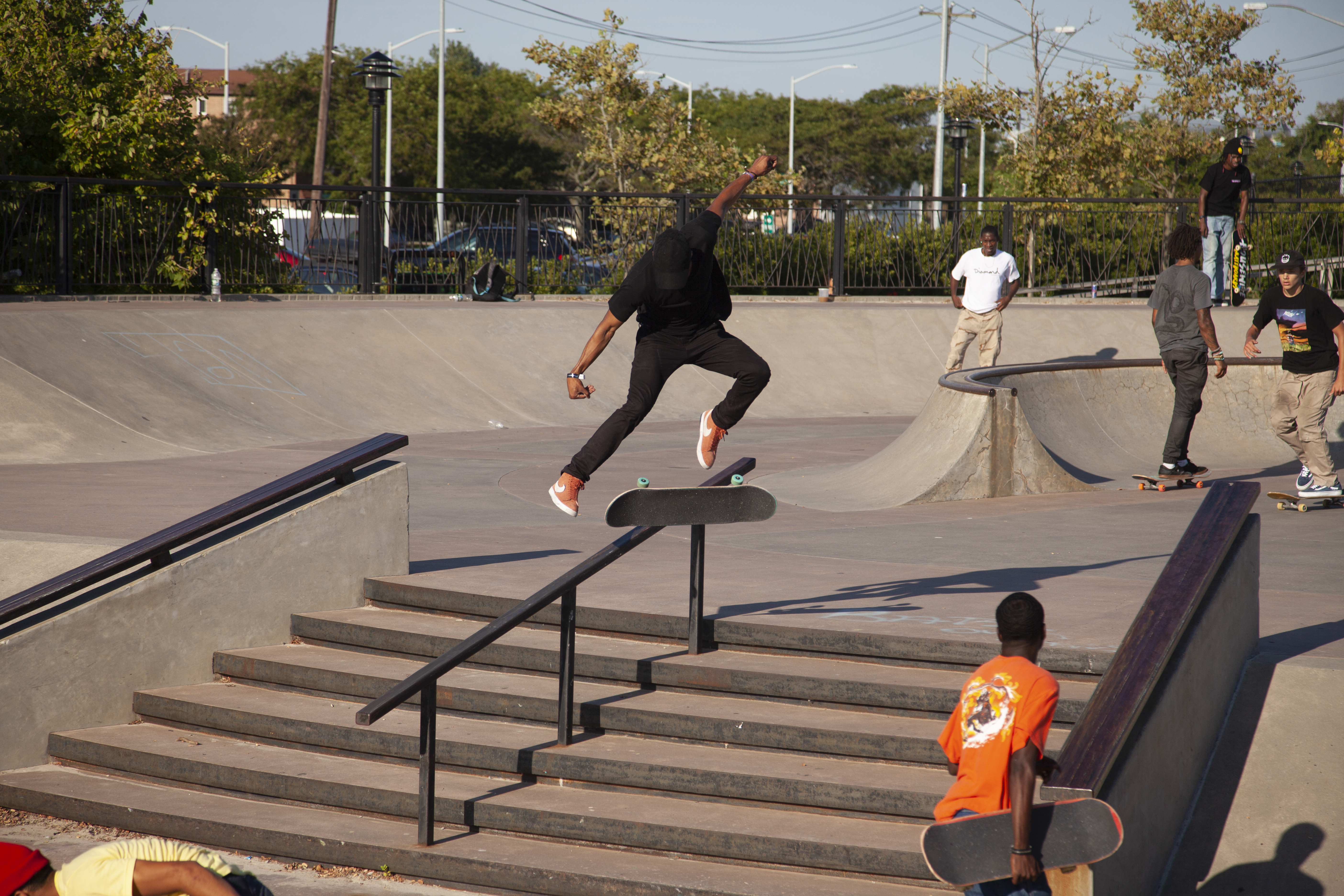
A skatepark, or skate park, is a purpose-built recreational environment made for skateboarding, BMX, scootering, wheelchairs, and aggressive inline skating. A skatepark may contain half-pipes, handrails, funboxes, vert ramps, stairsets, quarter pipes, ledges, spine transfers, pyramids, banked ramps, full pipes, pools, bowls, snake runs, and any number of other objects. History The first skatepark in the world, Surf City, opened for business at 5140 E. Speedway in Tucson, Arizona on September 3, 1965. Patti McGee, Women's National Champion, attended the grand opening. The park had concrete ramps and was operated by Arizona Surf City Enterprises, Inc. A skatepark for skateboarders and skaters made of plywood ramps on a half-acre lot in Kelso, Washington, USA opened in April 1966. It was lighted for night use. California's first skatepark, the Carlsbad Skatepark opened on March 3, 1976. The World Skateboard Championships were held here on April 10, 1977. It operated un ... [...More Info...] [...Related Items...] OR: [Wikipedia] [Google] [Baidu] |
Tennis Courts
A tennis court is the venue where the sport of tennis is played. It is a firm rectangular surface with a low net stretched across the centre. The same surface can be used to play both doubles and singles matches. A variety of surfaces can be used to create a tennis court, each with its own characteristics which affect the playing style of the game. Dimensions The dimensions of a tennis court are defined and regulated by the International Tennis Federation (ITF) governing body and are written down in the annual 'Rules of Tennis' document. The court is long. Its width is for singles matches and for doubles matches. The service line is from the net. Additional clear space around the court is needed in order for players to reach overrun balls for a total of wide and long. A net is stretched across the full width of the court, parallel with the baselines, dividing it into two equal ends. The net is high at the posts, and high in the center. The net posts are outside the d ... [...More Info...] [...Related Items...] OR: [Wikipedia] [Google] [Baidu] |
Basketball Court
In basketball, the basketball court is the playing surface, consisting of a rectangular floor, with baskets at each end. Indoor basketball courts are almost always made of polished wood, usually maple, with -high rims on each basket. Outdoor surfaces are generally made from standard paving materials such as concrete or asphalt. Dimensions Basketball courts come in many different sizes. In the National Basketball Association (NBA), the court is . Under International Basketball Federation (FIBA) rules, the court is slightly smaller, measuring . In amateur basketball, court sizes vary widely. Many older high school gyms were or even in length. The baskets are always above the floor (except possibly in youth competition). Basketball courts have a three-point arc at both baskets. A basket made from behind this arc is worth three points; a basket made from within this line, or with a player's foot touching the line, is worth 2 points. The free-throw line, where one stands while ... [...More Info...] [...Related Items...] OR: [Wikipedia] [Google] [Baidu] |
Association Football Pitch
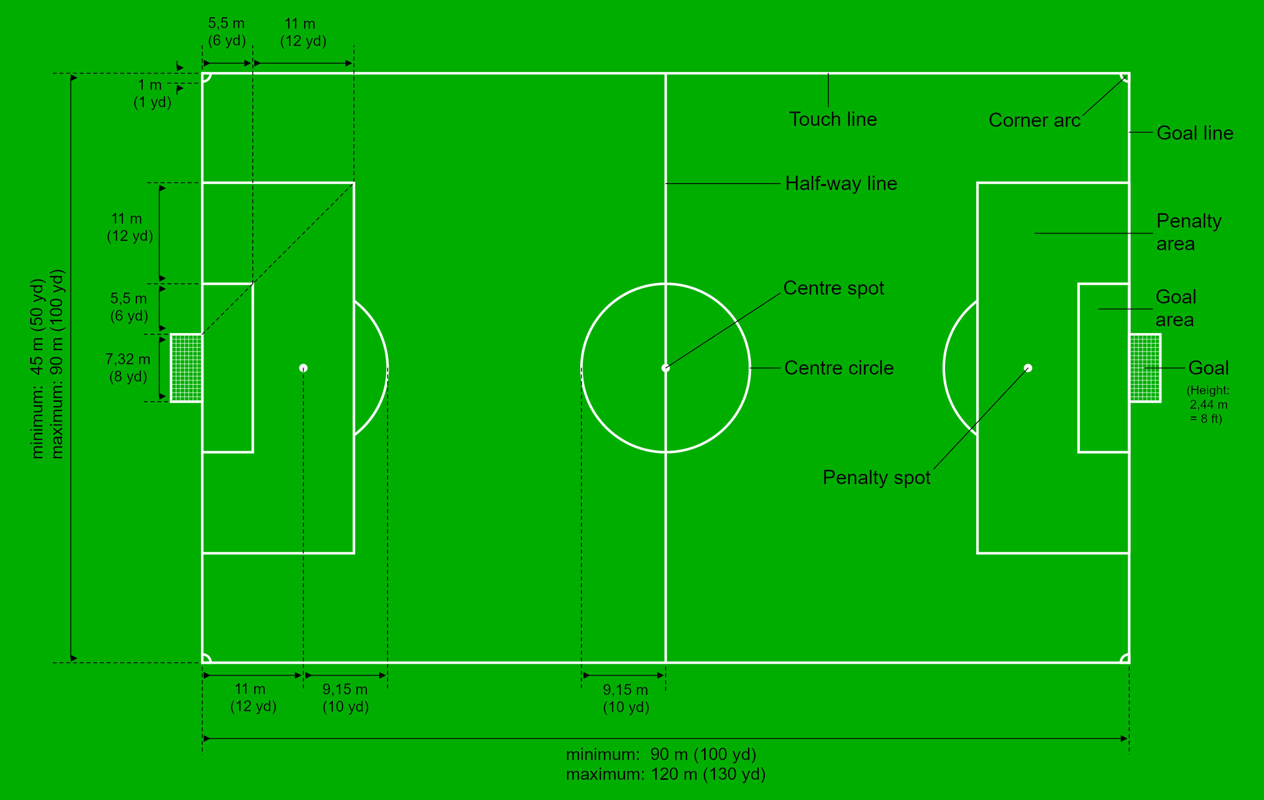
A football pitch (also known as soccer field) is the playing surface for the game of association football. Its dimensions and markings are defined by Law 1 of the Laws of the Game, "The Field of Play". The pitch is typically made of natural turf or artificial turf, although amateur and recreational teams often play on dirt fields. Artificial surfaces are allowed only to be green in colour. All line markings on the pitch form part of the area which they define. For example, a ball on or above the touchline is still on the field of play, and a foul committed over the line bounding the penalty area results in a penalty. Therefore, a ball has to completely cross the touchline to be out of play, and a ball has to wholly cross the goal line (between the goal posts) in order for a goal to be scored; if any part of the ball is still on or above the line, a goal is not scored and the ball is still in play. The field descriptions that apply to adult matches are described below. Becaus ... [...More Info...] [...Related Items...] OR: [Wikipedia] [Google] [Baidu] |
Swimming Pool
A swimming pool, swimming bath, wading pool, paddling pool, or simply pool, is a structure designed to hold water to enable Human swimming, swimming or other leisure activities. Pools can be built into the ground (in-ground pools) or built above ground (as a freestanding construction or as part of a building or other larger structure), and may be found as a feature aboard ocean-liners and cruise ships. In-ground pools are most commonly constructed from materials such as concrete, natural stone, metal, plastic, or fiberglass, and can be of a custom size and shape or built to a standardized size, the largest of which is the Olympic-size swimming pool. Many health clubs, fitness centers, and private clubs have pools used mostly for exercise or recreation. It is common for municipalities of every size to provide pools for public use. Many of these municipal pools are outdoor pools but indoor pools can also be found in buildings such as natatoriums and leisure centers. Hotels may ... [...More Info...] [...Related Items...] OR: [Wikipedia] [Google] [Baidu] |
Community Centre
Community centres, community centers, or community halls are public locations where members of a community tend to gather for group activities, social support, public information, and other purposes. They may sometimes be open for the whole community or for a specialized group within the greater community. Community centres can be religious in nature, such as Christian, Islamic, or Jewish community centres, or can be secular, such as youth clubs. Uses The community centres are usually used for: * Celebrations, * Public meetings of the citizens on various issues, * Organising meetings(where politicians or other official leaders come to meet the citizens and ask for their opinions, support or votes ("election campaigning" in democracies, other kinds of requests in non-democracies), * Volunteer activities, * Organising parties, weddings, * Organising local non-government activities, * Passes on and retells local history,etc. Organization and ownership Around the world (and s ... [...More Info...] [...Related Items...] OR: [Wikipedia] [Google] [Baidu] |


