|
Stanground North
Stanground North was a civil parish in the City of Peterborough, Cambridgeshire, England. The 2001 census recorded a population of zero. The parish, which covered open fields on a flood plain of the River Nene, has since been abolished as redundant. The parish was originally created in 1905, when Stanground parish was divided into two ( Stanground South becoming part of Old Fletton urban district), having hitherto been the only parish to still cross a county border. From then until 1974, it formed the only parish in Thorney Rural District apart from Thorney, Cambridgeshire, being in Isle of Ely until 1965 and then Huntingdon and Peterborough. In 1974 it became part of the Peterborough district of Cambridgeshire Cambridgeshire (abbreviated Cambs.) is a county in the East of England, bordering Lincolnshire to the north, Norfolk to the north-east, Suffolk to the east, Essex and Hertfordshire to the south, and Bedfordshire and Northamptonshire to th .... It had a p ... [...More Info...] [...Related Items...] OR: [Wikipedia] [Google] [Baidu] |
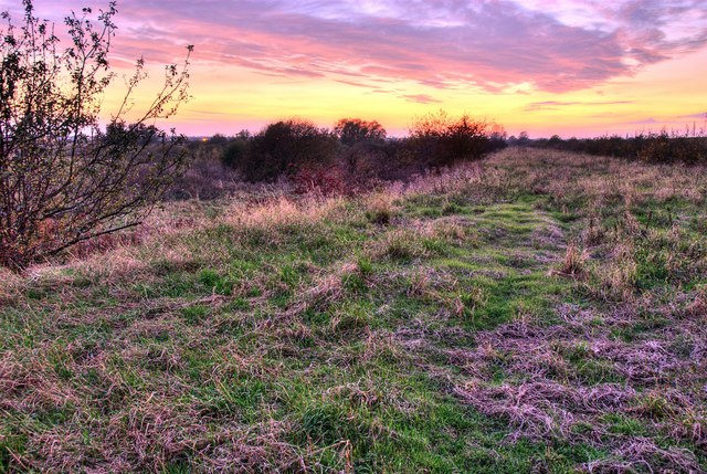
View Towards Peterborough - Geograph
A view is a sight or prospect or the ability to see or be seen from a particular place. View, views or Views may also refer to: Common meanings * View (Buddhism), a charged interpretation of experience which intensely shapes and affects thought, sensation, and action * Graphical projection in a technical drawing or schematic ** Multiview orthographic projection, standardizing 2D images to represent a 3D object * Opinion, a belief about subjective matters * Page view, a visit to a World Wide Web page * Panorama, a wide-angle view * Scenic viewpoint, an elevated location where people can view scenery * World view, the fundamental cognitive orientation of an individual or society encompassing the entirety of the individual or society's knowledge and point-of-view Places * View, Kentucky, an unincorporated community in Crittenden County * View, Texas, an unincorporated community in Taylor County Arts, entertainment, and media Music * ''View'' (album), the 2003 debut album ... [...More Info...] [...Related Items...] OR: [Wikipedia] [Google] [Baidu] |
Civil Parishes In England
In England, a civil parish is a type of administrative parish used for local government. It is a territorial designation which is the lowest tier of local government below districts and counties, or their combined form, the unitary authority. Civil parishes can trace their origin to the ancient system of ecclesiastical parishes, which historically played a role in both secular and religious administration. Civil and religious parishes were formally differentiated in the 19th century and are now entirely separate. Civil parishes in their modern form came into being through the Local Government Act 1894, which established elected parish councils to take on the secular functions of the parish vestry. A civil parish can range in size from a sparsely populated rural area with fewer than a hundred inhabitants, to a large town with a population in the tens of thousands. This scope is similar to that of municipalities in Continental Europe, such as the communes of France. Howeve ... [...More Info...] [...Related Items...] OR: [Wikipedia] [Google] [Baidu] |
City Of Peterborough
The City of Peterborough is a unitary authority district with city status in the ceremonial county of Cambridgeshire, England. The area is named after its largest settlement, Peterborough but also covers a wider area of outlying villages and hamlets. Historically the area was split into parts between the counties of Northamptonshire, Isle of Ely and Huntingdonshire until 1974 when it became part of the short-lived county of Huntingdon and Peterborough before becoming part of the ceremonial county of Cambridgeshire. Located in the East Anglia region of England, the area borders the surrounding counties of Lincolnshire and Northamptonshire. The population of the district was 202,259 making it the second-largest district by population in East Anglia (After Norwich). The district was also part of the Soke of Peterborough and was a Saxon settlement during the Anglo-Saxon era. The district also includes outlying villages such as Thorney, Old Fletton, Werrington, Parnwell, Dogs ... [...More Info...] [...Related Items...] OR: [Wikipedia] [Google] [Baidu] |
Cambridgeshire
Cambridgeshire (abbreviated Cambs.) is a county in the East of England, bordering Lincolnshire to the north, Norfolk to the north-east, Suffolk to the east, Essex and Hertfordshire to the south, and Bedfordshire and Northamptonshire to the west. The city of Cambridge is the county town. Following the Local Government Act 1972 restructuring, modern Cambridgeshire was formed in 1974 through the amalgamation of two administrative counties: Cambridgeshire and Isle of Ely, comprising the historic county of Cambridgeshire (including the Isle of Ely); and Huntingdon and Peterborough, comprising the historic county of Huntingdonshire and the Soke of Peterborough, historically part of Northamptonshire. Cambridgeshire contains most of the region known as Silicon Fen. The county is now divided between Cambridgeshire County Council and Peterborough City Council, which since 1998 has formed a separate unitary authority. In the non-metropolitan county there are five district counc ... [...More Info...] [...Related Items...] OR: [Wikipedia] [Google] [Baidu] |
River Nene
The River Nene ( or : see below) is a river in the east of England that rises from three sources in Northamptonshire.OS Explorer Map sheet 223, Northampton & Market Harborough, Brixworth & Pitsford Water. The river is about long, about of which forms the border between Cambridgeshire and Norfolk. It is the tenth-longest river in the United Kingdom, and is navigable for , from Northampton to The Wash. Etymology and pronunciation Spelling of the river's name has altered over time; it was called the "Nenn" or "Nyn" in an 1810 engraving by draughtsmen George Cole and John Roper, while the Ordnance Survey of 1885 used what has since become standard spelling, "Nene". The origin and meaning of the River Nene's name is unknown. The earliest known examples, which date back to the 10th century AD, have been linked to Indo-European root words for snow, rain, or washing, but a direct connection is purely speculative. According to the British toponymist and medieval scholar Victor Watt ... [...More Info...] [...Related Items...] OR: [Wikipedia] [Google] [Baidu] |
Stanground
Stanground is a residential area in the city of Peterborough, in the Peterborough district, in the ceremonial county of Cambridgeshire, England. For electoral purposes it comprises Stanground South and Fletton & Stanground wards in North West Cambridgeshire constituency. Overview Situated south of the River Nene, on relatively high ground overlooking The Fens, the area was historically part of the Isle of Ely in Cambridgeshire and of Huntingdonshire, rather than the Soke of Peterborough in Northamptonshire. By 1901 Stanground was the only civil parish in England contained partly in two administrative counties. In 1905 the part in the county of Huntingdon was designated a separate parish, Stanground South, within Old Fletton Urban District and the anomaly removed; the remainder, in Thorney Rural District, becoming Stanground North. In 1965 Huntingdonshire and the Soke amalgamated as Huntingdon and Peterborough and the Isle of Ely and historic Cambridgeshire (excluding Thorney ... [...More Info...] [...Related Items...] OR: [Wikipedia] [Google] [Baidu] |
Stanground South
Stanground is a residential area in the city of Peterborough, in the Peterborough district, in the ceremonial county of Cambridgeshire, England. For electoral purposes it comprises Stanground South and Fletton & Stanground wards in North West Cambridgeshire constituency. Overview Situated south of the River Nene, on relatively high ground overlooking The Fens, the area was historically part of the Isle of Ely in Cambridgeshire and of Huntingdonshire, rather than the Soke of Peterborough in Northamptonshire. By 1901 Stanground was the only civil parish in England contained partly in two administrative counties. In 1905 the part in the county of Huntingdon was designated a separate parish, Stanground South, within Old Fletton Urban District and the anomaly removed; the remainder, in Thorney Rural District, becoming Stanground North. In 1965 Huntingdonshire and the Soke amalgamated as Huntingdon and Peterborough and the Isle of Ely and historic Cambridgeshire (excluding Tho ... [...More Info...] [...Related Items...] OR: [Wikipedia] [Google] [Baidu] |
Old Fletton
Old or OLD may refer to: Places * Old, Baranya, Hungary * Old, Northamptonshire, England *Old Street station, a railway and tube station in London (station code OLD) *OLD, IATA code for Old Town Municipal Airport and Seaplane Base, Old Town, Maine, United States People *Old (surname) Music *OLD (band), a grindcore/industrial metal group * ''Old'' (Danny Brown album), a 2013 album by Danny Brown * ''Old'' (Starflyer 59 album), a 2003 album by Starflyer 59 * "Old" (song), a 1995 song by Machine Head *'' Old LP'', a 2019 album by That Dog Other uses * ''Old'' (film), a 2021 American thriller film *'' Oxford Latin Dictionary'' * Online dating *Over-Locknut Distance (or Dimension), a measurement of a bicycle wheel and frame * Old age See also * List of people known as the Old * * *Olde, a list of people with the surname *Olds (other) Olds may refer to: People * The olds, a jocular and irreverent online nickname for older adults * Bert Olds (1891–1953), Australia ... [...More Info...] [...Related Items...] OR: [Wikipedia] [Google] [Baidu] |
Urban District (Great Britain And Ireland)
In England and Wales, Northern Ireland, and the Republic of Ireland, an urban district was a type of local government district that covered an urbanised area. Urban districts had an elected urban district council (UDC), which shared local government responsibilities with a county council. England and Wales In England and Wales, urban districts and rural districts were created in 1894 (by the Local Government Act 1894) as subdivisions of administrative counties. They replaced the earlier system of urban and rural sanitary districts (based on poor law unions) the functions of which were taken over by the district councils. The district councils also had wider powers over local matters such as parks, cemeteries and local planning. An urban district usually contained a single parish, while a rural district might contain many. Urban districts were considered to have more problems with public health than rural areas, and so urban district councils had more funding and greater p ... [...More Info...] [...Related Items...] OR: [Wikipedia] [Google] [Baidu] |
Thorney Rural District
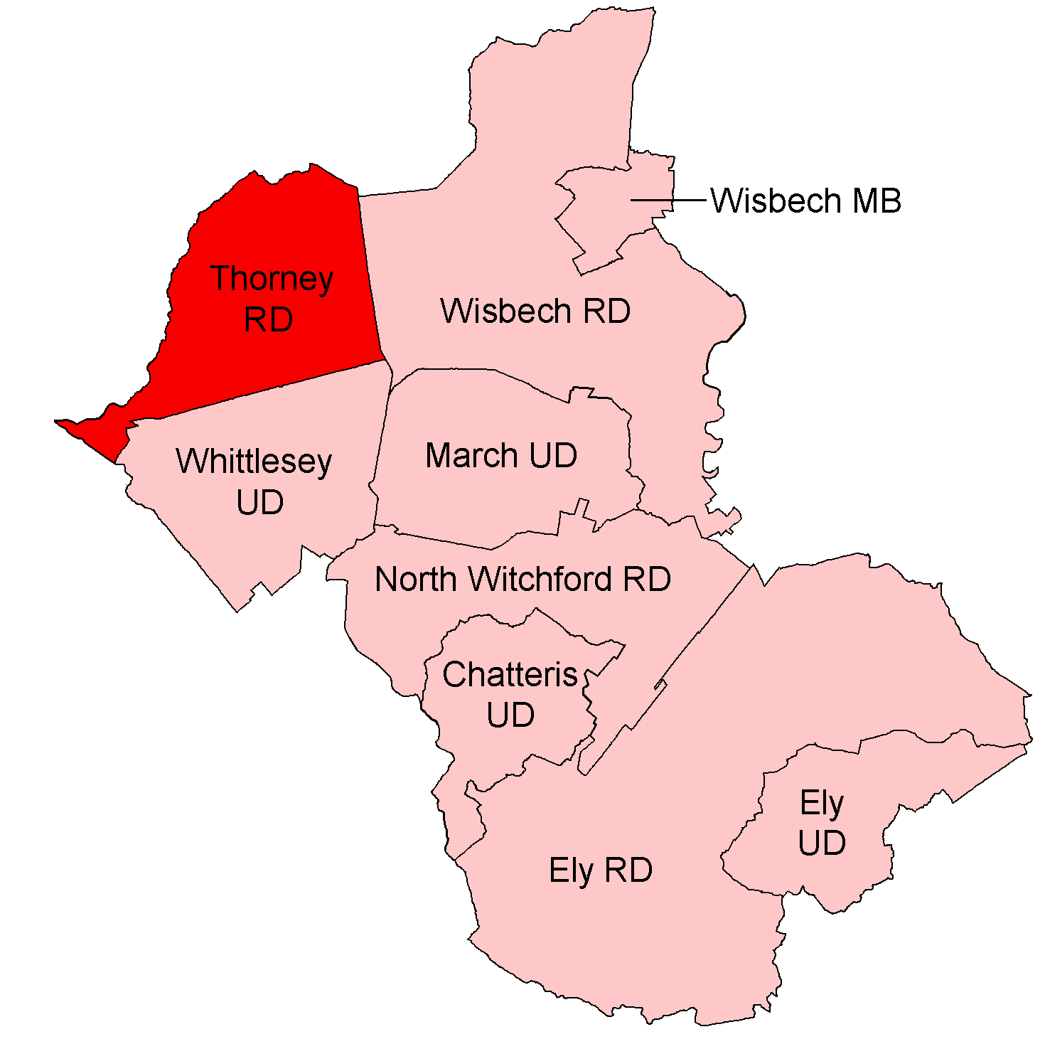
{{coord, 52.587, -0.109, display=title, region:GB_scale:50000 Thorney was a rural district in England from 1894 to 1974, situated to the east of Peterborough. It was created under the Local Government Act 1894, covering the parishes of Thorney and Stanground. It was considered part of the administrative county of the Isle of Ely. In 1904 Stanground was split, with the new parish Stanground North remaining in the district (and Isle of Ely), while the remainder, Stanground South, became part of the Old Fletton urban district in Huntingdonshire. In 1965, when Isle of Ely was merged with Cambridge to form Cambridgeshire and the Isle of Ely, Thorney RD was instead transferred to the administrative county of Huntingdon and Peterborough. In 1974, the district was abolished under the Local Government Act 1972, its area going to form part of the Peterborough district, in the new non-metropolitan county of Cambridgeshire Cambridgeshire (abbreviated Cambs.) is a county ... [...More Info...] [...Related Items...] OR: [Wikipedia] [Google] [Baidu] |
Thorney, Cambridgeshire
Thorney is a village in the Peterborough unitary authority in the ceremonial county of Cambridgeshire, England. Located around eight miles (13 km) east of Peterborough city centre, on the A47. Historically in the Isle of Ely, Thorney was transferred to the short-lived county of Huntingdon and Peterborough in 1965 and became part of the Peterborough district in 1974, on the merger into Cambridgeshire; the city became a unitary authority area in 1998. History Thorney began as a Saxon settlement in about 500 AD. The existence of Thorney Abbey made the settlement an important ecclesiastical centre, and until 2014 was the most northerly point of the Anglican Diocese of Ely. By 2007 the previous Thorney Abbey church, now the Church of St Mary and St Botolph, was part of the Deanery and Diocese of Peterborough. Following the Dissolution of the Monasteries the estate became crown property and it was granted to John Russell, 1st Earl of Bedford in 1550. At this time only a fe ... [...More Info...] [...Related Items...] OR: [Wikipedia] [Google] [Baidu] |
Isle Of Ely
The Isle of Ely () is a historic region around the city of Ely in Cambridgeshire, England. Between 1889 and 1965, it formed an administrative county. Etymology Its name has been said to mean "island of eels", a reference to the creatures that were often caught in the local rivers for food. This etymology was first recorded by the Venerable Bede. History Until the 17th century, the area was an island surrounded by a large area of fenland, a type of swamp. It was coveted as an area easy to defend, and was controlled in the very early medieval period by the Gyrwas, an Anglo-Saxon tribe. Upon their marriage in 652, Tondbert, a prince of the Gyrwas, presented Æthelthryth (who became St. Æthelthryth), the daughter of King Anna of the East Angles, with the Isle of Ely. She afterwards founded a monastery at Ely, which was destroyed by Viking raiders in 870, but was rebuilt and became a famous Abbey and Shrine. The Fens were drained beginning in 1626 using a network of canals d ... [...More Info...] [...Related Items...] OR: [Wikipedia] [Google] [Baidu] |


