|
Spitalfields
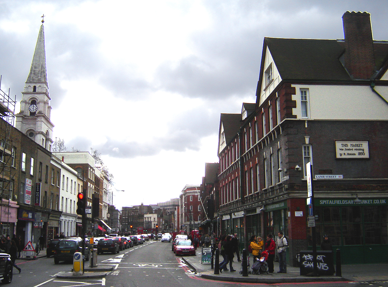
Spitalfields is a district in the East End of London and within the London Borough of Tower Hamlets. The area is formed around Commercial Street (on the A1202 London Inner Ring Road) and includes the locale around Brick Lane, Christ Church, Toynbee Hall and Commercial Tavern. It has several markets, including Spitalfields Market, the historic Old Spitalfields Market, Brick Lane Market and Petticoat Lane Market. It was part of the ancient parish of Stepney in the county of Middlesex and was split off as a separate parish in 1729. Just outside the City of London, the parish became part of the Metropolitan Board of Works area in 1855 as part of the Whitechapel District. It formed part of the County of London from 1889 and was part of the Metropolitan Borough of Stepney from 1900. It was abolished as a civil parish in 1921. Toponymy The name Spitalfields appears in the form ''Spittellond'' in 1399; as ''The spitel Fyeld'' on the "Woodcut" map of London of c.1561; and as ... [...More Info...] [...Related Items...] OR: [Wikipedia] [Google] [Baidu] |
Old Spitalfields Market
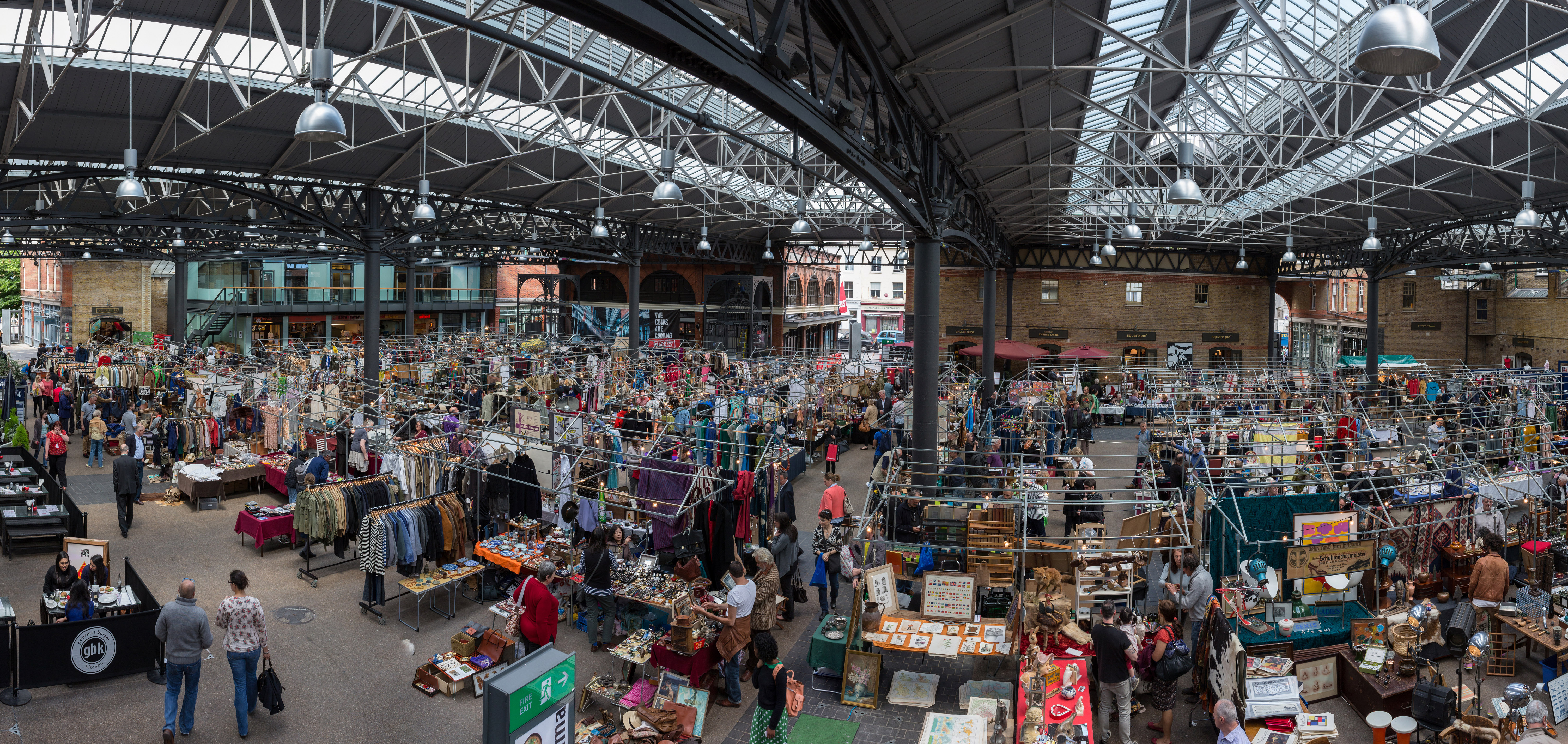
Old Spitalfields Market is a covered market in Spitalfields, London. There has been a market on the site for over 350 years. In 1991 it gave its name to New Spitalfields Market in Leyton, where fruit and vegetables are now traded. In 2005, a regeneration programme resulted in the new public spaces: Bishops Square and Crispin Place, which are now part of the modern Spitalfields Market. A range of public markets runs daily, with independent local stores and restaurants - as well as new office developments. It is situated in the London Borough of Tower Hamlets, just outside the City of London. The closest London Underground and mainline railway station is Liverpool Street. Historic market There has been a market on the site since 1638 when King Charles I gave a licence for flesh, fowl and roots to be sold on Spittle Fields, which was then a rural area on the eastern outskirts of London. After the rights to a market had seemingly lapsed during the time of the Commonwealth, t ... [...More Info...] [...Related Items...] OR: [Wikipedia] [Google] [Baidu] |
Spitalfields Market
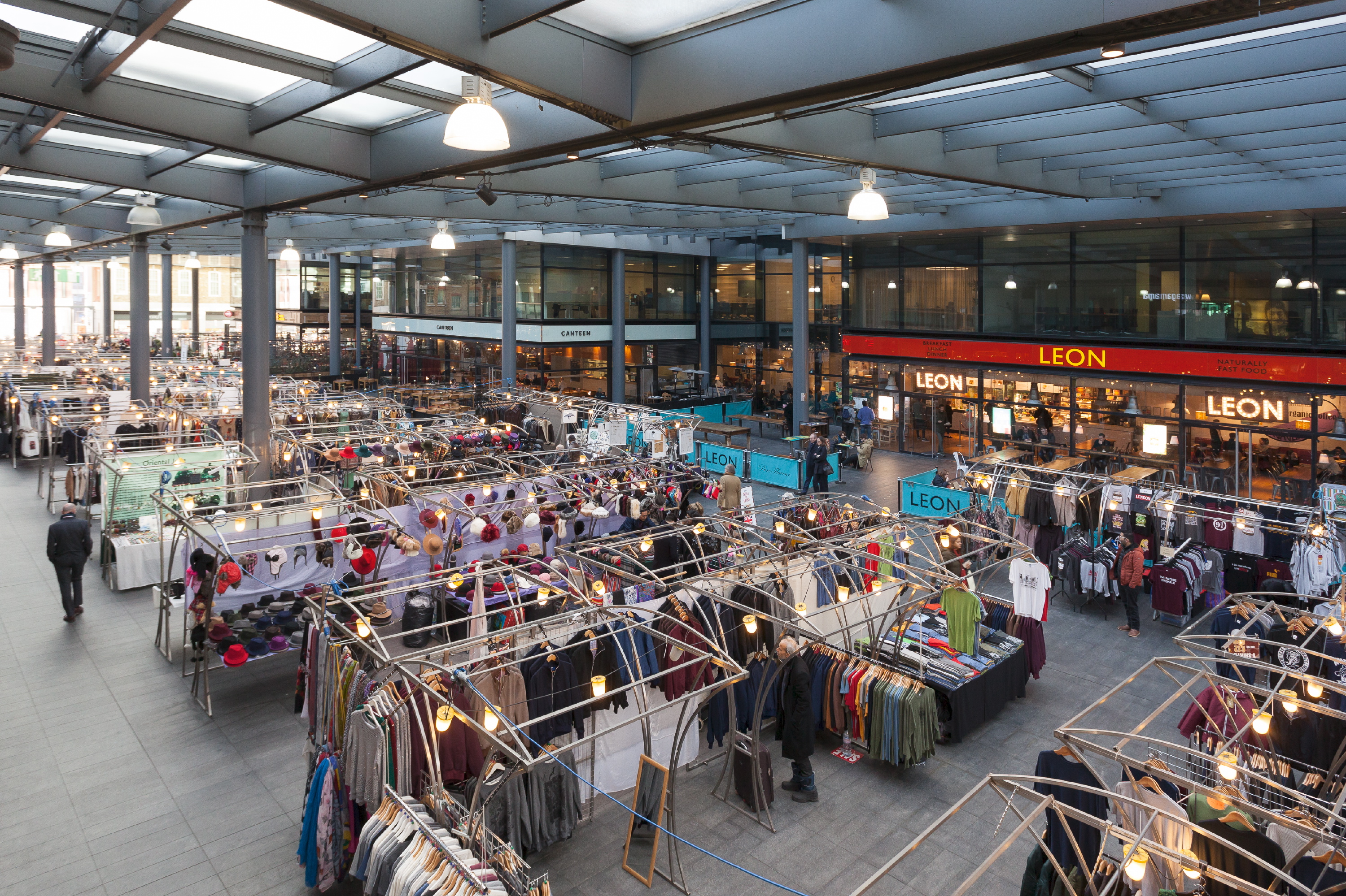
Spitalfields Market is a traders' market as well as a food and art market located in Spitalfields, Central London. Traders began operating around 1666, after the Great Fire of London, where the market stands today. The Spitalfields regeneration programme that ended in 2005, resulted in two new public spaces – Bishops Square and Crispin Place, which restored several historic streets and resulted in more independent retailers and restaurants. Spitalfields Market is situated in the London Borough of Tower Hamlets. It is surrounded by Lamb Street, Old Spitalfields market, Brushfield Street and Bishops Square. History Wholesale Market In 1682, King Charles II officially granted John Balch a Royal Charter allowing him to hold a market every Thursday and Saturday in Spital Square. Over time, the market became one of the main fruit and vegetable markets for London - alongside Covent Garden Market. The reputation of the market encouraged Huguenot silk weavers to settle in the ... [...More Info...] [...Related Items...] OR: [Wikipedia] [Google] [Baidu] |
Christ Church, Spitalfields
Christ Church Spitalfields is an Anglican church built between 1714 and 1729 to a design by Nicholas Hawksmoor. On Commercial Street in the East End and in today's Central London it is in the London Borough of Tower Hamlets, on its western border facing the City of London, it was one of the first (and arguably one of the finest) of the so-called "Commissioners' Churches" built for the Commission for Building Fifty New Churches, which had been established by an Act of Parliament in 1711. The purpose of the Commission was to acquire sites and build fifty new churches to serve London's new settlements. This parish was carved out of the circa medieval Stepney parish for an area then dominated by Huguenots (French Protestants and other 'dissenters' who owed no allegiance to the Church of England and thus to the King) as a show of Anglican authority. Some Huguenots used it for baptisms, marriages and burials but not for everyday worship, preferring their own chapels (their chapel ... [...More Info...] [...Related Items...] OR: [Wikipedia] [Google] [Baidu] |
East End Of London
The East End of London, often referred to within the London area simply as the East End, is the historic core of wider East London, east of the Roman and medieval walls of the City of London and north of the River Thames. It does not have universally accepted boundaries to the north and east, though the River Lea is sometimes seen as the eastern boundary. Parts of it may be regarded as lying within Central London (though that term too has no precise definition). The term "East of Aldgate Pump" is sometimes used as a synonym for the area. The East End began to emerge in the Middle Ages with initially slow urban growth outside the eastern walls, which later accelerated, especially in the 19th century, to absorb pre-existing settlements. The first known written record of the East End as a distinct entity, as opposed to its component parts, comes from John Strype's 1720 ''Survey of London'', which describes London as consisting of four parts: the City of London, Westminster, S ... [...More Info...] [...Related Items...] OR: [Wikipedia] [Google] [Baidu] |
Commercial Street, London
Commercial Street is an arterial road in Tower Hamlets, east London that runs north to south from Shoreditch High Street to Whitechapel High Street through the East End district of Spitalfields. The road is a section of the A1202 London Inner Ring Road and as such forms part of the boundary of the London congestion charge zone. As the name implies, Commercial Street has historically been dominated by industrial and commercial activity, which it maintains to this day. It is on the City fringes, and much industry that was seen as too noisome for the City was once exiled to such areas as this. However, since the early 1990s the street has grown increasingly fashionable, while maintaining its busy commercial feel. History Spitalfields was historically one of the poorest, most overcrowded and most crime-ridden districts in London: a parliamentary report of 1838 described this area as harbouring "an extremely immoral population; women of the lowest character, receivers of stolen g ... [...More Info...] [...Related Items...] OR: [Wikipedia] [Google] [Baidu] |
Brick Lane
Brick Lane ( Bengali: ব্রিক লেন) is a street in the East End of London, in the borough of Tower Hamlets. It runs from Swanfield Street in Bethnal Green in the north, crosses the Bethnal Green Road before reaching the busiest, most commercially active part which runs through Spitalfields, or along its eastern edge. Brick Lane’s southern end is connected to Whitechapel High Street by a short extension called Osborn Street. Today, it is the heart of the country's Bangladeshi community with the vicinity known to some as Banglatown. It is famous for its many curry houses. Early history 15th to 18th centuries The street was formerly known as Whitechapel Lane, and wound through fields. It derives its current name from brick and tile manufacture started in the 15th century, which used the local brick earth deposits. The street featured in the 16th-century Woodcut map of London as a partially-developed crossroad leading north from the city's most easterly edg ... [...More Info...] [...Related Items...] OR: [Wikipedia] [Google] [Baidu] |
Huguenot
The Huguenots ( , also , ) were a religious group of French Protestants who held to the Reformed, or Calvinist, tradition of Protestantism. The term, which may be derived from the name of a Swiss political leader, the Genevan burgomaster Bezanson Hugues (1491–1532?), was in common use by the mid-16th century. ''Huguenot'' was frequently used in reference to those of the Reformed Church of France from the time of the Protestant Reformation. By contrast, the Protestant populations of eastern France, in Alsace, Moselle, and Montbéliard, were mainly Lutherans. In his ''Encyclopedia of Protestantism'', Hans Hillerbrand wrote that on the eve of the St. Bartholomew's Day massacre in 1572, the Huguenot community made up as much as 10% of the French population. By 1600, it had declined to 7–8%, and was reduced further late in the century after the return of persecution under Louis XIV, who instituted the ''dragonnades'' to forcibly convert Protestants, and then finally revoked ... [...More Info...] [...Related Items...] OR: [Wikipedia] [Google] [Baidu] |
London Borough Of Tower Hamlets
The London Borough of Tower Hamlets is a London borough covering much of the traditional East End. It was formed in 1965 from the merger of the former metropolitan boroughs of Stepney, Poplar, and Bethnal Green. 'Tower Hamlets' was originally an alternative name for the historic Tower Division; the area of south-east Middlesex, focused on (but not limited to) the area of the modern borough, which owed military service to the Tower of London. The borough lies on the north bank of the River Thames immediately east of the City of London, and includes much of the redeveloped Docklands area. Some of the tallest buildings in London occupy the centre of the Isle of Dogs in the south of the borough. A part of the Queen Elizabeth Olympic Park is in Tower Hamlets. The 2019 mid-year population for the borough is estimated at 324,745. British Bangladeshis at 32% form the largest ethnic group. The 2011 census showed Tower Hamlets to have the highest proportion of Muslims of ... [...More Info...] [...Related Items...] OR: [Wikipedia] [Google] [Baidu] |
Commercial Tavern
The Commercial Tavern is a pub at 142 Commercial Street, Spitalfields, Shoreditch, London E1. It is a Grade II listed In the United Kingdom, a listed building or listed structure is one that has been placed on one of the four statutory lists maintained by Historic England in England, Historic Environment Scotland in Scotland, in Wales, and the Northern Ir ... round-ended building of white brick with painted stucco dressings, erected in 1865 by Abraham Keymer, publican of the Norfolk Arms in nearby Bethnal Green. Licence holders and residents A variety of sources provide information about the licence holder at various points in time: 1865 – Abraham Keymer (Survey of London) 1866 – Abraham Keymer (Post Office Directory) 1869 – Abraham Keymer (Post Office Directory) 1873 – Abraham Keymer transferred the license to Thomas Hoare (East London Observer) 1875 – Charles Entwhistle (Post Office Directory) 1881 – James Blumson of Bethnal Green (Census) ... Blum ... [...More Info...] [...Related Items...] OR: [Wikipedia] [Google] [Baidu] |
Toynbee Hall
Toynbee Hall is a charitable institution that works to address the causes and impacts of poverty in the East End of London and elsewhere. Established in 1884, it is based in Commercial Street, Spitalfields, and was the first university-affiliated institution of the worldwide settlement movement—a reformist social agenda that strove to get the rich and poor to live more closely together in an interdependent community. It was founded by Henrietta and Samuel Barnett in the economically depressed East End, and was named in memory of their friend and fellow reformer, Oxford historian Arnold Toynbee, who had died the previous year. Toynbee Hall continues to strive to bridge the gap between people of all social and financial backgrounds, with a focus on working towards a future without poverty. History Shortly after their marriage in 1873, Samuel Barnett and his wife, Henrietta, moved to the Whitechapel district of the East End of London.Canon and Mrs. S.A. Barnett (1909The Beginn ... [...More Info...] [...Related Items...] OR: [Wikipedia] [Google] [Baidu] |
Petticoat Lane Market
Petticoat Lane Market is a fashion and clothing market in Spitalfields, London. It consists of two adjacent street markets. Wentworth Street Market is open six days a week and Middlesex Street Market is open on Sunday only. The modern market It is one of a number of traditional markets located to the east of the City of London. A few hundred yards to the north is Old Spitalfields Market, which has been refurbished, and across Commercial Street, to the east, lies Brick Lane Market. A half mile further east is the Columbia Road Flower Market. Petticoat Lane Market was not formally recognised until an Act of Parliament in 1936, but its long history as an informal market makes it possibly one of the oldest surviving markets in Britain. The market is open Monday to Friday on Wentworth Street; on Sunday it extends over many of the surrounding streets, with over a thousand stalls. It is closed on Saturday, and on Sunday closes at about 2 pm. The markets are well signed from local s ... [...More Info...] [...Related Items...] OR: [Wikipedia] [Google] [Baidu] |
Black Eagle Brewery
The Black Eagle Brewery is the former brewing plant of Truman's Brewery located around Brick Lane in the Spitalfields area, in the London Borough of Tower Hamlets. Truman's subsequently became Truman, Hanbury and Buxton. By 1853, the Black Eagle Brewery was the largest in the world, with an annual production of 400,000 barrels. The former buildings, warehouses and yards were redeveloped by The Zeloof Partnership as the "Old Truman Brewery" and now house over 250 businesses, ranging from cultural venues to art galleries, restaurants, and retail shops. The Director's House and former Brew House are listed buildings. History The original brewery was probably established by the Bucknall family, who leased the site in the seventeenth century. The site's first associations with brewing can be traced back to 1666 when a Joseph Truman is recorded as joining William Bucknall's Brewhouse in Brick Lane. Part of the site was located on Black Eagle Street, hence the brewery's name. Truman a ... [...More Info...] [...Related Items...] OR: [Wikipedia] [Google] [Baidu] |


.jpg)


