|
Spinkhill Railway Station
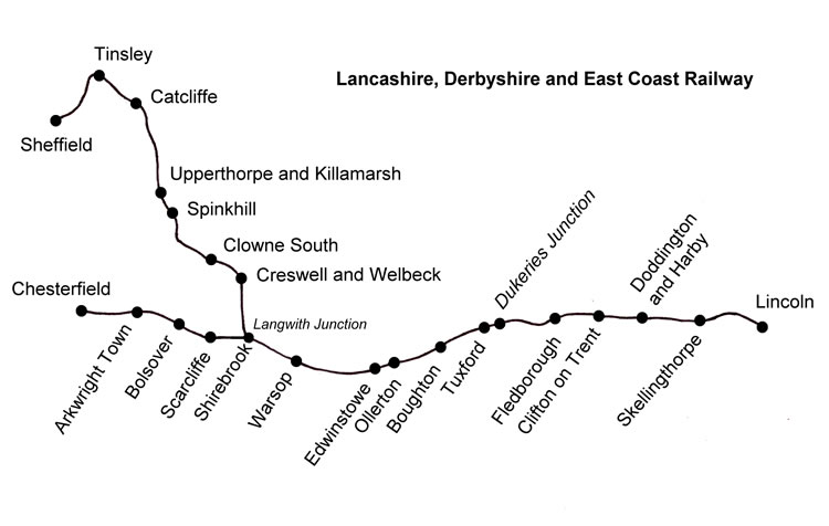
Spinkhill railway station is a disused railway station in Spinkhill, Derbyshire, England. History The station was built by the Lancashire, Derbyshire and East Coast Railway on their Beighton Branch, within sight of the northern portal of Spinkhill Tunnel. It opened in 1898 and closed to regular timetabled passenger traffic in 1939, though start and end of term special trains for pupils at the nearby Mount St Mary's College Mount St Mary's College is an independent, co-educational, day and boarding school situated at Spinkhill, Derbyshire, England. It was founded in 1842 by the Society of Jesus (better known as the Jesuits), and has buildings designed by notable ar ... continued for some years thereafter. The line through the station was closed as a through route on 9 January 1967 but trains continued to serve the nearby Westthorpe Colliery until it closed in 1984. This involved using the former running lines and the sidings behind the station house. Modern times The hu ... [...More Info...] [...Related Items...] OR: [Wikipedia] [Google] [Baidu] |
Spinkhill
Spinkhill is a small village in North East Derbyshire, England. It is approximately one mile south of the nearest town, Killamarsh, and half a mile north-east of Renishaw. It is home to the Church of the Immaculate Conception and its associated Catholic Primary School. Spinkhill is also home to Mount St Mary's College, a large private school. The village has strong historical links to the Roman Catholic Church via the Poles family. Spinkill has two commercial establishments, the Angel pub, saved from housing development by a community interest company (CIC). It was re opened in 2015 by an independent landlord and thrives as a gastro pub. Opposite the Angel is the former Post Office (closed over 20 years ago) which opened as a vintage tea/artisan coffee shop called the Chaffinch Room in 2017, which also serves food and sells gifts. Other economic activity comes from the several farms situated around the village. The village has a small bus station and is served by a handf ... [...More Info...] [...Related Items...] OR: [Wikipedia] [Google] [Baidu] |
Lancashire, Derbyshire And East Coast Railway Beighton Branch
The Beighton Branch was a railway branch line built by the Lancashire, Derbyshire and East Coast Railway (LD&ECR) in north eastern Derbyshire, England. History The line was a little over 12 miles long and ran from Langwith Junction in Derbyshire to Beighton Junction which is now in South Yorkshire. Building started in 1892. The line opened in stages up to 1900. The branch was occasionally referred to as the "Sheffield Branch", but the name "Beighton Branch" stuck and was widely used. A sparse and circuitous stopping passenger service used the route to connect with , this was withdrawn on the outbreak of World War II World War II or the Second World War, often abbreviated as WWII or WW2, was a world war that lasted from 1939 to 1945. It involved the vast majority of the world's countries—including all of the great powers—forming two opposin .... The line closed in stages: * 1967, middle section closed and lifted * 1974, southern end closed and lifted * ... [...More Info...] [...Related Items...] OR: [Wikipedia] [Google] [Baidu] |
Former Lancashire, Derbyshire And East Coast Railway Stations
A former is an object, such as a template, gauge or cutting die, which is used to form something such as a boat's hull. Typically, a former gives shape to a structure that may have complex curvature. A former may become an integral part of the finished structure, as in an aircraft fuselage, or it may be removable, being using in the construction process and then discarded or re-used. Aircraft formers Formers are used in the construction of aircraft fuselage, of which a typical fuselage has a series from the nose to the empennage, typically perpendicular to the longitudinal axis of the aircraft. The primary purpose of formers is to establish the shape of the fuselage and reduce the column length of stringers to prevent instability. Formers are typically attached to longerons, which support the skin of the aircraft. The "former-and-longeron" technique (also called stations and stringers) was adopted from boat construction, and was typical of light aircraft built until the ad ... [...More Info...] [...Related Items...] OR: [Wikipedia] [Google] [Baidu] |
Newark-upon-Trent
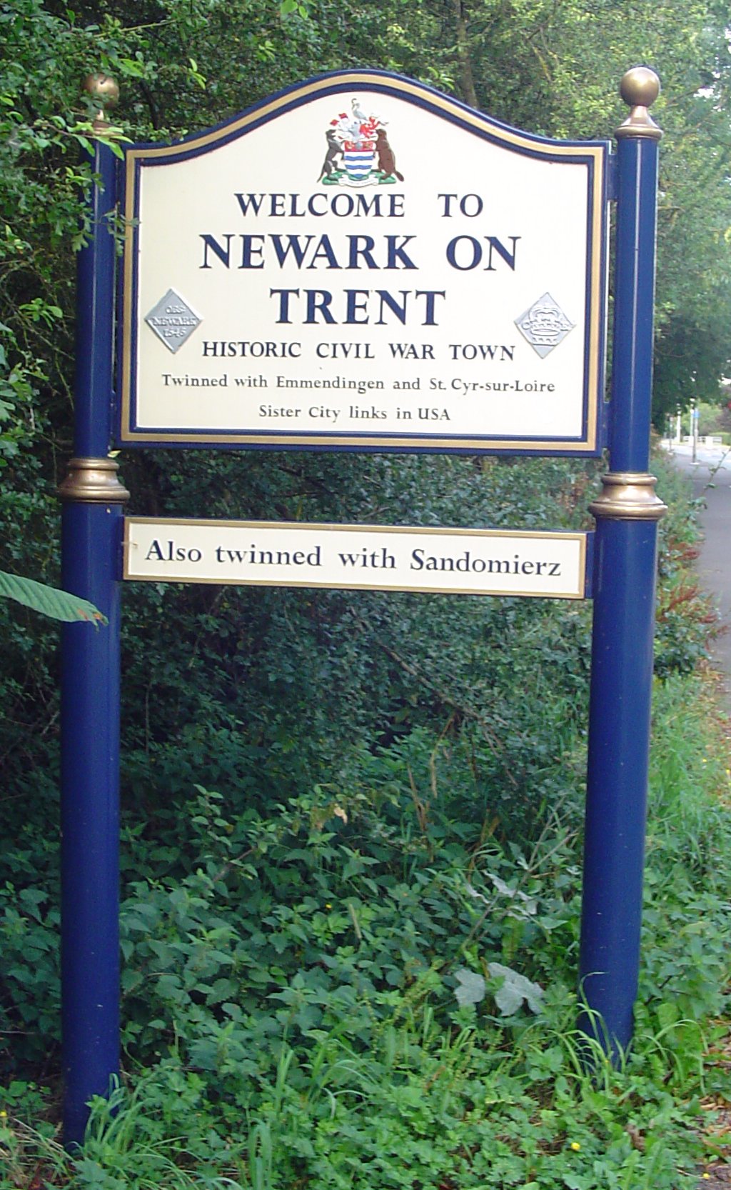
Newark-on-Trent or Newark () is a market town and civil parish in the Newark and Sherwood district in Nottinghamshire, England. It is on the River Trent, and was historically a major inland port. The A1 road bypasses the town on the line of the ancient Great North Road. The town's origins are likely to be Roman, as it lies on a major Roman road, the Fosse Way. It grew up round Newark Castle and as a centre for the wool and cloth trades. In the English Civil War, it was besieged by Parliamentary forces and relieved by Royalist forces under Prince Rupert. Newark has a market place lined with many historical buildings and one of its most notable landmark is St Mary Magdalene church with its towering spire at high and the highest structure in the town. The church is the tallest church in Nottinghamshire and can be seen when entering Newark or bypassing it. History Early history The place-name Newark is first attested in the cartulary of Eynsham Abbey in Oxfordshire, where ... [...More Info...] [...Related Items...] OR: [Wikipedia] [Google] [Baidu] |
Headington
Headington is an eastern suburb of Oxford, England. It is at the top of Headington Hill overlooking the city in the Thames valley below, and bordering Marston to the north-west, Cowley to the south, and Barton and Risinghurst to the east. The life of the large residential area is centred upon London Road, the main road between London and Oxford. History The site of Headington shows evidence of continued occupation from the Stone Age, as the 2001 field excavations in Barton Lane found, suggesting a date in the 11th century BC. Pottery was found on the Manor Ground, suggesting an Iron Age settlement there in the 7th century BC. Roman kilns from about 300 have been found, including one now on display at the Museum of Oxford. Anglo-Saxon burial remains from about 500 have also been discovered. Headington's toponym is derived from the Old English ''Hedena's dun'', meaning "Hedena's hill", when it was the site of a palace or hunting lodge of the Kings of Mercia. In a charter of 1 ... [...More Info...] [...Related Items...] OR: [Wikipedia] [Google] [Baidu] |
Mount St Mary's College
Mount St Mary's College is an independent, co-educational, day and boarding school situated at Spinkhill, Derbyshire, England. It was founded in 1842 by the Society of Jesus (better known as the Jesuits), and has buildings designed by notable architects such as Joseph Hansom, Henry Clutter and Adrian Gilbert Scott. The school is a member of the Headmasters' and Headmistresses' Conference and the Catholic Independent Schools Conference. Its affiliated preparatory school is Barlborough Hall School, just 2.2 miles down the road. History Foundation Since 1580, during the English Reformation, there were Jesuits living and working in Spinkhill, serving the local Catholic population. In 1580, Robert Persons, Edmund Campion, and Ralph Emerson came to England in secret. These first Jesuits were sheltered at Spinkhill Hall, the house that became Mount St Mary's College. In 1620, a clandestine school was founded in Stanley Grange near Derby. When this school was discovered and dispersed ... [...More Info...] [...Related Items...] OR: [Wikipedia] [Google] [Baidu] |
Spinkhill Tunnel
Spinkhill Tunnel is a disused twin-track railway tunnel south of Spinkhill railway station in Derbyshire, England. History The 501 yards long tunnel was opened by the Lancashire, Derbyshire and East Coast Railway (later part of the Great Central Railway and subsequently the London and North Eastern Railway, LNER) on 21 September 1898. It was the only tunnel on its Lancashire, Derbyshire and East Coast Railway Beighton Branch, Beighton Branch (occasionally referred to as the "Sheffield Branch") which ran north westwards from Shirebrook North railway station, Langwith Junction to Beighton Junction. The LD&ECR and its successors always referred to Spinkhill station, tunnel and signalbox as "Spink Hill", though the spelling "Spinkhill" is now universal. See, for example, railway tickets in the Glynn Waite collection. The Beighton Branch lost its local passenger traffic at the outbreak of World War II but remained in use for excursions, diversions and relief, together with its prime ... [...More Info...] [...Related Items...] OR: [Wikipedia] [Google] [Baidu] |
Derbyshire
Derbyshire ( ) is a ceremonial county in the East Midlands, England. It includes much of the Peak District National Park, the southern end of the Pennine range of hills and part of the National Forest. It borders Greater Manchester to the north-west, West Yorkshire to the north, South Yorkshire to the north-east, Nottinghamshire to the east, Leicestershire to the south-east, Staffordshire to the west and south-west and Cheshire to the west. Kinder Scout, at , is the highest point and Trent Meadows, where the River Trent leaves Derbyshire, the lowest at . The north–south River Derwent is the longest river at . In 2003, the Ordnance Survey named Church Flatts Farm at Coton in the Elms, near Swadlincote, as Britain's furthest point from the sea. Derby is a unitary authority area, but remains part of the ceremonial county. The county was a lot larger than its present coverage, it once extended to the boundaries of the City of Sheffield district in South Yorkshire where it cov ... [...More Info...] [...Related Items...] OR: [Wikipedia] [Google] [Baidu] |
North East Derbyshire
North East Derbyshire is a local government district in Derbyshire, England. It borders the districts of Chesterfield, Bolsover, Amber Valley and Derbyshire Dales in Derbyshire, and Sheffield and Rotherham in South Yorkshire. The population of the district as taken at the 2011 Census was 99,023. The district council is a non-constituent partner member of the Sheffield City Region Combined Authority. The district is a non-constituent member of the Sheffield City Region and shares a membership along with neighbouring Derbyshire Dales, Borough of Chesterfield, Bolsover District and Bassetlaw District in Nottinghamshire. The district is also part of The Derby, Derbyshire, Nottingham and Nottinghamshire Local Enterprise Partnership. Settlements in the district include: * Arkwright Town and Ashover * Barlow * Calow and Clay Cross * Dronfield * Eckington * Grassmoor * Holmesfield, Holymoorside and Holmewood * Killamarsh * Morton * North Wingfield * Pilsley * Renishaw and Rid ... [...More Info...] [...Related Items...] OR: [Wikipedia] [Google] [Baidu] |
Train Station
A train station, railway station, railroad station or depot is a railway facility where trains stop to load or unload passengers, freight or both. It generally consists of at least one platform, one track and a station building providing such ancillary services as ticket sales, waiting rooms and baggage/freight service. If a station is on a single-track line, it often has a passing loop to facilitate traffic movements. Places at which passengers only occasionally board or leave a train, sometimes consisting of a short platform and a waiting shed but sometimes indicated by no more than a sign, are variously referred to as "stops", "flag stops", " halts", or "provisional stopping places". The stations themselves may be at ground level, underground or elevated. Connections may be available to intersecting rail lines or other transport modes such as buses, trams or other rapid transit systems. Terminology In British English, traditional terminology favours ''railway station' ... [...More Info...] [...Related Items...] OR: [Wikipedia] [Google] [Baidu] |


.jpg)