|
Southern Pygmy Perch
The southern pygmy perch (''Nannoperca australis''), also known as the Tasmanian pygmy perch, is a species of freshwater ray-finned fish, a temperate perch from the family Percichthyidae which is native to southeastern Australia and Tasmania. Description The southern pygmy perch has an oblong and moderately compressed body with a convex dorsal profile and a straight ventral profile. It has a large head the top of which bulges slightly and a blunt snout. It has a slightly oblique, terminal mouth which is protractile with the maxilla reaching to a level near the centre of the eye. There are thin bands of villiform teeth on the jaws and the roof of the mouth. There is a lateral line made up of an irregular series of pored scales. The dorsal fin has 7-9 spines in its front part, separated from the rear part by a deep notch, the rear part contains 7-10 soft rays. The anal fin is similar in shape to the soft part of the dorsal fin and has 3 spines and 7-8 soft rays. The large caudal ... [...More Info...] [...Related Items...] OR: [Wikipedia] [Google] [Baidu] |
Albert Günther
Albert Karl Ludwig Gotthilf Günther FRS, also Albert Charles Lewis Gotthilf Günther (3 October 1830 – 1 February 1914), was a German-born British zoologist, ichthyologist, and herpetologist. Günther is ranked the second-most productive reptile taxonomist (after George Albert Boulenger) with more than 340 reptile species described. Early life and career Günther was born in Esslingen in Swabia (Württemberg). His father was a ''Stiftungs-Commissar'' in Esslingen and his mother was Eleonora Nagel. He initially schooled at the Stuttgart Gymnasium. His family wished him to train for the ministry of the Lutheran Church for which he moved to the University of Tübingen. A brother shifted from theology to medicine, and he, too, turned to science and medicine at Tübingen in 1852. His first work was "''Ueber den Puppenzustand eines Distoma''". He graduated in medicine with an M.D. from Tübingen in 1858, the same year in which he published a handbook of zoology for students of ... [...More Info...] [...Related Items...] OR: [Wikipedia] [Google] [Baidu] |
Fish Measurement
Fish measurement is the measuring of individual fish and various parts of their anatomies. These data are used in many areas of ichthyology, including taxonomy and fisheries biology. Overall length * Standard length (SL) is the length of a fish measured from the tip of the snout to the posterior end of the last vertebra or to the posterior end of the midlateral portion of the hypural plate. Simply put, this measurement excludes the length of the caudal (tail) fin. * Total length (TL) is the length of a fish measured from the tip of the snout to the tip of the longer lobe of the caudal fin, usually measured with the lobes compressed along the midline. It is a straight-line measure, not measured over the curve of the body. Standard length measurements are used with Teleostei (most bony fish), while total length measurements are used with Myxini (hagfish), Petromyzontiformes (lampreys), and (usually) Elasmobranchii (sharks and rays), as well as some other fishes. Total length meas ... [...More Info...] [...Related Items...] OR: [Wikipedia] [Google] [Baidu] |
Aquatic Vegetation
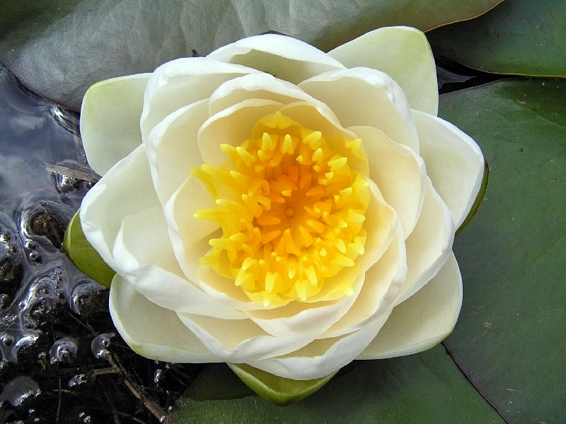
Aquatic plants are plants that have adapted to living in aquatic environments (saltwater or freshwater). They are also referred to as hydrophytes or macrophytes to distinguish them from algae and other microphytes. A macrophyte is a plant that grows in or near water and is either emergent, submergent, or floating. In lakes and rivers macrophytes provide cover for fish, substrate for aquatic invertebrates, produce oxygen, and act as food for some fish and wildlife. Macrophytes are primary producers and are the basis of the food web for many organisms. They have a significant effect on soil chemistry and light levels as they slow down the flow of water and capture pollutants and trap sediments. Excess sediment will settle into the benthos aided by the reduction of flow rates caused by the presence of plant stems, leaves and roots. Some plants have the capability of absorbing pollutants into their tissue. Seaweeds are multicellular marine algae and, although their ecologi ... [...More Info...] [...Related Items...] OR: [Wikipedia] [Google] [Baidu] |
Freshwater Ecosystem
Freshwater ecosystems are a subset of Earth's aquatic ecosystems. They include lakes, ponds, rivers, streams, springs, bogs, and wetlands. They can be contrasted with marine ecosystems, which have a larger salt content. Freshwater habitats can be classified by different factors, including temperature, light penetration, nutrients, and vegetation. There are three basic types of freshwater ecosystems: Lentic (slow moving water, including pools, ponds, and lakes), lotic (faster moving water, for example streams and rivers) and wetlands (areas where the soil is saturated or inundated for at least part of the time). Freshwater ecosystems contain 41% of the world's known fish species. Freshwater ecosystems have undergone substantial transformations over time, which has impacted various characteristics of the ecosystems. Original attempts to understand and monitor freshwater ecosystems were spurred on by threats to human health (for example cholera outbreaks due to sewage contamination). ... [...More Info...] [...Related Items...] OR: [Wikipedia] [Google] [Baidu] |
Bass Strait
Bass Strait () is a strait separating the island state of Tasmania from the Australian mainland (more specifically the coast of Victoria, with the exception of the land border across Boundary Islet). The strait provides the most direct waterway between the Great Australian Bight and the Tasman Sea, and is also the only maritime route into the economically prominent Port Phillip Bay. Formed 8,000 years ago by rising sea levels at the end of the last glacial period, the strait was named after English explorer and physician George Bass (1771-1803) by European colonists. Extent The International Hydrographic Organization defines the limits of Bass Strait as follows: :''On the west.'' The eastern limit of the Great Australian Bight eing a line from Cape Otway, Australia, to King Island (Tasmania)">King Island and thence to Cape Grim, the northwest extreme of Tasmania]. :''On the east.'' The western limit of the Tasman Sea between Gabo Island and Eddystone Point eing a line fr ... [...More Info...] [...Related Items...] OR: [Wikipedia] [Google] [Baidu] |
King Island (Tasmania)
King Island is an island in the Bass Strait, belonging to the Australian state of Tasmania. It is the largest of three islands known as the New Year Group, and the second-largest island in Bass Strait (after Flinders Island). The island's population at the was 1,585 people, up from 1,566 in 2011. The local government area of the island is the King Island Council. The island forms part of the official land divide between the Great Australian Bight and Bass Strait, off the north-western tip of Tasmania and about halfway to the mainland state of Victoria. The southernmost point is Stokes Point and the northernmost point is Cape Wickham. There are three small islands immediately offshore: New Year Island and Christmas Island situated to the northwest, and a smaller island Councillor Island to the east, opposite Sea Elephant Beach. King Island was first visited by Europeans in the late 18th century. It was named after Philip Gidley King, Colonial Governor of New South Wales, who ... [...More Info...] [...Related Items...] OR: [Wikipedia] [Google] [Baidu] |
Flinders Island
Flinders Island, the largest island in the Furneaux Group, is a island in the Bass Strait, northeast of the island of Tasmania. Flinders Island was the place where the last remnants of aboriginal Tasmanian population were exiled by the colonial British government. Today Flinders Island is part of the state of Tasmania, Australia. It is from Cape Portland and is located on 40° south, a zone known as the Roaring Forties. History Prehistory Flinders Island was first inhabited at least 35,000 years ago, when people made their way from Australia across the then land-bridge which is now Bass Strait. A population remained until about 4,500 years ago, succumbing to thirst and hunger following an acute El Niño climate shift. European discovery Some of the south-eastern islands of the Furneaux Group were first recorded in 1773 by British navigator Tobias Furneaux, commander of , the support vessel with James Cook on Cook's second voyage. In February 1798, British navigator Ma ... [...More Info...] [...Related Items...] OR: [Wikipedia] [Google] [Baidu] |
South Australia
South Australia (commonly abbreviated as SA) is a state in the southern central part of Australia. It covers some of the most arid parts of the country. With a total land area of , it is the fourth-largest of Australia's states and territories by area, and second smallest state by population. It has a total of 1.8 million people. Its population is the second most highly centralised in Australia, after Western Australia, with more than 77 percent of South Australians living in the capital Adelaide, or its environs. Other population centres in the state are relatively small; Mount Gambier, the second-largest centre, has a population of 33,233. South Australia shares borders with all of the other mainland states, as well as the Northern Territory; it is bordered to the west by Western Australia, to the north by the Northern Territory, to the north-east by Queensland, to the east by New South Wales, to the south-east by Victoria, and to the south by the Great Australian Bight.M ... [...More Info...] [...Related Items...] OR: [Wikipedia] [Google] [Baidu] |
Ewens Ponds
Ewens Ponds is a series of three water-filled limestone sinkholes in the Australian state of South Australia located in the gazetted locality of Eight Mile Creek, on the watercourse of Eight Mile Creek about south of Mount Gambier and east of Port Macdonnell. The ponds are popular with recreational divers due to underwater visibility of up to . It has a large fish population including the endangered golden pygmy perch. Ewens Ponds has been part of the Ewens Ponds Conservation Park since 1976. History The original inhabitants of the land are the Boandik group, of the Bungandidj people of Aboriginal people who lived in what is now south-eastern South Australia. The first European identified with the area was Thomas Ewens, whose dog chased a kangaroo into one of the ponds while he was hunting geese. Ewens reported his discovery of the ponds to the survey department and they became known as Thomas Ewens Spring Ponds. The land surrounding the ponds was gradually cleared ... [...More Info...] [...Related Items...] OR: [Wikipedia] [Google] [Baidu] |
Victoria (Australia)
Victoria is a state in southeastern Australia. It is the second-smallest state with a land area of , the second most populated state (after New South Wales) with a population of over 6.5 million, and the most densely populated state in Australia (28 per km2). Victoria is bordered by New South Wales to the north and South Australia to the west, and is bounded by the Bass Strait to the south (with the exception of a small land border with Tasmania located along Boundary Islet), the Great Australian Bight portion of the Southern Ocean to the southwest, and the Tasman Sea (a marginal sea of the South Pacific Ocean) to the southeast. The state encompasses a range of climates and geographical features from its temperate coastal and central regions to the Victorian Alps in the northeast and the semi-arid north-west. The majority of the Victorian population is concentrated in the central-south area surrounding Port Phillip Bay, and in particular within the metropolit ... [...More Info...] [...Related Items...] OR: [Wikipedia] [Google] [Baidu] |
New South Wales
) , nickname = , image_map = New South Wales in Australia.svg , map_caption = Location of New South Wales in AustraliaCoordinates: , subdivision_type = Country , subdivision_name = Australia , established_title = Before federation , established_date = Colony of New South Wales , established_title2 = Establishment , established_date2 = 26 January 1788 , established_title3 = Responsible government , established_date3 = 6 June 1856 , established_title4 = Federation , established_date4 = 1 January 1901 , named_for = Wales , demonym = , capital = Sydney , largest_city = capital , coordinates = , admin_center = 128 local government areas , admin_center_type = Administration , leader_title1 = Monarch , leader_name1 = Charles III , leader_title2 = Governor , leader_name2 = Margaret Beazley , leader_title3 = Premier , leader_name3 = Dominic Perrottet (Liberal) , national_representation = Parliament of Australia , national_representation_type1 = Senat ... [...More Info...] [...Related Items...] OR: [Wikipedia] [Google] [Baidu] |
Darlington Point
Darlington Point is a small town on the banks of the Murrumbidgee River in the Riverina district of western New South Wales, Australia. It is part of the Murrumbidgee Council local government area. The centre of town is four kilometres from the Sturt Highway, along Kidman Way. Darlington Point is south-west of Sydney and south of Griffith. At the , Darlington Point had a population of 1,030. History Pastoral runs The first pastoral run near present-day Darlington Point, on the north bank of the Murrumbidgee, was taken up in 1844 by John Peter; he named the run "Cuba" after the Aboriginal word for a locally-common Acacia tree. On the south bank John Peter also leased the "Tubbo" run, a property he had formed in the 1850s by the amalgamation of several runs. The site where the township later developed was a crossing-place over the Murrumbidgee River used by stockmen and teamsters. The Surveyor Townshend laid out reserves near the crossing-place during the ... [...More Info...] [...Related Items...] OR: [Wikipedia] [Google] [Baidu] |


