|
Southease
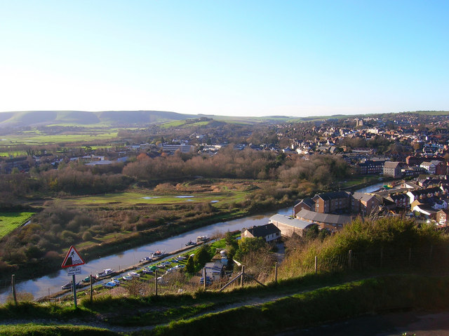
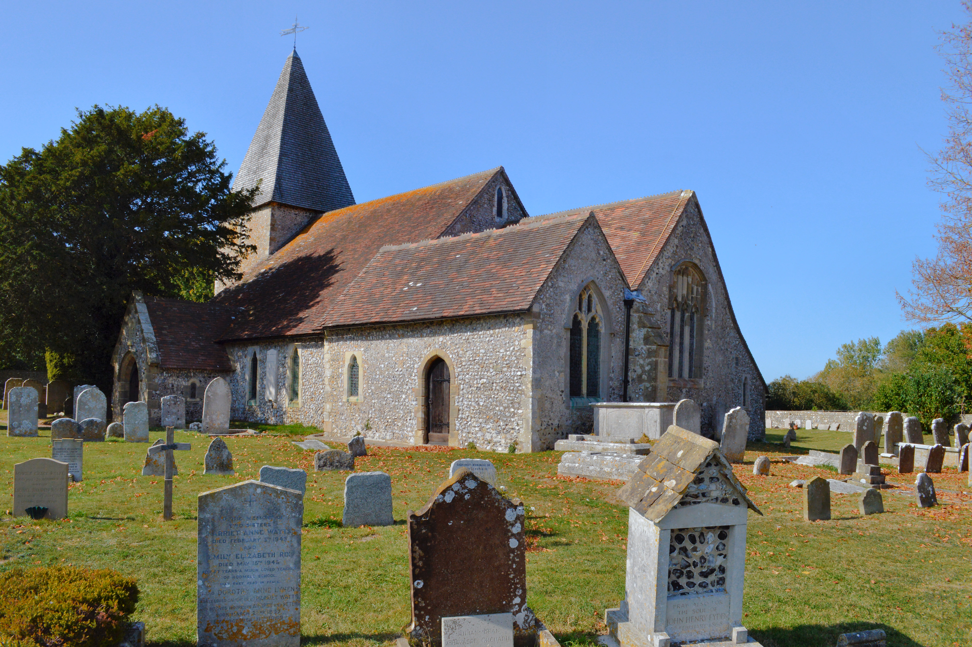
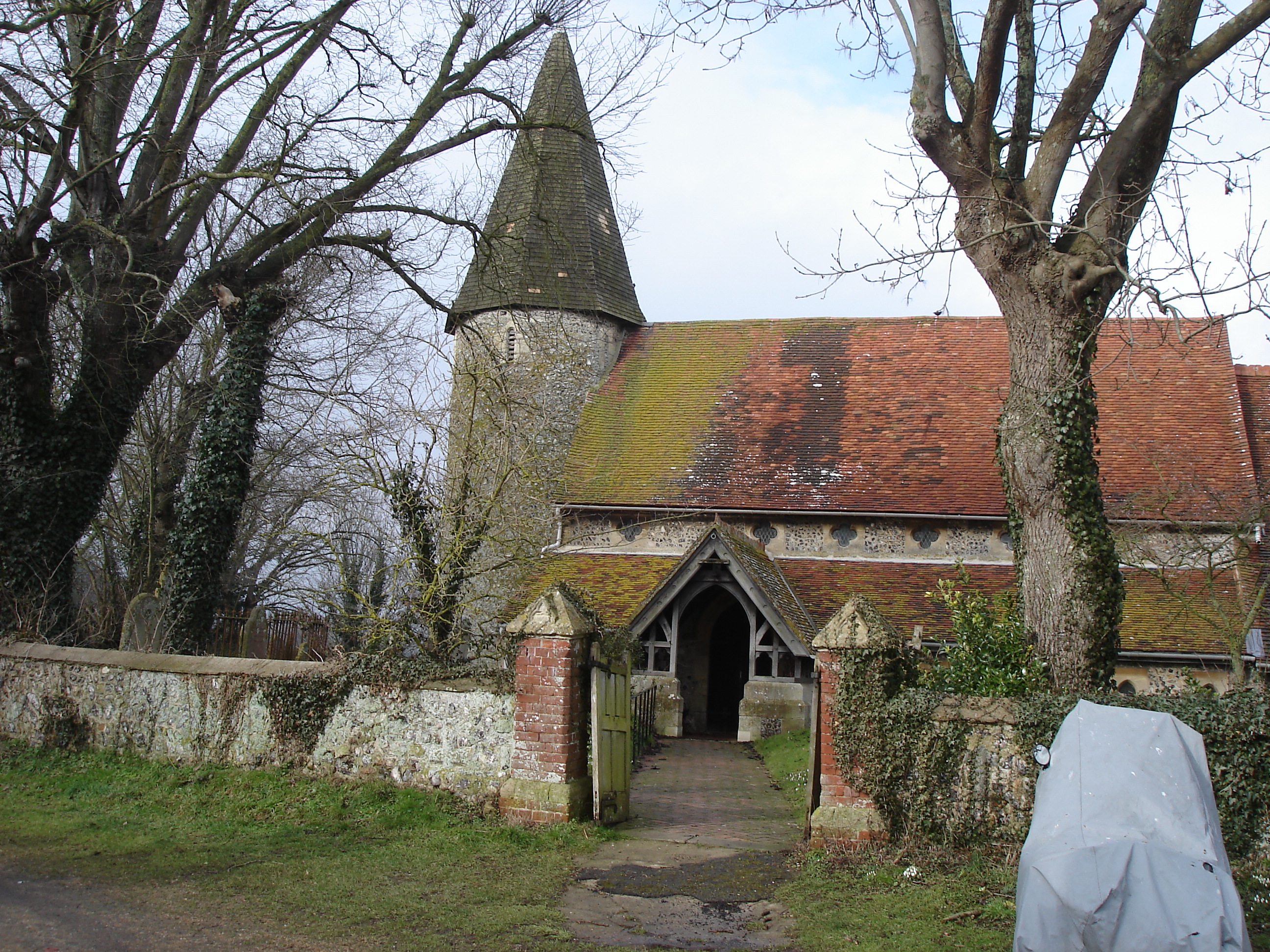
Southease is a small village and civil parish in East Sussex, in South East England between the A26 road and the C7 road from Lewes to Newhaven, East Sussex, Newhaven. The village is to the west of the River Ouse, Sussex and has a church dedicated to Saint Peter. Southease railway station lies roughly a kilometre east over the river and may be reached via a swing bridge. The church has one of only three round towers in Sussex, all of which are located in the Ouse Valley and all three built in the first half of the 12th century. It is downstream of Lewes, the county town of East Sussex and upstream of Piddinghoe and Newhaven, East Sussex, Newhaven. Paths along both the banks of the river allow hiking in either direction along the river. The remains of a slipway on the west bank of the River Ouse, Sussex, Ouse just north of the bridge faces Mount Caburn. The nearest village is Rodmell, about a kilometre to the northwest. The South Downs Way winds its way through the village tow ... [...More Info...] [...Related Items...] OR: [Wikipedia] [Google] [Baidu] |
Southease Green
Southease is a small village and civil parish in East Sussex, in South East England between the A26 road and the C7 road from Lewes to Newhaven, East Sussex, Newhaven. The village is to the west of the River Ouse, Sussex and has a church dedicated to Saint Peter. Southease railway station lies roughly a kilometre east over the river and may be reached via a swing bridge. The church has one of only three round towers in Sussex, all of which are located in the Ouse Valley and all three built in the first half of the 12th century. It is downstream of Lewes, the county town of East Sussex and upstream of Piddinghoe and Newhaven, East Sussex, Newhaven. Paths along both the banks of the river allow hiking in either direction along the river. The remains of a slipway on the west bank of the River Ouse, Sussex, Ouse just north of the bridge faces Mount Caburn. The nearest village is Rodmell, about a kilometre to the northwest. The South Downs Way winds its way through the village tow ... [...More Info...] [...Related Items...] OR: [Wikipedia] [Google] [Baidu] |
Southease Railway Station
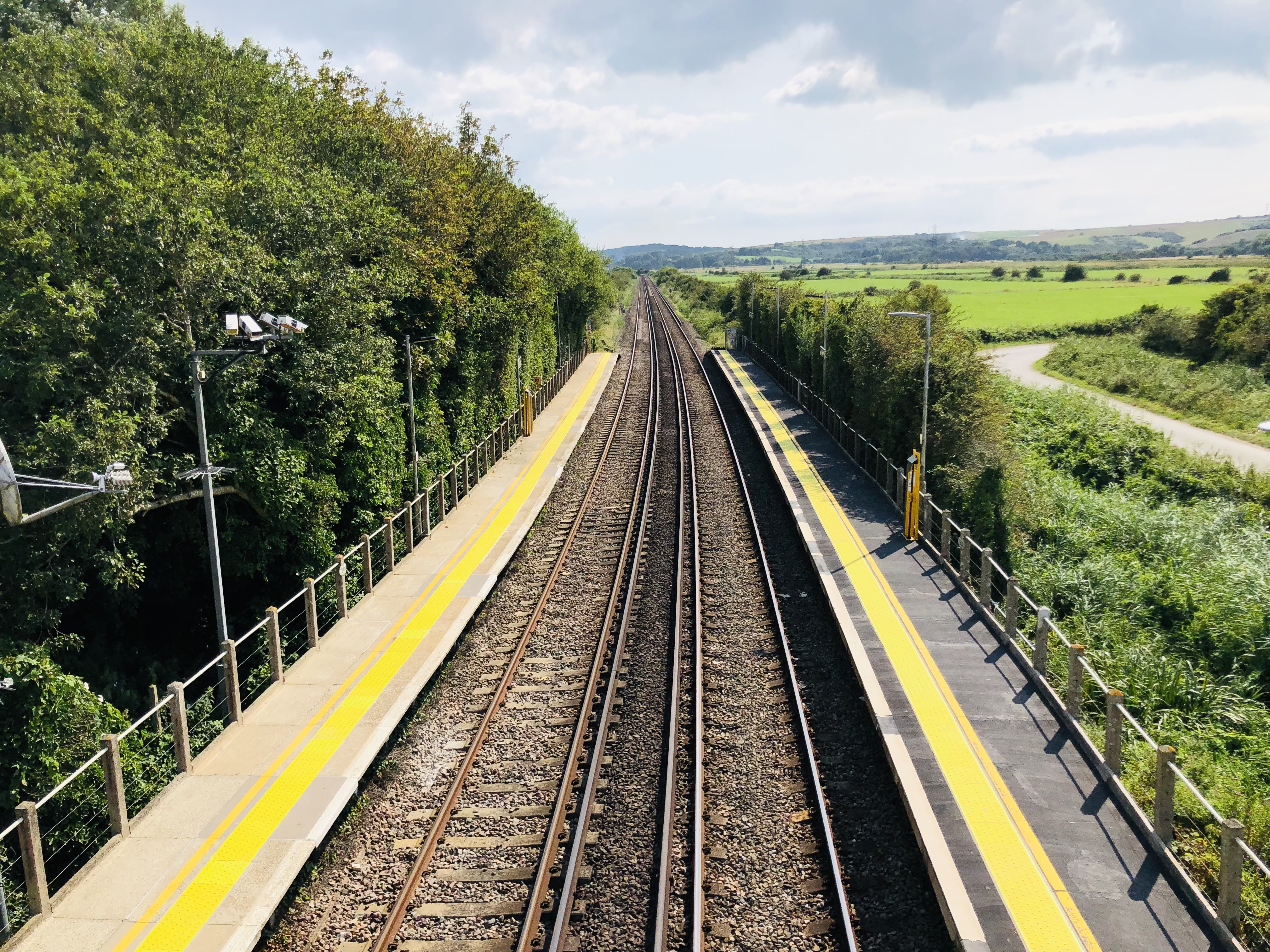
Southease railway station is located east of the village of Southease in East Sussex, England. It is on the Seaford branch of the East Coastway Line, measured from via Redhill. The station is surrounded by agricultural land. The South Downs Way crosses the Seaford Branch here. History The London, Brighton and South Coast Railway opened the station on 1 September 1906 as ''Southease and Rodmell Halt'', to serve two villages in the Ouse Valley; Southease, to the west, and the slightly larger Rodmell, more than away. The station was renamed ''Southease'' on 12 May 1980. There was a racecourse between the railway line and the River Ouse from the late 1920s to the early 1940s. Infrastructure The station is unmanned and has two platforms, each with a PERTIS machine. A self-service ticket machine was also installed in 2016. There is a level crossing immediately north of the station leading to Itford Farm and the A26 road The A26 road is a primary route in the southeas ... [...More Info...] [...Related Items...] OR: [Wikipedia] [Google] [Baidu] |
River Ouse, Sussex
The Ouse ( ) is a 35 mile (56 kilometre) long river in the English county, counties of West Sussex, West and East Sussex. It rises near Lower Beeding in West Sussex, and flows eastwards and then southwards to reach the sea at Newhaven, East Sussex, Newhaven. It skirts Haywards Heath and passes through Lewes. It forms the main spine of an extensive network of smaller streams, of which the River Uck is the main tributary. As it nears the coast it passes through the Lewes and Laughton Levels, an area of flat, low-lying land that borders the river and another tributary, the Glynde Reach. It was a large tidal inlet at the time of the Domesday book in 1086, but over the following centuries, some attempts were made to reclaim some of the valley floor for agriculture, by building embankments, but the drainage was hampered by the buildup of a large shingle bar which formed across the mouth of the river by longshore drift. In 1539, a new channel for the entrance to the river was cut thro ... [...More Info...] [...Related Items...] OR: [Wikipedia] [Google] [Baidu] |
Rodmell
Rodmell is a small village and civil parish in the Lewes District of East Sussex, England. It is located three miles (4.8 km) south-west of Lewes, on the Lewes to Newhaven road and six and a half miles from the City of Brighton & Hove and is situated by the west banks of the River Ouse. The village is served by Southease railway station, opened in 1906. The Prime Meridian passes just to the west of the village. The village name has been variously spelled as ''Ramelle'' or ''Redmelle'' (11th century), ''Redmelde'' (12th century), ''Radmelde'' (13th century) and ''Radmill'' (18th century). It most likely derives from Brittonic where ''Rhod'' denotes a wheel and ''Melin'' refers to a Mill, hence mill wheel. A less likely derivation is from Old English ''read *mylde'', " lace withred soil". Before the time of the Norman conquest the manor of Rodmell was held by King Harold II. [...More Info...] [...Related Items...] OR: [Wikipedia] [Google] [Baidu] |
Piddinghoe
Piddinghoe is a village and civil parish in the Lewes District of East Sussex, England. It is located in the valley of the River Ouse between Lewes and Newhaven, five miles (8 km) south of the former, downstream of Southease. The village was once a central player in Sussex smuggling. It is also notable for having the only remaining bottle-shaped brick kiln in the country. Piddinghoe is regularly visited by sailing enthusiasts as the body of water by the village is a fine location for dinghy sailing in particular but also windsurfing. An old saying of unknown origin says that "Piddinghoe people shoe their magpies". One theory is that this refers to the habit of shoeing oxen, which if black and white, were called magpies. History Piddinghoe does not appear in the Domesday Book, but by 1220 a manor of that name was in the hands of William de Warenne. In the 13th century the village name appears as ''Peddinghowe'' or ''Pidingeho'' and in the 14th century as ''Pydynghowe'' ... [...More Info...] [...Related Items...] OR: [Wikipedia] [Google] [Baidu] |
Lewes
Lewes () is the county town of East Sussex, England. It is the police and judicial centre for all of Sussex and is home to Sussex Police, East Sussex Fire & Rescue Service, Lewes Crown Court and HMP Lewes. The civil parish is the centre of the Lewes local government district and the seat of East Sussex County Council at East Sussex County Hall. A traditional market town and centre of communications, in 1264 it was the site of the Battle of Lewes. The town's landmarks include Lewes Castle, Lewes Priory, Bull House (the former home of Thomas Paine), Southover Grange and public gardens, and a 16th-century timber-framed Wealden hall house known as Anne of Cleves House. Other notable features of the area include the Glyndebourne festival, the Lewes Bonfire celebrations and the Lewes Pound. Etymology The place-name 'Lewes' is first attested in an Anglo-Saxon charter circa 961 AD, where it appears as ''Læwe''. It appears as ''Lewes'' in the Domesday Book of 1086. The additio ... [...More Info...] [...Related Items...] OR: [Wikipedia] [Google] [Baidu] |
Lewes And Laughton Levels
The Lewes and Laughton Levels are an area of low-lying land bordering the River Ouse near Lewes and the Glynde Reach near Laughton in East Sussex, England. The area was probably a tidal inlet in Norman times, but by the early 14th century, some meadows had been created by building embankments. Conditions deteriorated later that century, and by 1537, most of the meadows were permanently flooded. Part of the problem was the buildup of shingle across the mouth of the Ouse, but in 1537 a scot tax was raised, and a new channel cut through the shingle. By the mid 17th century, shingle was again preventing the region from draining properly, until the new channel was reinstated around 1731. In 1758 John Smeaton surveyed the area with a view to improving it for agriculture. He suggested straightening and widening the river channel, raising the banks around meadows, and building a large sluice near Piddinghoe, to keep the tides out. Some dredging and widening were carried out, but the str ... [...More Info...] [...Related Items...] OR: [Wikipedia] [Google] [Baidu] |
Telscombe
Telscombe is a civil parish and electoral ward (called East Saltdean and Telscombe Cliffs) with the status of a town in the Lewes District of East Sussex, England. It consists of three distinct settlements, separated from each other by an open area of downland called Telscombe Tye. Telscombe village is a small village on the South Downs, six miles (10 km) south of Lewes. It includes the parish church, with origins dating back to the 10th century. The village has a population of fewer than 50 people. The parish retains its ancient boundaries, which reach from the village to the coast, and the major part of the population is in the two coastal settlements. At the eastern end of the parish, about 4500 people live at Telscombe Cliffs, developed in the 20th century effectively as an extension of the town of Peacehaven over the town boundary. At the western end, the remaining 2500 population forms part of the community of Saltdean, the remainder of Saltdean being within the c ... [...More Info...] [...Related Items...] OR: [Wikipedia] [Google] [Baidu] |
Hyde Abbey
Hyde Abbey was a medieval Benedictine monastery just outside the walls of Winchester, Hampshire, England. It was dissolved and demolished in 1538 following various acts passed under King Henry VIII to dissolve monasteries and abbeys (see Dissolution of the Monasteries). The Abbey was once known to have housed the remains of King Alfred the Great, his son, King Edward the Elder, and his wife, Ealswitha. Following its dissolution these remains were lost, however excavations of the Abbey and the surrounding area continue. History When Alfred the Great re-founded the royal city of Winchester in about 880, the Saxon cathedral and the royal palace stood at the heart of the city. As the city grew, land was purchased in the city in the last year of Alfred's reign, and work was begun on the New Minster, beside the Old Minster, under the direction of Edward the Elder. When it was sufficiently complete, about 903, it was consecrated and fully endowed; the abbot Grimbald (died 8 July 901 ... [...More Info...] [...Related Items...] OR: [Wikipedia] [Google] [Baidu] |
Æthelred The Unready
√Üthelred II ( ang, √Ü√ĺelr√¶d, ;Different spellings of this king‚Äôs name most commonly found in modern texts are "Ethelred" and "√Üthelred" (or "Aethelred"), the latter being closer to the original Old English form . Compare the modern dialect word ., non, A√įalr√°√įr 966 ‚Äď 23 April 1016), known as √Üthelred the Unready, was King of the English from 978 to 1013 and again from 1014 until his death in 1016. His epithet does not derive from the modern word " unready", but rather from the Old English meaning "poorly advised"; it is a pun on his name, which means "well advised". √Üthelred was the son of King Edgar the Peaceful and Queen √Ülfthryth. He came to the throne at about the age of 12, following the assassination of his older half-brother, King Edward the Martyr. The chief problem of √Üthelred's reign was conflict with the Danes. After several decades of relative peace, Danish raids on English territory began again in earnest in the 980s, becoming marked ... [...More Info...] [...Related Items...] OR: [Wikipedia] [Google] [Baidu] |
Lewes (UK Parliament Constituency)
Lewes is a constituency in East Sussex represented in the House of Commons of the UK Parliament since 2015 by Maria Caulfield, a Conservative. Constituency profile The constituency is centred on the town of Lewes. However, the constituency also covers most of the Lewes district, including the coastal towns of Seaford and Newhaven, which are rural and semi-rural and all in outer parts of the London Commuter Belt, though with a high number of people who have retired from across the country. The constituency excludes Peacehaven and Telscombe which since 1997 have been in Brighton, Kemptown, and includes part of neighbouring Wealden District. Electoral Calculus categorises the constituency as "Centrist", indicating average levels of education and wealth and moderate support for Brexit. Boundaries 1885‚Äď1918: The Borough of Brighton, the Sessional Divisions of Hove and Worthing, and parts of the Sessional Divisions of Lewes and Steyning. 1918‚Äď1950: The Borough of Lewes, th ... [...More Info...] [...Related Items...] OR: [Wikipedia] [Google] [Baidu] |
Domesday Book
Domesday Book () ‚Äď the Middle English spelling of "Doomsday Book" ‚Äď is a manuscript record of the "Great Survey" of much of England and parts of Wales completed in 1086 by order of King William I, known as William the Conqueror. The manuscript was originally known by the Latin name ''Liber de Wintonia'', meaning "Book of Winchester", where it was originally kept in the royal treasury. The '' Anglo-Saxon Chronicle'' states that in 1085 the king sent his agents to survey every shire in England, to list his holdings and dues owed to him. Written in Medieval Latin, it was highly abbreviated and included some vernacular native terms without Latin equivalents. The survey's main purpose was to record the annual value of every piece of landed property to its lord, and the resources in land, manpower, and livestock from which the value derived. The name "Domesday Book" came into use in the 12th century. Richard FitzNeal wrote in the ''Dialogus de Scaccario'' ( 1179) that the book ... [...More Info...] [...Related Items...] OR: [Wikipedia] [Google] [Baidu] |

