|
Southease Railway Station
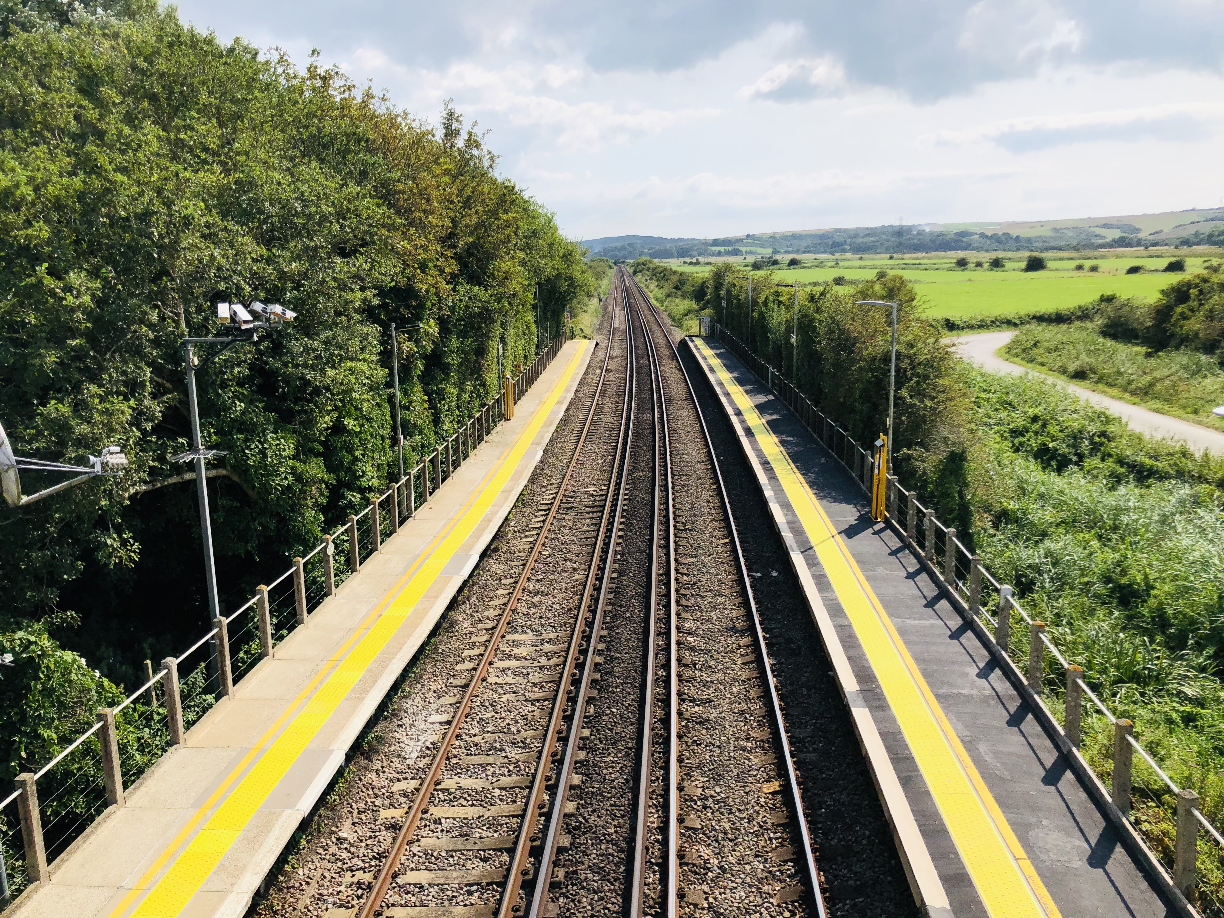
Southease railway station is located east of the village of Southease in East Sussex, England. It is on the Seaford branch of the East Coastway Line, measured from via Redhill. The station is surrounded by agricultural land. The South Downs Way crosses the Seaford Branch here. History The London, Brighton and South Coast Railway opened the station on 1 September 1906 as ''Southease and Rodmell Halt'', to serve two villages in the Ouse Valley; Southease, to the west, and the slightly larger Rodmell, more than away. The station was renamed ''Southease'' on 12 May 1980. There was a racecourse between the railway line and the River Ouse from the late 1920s to the early 1940s. Infrastructure The station is unmanned and has two platforms, each with a PERTIS machine. A self-service ticket machine was also installed in 2016. There is a level crossing immediately north of the station leading to Itford Farm and the A26 road The A26 road is a primary route in the southeas ... [...More Info...] [...Related Items...] OR: [Wikipedia] [Google] [Baidu] |
Southease
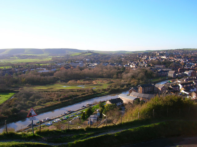
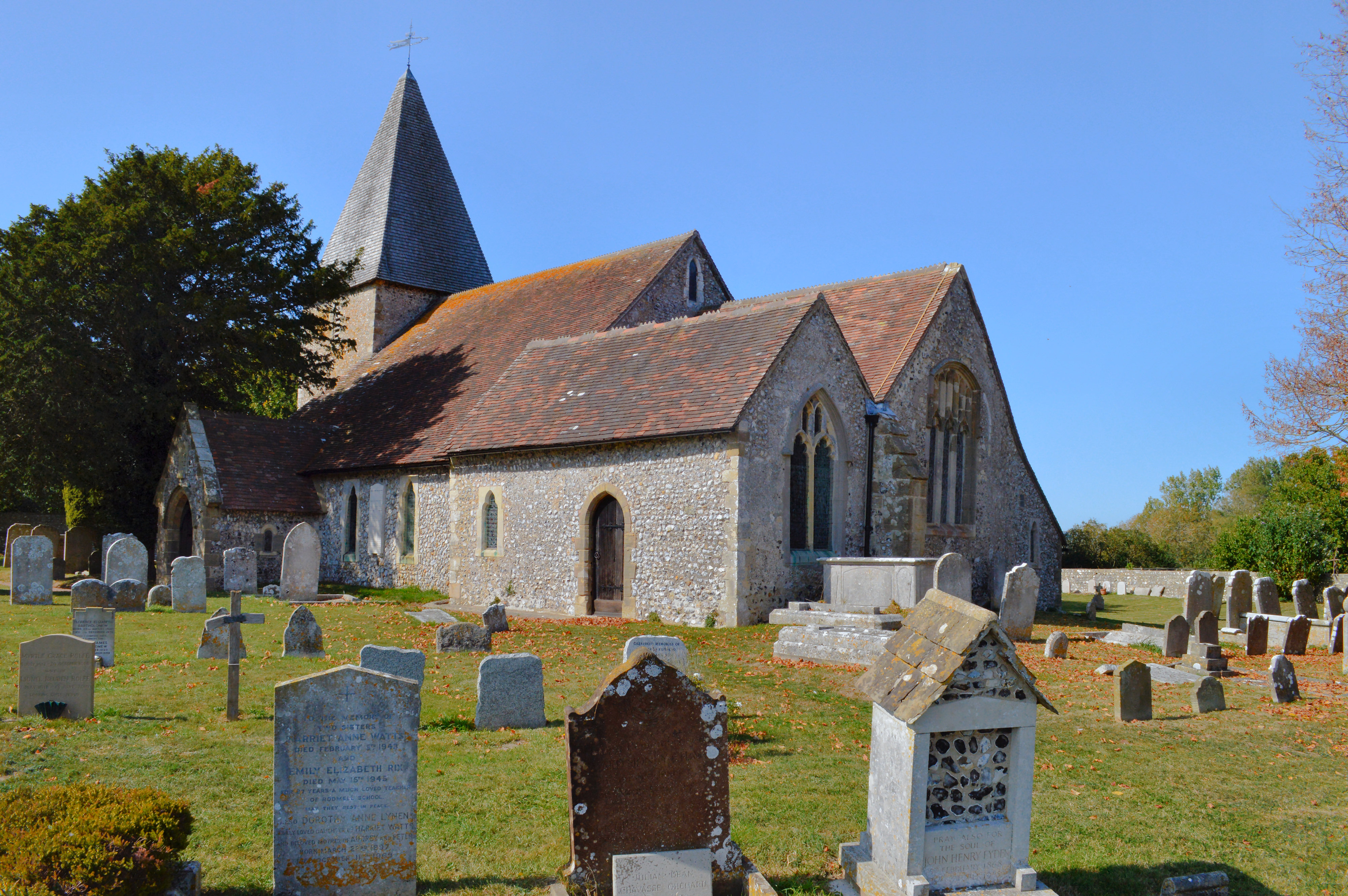
Southease is a small village and civil parish in East Sussex, in South East England between the A26 road and the C7 road from Lewes to Newhaven, East Sussex, Newhaven. The village is to the west of the River Ouse, Sussex and has a church dedicated to Saint Peter. Southease railway station lies roughly a kilometre east over the river and may be reached via a swing bridge. The church has one of only three round towers in Sussex, all of which are located in the Ouse Valley and all three built in the first half of the 12th century. It is downstream of Lewes, the county town of East Sussex and upstream of Piddinghoe and Newhaven, East Sussex, Newhaven. Paths along both the banks of the river allow hiking in either direction along the river. The remains of a slipway on the west bank of the River Ouse, Sussex, Ouse just north of the bridge faces Mount Caburn. The nearest village is Rodmell, about a kilometre to the northwest. The South Downs Way winds its way through the village tow ... [...More Info...] [...Related Items...] OR: [Wikipedia] [Google] [Baidu] |
River Ouse, Sussex
The Ouse ( ) is a 35 mile (56 kilometre) long river in the English county, counties of West Sussex, West and East Sussex. It rises near Lower Beeding in West Sussex, and flows eastwards and then southwards to reach the sea at Newhaven, East Sussex, Newhaven. It skirts Haywards Heath and passes through Lewes. It forms the main spine of an extensive network of smaller streams, of which the River Uck is the main tributary. As it nears the coast it passes through the Lewes and Laughton Levels, an area of flat, low-lying land that borders the river and another tributary, the Glynde Reach. It was a large tidal inlet at the time of the Domesday book in 1086, but over the following centuries, some attempts were made to reclaim some of the valley floor for agriculture, by building embankments, but the drainage was hampered by the buildup of a large shingle bar which formed across the mouth of the river by longshore drift. In 1539, a new channel for the entrance to the river was cut thro ... [...More Info...] [...Related Items...] OR: [Wikipedia] [Google] [Baidu] |
Former London, Brighton And South Coast Railway Stations
A former is an object, such as a template, gauge or cutting die, which is used to form something such as a boat's hull. Typically, a former gives shape to a structure that may have complex curvature. A former may become an integral part of the finished structure, as in an aircraft fuselage, or it may be removable, being using in the construction process and then discarded or re-used. Aircraft formers Formers are used in the construction of aircraft fuselage, of which a typical fuselage has a series from the nose to the empennage, typically perpendicular to the longitudinal axis of the aircraft. The primary purpose of formers is to establish the shape of the fuselage and reduce the column length of stringers to prevent instability. Formers are typically attached to longerons, which support the skin of the aircraft. The "former-and-longeron" technique (also called stations and stringers) was adopted from boat construction, and was typical of light aircraft built until the a ... [...More Info...] [...Related Items...] OR: [Wikipedia] [Google] [Baidu] |
DfT Category F2 Stations
The Department for Transport (DfT) is a department of His Majesty's Government responsible for the English transport network and a limited number of transport matters in Scotland, Wales and Northern Ireland that have not been devolved. The department is run by the Secretary of State for Transport, currently (since 25 October 2022) Mark Harper. The expenditure, administration and policy of the Department for Transport are scrutinised by the Transport Committee. History The Ministry of Transport was established by the Ministry of Transport Act 1919 which provided for the transfer to the new ministry of powers and duties of any government department in respect of railways, light railways, tramways, canals and inland waterways, roads, bridges and ferries, and vehicles and traffic thereon, harbours, docks and piers. In September 1919, all the powers of the Road Board, the Ministry of Health, and the Board of Trade in respect of transport, were transferred to the new ministry. ... [...More Info...] [...Related Items...] OR: [Wikipedia] [Google] [Baidu] |
Railway Stations In East Sussex
Rail transport (also known as train transport) is a means of transport that transfers passengers and goods on wheeled vehicles running on rails, which are incorporated in tracks. In contrast to road transport, where the vehicles run on a prepared flat surface, rail vehicles (rolling stock) are directionally guided by the tracks on which they run. Tracks usually consist of steel rails, installed on sleepers (ties) set in ballast, on which the rolling stock, usually fitted with metal wheels, moves. Other variations are also possible, such as "slab track", in which the rails are fastened to a concrete foundation resting on a prepared subsurface. Rolling stock in a rail transport system generally encounters lower frictional resistance than rubber-tyred road vehicles, so passenger and freight cars (carriages and wagons) can be coupled into longer trains. The operation is carried out by a railway company, providing transport between train stations or freight customer facilit ... [...More Info...] [...Related Items...] OR: [Wikipedia] [Google] [Baidu] |
Lewes District
Lewes is a local government district in East Sussex in southern England covering an area of , with of coastline. It is named after its administrative centre, Lewes. Other towns in the district include Newhaven, Peacehaven, Seaford and Telscombe. Plumpton racecourse is within the district. There are 28 parishes in the district. The district was formed on 1 April 1974 by the Local Government Act 1972, and was a merger of the former borough of Lewes along with Newhaven and Seaford urban districts and Chailey Rural District. Politics Elections to the council are held every four years, with all of the 41 seats, representing 21 wards, on the council being filled. Since July 2019, following the May election, an alliance of councillors from the Green, Liberal Democrat, and Labour parties, plus two Independents, has controlled the council, with Green Councillor Zoe Nicholson and Liberal Democrat Councillor James MacCleary holding the leader and deputy leader roles alternating each ... [...More Info...] [...Related Items...] OR: [Wikipedia] [Google] [Baidu] |
Seaford Railway Station, East Sussex
Seaford railway station is in Seaford, East Sussex, England. It is the terminus of the Seaford branch line of the East Coastway line, measured from . The line to the station has been reduced to a Single track (rail), single track and only one Railway platform, platform remains in use (previously two), though it is still numbered "platform 2". Platform 1 is still visible but the track has been removed. Train services from the station are provided by Southern (Govia Thameslink Railway), Southern. The London, Brighton and South Coast Railway opened Seaford station on 1 June 1864. It was designed as a through station for a proposed extension to that was never built. A working model of Seaford Station as it appeared in the 1920s is displayed at Seaford Museum. Signal box At the end of the station, there was a signal box that was used up until the mid 1980s. The box was damaged by the salt air coming from the nearby sea and the box was dangerously unstable, therefore Seaford sign ... [...More Info...] [...Related Items...] OR: [Wikipedia] [Google] [Baidu] |
A26 Road
The A26 road is a primary route in the southeast of England, going from Maidstone to Newhaven through the counties of Kent and East Sussex. The road is almost entirely single carriageway with one lane on each side, although some of the road is three lanes, with the middle lane switching sides for overtaking and right turns. The road runs for a total distance of some and provides access to the North Kent area and its industrial base with the ferry port of Newhaven. As consequence, it has a large Heavy Goods Vehicle usage. History The A26 was originally classified in 1922 due to the Ministry of Transport Act 1919, which in section 19 instructed the classification of all major roads. The original route went from Maidstone to Brighton, along part of what is now the A27. The part of the road going from Lewes was later reclassified to the A27 between 1947 and 1951. The road was later extended along the B2109 to Newhaven after 1969. Route Maidstone to Tonbridge The roa ... [...More Info...] [...Related Items...] OR: [Wikipedia] [Google] [Baidu] |
Level Crossing
A level crossing is an intersection where a railway line crosses a road, Trail, path, or (in rare situations) airport runway, at the same level, as opposed to the railway line crossing over or under using an Overpass#Railway, overpass or tunnel. The term also applies when a light rail line with separate Right-of-way (railroad), right-of-way or reserved track crosses a road in the same fashion. Other names include railway level crossing, railway crossing (chiefly international), grade crossing or railroad crossing (chiefly American), road through railroad, criss-cross, train crossing, and RXR (abbreviated). There are more than 100,000 level crossings in Europe and more than 200,000 in North America. History The history of level crossings depends on the location, but often early level crossings had a Flagman (rail), flagman in a nearby booth who would, on the approach of a train, wave a red flag or lantern to stop all traffic and clear the tracks. Gated crossings bec ... [...More Info...] [...Related Items...] OR: [Wikipedia] [Google] [Baidu] |
Permit To Travel
In the ticketing system of the British rail network, a Permit to Travel provisionally allows passengers to travel on a train when they have not purchased a ticket in advance and the ticket office of the station they are travelling from is closed, without incurring a penalty fare. Because some rail passengers may travel without having their tickets checked at any point of their journey, particularly at off-peak times when stations are less likely to be staffed, the obligation to possess a Permit to Travel allows the collection of at least some revenue from passengers who would otherwise travel for free. Most train operating companies (TOCs) have altered their penalty fare policies and have removed many ''permit to travel'' machines. PERTIS machines at larger stations have also in recent years given way to more sophisticated self-service ticket machines. History The system, known officially as PERTIS (Permit to Travel Issuing System ), was first introduced by Network SouthEast ... [...More Info...] [...Related Items...] OR: [Wikipedia] [Google] [Baidu] |
Rodmell
Rodmell is a small village and civil parish in the Lewes District of East Sussex, England. It is located three miles (4.8 km) south-west of Lewes, on the Lewes to Newhaven road and six and a half miles from the City of Brighton & Hove and is situated by the west banks of the River Ouse. The village is served by Southease railway station, opened in 1906. The Prime Meridian passes just to the west of the village. The village name has been variously spelled as ''Ramelle'' or ''Redmelle'' (11th century), ''Redmelde'' (12th century), ''Radmelde'' (13th century) and ''Radmill'' (18th century). It most likely derives from Brittonic where ''Rhod'' denotes a wheel and ''Melin'' refers to a Mill, hence mill wheel. A less likely derivation is from Old English ''read *mylde'', " lace withred soil". Before the time of the Norman conquest the manor of Rodmell was held by King Harold II. [...More Info...] [...Related Items...] OR: [Wikipedia] [Google] [Baidu] |
South Downs Way
The South Downs Way is a long distance footpath and bridleway running along the South Downs in southern England. It is one of 16 National Trails in England and Wales. The trail runs for from Winchester in Hampshire to Eastbourne in East Sussex, with about of ascent and descent. History People have been using the paths and tracks that have been linked to form the South Downs Way for approximately 8000 years. They were a safer and drier alternative to those in the wetter lowlands throughout the mesolithic era. Early occupation in the area began 2000 years after that in the neolithic era. Early inhabitants built tumuli in places on the hills and hill forts later, once tribal fighting became more common. Old Winchester Hill is an example of one of these hill forts along the path. The trail was probably used by the Romans, despite the fact that they built one of their roads across the path at Stane Street (Chichester), this use possibly evidenced by the existence of Bignor Roman ... [...More Info...] [...Related Items...] OR: [Wikipedia] [Google] [Baidu] |


