|
South Lynn
South Lynn is an area of King's Lynn, in the unparished area of King's Lynn, in the King's Lynn and West Norfolk district, in the county of Norfolk, England. It is located directly south of the town, near the A47 and A418 roads. History South Lynn was historically known as "Old South Lynn" and had a manor that was owned before 1066 by King Harold. When travellers visited the area, to access Bishop's Lynn, they would have to gain access via Friar Street and All Saints Church. Traffic inbound to the area would have to use the south gate at South Lynn. Due to it lacking a community, a market, or any major important centre, South Lynn was merged into King's Lynn in 1555 and since then, has formed a major part of the southern part of the town. The area is a parish of King's Lynn and is directly southeast of West Lynn which is separated from the area by the Great River Ouse and the area is also separated from King's Lynn to the north by a small part of the River Nar. The civil ... [...More Info...] [...Related Items...] OR: [Wikipedia] [Google] [Baidu] |
King's Lynn And West Norfolk
King's Lynn and West Norfolk is a local government district with borough status in Norfolk, England. Its council is based in the town of King's Lynn. The population of the Local Authority at the 2011 Census was 147,451. History The district was formed in 1974 by the merger of the Municipal Borough of King's Lynn, Hunstanton and Downham Market urban districts along with Docking Rural District, Downham Rural District, Freebridge Lynn Rural District and Marshland Rural District. The district was originally known as just West Norfolk, and adopted its present name in 1981. Politics Elections to the borough council are held every four years, with all of the 55 councillors, representing 42 wards, on the council being elected at each election. After being under no overall control from the 1999 election, the Conservative party gained a majority at the 2003 election and has held one ever since, although losing a large number of seats due to the resurgence of the Independent Group ... [...More Info...] [...Related Items...] OR: [Wikipedia] [Google] [Baidu] |
Wisbech
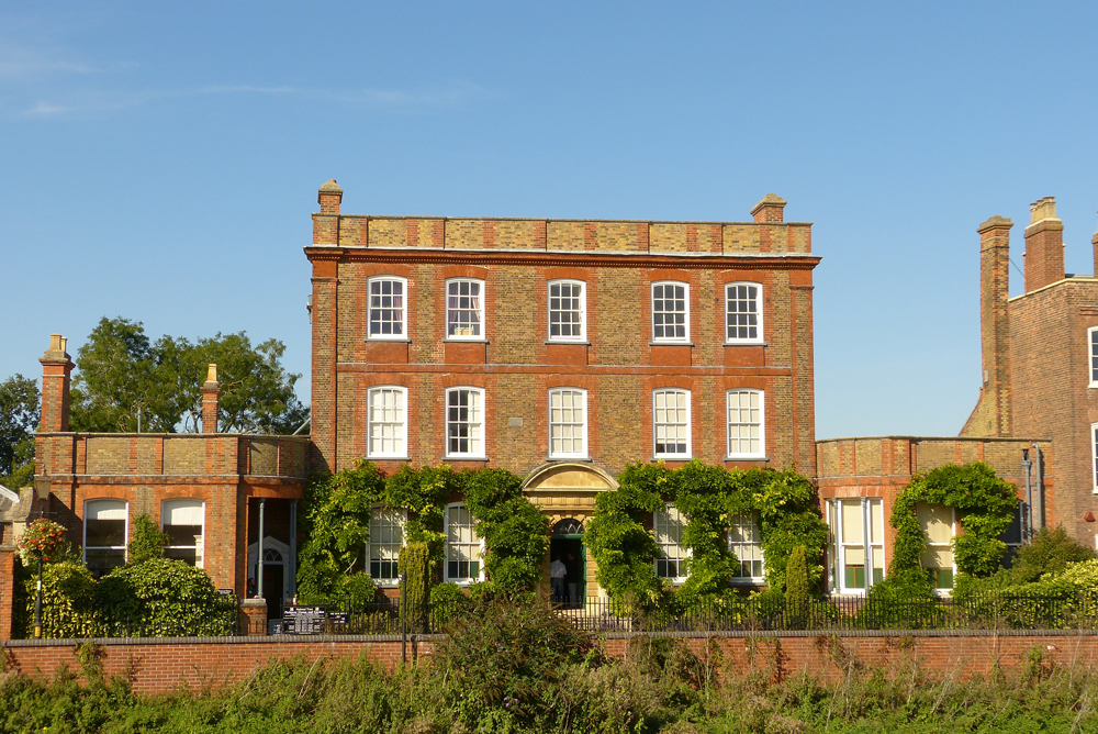
Wisbech ( ) is a market town, inland Port of Wisbech, port and civil parish in the Fenland District, Fenland district in Cambridgeshire, England. In 2011 it had a population of 31,573. The town lies in the far north-east of Cambridgeshire, bordering Norfolk and only 5 miles (8 km) south of Lincolnshire. The tidal River Nene running through the town is spanned by two road bridges. Wisbech is in the Isle of Ely (a former administrative county) and has been described as 'the Capital of The Fens". Wisbech is noteworthy for its fine examples of Georgian architecture, particularly the parade of houses along the North Brink, which includes the National Trust property of Peckover House and Garden, Peckover House and The Crescent, Wisbech, the circus surrounding Wisbech Castle. History Etymology The place name 'Wisbech' is first attested in the ''Anglo-Saxon Chronicle'' for the year 656, where it appears as ''Wisbeach''. It is recorded in the 1086 Domesday Book as ''Wisbeach''. ... [...More Info...] [...Related Items...] OR: [Wikipedia] [Google] [Baidu] |
Norwich City Railway Station
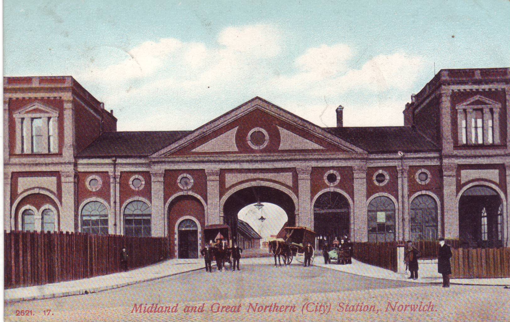
Norwich City railway station was located in Norwich, Norfolk, England and was closed in 1969. History The station was opened in 1882 by the Lynn and Fakenham Railway, and later became the southern terminus of the Midland and Great Northern Joint Railway (MG&N) line from Melton Constable. The station became well-used, with services to Cromer and through-carriages to a range of destinations including Peterborough and Leicester. The station was badly bombed in the Baedeker raids of 1942 when the main building was largely destroyed. The station was further damaged when a badly damaged USAF B24 Liberator bomber was deliberately crashed there to avoid greater loss of life. Thereafter, the station operated from "temporary" buildings constructed on the site. It was closed to passengers on 2 March 1959 along with most of the Midland & Great Northern system, although the station remained in use for goods traffic until 1969. Location The old Norwich City station stood where a rounda ... [...More Info...] [...Related Items...] OR: [Wikipedia] [Google] [Baidu] |
Yarmouth Beach Railway Station
Yarmouth Beach railway station was a railway station serving Great Yarmouth, Norfolk. It was opened in 1877 by the Great Yarmouth & Stalham Light Railway. In 1893 it was taken over by the Midland and Great Northern Joint Railway which had built a large network of track over East Anglia, initially conceived to transport holidaymakers from the Midlands to their destinations on the Norfolk coast. Acquiring Yarmouth Beach station fitted into this grand strategy. The line was also dependent on use by local travellers. Use of the line gradually began to decline and by the 1950s competition from the roads diminished passenger numbers. Yarmouth Beach and the line it stood on closed in 1959 along with most of the Midland and Great Northern Joint Railway The Midland and Great Northern Joint Railway (M&GNJR) was a railway network in England, in the area connecting southern Lincolnshire, the Isle of Ely and north Norfolk. It developed from several local independent concerns and wa ... [...More Info...] [...Related Items...] OR: [Wikipedia] [Google] [Baidu] |
Saxby Railway Station
Saxby railway station was a station serving the villages of Saxby and Freeby, Leicestershire. It was located between the two villages. Access The older station was accessed along a turning from the B676 road, now known as ''Old Station Drive'', whereas the newer station building was accessed off the Saxby to Stapleford road on the right before the railway bridge. Inter platform access on the newer station was via three sets of stairs to the road bridge. History The Syston and Peterborough Railway was opened in stages; the third and last section of line, between and opened for goods traffic on 20 March 1848, and for passengers on 1 May 1848. The station at Saxby opened on 1 February 1849, and was at the north end of a tight curve around a corner of Stapleford Park. The curve was considered unsuitable for express trains running between Kettering and Nottingham via the Manton loop, so an easier curve was built in 1892 together with a new Saxby station, which opened on 28 Au ... [...More Info...] [...Related Items...] OR: [Wikipedia] [Google] [Baidu] |
Midland And Great Northern Joint Railway
The Midland and Great Northern Joint Railway (M&GNJR) was a railway network in England, in the area connecting southern Lincolnshire, the Isle of Ely and north Norfolk. It developed from several local independent concerns and was incorporated in 1893. It was jointly owned by the Midland Railway and the Great Northern Railway, and those companies had long sponsored and operated the predecessor companies. The area directly served was agricultural and sparsely populated, but seaside holidays had developed and the M&GNJR ran many long-distance express trains to and from the territory of the parent companies, as well as summer local trains for holidaymakers. It had the longest mileage of any joint railway in the United Kingdom. In the grouping of 1923, the two joint owners of the M&GNJR were absorbed into two separate companies (the Midland into the London, Midland and Scottish Railway and the Great Northern into the London and North Eastern Railway). The M&GNJR maintained a disti ... [...More Info...] [...Related Items...] OR: [Wikipedia] [Google] [Baidu] |
South Lynn Railway Station
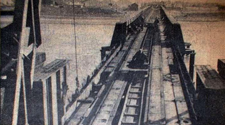
South Lynn railway station was a railway station serving the areas of South Lynn and West Lynn in King's Lynn in Norfolk, England. The station was on the Midland and Great Northern Joint Railway. History The Lynn & Sutton Bridge Railway was authorised on 6 August 1861, to build a line between those points. It was opened between and in November 1864; passenger trains began on 1 March 1866. The first station after King's Lynn was West Lynn, which was located at the western end of the bridge over the Great Ouse; that station was closed on 1 July 1886. The station at South Lynn was opened on 1 January 1886 along with other improvements in the area. South Lynn station was closed to passengers on 2 March 1959. It was located at the southern end of King's Lynn, and saw far less traffic than King's Lynn railway station. Routes See also * King's Lynn railway station * List of closed railway stations in Norfolk This is a list of closed railway stations in Norfolk, Englan ... [...More Info...] [...Related Items...] OR: [Wikipedia] [Google] [Baidu] |
South Lynn Ex-GE B12-3 4-6-0 On Rail Tour Geograph-2846661-by-Ben-Brooksbank
South is one of the cardinal directions or compass points. The direction is the opposite of north and is perpendicular to both east and west. Etymology The word ''south'' comes from Old English ''sūþ'', from earlier Proto-Germanic ''*sunþaz'' ("south"), possibly related to the same Proto-Indo-European root that the word ''sun'' derived from. Some languages describe south in the same way, from the fact that it is the direction of the sun at noon (in the Northern Hemisphere), like Latin meridies 'noon, south' (from medius 'middle' + dies 'day', cf English meridional), while others describe south as the right-hand side of the rising sun, like Biblical Hebrew תֵּימָן teiman 'south' from יָמִין yamin 'right', Aramaic תַּימנַא taymna from יָמִין yamin 'right' and Syriac ܬܰܝܡܢܳܐ taymna from ܝܰܡܝܺܢܳܐ yamina (hence the name of Yemen, the land to the south/right of the Levant). Navigation By convention, the ''bottom or down-facing side'' of a ... [...More Info...] [...Related Items...] OR: [Wikipedia] [Google] [Baidu] |
London King's Cross
King's Cross railway station, also known as London King's Cross, is a passenger railway terminus in the London Borough of Camden, on the edge of Central London. It is in the London station group, one of the busiest stations in the United Kingdom and the southern terminus of the East Coast Main Line to North East England and Scotland. Adjacent to King's Cross station is St Pancras International, the London terminus for Eurostar services to continental Europe. Beneath both main line stations is King's Cross St Pancras tube station on the London Underground; combined they form one of the country's largest and busiest transport hubs. The station was opened in Kings Cross in 1852 by the Great Northern Railway on the northern edge of Central London to accommodate the East Coast Main Line. It quickly grew to cater for suburban lines and was expanded several times in the 19th century. It came under the ownership of the London and North Eastern Railway as part of the Big Four group ... [...More Info...] [...Related Items...] OR: [Wikipedia] [Google] [Baidu] |
Cambridge Railway Station
Cambridge railway station is the principal station serving the city of Cambridge in the east of England. It stands at the end of Station Road, south-east of the city centre. It is the northern terminus of the West Anglia Main Line, down the line from London Liverpool Street, the southern terminus. The station is managed by Greater Anglia. It is one of two railway stations in the city (the other being , approximately away). Cambridge is noted for having the third-longest platform on the network in England. Cambridge is also the terminus of three secondary routes: the Fen line to , the Breckland line to and the Ipswich–Ely line to . It is the thirteenth busiest station in the UK outside London. History Up to 1923 In 1822, the first survey for a railway line in the Cambridge area was made and, in the 1820s and 1830s, a number of other surveys were undertaken none of which came to fruition although the Northern and Eastern Railway had opened up a line as far as Bisho ... [...More Info...] [...Related Items...] OR: [Wikipedia] [Google] [Baidu] |
Ely Railway Station
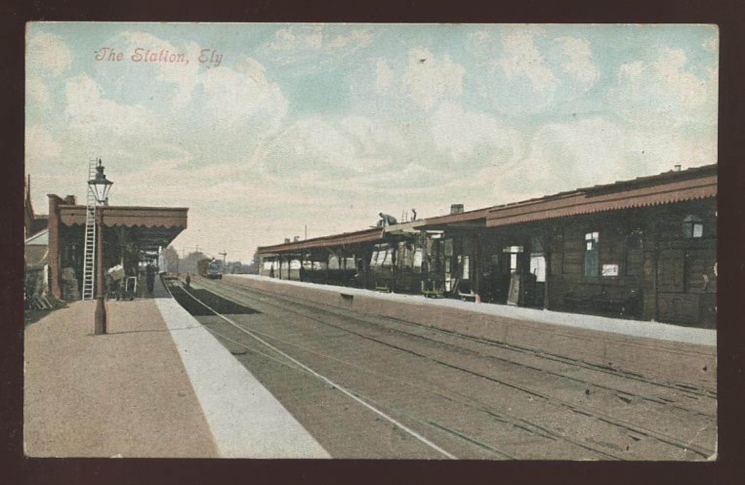
Ely railway station is on the Fen line in the east of England, serving the city of Ely, Cambridgeshire. It is from London Liverpool Street and is situated between and stations on the Fen line to King's Lynn. It is an important junction for three other lines; the Ely to Peterborough Line, the Ipswich to Ely Line and the Norwich to Ely line. Ely is a busy station with trains running to a variety of destinations including London, , , Birmingham, , , Manchester and Liverpool. It is managed by Greater Anglia which is also one of four train operators that serve the station, the others being Great Northern, CrossCountry and East Midlands Railway. The station was opened in 1845 by the Eastern Counties Railway at a cost of £81,500, the land on which it was built being a marshy swamp. The station was modified substantially by British Rail in the early 1990s, at the time that electrification of the line was taking place. Description The station building was designed by Francis Th ... [...More Info...] [...Related Items...] OR: [Wikipedia] [Google] [Baidu] |

_station_geograph-2361891-by-Ben-Brooksbank.jpg)


.jpg)
