|
South Hampshire Lowlands
The South Hampshire Lowlands form a natural landscape in south, central England within the county of Hampshire. The UK Government's advisors on the natural environment, Natural England, have named the South Hampshire Lowlands as one of their National Character Areas (No. 128). This covers 38,635 hectares of countryside running from Totton and Southampton in the west to Havant in the east. It excludes the coastal strip containing Fareham and Portsmouth, however.''NCA 128: South Hampshire Lowlands - Key Facts & Data'' at www.naturalengland.org.uk. Accessed on 3 Apr 2013. The area consists of low-lying land between the chalk outcrops of the |
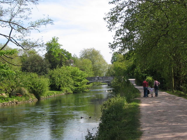
River Test, Romsey - Geograph
A river is a natural flowing watercourse, usually freshwater, flowing towards an ocean, sea, lake or another river. In some cases, a river flows into the ground and becomes dry at the end of its course without reaching another body of water. Small rivers can be referred to using names such as Stream#Creek, creek, Stream#Brook, brook, rivulet, and rill. There are no official definitions for the generic term river as applied to Geographical feature, geographic features, although in some countries or communities a stream is defined by its size. Many names for small rivers are specific to geographic location; examples are "run" in some parts of the United States, "Burn (landform), burn" in Scotland and northeast England, and "beck" in northern England. Sometimes a river is defined as being larger than a creek, but not always: the language is vague. Rivers are part of the water cycle. Water generally collects in a river from Precipitation (meteorology), precipitation through a ... [...More Info...] [...Related Items...] OR: [Wikipedia] [Google] [Baidu] |
Hampshire Downs
The Hampshire Downs form a large area of downland in central southern England, mainly in the county of Hampshire but with parts in Berkshire and Wiltshire. They are part of a belt of chalk downland that extends from the South Downs in the southeast, north to the Berkshire and Marlborough Downs, and west to the Dorset Downs. The downs have been designated a National Character Area (NCA 130) by Natural England, the UK Government's advisor on the natural environment. To the north lie the Thames Basin Heaths, to the east the Low Weald (Western Weald), to the south the South Hampshire Lowlands and the South Downs, and, to the west, Salisbury Plain and the West Wiltshire Downs.''NCA 130: Hampshire Downs - Key Facts & Data'' at www.naturalengland.org.uk. Accessed on 3 Apr 2013. ... [...More Info...] [...Related Items...] OR: [Wikipedia] [Google] [Baidu] |
Bishops Waltham
Bishop's Waltham (or Bishops Waltham) is a medieval market town situated at the source of the River Hamble in Hampshire, England. It has a foot in the South Downs National Park and is located at the midpoint of a long-established route between Winchester and Portsmouth. It is home to the ruins of Bishop's Waltham Palace, a Scheduled Ancient Monument under English Heritage management, and a well-preserved high street with many listed buildings which now house independent shops. Bishop's Waltham's long history includes a roll call of Medieval and Tudor kings and queens who visited the town to stay at the palace. The name of the town is derived from the Anglo-Saxon words: "wald" (forest) and "ham" (settlement). Modern day Bishop's Waltham has a population of over 6,723 and is the largest settlement in the Winchester district outside the city itself. It is home to an infant and junior school. History The town's name comprises three parts 'walt' – forest; 'ham' – settleme ... [...More Info...] [...Related Items...] OR: [Wikipedia] [Google] [Baidu] |
Eastleigh
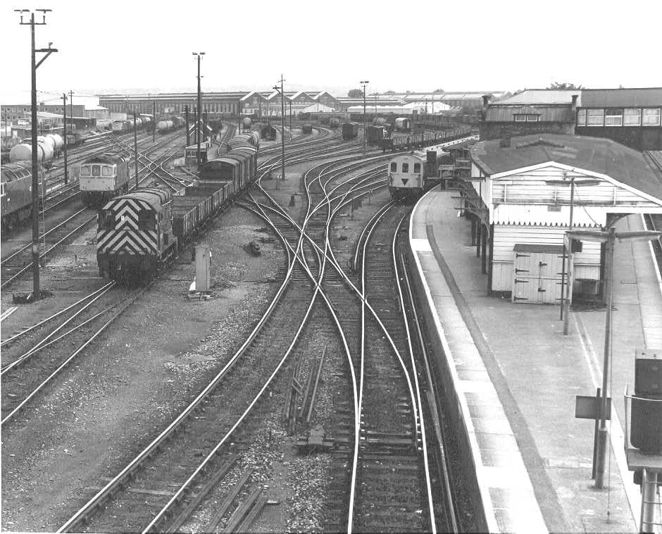
Eastleigh is a town in Hampshire, England, between Southampton and Winchester. It is the largest town and the administrative seat of the Borough of Eastleigh, with a population of 24,011 at the 2011 census. The town lies on the River Itchen, one of England's premier chalk streams for fly fishing, and a designated site of Special Scientific Interest. The area was originally villages until the 19th century, when Eastleigh was developed as a railway town by the London and South-Western Railway. History The modern town of Eastleigh lies on the old Roman road, built in A.D.79 between Winchester ''(Venta Belgarum)'' and Bitterne ''(Clausentum)''. Nicola Gosling: 1986, Page 4 Roman remains discovered in the Eastleigh area, including a Roman lead coffin excavated in 1908, indicate that a settlement probably existed here in Roman times. A Saxon village called 'East Leah' has been recorded to have existed since 932 AD. ('Leah' is an ancient Anglo-Saxon word meaning 'a clearing in ... [...More Info...] [...Related Items...] OR: [Wikipedia] [Google] [Baidu] |
Romsey
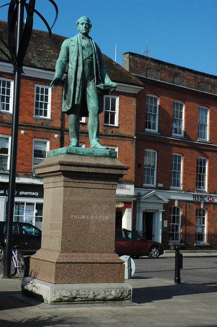
Romsey ( ) is a historic market town in the county of Hampshire, England. Romsey was home to the 17th-century philosopher and economist William Petty and the 19th-century British prime minister, Lord Palmerston, whose statue has stood in the town centre since 1857. The town was also home to the 20th-century naval officer and statesman Louis Mountbatten, 1st Earl Mountbatten of Burma, who lived at Broadlands. Romsey Abbey, the largest parish church in Hampshire, dominates the centre of the town. Other notable buildings include a 13th-century hunting lodge, an 18th-century coaching inn and the 19th-century Corn Exchange. The town is situated northwest of Southampton, southwest of Winchester and southeast of Salisbury. It sits on the outskirts of the New Forest, just over northeast of its eastern edge. The population of Romsey was 14,768 at the 2011 Census. Romsey is one of the principal towns in the Test Valley Borough and lies on the River Test, which is known for fly fishi ... [...More Info...] [...Related Items...] OR: [Wikipedia] [Google] [Baidu] |
Portsdown Hill
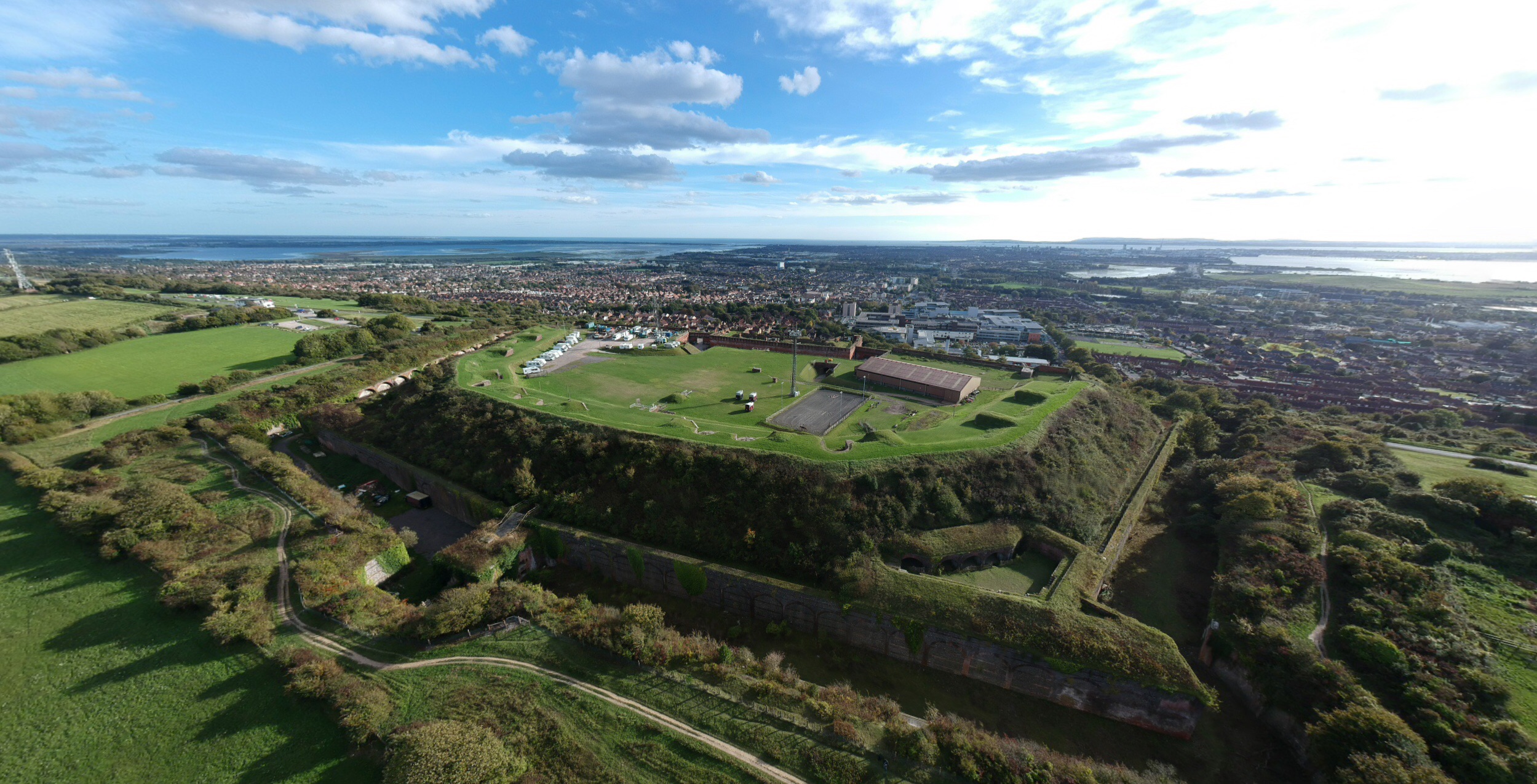
Portsdown Hill is a long chalk ridge in Hampshire, England. The highest point of the hill lies within Fort Southwick at 131m above sea level. The ridge offers good views to the south over Portsmouth, the Solent, Hayling Island and Gosport, with the Isle of Wight beyond. The hill is on the mainland, just to the north of Ports Creek, which separates the mainland from Portsea Island, on which lies the main part of the city of Portsmouth, one of the United Kingdom's main naval bases. To the north lies the Forest of Bere, with the South Downs visible in the distance. Butser Hill can be seen on a clear day. The hill is formed from an inlier of chalk which has been brought to the surface by an east–west upfold of the local strata known as the Portsdown Anticline. Southwick House is close by the north side of the hill, the HQ for U.S. General Dwight D. Eisenhower during the D-Day invasions; the generals prayed together before D-Day at Christ Church Portsdown, on the hill, which has ... [...More Info...] [...Related Items...] OR: [Wikipedia] [Google] [Baidu] |
English Channel
The English Channel, "The Sleeve"; nrf, la Maunche, "The Sleeve" (Cotentinais) or ( Jèrriais), (Guernésiais), "The Channel"; br, Mor Breizh, "Sea of Brittany"; cy, Môr Udd, "Lord's Sea"; kw, Mor Bretannek, "British Sea"; nl, Het Kanaal, "The Channel"; german: Ärmelkanal, "Sleeve Channel" ( French: ''la Manche;'' also called the British Channel or simply the Channel) is an arm of the Atlantic Ocean that separates Southern England from northern France. It links to the southern part of the North Sea by the Strait of Dover at its northeastern end. It is the busiest shipping area in the world. It is about long and varies in width from at its widest to at its narrowest in the Strait of Dover."English Channel". ''The Columbia Encyclopedia'', 2004. It is the smallest of the shallow seas around the continental shelf of Europe, covering an area of some . The Channel was a key factor in Britain becoming a naval superpower and has been utilised by Britain as a natural def ... [...More Info...] [...Related Items...] OR: [Wikipedia] [Google] [Baidu] |
Solent
The Solent ( ) is a strait between the Isle of Wight and Great Britain. It is about long and varies in width between , although the Hurst Spit which projects into the Solent narrows the sea crossing between Hurst Castle and Colwell Bay to just over . The Solent is a major shipping lane for passenger, freight and military vessels. It is an important recreational area for water sports, particularly yachting, hosting the Cowes Week sailing event annually. It is sheltered by the Isle of Wight and has a complex tidal pattern, which has benefited Southampton's success as a port, providing a "double high tide" that extends the tidal window during which deep-draught ships can be handled. Portsmouth lies on its shores. Spithead, an area off Gilkicker Point near Gosport, is known as the place where the Royal Navy is traditionally reviewed by the monarch of the day. The area is of great ecological and landscape importance, particularly because of the coastal and estuarine habitats a ... [...More Info...] [...Related Items...] OR: [Wikipedia] [Google] [Baidu] |
South Coast Plain
The South Coast Plain is a natural region in England running along the central south coast in the counties of East Sussex, East and West Sussex and Hampshire. It has been designated as National Character Area No. 126 by Natural England. The NCA has a total area of 52,245 hectares and forms a coastal strip, 2 to 16 kilometres wide, running from the area of Hamble-le-Rice in Hampshire in the west across the entire length of West Sussex to Brighton in East Sussex to the east.''NCA 126: South Coast Plain - Key Facts & Data'' at www.naturalengland.org.uk. Accessed on 5 Apr 2013. Its major settlements include the cities of Brighton and Hove, Chichester and Portsmouth, the market town of Fareham, the coastal town of Gosport and the seaside resorts of Bognor Regis, Littlehampto ... [...More Info...] [...Related Items...] OR: [Wikipedia] [Google] [Baidu] |
South Downs
The South Downs are a range of chalk hills that extends for about across the south-eastern coastal counties of England from the Itchen valley of Hampshire in the west to Beachy Head, in the Eastbourne Downland Estate, East Sussex, in the east. The Downs are bounded on the northern side by a steep escarpment, from whose crest there are extensive views northwards across the Weald. The South Downs National Park forms a much larger area than the chalk range of the South Downs and includes large parts of the Weald. The South Downs are characterised by rolling chalk downland with close-cropped turf and dry valleys, and are recognised as one of the most important chalk landscapes in England. The range is one of the four main areas of chalk downland in southern England. The South Downs are relatively less populated compared to South East England as a whole, although there has been large-scale urban encroachment onto the chalk downland by major seaside resorts, including most notably ... [...More Info...] [...Related Items...] OR: [Wikipedia] [Google] [Baidu] |
England
England is a country that is part of the United Kingdom. It shares land borders with Wales to its west and Scotland to its north. The Irish Sea lies northwest and the Celtic Sea to the southwest. It is separated from continental Europe by the North Sea to the east and the English Channel to the south. The country covers five-eighths of the island of Great Britain, which lies in the North Atlantic, and includes over 100 smaller islands, such as the Isles of Scilly and the Isle of Wight. The area now called England was first inhabited by modern humans during the Upper Paleolithic period, but takes its name from the Angles, a Germanic tribe deriving its name from the Anglia peninsula, who settled during the 5th and 6th centuries. England became a unified state in the 10th century and has had a significant cultural and legal impact on the wider world since the Age of Discovery, which began during the 15th century. The English language, the Anglican Church, and Engli ... [...More Info...] [...Related Items...] OR: [Wikipedia] [Google] [Baidu] |
Portsmouth
Portsmouth ( ) is a port and city in the ceremonial county of Hampshire in southern England. The city of Portsmouth has been a unitary authority since 1 April 1997 and is administered by Portsmouth City Council. Portsmouth is the most densely populated city in the United Kingdom, with a population last recorded at 208,100. Portsmouth is located south-west of London and south-east of Southampton. Portsmouth is mostly located on Portsea Island; the only English city not on the mainland of Great Britain. Portsea Island has the third highest population in the British Isles after the islands of Great Britain and Ireland. Portsmouth also forms part of the regional South Hampshire conurbation, which includes the city of Southampton and the boroughs of Eastleigh, Fareham, Gosport, Havant and Waterlooville. Portsmouth is one of the world's best known ports, its history can be traced to Roman times and has been a significant Royal Navy dockyard and base for centuries. Portsm ... [...More Info...] [...Related Items...] OR: [Wikipedia] [Google] [Baidu] |


2009.jpg)