|
Sorde-l'Abbaye
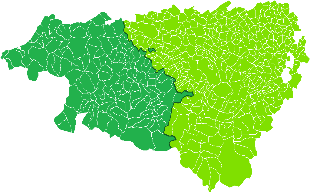
Sorde-l'Abbaye (; oc, Sòrda l'Abadia) is a commune, in the department of Landes and the region of Nouvelle-Aquitaine in southwestern France. Geography The commune is situated on the edge of the Pays d'Orthe, a territory which was once under the control of the vicomté de Gascogne. These lands are irrigated by the gave d'Oloron river, which is a tributary of the gave de Pau. In 1920, a hydroelectric plant was built on this river, on the site of a mill belonging to the abbey. History Situated on the via Turonensis, an ancient road between Landes and Pyrénées, Sorde l'Abbaye was visited from the Upper Paleolithic and experienced a revival in the Middle Ages as a result of pilgrimage to Compostella. The site of Barat-de-Vin (in Gascon, "barat de bi") not far from the village, has been a thoroughfare for at least two thousand years, and was inhabited by ancient man who would have been attracted by the fertility of the Adour river valley. Population Nucleus MHNT PRE 20 ... [...More Info...] [...Related Items...] OR: [Wikipedia] [Google] [Baidu] |
Communes Of France
The () is a level of administrative division in the French Republic. French are analogous to civil townships and incorporated municipalities in the United States and Canada, ' in Germany, ' in Italy, or ' in Spain. The United Kingdom's equivalent are civil parishes, although some areas, particularly urban areas, are unparished. are based on historical geographic communities or villages and are vested with significant powers to manage the populations and land of the geographic area covered. The are the fourth-level administrative divisions of France. vary widely in size and area, from large sprawling cities with millions of inhabitants like Paris, to small hamlets with only a handful of inhabitants. typically are based on pre-existing villages and facilitate local governance. All have names, but not all named geographic areas or groups of people residing together are ( or ), the difference residing in the lack of administrative powers. Except for the municipal arrondi ... [...More Info...] [...Related Items...] OR: [Wikipedia] [Google] [Baidu] |
Flint
Flint, occasionally flintstone, is a sedimentary cryptocrystalline form of the mineral quartz, categorized as the variety of chert that occurs in chalk or marly limestone. Flint was widely used historically to make stone tools and start fires. It occurs chiefly as nodules and masses in sedimentary rocks, such as chalks and limestones.''The Flints from Portsdown Hill'' Inside the nodule, flint is usually dark grey, black, green, white or brown in colour, and often has a glassy or waxy appearance. A thin layer on the outside of the nodules is usually different in colour, typically white and rough in texture. The nodules can often be found along s and |
Béarn
The Béarn (; ; oc, Bearn or ''Biarn''; eu, Bearno or ''Biarno''; or ''Bearnia'') is one of the traditional provinces of France, located in the Pyrenees mountains and in the plain at their feet, in southwest France. Along with the three Basque provinces of Soule, Lower Navarre, and Labourd, the Principality of Bidache, as well as small parts of Gascony, it forms in the southwest the current ''département'' of Pyrénées-Atlantiques (64). The capitals of Béarn were Beneharnum (until 841), Morlaàs (from ca. 1100), Orthez (from the second half of the 13th century), and then Pau (beginning in the mid-15th century). Béarn is bordered by Basque provinces Soule and Lower Navarre to the west, by Gascony ( Landes and Armagnac) to the north, by Bigorre to the east, and by Spain (Aragon) to the south. Today, the mainstays of the Béarn area are the petroleum industry, the aerospace industry through the helicopter turboshaft engine manufacturer Turbomeca, tourism and agriculture ... [...More Info...] [...Related Items...] OR: [Wikipedia] [Google] [Baidu] |
Roman Mosaic
A Roman mosaic is a mosaic made during the Roman period, throughout the Roman Republic and later Empire. Mosaics were used in a variety of private and public buildings, on both floors and walls, though they competed with cheaper frescos for the latter. They were highly influenced by earlier and contemporary Hellenistic Greek mosaics, and often included famous figures from history and mythology, such as Alexander the Great in the Alexander Mosaic. A large proportion of the surviving examples of wall mosaics come from Italian sites such as Pompeii and Herculaneum. Otherwise, floor mosaics are far more likely to have survived, with many coming from the fringes of the Roman Empire. The Bardo National Museum in Tunis has an especially large collection from large villas in modern Tunisia. Development Perhaps the earliest examples of Greco-Roman mosaic floors date to the late Republican period (2nd century BC) and are from Delos, Greece. Witts claims that tessellated pavem ... [...More Info...] [...Related Items...] OR: [Wikipedia] [Google] [Baidu] |
Roman Villa
A Roman villa was typically a farmhouse or country house built in the Roman Republic and the Roman Empire, sometimes reaching extravagant proportions. Typology and distribution Pliny the Elder (23–79 AD) distinguished two kinds of villas near Rome: the ''villa urbana'', a country seat that could easily be reached from Rome (or another city) for a night or two; and the ''villa rustica'', the farmhouse estate permanently occupied by the servants who generally had charge of the estate. The Roman Empire contained many kinds of villas, not all of them lavishly appointed with mosaic floors and frescoes. In the provinces, any country house with some decorative features in the Roman style may be called a "villa" by modern scholars. Some were pleasure houses, like Hadrian's Villa at Tivoli, that were sited in the cool hills within easy reach of Rome or, like the Villa of the Papyri at Herculaneum, on picturesque sites overlooking the Bay of Naples. Some villas were more like the co ... [...More Info...] [...Related Items...] OR: [Wikipedia] [Google] [Baidu] |
Gallo-Roman
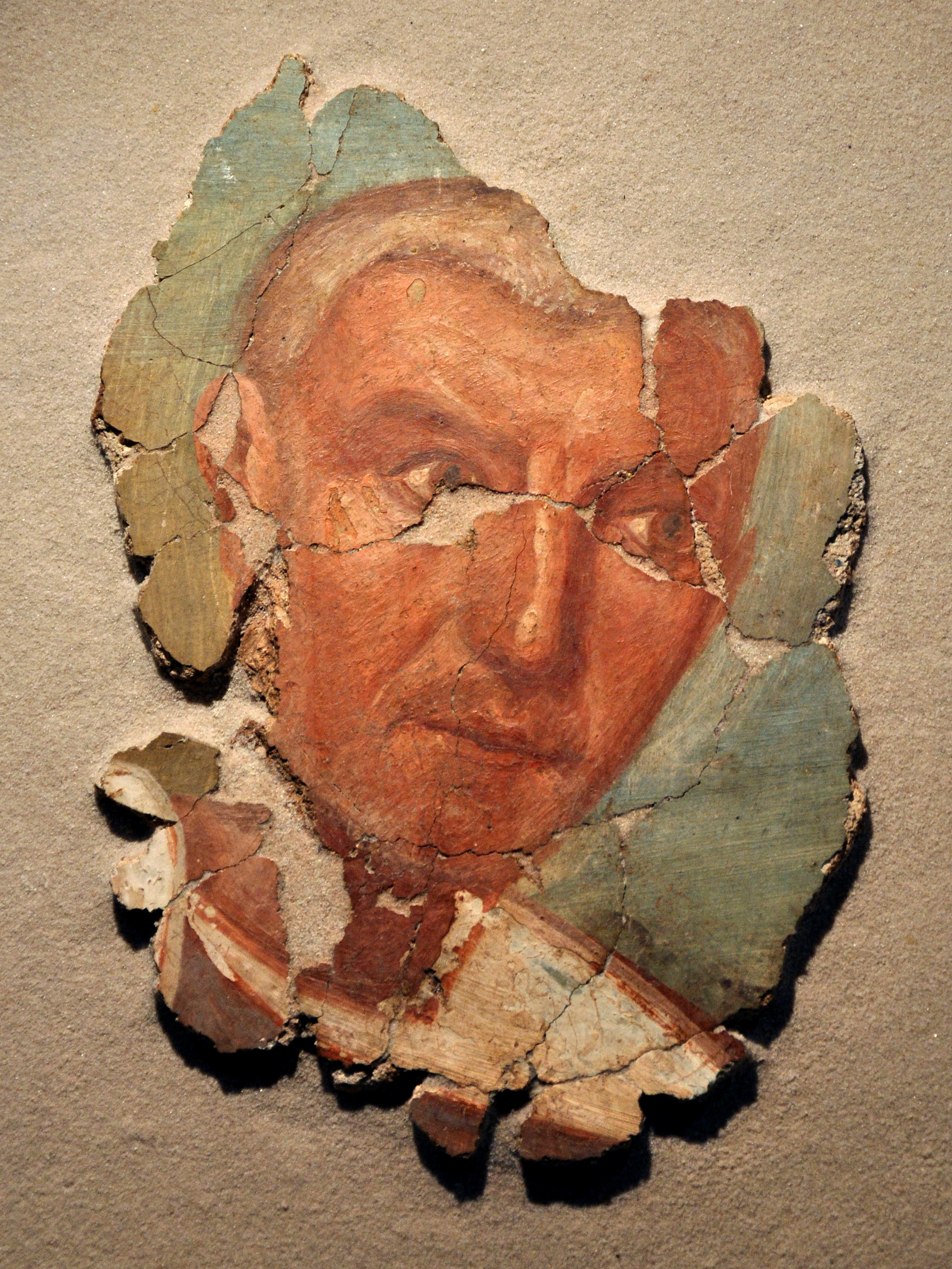
Gallo-Roman culture was a consequence of the Romanization of Gauls under the rule of the Roman Empire. It was characterized by the Gaulish adoption or adaptation of Roman culture, language, morals and way of life in a uniquely Gaulish context. The well-studied meld of cultures in Gaul gives historians a model against which to compare and contrast parallel developments of Romanization in other, less-studied Roman provinces. ''Interpretatio romana'' offered Roman names for Gaulish deities such as the smith-god Gobannus, but of Celtic deities only the horse-patroness Epona penetrated Romanized cultures beyond the confines of Gaul. The barbarian invasions beginning in the late third century forced upon Gallo-Roman culture fundamental changes in politics, in the economic underpinning, in military organization. The Gothic settlement of 418 offered a double loyalty, as Western Roman authority disintegrated at Rome. The plight of the highly Romanized governing class is examined by ... [...More Info...] [...Related Items...] OR: [Wikipedia] [Google] [Baidu] |
Col De Cize
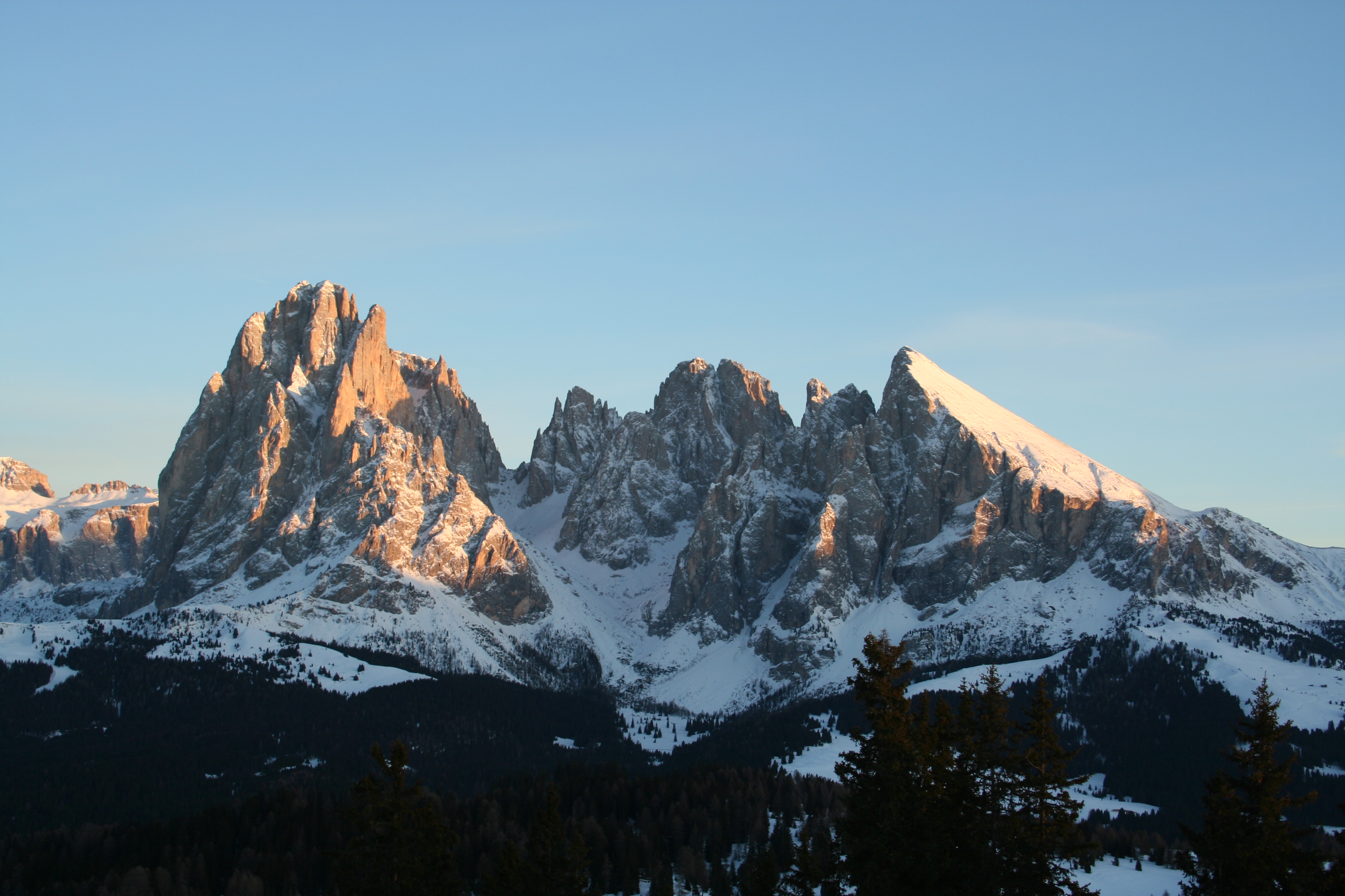
In geomorphology, a col is the lowest point on a mountain ridge between two peaks.Whittow, John (1984). ''Dictionary of Physical Geography''. London: Penguin, 1984, p. 103. . It may also be called a gap. Particularly rugged and forbidding cols in the terrain are usually referred to as notches. They are generally unsuitable as mountain passes, but are occasionally crossed by mule tracks or climbers' routes. The term col tends to be associated more with mountain rather than hill ranges. It is derived from the French ''col'' ("collar, neck") from Latin ''collum'', "neck". The height of a summit above its highest col (called the key col) is effectively a measure of a mountain's topographic prominence. Cols lie on the line of the watershed between two mountains, often on a prominent ridge or arête. For example, the highest col in Austria, the ''Obere Glocknerscharte'' ("Upper Glockner Col", ), lies between the Kleinglockner () and Grossglockner () mountains, giving the Kleinglockn ... [...More Info...] [...Related Items...] OR: [Wikipedia] [Google] [Baidu] |
Spain
, image_flag = Bandera de España.svg , image_coat = Escudo de España (mazonado).svg , national_motto = ''Plus ultra'' (Latin)(English: "Further Beyond") , national_anthem = (English: "Royal March") , image_map = , map_caption = , image_map2 = , capital = Madrid , coordinates = , largest_city = Madrid , languages_type = Official language , languages = Spanish language, Spanish , ethnic_groups = , ethnic_groups_year = , ethnic_groups_ref = , religion = , religion_ref = , religion_year = 2020 , demonym = , government_type = Unitary state, Unitary Parliamentary system, parliamentary constitutional monarchy , leader_title1 = Monarchy of Spain, Monarch , leader_name1 = Felipe VI , leader_title2 = Prime Minister of Spain ... [...More Info...] [...Related Items...] OR: [Wikipedia] [Google] [Baidu] |
Roman Road
Roman roads ( la, viae Romanae ; singular: ; meaning "Roman way") were physical infrastructure vital to the maintenance and development of the Roman state, and were built from about 300 BC through the expansion and consolidation of the Roman Republic and the Roman Empire. They provided efficient means for the overland movement of armies, officials, civilians, inland carriage of official communications, and trade goods. Roman roads were of several kinds, ranging from small local roads to broad, long-distance highways built to connect cities, major towns and military bases. These major roads were often stone-paved and metaled, cambered for drainage, and were flanked by footpaths, bridleways and drainage ditches. They were laid along accurately surveyed courses, and some were cut through hills, or conducted over rivers and ravines on bridgework. Sections could be supported over marshy ground on rafted or piled foundations.Corbishley, Mike: "The Roman World", page 50. Warwick Press, ... [...More Info...] [...Related Items...] OR: [Wikipedia] [Google] [Baidu] |
Oppidum
An ''oppidum'' (plural ''oppida'') is a large fortified Iron Age settlement or town. ''Oppida'' are primarily associated with the Celtic late La Tène culture, emerging during the 2nd and 1st centuries BC, spread across Europe, stretching from Britain and Iberia in the west to the edge of the Hungarian plain in the east. These settlements continued to be used until the Romans conquered Southern and Western Europe. Many subsequently became Roman-era towns and cities, whilst others were abandoned. In regions north of the rivers Danube and Rhine, such as most of Germania, where the populations remained independent from Rome, ''oppida'' continued to be used into the 1st century AD. Definition is a Latin word meaning 'defended (fortified) administrative centre or town', originally used in reference to non-Roman towns as well as provincial towns under Roman control. The word is derived from the earlier Latin , 'enclosed space', possibly from the Proto-Indo-European , 'occupi ... [...More Info...] [...Related Items...] OR: [Wikipedia] [Google] [Baidu] |
Protohistorical
Protohistory is a period between prehistory and history during which a culture or civilization has not yet developed writing, but other cultures have already noted the existence of those pre-literate groups in their own writings. For example, in Europe, the Celts and the Germanic tribes are considered to have been protohistoric when they began appearing in Greek and Roman sources. Protohistoric may also refer to the transition period between the advent of literacy in a society and the writings of the first historians. The preservation of oral traditions may complicate matters, as they can provide a secondary historical source for even earlier events. Colonial sites involving a literate group and a nonliterate group are also studied as protohistoric situations. The term can also refer to a period in which fragmentary or external historical documents, not necessarily including a developed writing system, have been found. For instance, the Proto–Three Kingdoms of Korea, the Yayoi ... [...More Info...] [...Related Items...] OR: [Wikipedia] [Google] [Baidu] |
Magdalenian
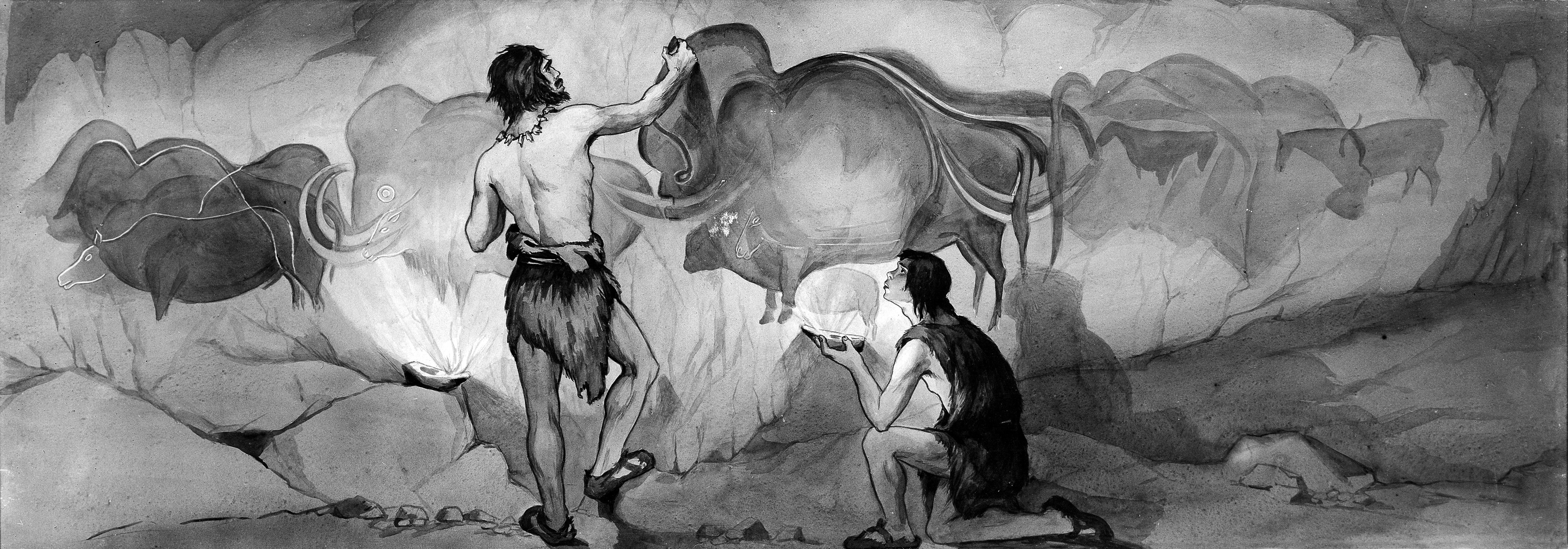
The Magdalenian cultures (also Madelenian; French: ''Magdalénien'') are later cultures of the Upper Paleolithic and Mesolithic in western Europe. They date from around 17,000 to 12,000 years ago. It is named after the type site of La Madeleine, a rock shelter located in the Vézère valley, commune of Tursac, in France's Dordogne department. Édouard Lartet and Henry Christy originally termed the period ''L'âge du renne'' (the Age of the Reindeer). They conducted the first systematic excavations of the type site, publishing in 1875. The Magdalenian epoch is associated with reindeer hunters, although Magdalenian sites contain extensive evidence for the hunting of red deer, horses, and other large mammals present in Europe toward the end of the last glacial period. The culture was geographically widespread, and later Magdalenian sites stretched from Portugal in the west to Poland in the east, and as far north as France, the Channel Islands, England, and Wales. It is the th ... [...More Info...] [...Related Items...] OR: [Wikipedia] [Google] [Baidu] |


.jpg)


