|
Smolikas
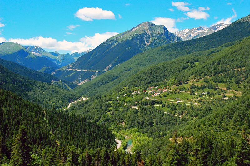
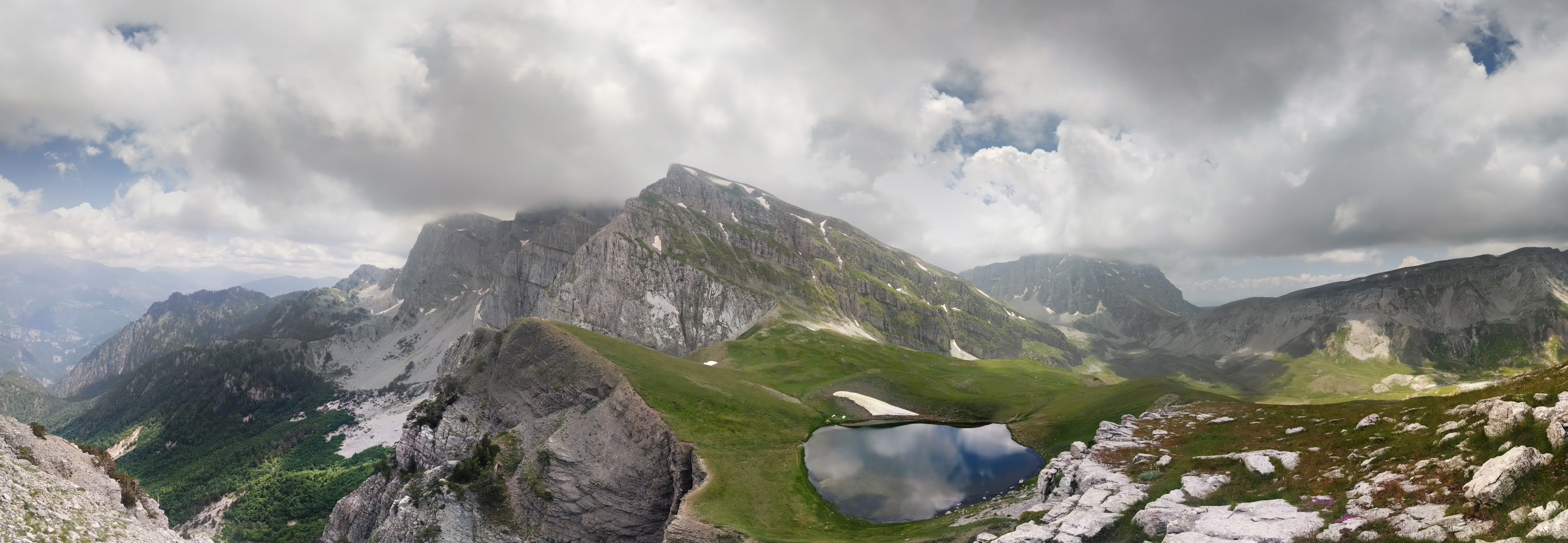
Mount Smolikas ( el, Σμόλικας; rup, Smolcu) is a mountain in the Ioannina regional unit, northwestern Greece. At a height of 2,637 metres above sea level, it is the highest of the Pindus Mountains, and the second highest mountain in Greece after Mount Olympus. The mountain consists of ophiolite rocks. During several periods in the Pleistocene the northern and eastern cirques and valleys were glaciated. The last glaciers of this area retreated around 11,500 years ago. It is drained by the river Vjosa to the south, and the river Vourkopotamo (a tributary of the Sarantaporos) to the north. There is a small alpine lake called "Drakolimni Smolika" near the summit, at about 2,200 metres elevation. Nearby mountain ranges are Tymfi to the south, Gramos to the northwest, Vasilitsa to the southeast and Voio to the northeast. The higher elevations, above 2,000 metres, consist of grasslands and rocks, and there are deciduous and conifer forests at lower elevations. The mountai ... [...More Info...] [...Related Items...] OR: [Wikipedia] [Google] [Baidu] |
Pindus
The Pindus (also Pindos or Pindhos; el, Πίνδος, Píndos; sq, Pindet; rup, Pindu) is a mountain range located in Northern Greece and Southern Albania. It is roughly 160 km (100 miles) long, with a maximum elevation of 2,637 metres (8652') (Mount Smolikas). Because it runs along the border of Thessaly and Epirus, the Pindus range is known colloquially as the ''spine of Greece''. The mountain range stretches from near the Greek-Albanian border in southern Albania, entering the Epirus and Macedonia regions in northern Greece down to the north of the Peloponnese. Geologically it is an extension of the Dinaric Alps, which dominate the western region of the Balkan Peninsula. History of the name Historically, the name Pindos refers to the mountainous territory that separates the greater Epirus region from the regions of Macedonia and Thessaly. According to John Tzetzes (a 12th-century Byzantine writer), the Pindos range was then called Metzovon. When translated (bet ... [...More Info...] [...Related Items...] OR: [Wikipedia] [Google] [Baidu] |
Pindus Mountains
The Pindus (also Pindos or Pindhos; el, Πίνδος, Píndos; sq, Pindet; rup, Pindu) is a mountain range located in Northern Greece and Southern Albania. It is roughly 160 km (100 miles) long, with a maximum elevation of 2,637 metres (8652') ( Mount Smolikas). Because it runs along the border of Thessaly and Epirus, the Pindus range is known colloquially as the ''spine of Greece''. The mountain range stretches from near the Greek-Albanian border in southern Albania, entering the Epirus and Macedonia regions in northern Greece down to the north of the Peloponnese. Geologically it is an extension of the Dinaric Alps, which dominate the western region of the Balkan Peninsula. History of the name Historically, the name Pindos refers to the mountainous territory that separates the greater Epirus region from the regions of Macedonia and Thessaly. According to John Tzetzes (a 12th-century Byzantine writer), the Pindos range was then called Metzovon. When tran ... [...More Info...] [...Related Items...] OR: [Wikipedia] [Google] [Baidu] |
Drakolimni
Drakolimni ( el, Δρακολίμνη, "Dragon Lake") is the name of several alpine or sub-alpine lakes in northwestern Greece Epirus region: the ones in mountain Tymfi and Smolikas are the most widely known. According to local folktales the lakes used to be inhabited by dragons who fought each other by throwing pines and rocks and thus created the peculiar landscape and gave their names to the lakes. Drakolimni of Tymfi The first lake resides at an altitude of 2050m above sea level, on the mountain range of Tymfi, in Vikos–Aoös National Park. It is overlooked by the nearby peaks of Ploskos (Greek: Πλόσκος) and Astraka (Greek: Αστράκα). At 5 hours walking distance from the village of Papingo Papingo ( el, Πάπιγκο, also transcribed as Papigko, Papigo) is a former community (1919-2010) in the Ioannina regional unit, Epirus, Greece. Since the 2011 local government reform (the so-called Kallikratis Law) it has become part of the ..., the lake is a ... [...More Info...] [...Related Items...] OR: [Wikipedia] [Google] [Baidu] |
Ioannina (regional Unit)
Ioannina ( el, Περιφερειακή ενότητα Ιωαννίνων) is one of the regional units of Greece. It is part of the region of Epirus (region), Epirus. Its capital is the city of Ioannina. It is the largest regional unit in Epirus, and one of the largest regional units of Greece, with a population of 167,901 people, according to the 2011 census.GOV. results of permanent population 2011, p. 10561 (p. 87 of pdf), and in Excel formatTable of permanent population 2011 from the sitHellenic Statistical Authority 2017-11-24. Retrieved 2018-01-09. Geography Ioannina borders Albania in the north, and the regional units of Kastoria (regional unit), Kastoria in the northeast, Grevena (regional unit), Grevena and Trikala ...[...More Info...] [...Related Items...] OR: [Wikipedia] [Google] [Baidu] |
Greece
Greece,, or , romanized: ', officially the Hellenic Republic, is a country in Southeast Europe. It is situated on the southern tip of the Balkans, and is located at the crossroads of Europe, Asia, and Africa. Greece shares land borders with Albania to the northwest, North Macedonia and Bulgaria to the north, and Turkey to the northeast. The Aegean Sea lies to the east of the mainland, the Ionian Sea to the west, and the Sea of Crete and the Mediterranean Sea to the south. Greece has the longest coastline on the Mediterranean Basin, featuring thousands of islands. The country consists of nine traditional geographic regions, and has a population of approximately 10.4 million. Athens is the nation's capital and largest city, followed by Thessaloniki and Patras. Greece is considered the cradle of Western civilization, being the birthplace of democracy, Western philosophy, Western literature, historiography, political science, major scientific and mathematica ... [...More Info...] [...Related Items...] OR: [Wikipedia] [Google] [Baidu] |
Tymfi
Tymphe (in Latin and English usage) or Tymfi (in the Greek government's preferred transliteration), Timfi, also Tymphi (, ) is a mountain in the northern Pindus mountain range, northwestern Greece. It is part of the regional unit of Ioannina and lies in the region of Zagori, just a few metres south of the 40° parallel. Tymphe forms a massif with its highest peak, Gamila, at . The massif of Tymphe includes in its southern part the Vikos Gorge, while they both form part of the Vikos–Aoös National Park which accepts over 100,000 visitors per year. The former municipality of the same name owed its name to the mountain. Etymology The exact meaning of the name is not known but has been in use since ancient times. The name "Tymphe" or "Stymphe" is mentioned by ancient geographer Strabo, Book 7, Ch. 7, and is associated with the ancient land of Tymphaea and the Tymphaeans, one of the tribes of Ancient Epirus. Despite its ancient use, the name does not appear in any descriptions o ... [...More Info...] [...Related Items...] OR: [Wikipedia] [Google] [Baidu] |
Greek National Road 20
National Road 20 ( el, Εθνική Οδός 20, abbreviated as EO20) is a single carriageway road in northwestern Greece. It links the cities of Ioannina and Kozani via Konitsa and Siatista. It passes through the Ioannina, Kastoria and the Kozani regional units. Since the opening of the A2 (Egnatia Odos), it is no longer the fastest connection between Kozani and Ioannina. The section between Ioannina and Kalpaki is part of the European route E853. Route The western end of National Road 20 is in the centre of Ioannina, where it is connected with the national roads GR-5, GR-6 and GR-17. It runs northwest towards Kalpaki (junction with GR-22), where it turns northeast towards Konitsa. Between Konitsa and Tsotyli it passes through the Pindus mountains. The section between Neapoli and Siatista is shared with the GR-15. From Siatista the GR-20 continues east, until it reaches the city Kozani, its eastern terminus. The National Road 20 passes through the following places (wes ... [...More Info...] [...Related Items...] OR: [Wikipedia] [Google] [Baidu] |
Konitsa
Konitsa ( el, Κόνιτσα; see also names in other languages) is a town of Ioannina in Epirus, Greece. It is located north of the capital Ioannina and near the Albanian border. Northeast of Konitsa lies a group of villages known as the Zagorochoria. The town was built amphitheatrically-shaped on a mountain slope of the Pindos mountain range from where it overlooks the valley where the river Aoos meets the river Voidomatis. Konitsa acts as a regional hub for several small villages of Pindos, and features many shops, schools and a general hospital. Primary aspects of the economy are agriculture and tourism; it is a popular starting point for tourists and hikers who want to explore the Pindos mountains, or who want to go rafting in the river Aoos or parapenting. Due to Konitsa's closeness to places of particular interest, such as the Vikos–Aoös National Park, which includes the Vikos Gorge, the Aoos Gorge and the Tymfi mountains, where the Vikos spring water brand is collec ... [...More Info...] [...Related Items...] OR: [Wikipedia] [Google] [Baidu] |
Voio
Voio ( el, Βόιο, ''Vóio''; grc, Βόιον - ''Boeon'') is a mountain range in the southwestern Kastoria and western Kozani regional units in Greece. The mountain is part of the Pindus mountains. Its highest elevation is 1,805 m. It is a densely forested and sparsely populated mountain range. It is drained towards the river Sarantaporos in the west and towards the Aliakmonas in the east. The nearest mountain ranges are Gramos to the west and Smolikas to the southwest. The nearest villages are Pentalofos in the east, Eptachori in the west and Kypseli in the north. The municipality Voio, named after the mountains, is situated in the eastern part. The Greek National Road 20 (Kozani - Konitsa - Ioannina Ioannina ( el, Ιωάννινα ' ), often called Yannena ( ' ) within Greece, is the capital and largest city of the Ioannina regional unit and of Epirus, an administrative region in north-western Greece. According to the 2011 census, the c ...) passes through t ... [...More Info...] [...Related Items...] OR: [Wikipedia] [Google] [Baidu] |
Gramos
Gramos ( sq, Gramoz, Mali i Gramozit; rup, Gramosta, Gramusta; el, Γράμος or Γράμμος) is a mountain range on the border of Albania and Greece. The mountain is part of the northern Pindus mountain range. Its highest peak, at the border of Albania and Greece, is . The region is inhabited by Albanians, Aromanians and Greeks. The brown bear occurs in the region. Geography The Gramos is situated on the borders of the Kolonjë district of Albania and the Ioannina and Kastoria regional units of Greece. Three ridges join at its highest peak, running towards the north, southwest, and east. The Gramos is drained towards the west by the river Osum, towards the northwest by the Devoll, towards the northeast by the Aliakmonas and towards the south by the Sarantaporos. The Gramos is very sparsely populated, the only sizable town being Ersekë (Albania) at its western foot. Other villages in the mountains are Gramos (northeast), Aetomilitsa (southeast), Starje (west) a ... [...More Info...] [...Related Items...] OR: [Wikipedia] [Google] [Baidu] |
Ultra Prominent Peak
An ultra-prominent peak, or Ultra for short, is a mountain summit with a topographic prominence of or more; it is also called a P1500. The prominence of a peak is the minimum height of climb to the summit on any route from a higher peak, or from sea level if there is no higher peak. There are approximately 1,524 such peaks on Earth. Some well-known peaks, such as the Matterhorn and Eiger, are not Ultras because they are connected to higher mountains by high cols and therefore do not achieve enough topographic prominence. The term "Ultra" originated with earth scientist Steve Fry, from his studies of the prominence of peaks in Washington in the 1980s. His original term was "ultra major mountain", referring to peaks with at least of prominence. Distribution Currently, 1,518 Ultras have been identified above sea level: 639 in Asia, 356 in North America, 209 in South America, 120 in Europe (including 12 in the Caucasus), 84 in Africa, 69 in Oceania, and 41 in Antarctica. ... [...More Info...] [...Related Items...] OR: [Wikipedia] [Google] [Baidu] |


