|
Sitamau
Sitamau is a town and a nagar panchayat in Mandsaur district in the Indian States and territories of India, state of Madhya Pradesh. It is in the Mandsaur district of Malwa region of Madhya Pradesh. It was the seat of the princely Sitamau State. Demographics India census, Sitamau had a population of 12,889. Males constitute 51% of the population and females 49%. Sitamau has an average literacy rate of 71%, higher than the national average of 59.5%: male literacy is 79%, and female literacy is 26%. Notable people King Sattaji Bhil was a founder of Sitamau in 1700. Transport References {{Authority control Cities and towns in Mandsaur district Cities in Malwa Populated places established in 1701 ... [...More Info...] [...Related Items...] OR: [Wikipedia] [Google] [Baidu] |
Sitamau State
Sitamau State was a princely state of the British Raj before 1947. Its capital was in Sitamau town, Mandsaur district, Madhya Pradesh. The total area of the state was 350 square miles. The average revenue of the state was Rs.130,000. History Ratan Singh Rathore was killed in the battle of Dharmat, after which his descendants continued to rule Ratlam. During Raja Keshodas's reign some soldiers of the Raja killed the Jaziya tax collectors due to which the Mughals completely annexed Ratlam. Keshodas stuck to imperial service during this time and on 3rd September 1699, he was made the faujdar of Nalgunda. Due to his good governance, Aurangzeb later granted Keshodas the Pargana of Titrod from which Raja Keshodas founded Sitamau State on 31st October 1701. The State of Ratlam was restored to an uncle of Keshodas called Chattrasal in 1705. In 1714 the emperor Farrukhsiyar further added the paragana of Alot to the new state. Sitamau faced invasions after the decline of the Mughal Empir ... [...More Info...] [...Related Items...] OR: [Wikipedia] [Google] [Baidu] |
Mandsaur District
Mandsaur district is a Districts of Madhya Pradesh, District of Madhya Pradesh state in central India. The town of Mandsaur is the administrative headquarters of the district.The ancient pashupatinath temple is situated in Mandsaur. Large quantities of opium are produced in Mandsaur district. Origin of name The District takes its name from the headquarters town, Mandsaur. It is considered to have been evolved from Marhsaur, originating from Marh and Saur or Dasaur, two of the villages which merged in the town. The town was known as Dashpur during ancient times. Other etymology claims it derives from Mandodari, wife of Ravana, who is said to have been born in the district. Geography The district has an area of . The district is present on the border of the Mewar and Malwa so the culture is the combination of the both regions, and is bounded by Neemuch District to the north west, Chittorgarh district to North east, Kota district and Jhalawar district to east and Pratapgarh distric ... [...More Info...] [...Related Items...] OR: [Wikipedia] [Google] [Baidu] |
Malwa
Malwa is a historical region of west-central India occupying a plateau of volcanic origin. Geologically, the Malwa Plateau generally refers to the volcanic upland north of the Vindhya Range. Politically and administratively, it is also synonymous with the former state of Madhya Bharat which was later merged with Madhya Pradesh. At present the historical Malwa region includes districts of western Madhya Pradesh and parts of south-eastern Rajasthan. Sometimes the definition of Malwa is extended to include the Nimar region south of the Vindhyas. The Malwa region had been a separate political unit from the time of the ancient Malava Kingdom. It has been ruled by several kingdoms and dynasties, including the Avanti Kingdom, The Mauryans, the Malavas, the Guptas, the Paramaras, the Delhi Sultanate, the Malwa sultans, the Mughals and the Marathas. Malwa continued to be an administrative division until 1947, when the Malwa Agency of British India was merged into Madhya Bharat (a ... [...More Info...] [...Related Items...] OR: [Wikipedia] [Google] [Baidu] |
WikiProject Indian Cities
A WikiProject, or Wikiproject, is a Wikimedia movement affinity group for contributors with shared goals. WikiProjects are prevalent within the largest wiki, Wikipedia, and exist to varying degrees within sister projects such as Wiktionary, Wikiquote, Wikidata, and Wikisource. They also exist in different languages, and translation of articles is a form of their collaboration. During the COVID-19 pandemic, CBS News noted the role of Wikipedia's WikiProject Medicine in maintaining the accuracy of articles related to the disease. Another WikiProject that has drawn attention is WikiProject Women Scientists, which was profiled by '' Smithsonian'' for its efforts to improve coverage of women scientists which the profile noted had "helped increase the number of female scientists on Wikipedia from around 1,600 to over 5,000". On Wikipedia Some Wikipedia WikiProjects are substantial enough to engage in cooperative activities with outside organizations relevant to the field at issue. For ex ... [...More Info...] [...Related Items...] OR: [Wikipedia] [Google] [Baidu] |
India
India, officially the Republic of India (Hindi: ), is a country in South Asia. It is the seventh-largest country by area, the second-most populous country, and the most populous democracy in the world. Bounded by the Indian Ocean on the south, the Arabian Sea on the southwest, and the Bay of Bengal on the southeast, it shares land borders with Pakistan to the west; China, Nepal, and Bhutan to the north; and Bangladesh and Myanmar to the east. In the Indian Ocean, India is in the vicinity of Sri Lanka and the Maldives; its Andaman and Nicobar Islands share a maritime border with Thailand, Myanmar, and Indonesia. Modern humans arrived on the Indian subcontinent from Africa no later than 55,000 years ago., "Y-Chromosome and Mt-DNA data support the colonization of South Asia by modern humans originating in Africa. ... Coalescence dates for most non-European populations average to between 73–55 ka.", "Modern human beings—''Homo sapiens''—originated in Africa. Then, int ... [...More Info...] [...Related Items...] OR: [Wikipedia] [Google] [Baidu] |
Cities And Towns In Mandsaur District
A city is a human settlement of notable size.Goodall, B. (1987) ''The Penguin Dictionary of Human Geography''. London: Penguin.Kuper, A. and Kuper, J., eds (1996) ''The Social Science Encyclopedia''. 2nd edition. London: Routledge. It can be defined as a permanent and densely settled place with administratively defined boundaries whose members work primarily on non-agricultural tasks. Cities generally have extensive systems for housing, transportation, sanitation, utilities, land use, production of goods, and communication. Their density facilitates interaction between people, government organisations and businesses, sometimes benefiting different parties in the process, such as improving efficiency of goods and service distribution. Historically, city-dwellers have been a small proportion of humanity overall, but following two centuries of unprecedented and rapid urbanization, more than half of the world population now lives in cities, which has had profound consequences for g ... [...More Info...] [...Related Items...] OR: [Wikipedia] [Google] [Baidu] |
King Sattaji Bhil
King is the title given to a male monarch in a variety of contexts. The female equivalent is queen, which title is also given to the consort of a king. *In the context of prehistory, antiquity and contemporary indigenous peoples, the title may refer to tribal kingship. Germanic kingship is cognate with Indo-European traditions of tribal rulership (c.f. Indic ''rājan'', Gothic ''reiks'', and Old Irish ''rí'', etc.). *In the context of classical antiquity, king may translate in Latin as '' rex'' and in Greek as '' archon'' or '' basileus''. *In classical European feudalism, the title of ''king'' as the ruler of a ''kingdom'' is understood to be the highest rank in the feudal order, potentially subject, at least nominally, only to an emperor (harking back to the client kings of the Roman Republic and Roman Empire). *In a modern context, the title may refer to the ruler of one of a number of modern monarchies (either absolute or constitutional). The title of ''king'' is us ... [...More Info...] [...Related Items...] OR: [Wikipedia] [Google] [Baidu] |
Census
A census is the procedure of systematically acquiring, recording and calculating information about the members of a given population. This term is used mostly in connection with national population and housing censuses; other common censuses include censuses of agriculture, traditional culture, business, supplies, and traffic censuses. The United Nations (UN) defines the essential features of population and housing censuses as "individual enumeration, universality within a defined territory, simultaneity and defined periodicity", and recommends that population censuses be taken at least every ten years. UN recommendations also cover census topics to be collected, official definitions, classifications and other useful information to co-ordinate international practices. The UN's Food and Agriculture Organization (FAO), in turn, defines the census of agriculture as "a statistical operation for collecting, processing and disseminating data on the structure of agriculture, covering th ... [...More Info...] [...Related Items...] OR: [Wikipedia] [Google] [Baidu] |
Vehicle Registration Plates Of India
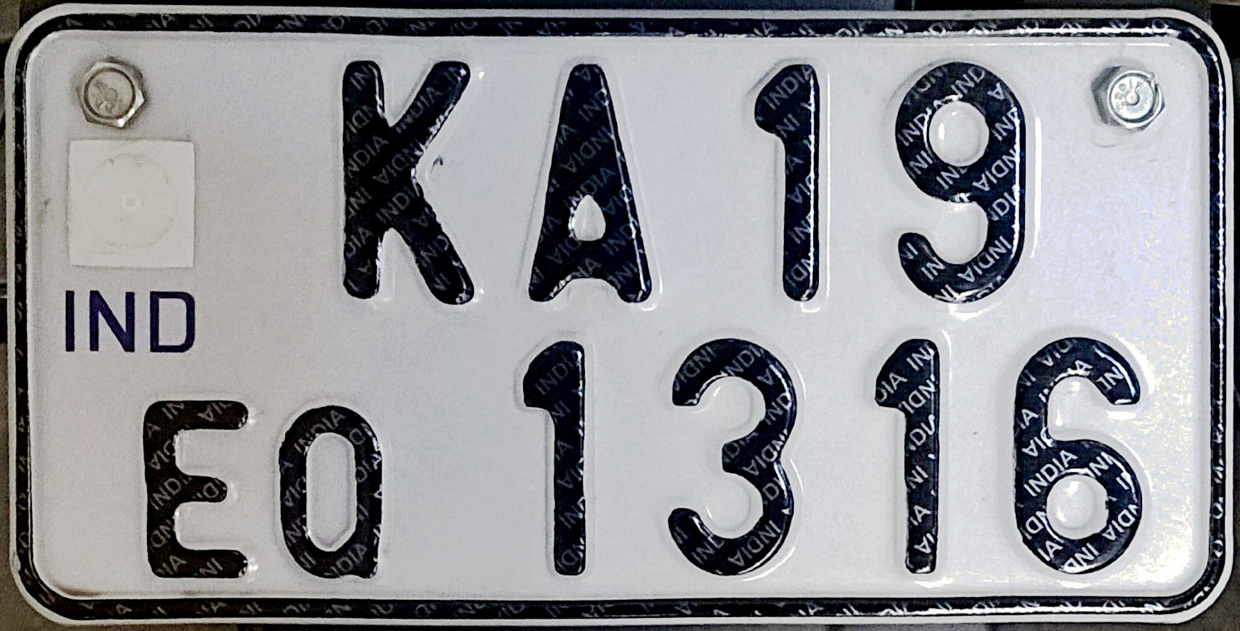
All motorised road vehicles in India are tagged with a registration or licence number. The Vehicle registration plate (commonly known as number plate) number is issued by the district-level Regional Transport Office (RTO) of respective states — the main authority on road matters. The number plates are placed in the front and back of the vehicle. By law, all plates are required to be in modern Hindu-Arabic numerals with Latin letters. The international vehicle registration code for India is IND. Colour coding Permanent Registration * Private vehicles: ** Private vehicles, by default, have black lettering on a white background (e.g. ). ** Vehicles which run purely on electricity have white lettering on a green background (e.g. ) * Commercial vehicles: ** Commercial vehicles such as taxis, buses and trucks, by default, have black lettering on a yellow background (e.g. ). ** Vehicles available on rent for self-drive have yellow lettering on a black background (e.g. ). ** V ... [...More Info...] [...Related Items...] OR: [Wikipedia] [Google] [Baidu] |
Nagar Panchayat
A nagar panchayat (town panchayat; ) or Notified Area Council (NAC) in India is a settlement in transition from rural to urban and therefore a form of an urban political unit comparable to a municipality. An urban centre with more than 12,000 and less than 40,000 inhabitants is classified as a nagar panchayat. Such councils are formed under the panchayati raj administrative system. In census data, the abbreviation T.P. is used to indicate a "town panchayat". Tamil Nadu was the first state to introduce the panchayat town as an intermediate step between rural villages and urban local bodies (ULB). The structure and the functions of the nagar panchayat are decided by the state government. Management Each nagar panchayat has a committee consisting of a chairman with ward members. Membership consists of a minimum of ten elected ward members and three nominated members. The NAC members of the Nagar are elected from the several wards of the nagar panchayat on the basis of adult fran ... [...More Info...] [...Related Items...] OR: [Wikipedia] [Google] [Baidu] |
States And Territories Of India
India is a federal union comprising 28 states and 8 union territories, with a total of 36 entities. The states and union territories are further subdivided into districts and smaller administrative divisions. History Pre-independence The Indian subcontinent has been ruled by many different ethnic groups throughout its history, each instituting their own policies of administrative division in the region. The British Raj mostly retained the administrative structure of the preceding Mughal Empire. India was divided into provinces (also called Presidencies), directly governed by the British, and princely states, which were nominally controlled by a local prince or raja loyal to the British Empire, which held ''de facto'' sovereignty ( suzerainty) over the princely states. 1947–1950 Between 1947 and 1950 the territories of the princely states were politically integrated into the Indian union. Most were merged into existing provinces; others were organised into ... [...More Info...] [...Related Items...] OR: [Wikipedia] [Google] [Baidu] |
Postal Index Number
A Postal Index Number (PIN; sometimes redundantly a PIN code) refers to a six-digit code in the Indian postal code system used by India Post. On 15 August 2022, the PIN system celebrated its 50th anniversary. History The PIN system was introduced on 15 August 1972 by Shriram Bhikaji Velankar, an additional secretary in the Government of India's Ministry of Communications. The system was introduced to simplify the manual sorting and delivery of mail by eliminating confusion over incorrect addresses, similar place names, and different languages used by the public. PIN structure The first digit of a PIN indicates the zone, the second indicates the sub-zone, and the third, combined with the first two, indicates the sorting district within that zone. The final three digits are assigned to individual post offices within the sorting district. Postal zones There are nine postal zones in India, including eight regional zones and one functional zone (for the Indian Army). The f ... [...More Info...] [...Related Items...] OR: [Wikipedia] [Google] [Baidu] |


