|
Shivappa Nayaka
Shivappa Nayaka (ಶಿವಪ್ಪ ನಾಯಕ) (r.1645–1660), popularly known as Keladi Shivappa Nayaka, was an Indian king and ruler of the Keladi Nayaka Kingdom. The Keladi Nayakas were successors of the Vijayanagara Empire in the coastal and Malnad (hill) districts of Karnataka, India, in the late 16th century. At their peak, the Nayakas built a niche kingdom comprising the coastal, hill and some interior districts (Bayaluseeme) of modern Karnataka, before succumbing to the Kingdom of Mysore in 1763, which at that time was ruled by Hyder Ali.Kamath (2001), p220 He was known as ''Sistina'' Shivappa Nayaka because he introduced a tax system called ''Sist''. Conquests Shivappa Nayaka is remembered as an able administrator and soldier. He ascended the throne in 1645. During this time, the last ruler of the diminished Vijayanagara Empire ruling from Vellore, Shriranga Raya III was defeated by the Bijapur Sultanate and sought refuge with Shivappa. The growing threat of the P ... [...More Info...] [...Related Items...] OR: [Wikipedia] [Google] [Baidu] |
Shivamogga
Shimoga, officially known as Shivamogga, is a city and the district headquarters of Shimoga district in the central part of the state of Karnataka, India. The city lies on the banks of the Tunga River. Being the gateway for the hilly region of the Western Ghats, the city is popularly nicknamed the "Gateway of Malnad". The population of Shimoga city is 322,650 as per 2011 census. The city has been selected for the Smart Cities project, standing in the fourth position in the state and 25th in the country as of November 2020. The city is 569 m above sea level and is surrounded by lush green paddy fields, arecanut and coconut groves. It is located 267 km from the state capital Bangalore and 195 km from the port city Mangalore. History The name of the city is derived from the term "''shivmoga''". A version of the etymology is the story that Shiva drank the Tunga River water using "''Mogge''", hence the name Shiva-mogga". Another version of the etymology is that the name ... [...More Info...] [...Related Items...] OR: [Wikipedia] [Google] [Baidu] |
Kundapura
Kundapur, also called Kundapura, is a coastal town situated in the Udupi district of the state of Karnataka, India. This town was known as Coondapoor while it was part of the erstwhile South Canara district (1862–1947) of the Madras Presidency of British India. Present-day Kundapur is administered by the Kundapur Town Municipal Council and serves as the headquarters of the Kundapur Taluk of Udupi district. History The name Kundapura can be traced to the Kundeshwara Temple built by Kundavarma of the Alupa dynasty who ruled the region in the 10th - 11th century, in the vicinity of the Panchagangavalli River. In Kundagannada language, the word "Kunda" also refers to the flower Jasmine.Where the Majority people of Kundapura grow flower Jasmine in this region which came to be called as kundapura(Land of Jasmine). Kundapura is surrounded by water from three sides. To the north lies the Panchagangavalli River. To the east lies the Kalaghar river. To the west lie the Kodi ... [...More Info...] [...Related Items...] OR: [Wikipedia] [Google] [Baidu] |
Historical Vedic Religion
The historical Vedic religion (also known as Vedicism, Vedism or ancient Hinduism and subsequently Brahmanism (also spelled as Brahminism)), constituted the religious ideas and practices among some Indo-Aryan peoples of northwest Indian Subcontinent (Punjab and the western Ganges plain) during the Vedic period (1500–500 BCE). These ideas and practices are found in the Vedic texts, and some Vedic rituals are still practiced today. It is one of the major traditions which shaped Hinduism, though present-day Hinduism is markedly different from the historical Vedic religion. The Vedic religion developed in the northwestern region of the Indian subcontinent during the early Vedic period (1500–1100 BCE), but has roots in the Eurasian Steppe Sintashta culture (2200–1800 BCE), the subsequent Central Asian Andronovo culture (2000–900 BCE), and the Indus Valley civilization (2600–1900 BCE). It was a composite of the religion of the Central Asian Indo-Aryans, itself "a syncreti ... [...More Info...] [...Related Items...] OR: [Wikipedia] [Google] [Baidu] |
Akbar
Abu'l-Fath Jalal-ud-din Muhammad Akbar (25 October 1542 – 27 October 1605), popularly known as Akbar the Great ( fa, ), and also as Akbar I (), was the third Mughal emperor, who reigned from 1556 to 1605. Akbar succeeded his father, Humayun, under a regent, Bairam Khan, who helped the young emperor expand and consolidate Mughal domains in India. A strong personality and a successful general, Akbar gradually enlarged the Mughal Empire to include much of the Indian subcontinent. His power and influence, however, extended over the entire subcontinent because of Mughal military, political, cultural, and economic dominance. To unify the vast Mughal state, Akbar established a centralised system of administration throughout his empire and adopted a policy of conciliating conquered rulers through marriage and diplomacy. To preserve peace and order in a religiously and culturally diverse empire, he adopted policies that won him the support of his non-Muslim subjects. Eschewing t ... [...More Info...] [...Related Items...] OR: [Wikipedia] [Google] [Baidu] |
Mughal Empire
The Mughal Empire was an early-modern empire that controlled much of South Asia between the 16th and 19th centuries. Quote: "Although the first two Timurid emperors and many of their noblemen were recent migrants to the subcontinent, the dynasty and the empire itself became indisputably Indian. The interests and futures of all concerned were in India, not in ancestral homelands in the Middle East or Central Asia. Furthermore, the Mughal empire emerged from the Indian historical experience. It was the end product of a millennium of Muslim conquest, colonization, and state-building in the Indian subcontinent." For some two hundred years, the empire stretched from the outer fringes of the Indus river basin in the west, northern Afghanistan in the northwest, and Kashmir in the north, to the highlands of present-day Assam and Bangladesh in the east, and the uplands of the Deccan Plateau in South India. Quote: "The realm so defined and governed was a vast territory of some , rang ... [...More Info...] [...Related Items...] OR: [Wikipedia] [Google] [Baidu] |
Kanara
Kanara, also known as Karavali is the historically significant stretch of land situated by the southwestern coast of India, alongside the Arabian Sea in the present-day Indian state of Karnataka. The region comprises three civil districts, namely: Uttara Kannada, Udupi, and Dakshina Kannada. Etymology According to historian Severino da Silva, the ancient name for this region is ''Parashurama Srushti'' (creation of Parashurama). According to him and Stephen Fuchs, the name ''Canara'' is the invention of Portuguese, Dutch, and English people who visited the area for trade from the early sixteenth century onwards. The Bednore Dynasty, under whose rule this tract was at that time, was known to them as the Kannada Dynasty, i.e., the dynasty speaking the Kannada language. "Karāvalli", the Kannada word for 'coast', is the term used by Kannada-speakers to refer to this region. The letter 'd' being always pronounced like 'r' by the Europeans, the district was named by them as ... [...More Info...] [...Related Items...] OR: [Wikipedia] [Google] [Baidu] |
Mysore District
Mysore district, officially Mysuru district is an administrative district located in the southern part of the state of Karnataka, India. It is the administrative headquarters of Mysore division.Chamarajanagar district, Chamarajanagar District was carved out of the original larger Mysore District in the year 1998. The district is bounded by Chamrajanagar district to the southeast, Mandya district to the east and northeast, Kerala state to the south, Kodagu district to the west, and Hassan district to the north. This district has a prominent place in the history of Karnataka; Mysore was ruled by the Wodeyars from the year 1399 till the independence of India in the year 1947. It features many tourist destinations, from Mysore Palace to Nagarhole National Park. It is the third-most populous district in Karnataka (out of List of districts in Karnataka, 31), after Bangalore Urban district, Bangalore Urban. Etymology Mysore district gets its name from the city of Mysore which is also t ... [...More Info...] [...Related Items...] OR: [Wikipedia] [Google] [Baidu] |
Srirangapatna
Srirangapatna is a town and headquarters of one of the seven Tehsil, Taluks of Mandya district, in the Indian States and territories of India, State of Karnataka. It gets its name from the Ranganathaswamy Temple, Srirangapatna, Ranganthaswamy temple consecrated at around 984 CE. Later, under the British rule the city was renamed to Seringapatnam. Located near the city of Mandya, it is of religious, cultural and historic importance. The monuments on the island town of Srirangapatna have been nominated as a UNESCO World Heritage Site, and the application is pending on the tentative list of UNESCO. History Srirangapatna has since time immemorial been an urban center and place of pilgrimage. During the Vijayanagar empire, it became the seat of a major viceroyalty, from where several nearby vassal states of the empire, such as Mysore and Talakad, were overseen. When perceiving the decline of the Vijayanagar empire, the rulers of Mysore ventured to assert independence, Srirangapatn ... [...More Info...] [...Related Items...] OR: [Wikipedia] [Google] [Baidu] |
Dharwad District
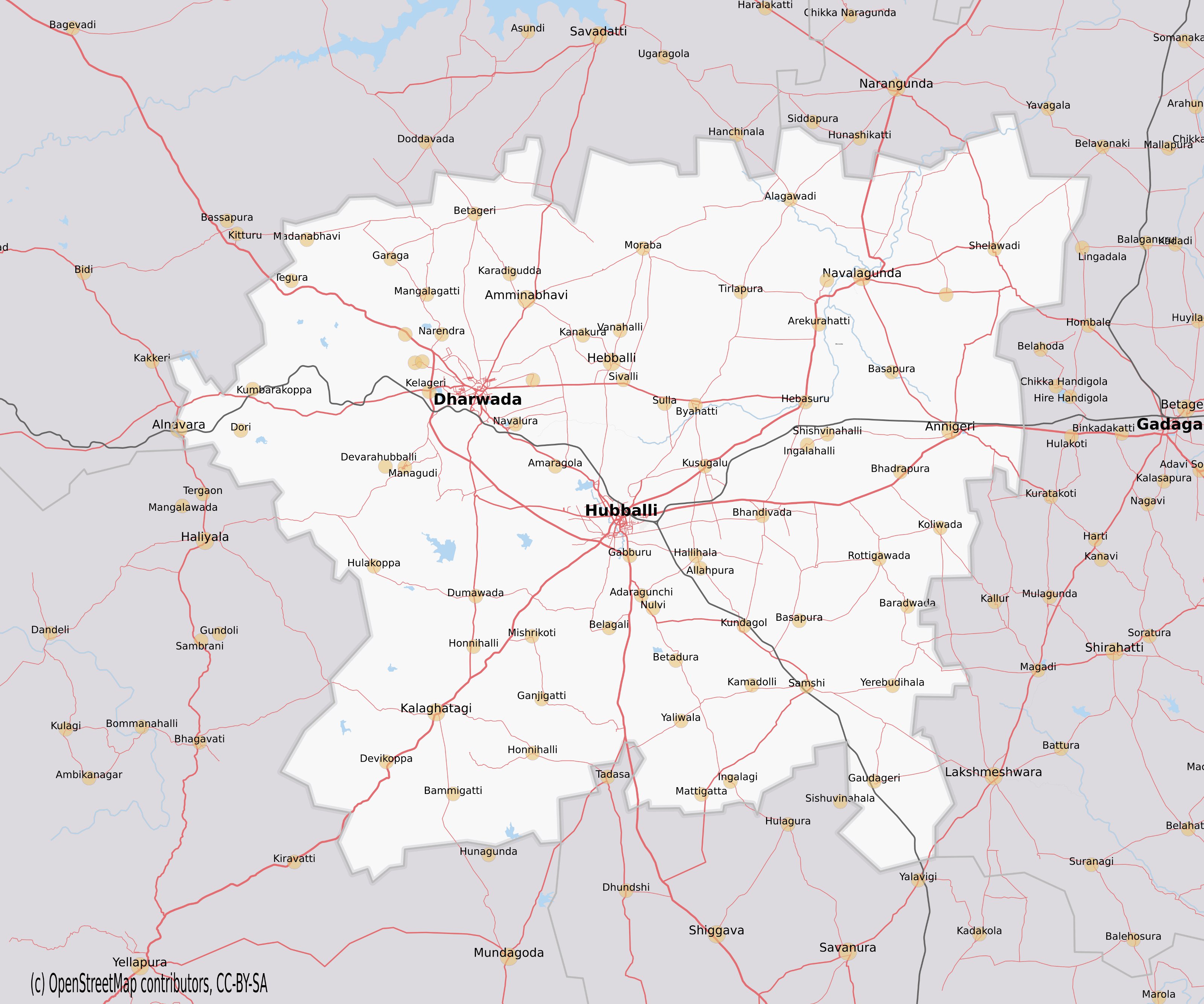
Dharwad is an administrative district of the state of Karnataka in southern India.The administrative headquarters of the district is the city of Dharwad, also known as Dharwar. Dharwad is located 425 km northwest of Bangalore and 421 km southeast of Pune, on the main highway between Chennai and Pune, the National Highway 4 (NH4). Before 1997 the district had an area of 13738 km2. In 1997, the new districts of Gadag and Haveri were carved out of Dharwad's former territory, and a portion of Dharwad district was combined with lands formerly part of three other districts to create the new district of Davanagere. History Historical studies show that people from early Paleolithic age inhabited Dharwad district. The district was ruled by various dynasties from the 5th century onwards, Important among them are Badami and Kalyan Chalukyas, Rastrakutas, Vijayanagar, Adilshahi, Mysore kingdom and Peshawas of Pune. Due to the rule of Peshwas, influence of Marathi is s ... [...More Info...] [...Related Items...] OR: [Wikipedia] [Google] [Baidu] |
Bekal
Bekal is a small town in the Kasaragod district on the West coast of the States and territories of India, state of Kerala, India. Location Bekal is a town located south of Kasaragod town and north of Kanhangad on the State Highway 57 (Kerala), State Highway 57. Bekal Fort is the largest fort in Kerala state situated adjacent to the beach. Shaped like a giant keyhole, the historic Bekal Fort offers a view of the Arabian Sea from its tall observation towers, which had huge cannons a couple centuries ago. The state of Kerala is reviewing a plan to start seaplane services connecting Bekal with Ashtamudi, Kollam Ashtamudi, Kumarakom, Punnamada and famous Paravur, Kollam, Paravur backwaters. Bekal in Northern Kerala was one of the top ten travel destinations selected by Lonely Planet. Local roads have access to National Highway 66 (India), NH 66 which connects to Mangalore in the north and Calicut in the south. The nearest railway station is Kanhangad on Mangalore-Palakkad line. ... [...More Info...] [...Related Items...] OR: [Wikipedia] [Google] [Baidu] |
Kerala
Kerala ( ; ) is a state on the Malabar Coast of India. It was formed on 1 November 1956, following the passage of the States Reorganisation Act, by combining Malayalam-speaking regions of the erstwhile regions of Cochin, Malabar, South Canara, and Thiruvithamkoor. Spread over , Kerala is the 21st largest Indian state by area. It is bordered by Karnataka to the north and northeast, Tamil Nadu to the east and south, and the Lakshadweep Sea to the west. With 33 million inhabitants as per the 2011 census, Kerala is the 13th-largest Indian state by population. It is divided into 14 districts with the capital being Thiruvananthapuram. Malayalam is the most widely spoken language and is also the official language of the state. The Chera dynasty was the first prominent kingdom based in Kerala. The Ay kingdom in the deep south and the Ezhimala kingdom in the north formed the other kingdoms in the early years of the Common Era (CE). The region had been a prominent spic ... [...More Info...] [...Related Items...] OR: [Wikipedia] [Google] [Baidu] |
.png)


