|
Sheopur
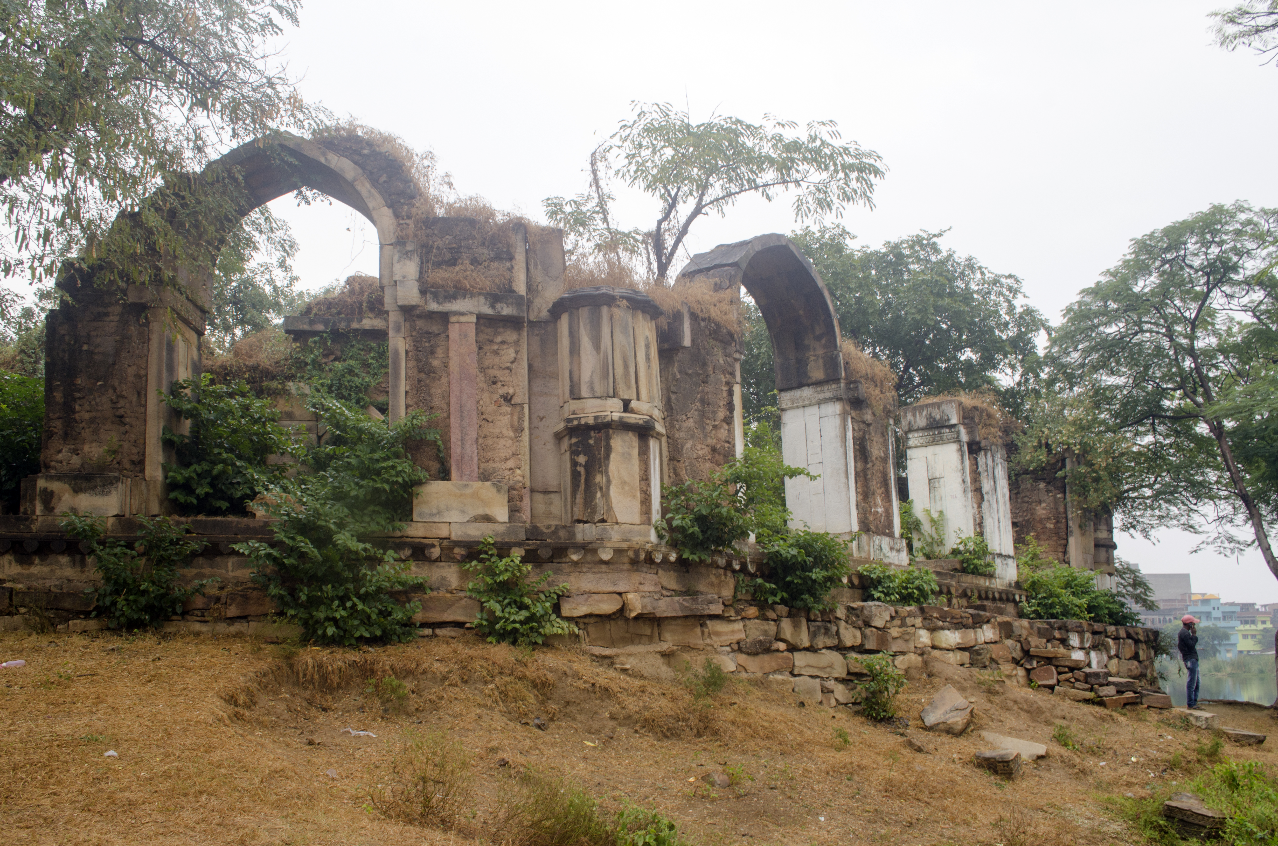
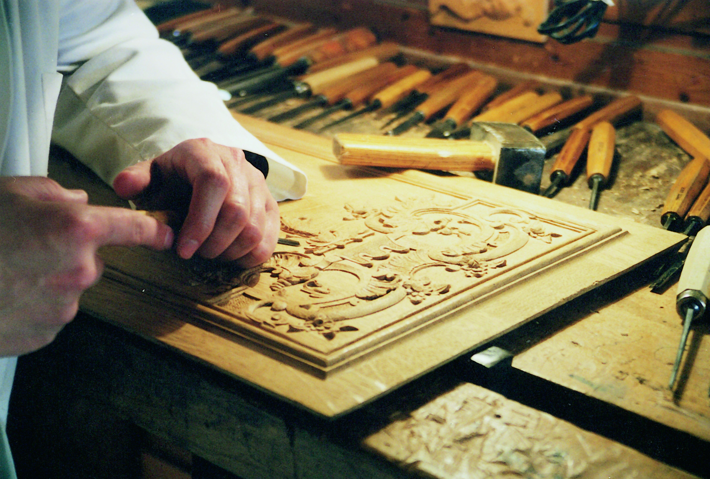
Sheopur is a city in Madhya Pradesh state of central India. It is the administrative headquarters of Sheopur District. Sheopur is linked by narrow gauge rail to Gwalior(No longer in operation). The town is traditionally famous for its wood carving. Chambal River is just 25 km, which forms the boundary between Rajasthan and MP states. Sheopur can be reached via train and buses from Gwalior which is 240 km and via buses from Sawai Madhopur and Kota which are 60 km and 110 km from Sheopur. Sheopur is located at northern part of Madhya Pradesh. Some of the main locations are Vijaipur, Karahal and Badoda. Major tourist attraction is Palpur (kuno) wildlife sanctuary. The well-known Kaketa reservoir is located in this district. The art of woodcarving has flourished in district Sheopur and the beautifully embellished wooden ceilings, doors and lintels with finely carved designs are silent testimonials of its glory. The wood carvers of Sheopur, with great sensiti ... [...More Info...] [...Related Items...] OR: [Wikipedia] [Google] [Baidu] |
Sheopur District
Sheopur District is a district of Madhya Pradesh state in central India. The district is located in the north of the state and forms part of Chambal division. It is situated on the periphery of Rajasthan, which shows in the influence of Rajasthani culture in this district. The town of Sheopur is the district headquarters. Other towns include Bijeypur, Karahal and Badoda. The district has a population of 687,861 (2011 census) and covers an area of 6,606 km². It is the third least populous district of Madhya Pradesh (out of 50), after Harda and Umaria. It is one out of 21 tribal districts of Madhya Pradesh. Geography Sheopur district is located in the north of Madhya Pradesh in the Chambal division. It is bordered by Morena district to the north, Gwalior district to the east, Shivpuri district to the southeast, and Rajasthan to the south and northwest. The region is chiefly marked by the presence of the Chambal ravines - the Chambal river marks the border with R ... [...More Info...] [...Related Items...] OR: [Wikipedia] [Google] [Baidu] |
Gwalior
Gwalior() is a major city in the central Indian state of Madhya Pradesh; it lies in northern part of Madhya Pradesh and is one of the Counter-magnet cities. Located south of Delhi, the capital city of India, from Agra and from Bhopal, the state capital, Gwalior occupies a strategic location in the Gird region of India. The historic city and its fortress have been ruled by several historic Indian kingdoms. From the Kachchhapaghatas in the 10th century, Tomars in the 13th century, it was passed on to the Mughal Empire, then to the Maratha in 1754, and the Scindia dynasty of Maratha Empire in the 18th century. In April 2021, It was found that Gwalior had the best air quality index (AQI 152) amongst the 4 major cities in Madhya Pradesh. Besides being the administrative headquarters of Gwalior district and Gwalior division, Gwalior has many administrative offices of the Chambal division of northern Madhya Pradesh. Several administrative and judicial organisations, commissi ... [...More Info...] [...Related Items...] OR: [Wikipedia] [Google] [Baidu] |
List Of Districts Of Madhya Pradesh
The Indian state of Madhya Pradesh came into existence on 1 November 1956. Madhya Pradesh has various geographic regions which have no official administrative governmental status; some correspond to historic countries, states or provinces. Currently, the number of districts in the state is 52. These districts are grouped into ten administrative divisions. Districts are subdivided into tehsils, of which there are 428 in Madhya Pradesh. List of districts There are 52 districts in Madhya Pradesh categorized into ten divisions. All districts share their name with their capital city. Proposed districts A bill giving in-principle approval to the creation of three districts was passed on 19 March 2020. The following districts would be created: * Nagda district Nagda district (Hindi: नागदा जिला, Nāgdā zilā) is a proposed district to be created in Madhya Pradesh, India. The district capital would be Nagda. In 2008, Madhya Pradesh MLA Dilip Gurjar, who represe ... [...More Info...] [...Related Items...] OR: [Wikipedia] [Google] [Baidu] |
WikiProject Indian Cities
A WikiProject, or Wikiproject, is a Wikimedia movement affinity group for contributors with shared goals. WikiProjects are prevalent within the largest wiki, Wikipedia, and exist to varying degrees within sister projects such as Wiktionary, Wikiquote, Wikidata, and Wikisource. They also exist in different languages, and translation of articles is a form of their collaboration. During the COVID-19 pandemic, CBS News noted the role of Wikipedia's WikiProject Medicine in maintaining the accuracy of articles related to the disease. Another WikiProject that has drawn attention is WikiProject Women Scientists, which was profiled by '' Smithsonian'' for its efforts to improve coverage of women scientists which the profile noted had "helped increase the number of female scientists on Wikipedia from around 1,600 to over 5,000". On Wikipedia Some Wikipedia WikiProjects are substantial enough to engage in cooperative activities with outside organizations relevant to the field at issue. For ... [...More Info...] [...Related Items...] OR: [Wikipedia] [Google] [Baidu] |
Sher Shah Suri
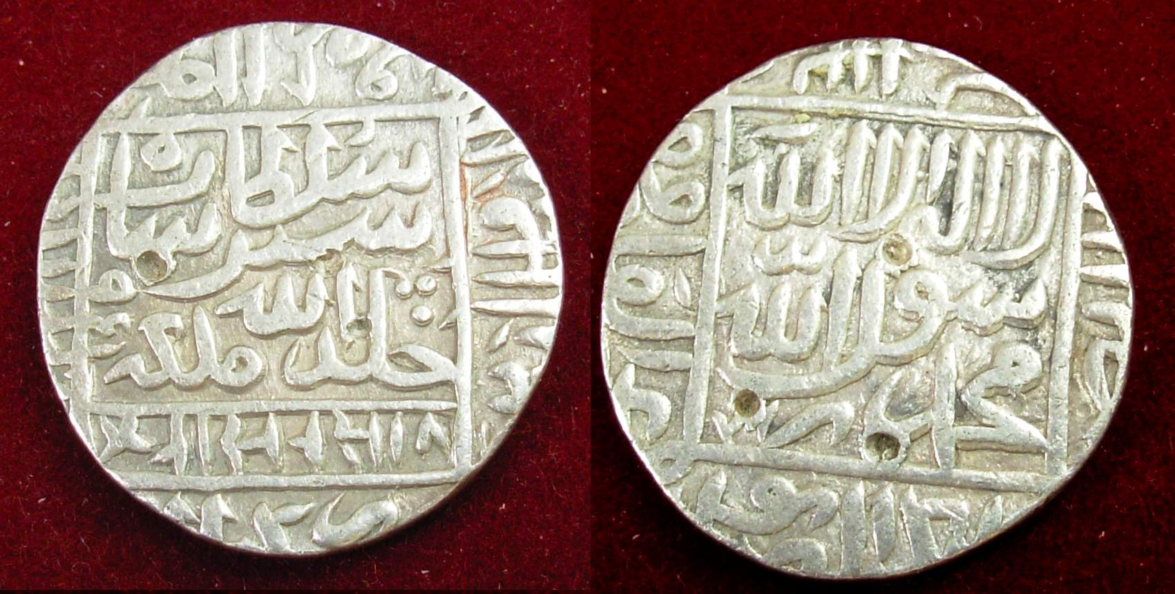
Sher Shah Suri ( ps, شیرشاه سوری) (1472, or 1486 – 22 May 1545), born Farīd Khān ( ps, فرید خان) , was the founder of the Sur Empire in India, with its capital in Sasaram in modern-day Bihar. He standardized the silver coin to the weight of 178 grams and named the currency as rupee based on the ancient Sanskrit term for silver. An ethnic Pashtun ruler, Sher Shah took control of the Mughal Empire in 1540 CE. After his accidental death in 1545 CE, his son Islam Shah became his successor. He first served as a private before rising to become a commander in the Mughal army under Babur and then the governor of Bihar. In 1537, when Babur's son Humayun was elsewhere on an expedition, Sher Shah overran the state of Bengal and established the Suri dynasty. A brilliant strategist, Sher Shah proved himself as a gifted administrator as well as a capable general. His reorganization of the empire laid the foundations for the later Mughal emperors, notably Akbar, son of ... [...More Info...] [...Related Items...] OR: [Wikipedia] [Google] [Baidu] |
Ranthambore Fort
Ranthambore Fort lies within the Ranthambore National Park, near the city of Sawai Madhopur in Sawai Madhopur district of Rajasthan, India. the park being the former hunting grounds of the Maharajahs of Jaipur until the time of India's Independence. It is a formidable fort having been a focal point of the historical developments of Rajasthan. The fort is believed to be constructed by the Chahamanas. In the 13th century the Delhi Sultanate captured it for a brief time. The fort provides a panoramic view of the surrounding Ranthambore National Park and is now a popular tourist attraction. In 2013, at the 37th session of the World Heritage Committee, Ranthambore Fort, along with 5 other forts of Rajasthan, was declared a UNESCO World Heritage Site under the group Hill Forts of Rajasthan. History The oldest settlement in the area near Sawai Madhopur was around the Ranthambhore fort. The exact origin of the Ranthambore fort is still disputed but it is generally accepted that ... [...More Info...] [...Related Items...] OR: [Wikipedia] [Google] [Baidu] |
Sultan Mahmood Khalji
Sultan (; ar, سلطان ', ) is a position with several historical meanings. Originally, it was an Arabic abstract noun meaning "strength", "authority", "rulership", derived from the verbal noun ', meaning "authority" or "power". Later, it came to be used as the title of certain rulers who claimed almost full sovereignty (i.e., not having dependence on any higher ruler) without claiming the overall caliphate, or to refer to a powerful governor of a province within the caliphate. The adjectival form of the word is "sultanic", and the state and territories ruled by a sultan, as well as his office, are referred to as a sultanate ( '. The term is distinct from king ( '), despite both referring to a sovereign ruler. The use of "sultan" is restricted to Muslim countries, where the title carries religious significance, contrasting the more secular ''king'', which is used in both Muslim and non-Muslim countries. Brunei and Oman are the only independent countries which retain the ti ... [...More Info...] [...Related Items...] OR: [Wikipedia] [Google] [Baidu] |
Malwa Sultanate
The Malwa Sultanate ( fa, ) (Pashto: ; ''lit: Mālwā Salṭanat'') was a late medieval Islamic sultanate in the Malwa region, covering the present day Indian states of Madhya Pradesh and south-eastern Rajasthan from 1392 to 1562. It was founded by Dilawar Khan, an Afghan governor of the Delhi Sultanate. Dilawar Khan had ceased to pay tribute to Delhi after 1392. Following Timur's invasion and the disintegration of the Delhi Sultanate, in 1401/2, Dilawar Khan made Malwa an independent realm. History The sultanate of Malwa was founded by Dilawar Khan Ghuri, the governor of Malwa for the Delhi Sultanate, who asserted his independence in 1392, but did not actually assume the ensigns of royalty till 1401. Initially Dhar was the capital of the new kingdom, but soon it was shifted to Mandu, which was renamed Shadiabad (the city of joy). After his death, he was succeeded by his son Alp Khan, who assumed the title of Hoshang Shah. The Ghurid dynasty, founded by Dilawar Kha ... [...More Info...] [...Related Items...] OR: [Wikipedia] [Google] [Baidu] |
Surjan Singh Hada
{{disambiguation ...
Surjan can refer to: * Jacob Surjan (born 1985), Australian rules footballer * Surjan, Bosnia and Herzegovina, a village in Bosnia and Herzegovina * Šurjan, a village in Serbia Serbia (, ; Serbian: , , ), officially the Republic of Serbia ( Serbian: , , ), is a landlocked country in Southeastern and Central Europe, situated at the crossroads of the Pannonian Basin and the Balkans. It shares land borders with Hu ... [...More Info...] [...Related Items...] OR: [Wikipedia] [Google] [Baidu] |
Islam Shah
Islam Shah Suri (reigned: 1545–1554) was the second ruler of the Suri dynasty which ruled the part of India in the mid-16th century. His original name was Jalal Khan and he was the second son of Sher Shah Suri. History On his father's death, an emergency meeting of nobles chose Jalal Khan to be successor instead of his elder brother Adil Khan, since he had shown greater military ability. Jalal Khan was crowned on 26 May 1545 and took the title "Islam Shah". He was still worried that his brother would threaten his power and tried to have him captured. But Adil Khan evaded his grasp and raised an army. It marched on Islam Shah while he was at Agra. In the battle Islam Shah came out victorious and Adil Khan fled, never to be seen again. The support some of the nobles had given his brother made Islam Shah suspicious and he ruthlessly purged their ranks, strictly subordinating the nobility to the crown. He continued his father's policies of efficient administration and increas ... [...More Info...] [...Related Items...] OR: [Wikipedia] [Google] [Baidu] |
Woodcarving
Wood carving is a form of woodworking by means of a cutting tool (knife) in one hand or a chisel by two hands or with one hand on a chisel and one hand on a mallet, resulting in a wooden figure or figurine, or in the sculptural ornamentation of a wooden object. The phrase may also refer to the finished product, from individual sculptures to hand-worked mouldings composing part of a tracery. The making of sculpture in wood has been extremely widely practised, but doesn't survive undamaged as well as the other main materials like stone and bronze, as it is vulnerable to decay, insect damage, and fire. Therefore, it forms an important hidden element in the art history of many cultures. Outdoor wood sculptures do not last long in most parts of the world, so it is still unknown how the totem pole tradition developed. Many of the most important sculptures of China and Japan, in particular, are in wood, and so are the great majority of African sculpture and that of Oceania and ... [...More Info...] [...Related Items...] OR: [Wikipedia] [Google] [Baidu] |


