|
Second Australian Inland Mission Hospital, Birdsville
Australian Inland Mission Hospital is a heritage-listed former hospital at Adelaide Street, Birdsville, Shire of Diamantina, Queensland, Australia. It was built from 1952 to 1953 by Ben Hargreaves. It was added to the Queensland Heritage Register on 17 July 2008. History Located in Adelaide Street, Birdsville, the single-storeyed, prefabricated steel, Australian Inland Mission Hospital building was erected in 1952-1953 on the site of its predecessor, which burnt down in November 1951. An Australian Inland Mission bush nursing home or hostel was established at Birdsville in 1923 in the former Royal Hotel building, the first mission hostel in Queensland and the seventh in Australia. It was replaced by a purpose-built, pre-fabricated hospital opened in 1937 on land purchased by the Presbyterian Church. Although European explorers had passed through the Diamantina district in the 1840s and early 1860s, this semi-arid region was not occupied until the mid-1870s when a number of p ... [...More Info...] [...Related Items...] OR: [Wikipedia] [Google] [Baidu] |
Birdsville, Queensland
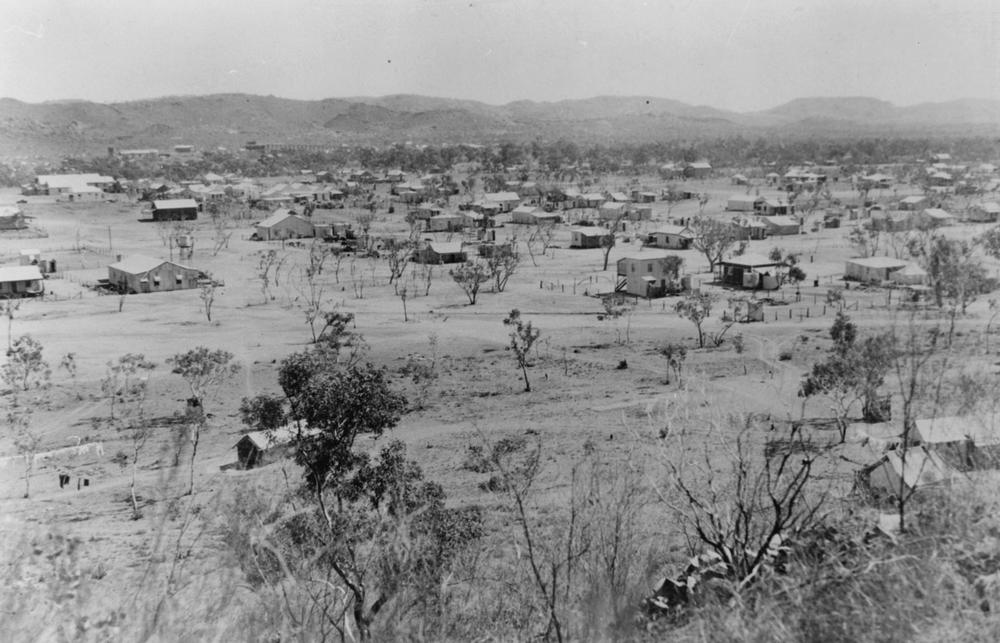
Birdsville is a rural town and locality in the Shire of Diamantina, Queensland, Australia. In the the locality of Birdsville had a population of 110 people. It is a popular tourist destination with many people using it as a starting point across the Simpson Desert. Betoota is a ghost town within the locality (). Geography Birdsville is west of the state capital, Brisbane, and south of the city of Mount Isa. Birdsville is on the edge of the Simpson Desert, approximately 174 km east of Poeppel Corner. Birdsville is located about north-east of the Diamantina River in the Channel Country in the Lake Eyre drainage basin. The Birdsville Track extends from Marree, South Australia, Marree in South Australia before ending at Birdsville; the road continues north as the Eyre Developmental Road to Bedourie. The Birdsville Developmental Road travels east from the town towards Windorah, Queensland, Windorah. A popular route across the Simpson Desert goes from Birdsville to Mt Dar ... [...More Info...] [...Related Items...] OR: [Wikipedia] [Google] [Baidu] |
Alfred Traeger
Alfred Hermann Traeger (2 August 1895 – 31 July 1980), known as Alf Traeger, was an Australian engineer and inventor, chiefly known for the development of the pedal radio. Early life and education Traeger was born at Glenlee, near Dimboola, Victoria (Australia), Victoria, and raised near and in Adelaide, South Australia, the son of South Australian-born parents. His paternal grandparents had been German Australians, German migrants to the young colony in 1848. Traeger attended Balaklava, South Australia, Balaklava Public School, about north of Adelaide, then German schools in South Australia, Martin Luther School in Flinders Street, Adelaide, followed by two years at Adelaide Technical High School (now Glenunga International High School). From 1912, aged 16, he spent three years at the South Australian School of Mines and Industries, studying mechanical engineering, mechanical and electrical engineering, earning an Associate Diploma. At the age of 12, he built a telephone ... [...More Info...] [...Related Items...] OR: [Wikipedia] [Google] [Baidu] |
Burketown, Queensland
Burketown is an isolated outback town and coastal locality in the Shire of Burke, Queensland, Australia. In the , the locality of Burketown had a population of 238 people. It is located west of Cairns and west of Normanton on the Albert River and Savannah Way in the area known as the Gulf Savannah. Geography Burketown is located on the Albert River to the north west of the state capital, Brisbane, with the nearest larger town being Normanton, to the east, and the nearest city being Mount Isa, to the south. The town is roughly inland from the Gulf of Carpentaria. It is located west of Cairns via the Savannah Way passing through the area known as the Gulf Savannah. The town is the administrative centre of the Burke Shire Council. History Aboriginal History Aboriginal Australian peoples had inhabited the region for millennia before European explorers travelled the area. The Yukulta / Ganggalidda and Garawa peoples are recognised as the traditional owners of the ... [...More Info...] [...Related Items...] OR: [Wikipedia] [Google] [Baidu] |
Western Queensland
Western Queensland encompasses the three western regions in the Australian state of Queensland: * North West Queensland, often known as Gulf Country; * Central West Queensland; and * South West Queensland. History Karuwali (also known as ''Garuwali'' or ''Dieri'') is a language of far western Queensland. The Karuwali language region includes the landscape within the local government boundaries of the Diamantina Shire Council, including the localities of Betoota and Haddon Corner. Kuungkari (also known as ''Kungkari'' and ''Koonkerri'') is an Australian Aboriginal language of Western Queensland. The Kuungkari language region includes the landscape within the local government boundaries of Shire of Longreach and Blackall-Tambo Region. Pitta Pitta (also known as ''Bitha Bitha'', ''Pitapita'', and ''Bitta bitta'') is an Australian Aboriginal language of the Western Queensland region. The Pitta Pitta language region includes the landscape within the local government boundarie ... [...More Info...] [...Related Items...] OR: [Wikipedia] [Google] [Baidu] |
Antenna (radio)
In radio engineering, an antenna or aerial is the interface between radio waves propagating through space and electric currents moving in metal conductors, used with a transmitter or receiver. In transmission, a radio transmitter supplies an electric current to the antenna's terminals, and the antenna radiates the energy from the current as electromagnetic wave In physics, electromagnetic radiation (EMR) consists of waves of the electromagnetic (EM) field, which propagate through space and carry momentum and electromagnetic radiant energy. It includes radio waves, microwaves, infrared, (visib ...s (radio waves). In Receiver (radio), reception, an antenna intercepts some of the power of a radio wave in order to produce an electric current at its terminals, that is applied to a receiver to be Amplifier, amplified. Antennas are essential components of all radio equipment. An antenna is an array of conductor (material), conductors (Driven element, elements), elect ... [...More Info...] [...Related Items...] OR: [Wikipedia] [Google] [Baidu] |
Transceiver
In radio communication, a transceiver is an electronic device which is a combination of a radio ''trans''mitter and a re''ceiver'', hence the name. It can both transmit and receive radio waves using an antenna, for communication purposes. These two related functions are often combined in a single device to reduce manufacturing costs. The term is also used for other devices which can both transmit and receive through a communications channel, such as ''optical transceivers'' which transmit and receive light in optical fiber systems, and ''bus transceivers'' which transmit and receive digital data in computer data buses. Radio transceivers are widely used in wireless devices. One large use is in two-way radios, which are audio transceivers used for bidirectional person-to-person voice communication. Examples are cell phones, which transmit and receive the two sides of a phone conversation using radio waves to a cell tower, cordless phones in which both the phone handset and ... [...More Info...] [...Related Items...] OR: [Wikipedia] [Google] [Baidu] |
Charleville, Queensland
Charleville () is a rural town and locality in the Shire of Murweh, Queensland, Australia. In the , the locality of Charleville had a population of 3,335 people. Geography Located in southwestern Queensland, Australia, Charleville is west of Brisbane (the Queensland capital), 616 kilometres (384 mi) west of Toowoomba, 535 kilometres (333 mi) west of Dalby, 393 kilometres (244 mi) west of Miles and 254 kilometres (158 mi) west of Roma. It is the largest town and administrative centre of the Shire of Murweh, which covers an area of 43,905 square kilometres. Charleville is situated on the banks of the Warrego River. Charleville is the terminus for the Warrego Highway which stretches 683 kilometres (424 mi) from Brisbane. The Mitchell Highway also connects Charleville with: * Augathella - 84 kilometres (53 mi) north * Wyandra - 124 kilometres (77 mi) south * Cunnamulla - 198 kilometres (123 mi) south * Bourke - 454 kilometres (282&nb ... [...More Info...] [...Related Items...] OR: [Wikipedia] [Google] [Baidu] |
Corrugated Iron
Corrugated galvanised iron or steel, colloquially corrugated iron (near universal), wriggly tin (taken from UK military slang), pailing (in Caribbean English), corrugated sheet metal (in North America) and occasionally abbreviated CGI is a building material composed of sheets of hot-dip galvanised mild steel, cold-rolled to produce a linear ridged pattern in them. Although it is still popularly called "iron" in the UK, the material used is actually steel (which is iron alloyed with carbon for strength, commonly 0.3% carbon), and only the surviving vintage sheets may actually be made up of 100% iron. The corrugations increase the bending strength of the sheet in the direction perpendicular to the corrugations, but not parallel to them, because the steel must be stretched to bend perpendicular to the corrugations. Normally each sheet is manufactured longer in its strong direction. CGI is lightweight and easily transported. It was and still is widely used especially in rural a ... [...More Info...] [...Related Items...] OR: [Wikipedia] [Google] [Baidu] |
Gable
A gable is the generally triangular portion of a wall between the edges of intersecting roof pitches. The shape of the gable and how it is detailed depends on the structural system used, which reflects climate, material availability, and aesthetic concerns. The term gable wall or gable end more commonly refers to the entire wall, including the gable and the wall below it. Some types of roof do not have a gable (for example hip roofs do not). One common type of roof with gables, the gable roof, is named after its prominent gables. A parapet made of a series of curves (Dutch gable) or horizontal steps (crow-stepped gable) may hide the diagonal lines of the roof. Gable ends of more recent buildings are often treated in the same way as the Classic pediment form. But unlike Classical structures, which operate through trabeation, the gable ends of many buildings are actually bearing-wall structures. Gable style is also used in the design of fabric structures, with varying degree ... [...More Info...] [...Related Items...] OR: [Wikipedia] [Google] [Baidu] |
Alice Springs
Alice Springs ( aer, Mparntwe) is the third-largest town in the Northern Territory of Australia. Known as Stuart until 31 August 1933, the name Alice Springs was given by surveyor William Whitfield Mills after Alice, Lady Todd (''née'' Alice Gillam Bell), wife of the telegraph pioneer Sir Charles Todd. Known colloquially as 'The Alice' or simply 'Alice', the town is situated roughly in Australia's geographic centre. It is nearly equidistant from Adelaide and Darwin. The area is also known locally as Mparntwe to its original inhabitants, the Arrernte, who have lived in the Central Australian desert in and around what is now Alice Springs for tens of thousands of years. Alice Springs had an urban population of 26,534 Estimated resident population, 30 June 2018. in June 2018, having declined an average of 1.16% per year the preceding five years. The town's population accounts for approximately 10 per cent of the population of the Northern Territory. The town straddles th ... [...More Info...] [...Related Items...] OR: [Wikipedia] [Google] [Baidu] |
Innamincka, South Australia
Innamincka, formerly Hopetoun, is a township and locality in north-east South Australia with a population of 44 people as of the . By air it is north-east of the state capital, Adelaide, and north-east of the closest town, Lyndhurst. It is north-east of the Moomba Gas Refinery. The town lies within the Innamincka Regional Reserve and is surrounded by the Strzelecki Desert to the south and the Sturt Stony Desert to the north. It is linked by road to Lyndhurst via the Strzelecki Track, to the Birdsville Developmental Road via Cordillo Downs Road and Arrabury Road (via Haddon Corner), and the Walkers Crossing Track to the Birdsville Track. The Walkers Crossing Track is closed in summer and only traversable in dry weather. The township is situated along the Cooper Creek, a part of the Lake Eyre basin. History Aboriginal Australians have lived in the lands around Innamincka for millennia, in what they call Wangkangurru country, the traditional home of the Yawarrawarrka and ... [...More Info...] [...Related Items...] OR: [Wikipedia] [Google] [Baidu] |
Victoria River Downs Station
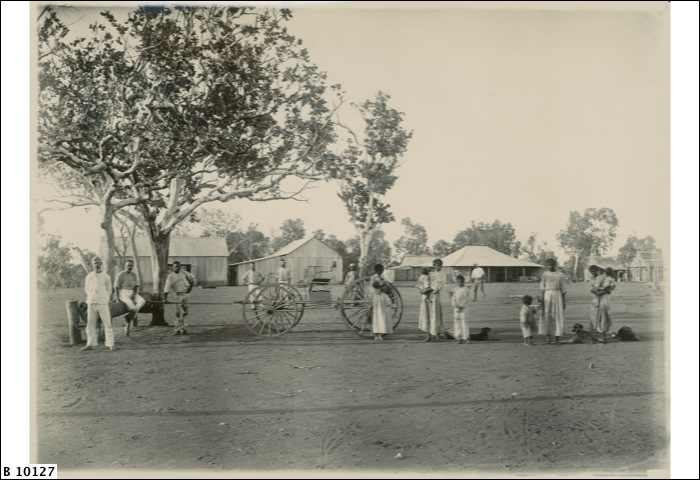
Victoria River Downs Station, also known as Victoria Downs and often referred to as The Big Run, is a pastoral lease that operates as a cattle station in the Northern Territory of Australia. Location It is located about south east of Timber Creek and west of Daly Waters in the Northern Territory. The property abuts the Daguragu Aboriginal Land Trust to the south, Camfield Station, Montejinni and Killarney Stations to the east, Delamere to the north and Humbert River Station and the Bilinarra-Jutpurra Aboriginal Land Trust to the west. The Auvergne and Wave Hills Stock routes both pass through the station as does the Buntine Highway that passes through the south east corner. Description Currently Victoria River Downs has an area of The property was once the world's largest pastoral property with an area of , but following much of the land being resumed it is now less than half its former size, and less than half the size of the current largest, Anna Creek station. Seve ... [...More Info...] [...Related Items...] OR: [Wikipedia] [Google] [Baidu] |


