|
Sea Point, Cape Town
Sea Point (Afrikaans: ''Seepunt'') is one of Cape Town's most affluent and densely populated suburbs, situated between Signal Hill and the Atlantic Ocean, a few kilometres to the west of Cape Town's Central Business District (CBD). Moving from Sea Point to the CBD, one passes first through the small suburb of Three Anchor Bay, then Green Point. Seaward from Green Point is the area known as Mouille Point (pronounced MOO-lee), where the local lighthouse is situated. It borders to the southwest the suburb of Bantry Bay. Sea Point is the only seaside suburb of Cape Town with significant high-rise development and this, along with other factors, has made it a very popular residential area, or for investing in first or second homes and apartments. Demographics The area was historically classed as a "whites only" area only during the apartheid era under the terms of the Group Areas Act, a series of South African laws that restricted urban areas according to racial classifications W ... [...More Info...] [...Related Items...] OR: [Wikipedia] [Google] [Baidu] |
Lion's Head (Cape Town)
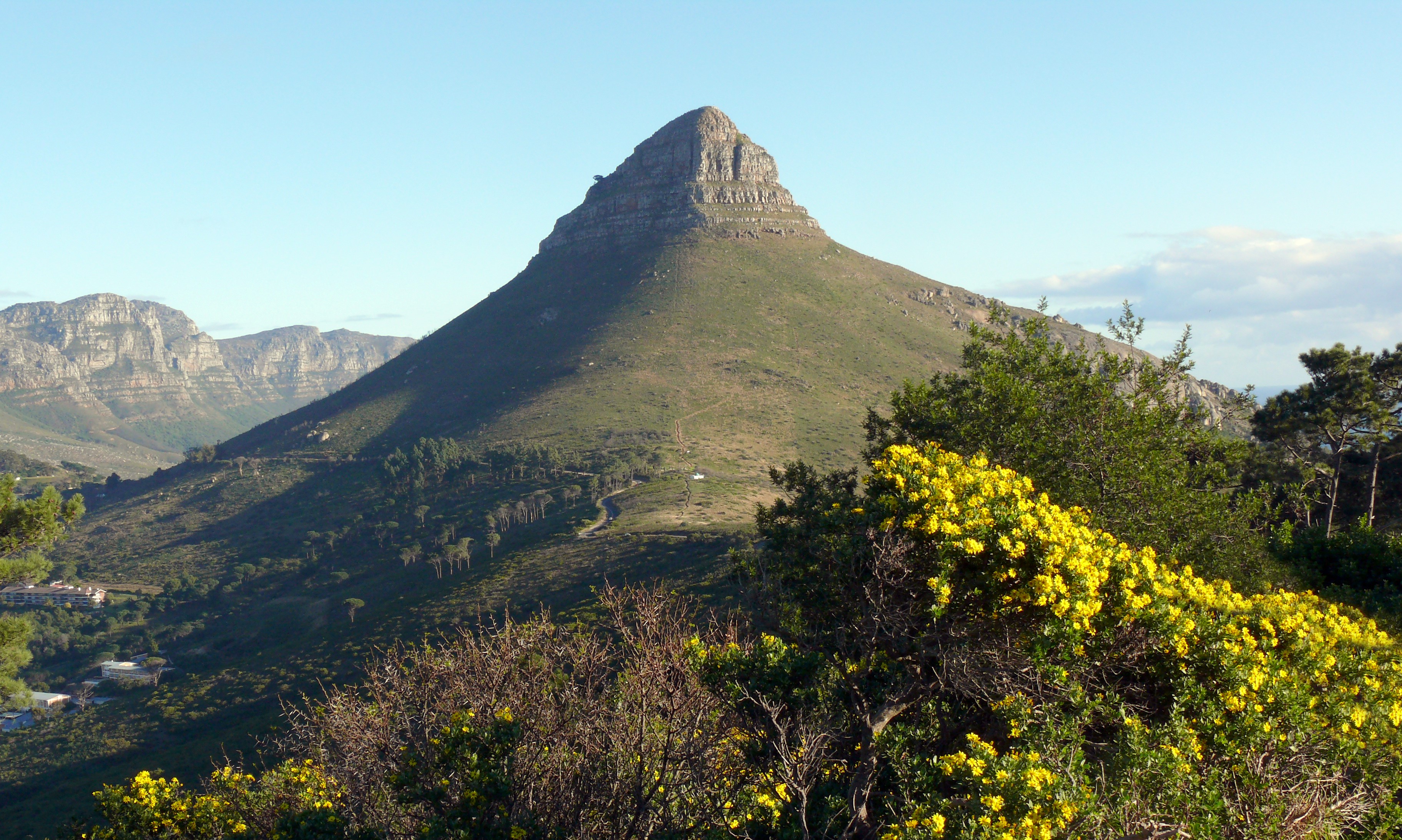
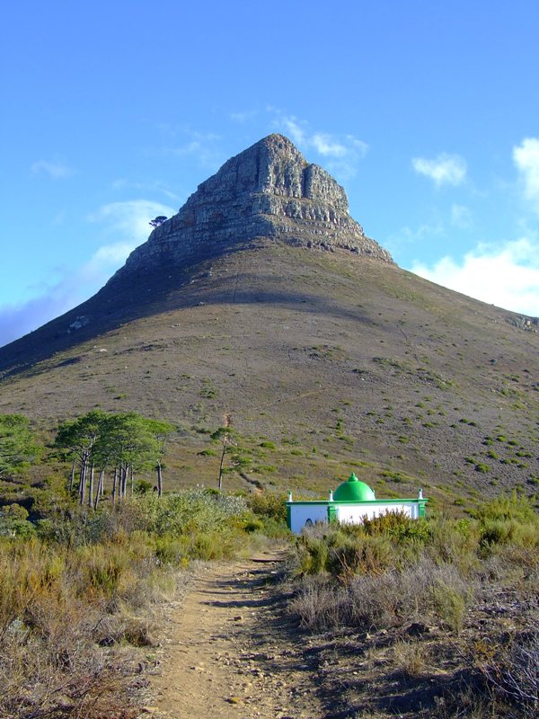
Lion's Head is a mountain in Cape Town, South Africa, between Table Mountain and Signal Hill. Lion's Head peaks at above sea level. The peak forms part of a dramatic backdrop to the city of Cape Town and is part of the Table Mountain National Park. Surrounding The suburbs of the city surround the peak and Signal Hill on almost all sides, but strict management by city authorities has kept development of housing off the higher ground. The area is significant to the Cape Malay community, who historically lived in the Bo-Kaap quarter close to Lion's Head. There are a number of historic graves and shrines (''kramat''s) of Malay leaders on the lower slopes and on Signal Hill. History In the 17th century the peak was known as ''Leeuwen Kop'' (Lion's Head) by the Dutch, and Signal Hill was known as ''Leeuwen Staart'' (Lion's Tail), as the shape resembles a crouching lion or a sphinx. The English in the 17th Century called the peak Sugar Loaf. In 1897 gold was discovered on Lion' ... [...More Info...] [...Related Items...] OR: [Wikipedia] [Google] [Baidu] |
South African Standard Time
South African Standard Time (SAST) is the time zone used by all of South Africa as well as Eswatini and Lesotho. The zone is two hours ahead of UTC ( UTC+02:00) and is the same as Central Africa Time. Daylight saving time is not observed in either time zone. Solar noon in this time zone occurs at 30° E in SAST, effectively making Pietermaritzburg at the correct solar noon point, with Johannesburg and Pretoria slightly west at 28° E and Durban slightly east at 31° E. Thus, most of South Africa's population experience true solar noon at approximately 12:00 daily. The western Northern Cape and Western Cape differ, however. Everywhere on land west of 22°30′ E effectively experiences year-round daylight saving time because of its location in true UTC+01:00 but still being in South African Standard Time. Sunrise and sunset are thus relatively late in Cape Town, compared to the rest of the country. To illustrate, daylight hours for South Africa's west ... [...More Info...] [...Related Items...] OR: [Wikipedia] [Google] [Baidu] |
Sea Point Beach
The sea, connected as the world ocean or simply the ocean, is the body of salty water that covers approximately 71% of the Earth's surface. The word sea is also used to denote second-order sections of the sea, such as the Mediterranean Sea, as well as certain large, entirely landlocked, saltwater lakes, such as the Caspian Sea. The sea moderates Earth's climate and has important roles in the water, carbon, and nitrogen cycles. Humans harnessing and studying the sea have been recorded since ancient times, and evidenced well into prehistory, while its modern scientific study is called oceanography. The most abundant solid dissolved in seawater is sodium chloride. The water also contains salts of magnesium, calcium, potassium, and mercury, amongst many other elements, some in minute concentrations. Salinity varies widely, being lower near the surface and the mouths of large rivers and higher in the depths of the ocean; however, the relative proportions of dissolved salts vary li ... [...More Info...] [...Related Items...] OR: [Wikipedia] [Google] [Baidu] |
Population Registration Act, 1950
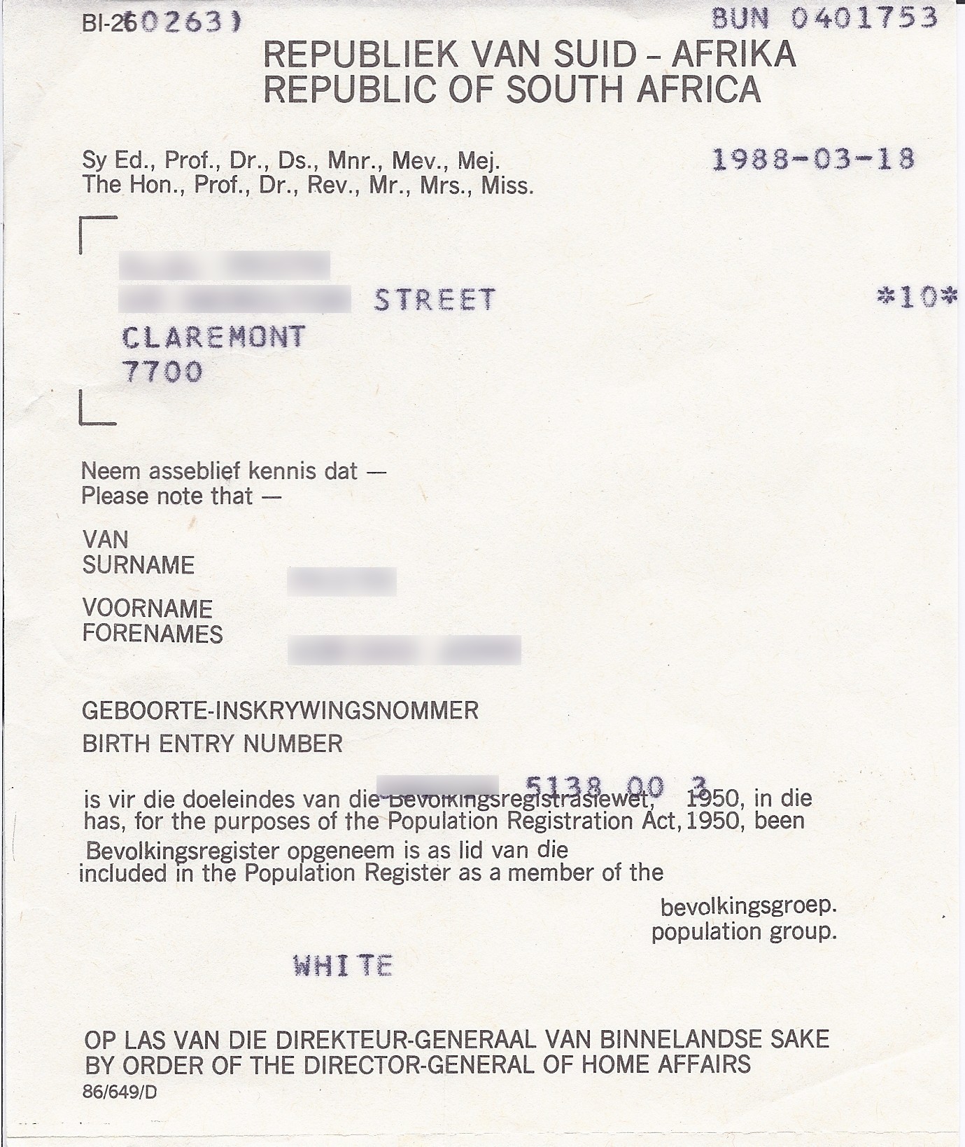
The Population Registration Act of 1950 required that each inhabitant of South Africa be classified and registered in accordance with their racial characteristics as part of the system of apartheid. Social rights, political rights, educational opportunities, and economic status were largely determined by the group to which an individual belonged. There were three basic racial classifications under the law: Black, White and Coloured (mixed). Indians (that is, South Asians from the former British India, and their descendants) were later added as a separate classification as they were seen as having "no historical right to the country". An ''Office for Race Classification'' was set up to overview the classification process. Classification into groups was carried out using criteria such as outer appearance, general acceptance and social standing. For example, it defined a "white person" as one who "in appearance is obviously a white person who is generally not accepted as a colou ... [...More Info...] [...Related Items...] OR: [Wikipedia] [Google] [Baidu] |
Group Areas Act
Group Areas Act was the title of three acts of the Parliament of South Africa enacted under the apartheid government of South Africa. The acts assigned racial groups to different residential and business sections in urban areas in a system of urban apartheid. An effect of the law was to exclude people of color from living in the most developed areas, which were restricted to Whites (Sea Point, Claremont). It required many people of color to commute large distances from their homes to be able to work. The law led to people of color being forcibly removed for living in the "wrong" areas. The majority that was people of color, were given much smaller areas (e.g., Tongaat, Grassy Park) to live in than the white minority who owned most of the country. Pass Laws required people of color to carry pass books and later "reference books", similar to passports, to enter the "white" parts of the country. The first Group Areas Act, the ''Group Areas Act, 1950'' was promulgated on 7 July 195 ... [...More Info...] [...Related Items...] OR: [Wikipedia] [Google] [Baidu] |
Apartheid
Apartheid (, especially South African English: , ; , "aparthood") was a system of institutionalised racial segregation that existed in South Africa and South West Africa (now Namibia) from 1948 to the early 1990s. Apartheid was characterised by an authoritarian political culture based on ''baasskap'' (boss-hood or boss-ship), which ensured that South Africa was dominated politically, socially, and economically by the nation's minority white population. According to this system of social stratification, white citizens had the highest status, followed by Indians and Coloureds, then black Africans. The economic legacy and social effects of apartheid continue to the present day. Broadly speaking, apartheid was delineated into ''petty apartheid'', which entailed the segregation of public facilities and social events, and ''grand apartheid'', which dictated housing and employment opportunities by race. The first apartheid law was the Prohibition of Mixed Marriages ... [...More Info...] [...Related Items...] OR: [Wikipedia] [Google] [Baidu] |
Bantry Bay, Cape Town
Bantry Bay is an affluent suburb of Cape Town in the Western Cape Province, South Africa, situated on the slopes of Lion's Head and overlooking a rocky coastline. Its neighboring suburbs are Sea Point and Clifton Clifton may refer to: People *Clifton (surname) *Clifton (given name) Places Australia * Clifton, Queensland, a town **Shire of Clifton *Clifton, New South Wales, a suburb of Wollongong *Clifton, Western Australia Canada *Clifton, Nova Scotia .... It was originally called Botany Bay after a botanical garden that was planted here for the cultivation of medicinal herbs. The name was changed during the First World War. It is overlooked by Lion's Head, which is an eroded outlier of sandstone. There is a plaque on the seashore that commemorates a visit by Charles Darwin, who made important geological observations here relating to the nature and origin of granite.James, Wilmot''Charles Darwin at the Cape: notes on his sociological observations''. South African Journal o ... [...More Info...] [...Related Items...] OR: [Wikipedia] [Google] [Baidu] |
Mouille Point, Cape Town
Mouille Point ("Mu-lee") is an affluent suburb of Cape Town, situated between the Victoria and Alfred Waterfront and Granger Bay to the east, Green Point to the south and the Atlantic Ocean to the north and west. The suburb hugs the coastline and is dominated by high-end apartment blocks. It is a very small suburb, having only two major roads (Beach Road and Bay Road). It is home to the Mouille Point promenade, a paved promenade on the coast that is used daily by thousands of Capetonians. Behind it lies the Green Point Common, where numerous playing fields and a golf course are situated. The new Green Point Urban Park & Biodiversity Garden is just behind Mouille Point and has an entrance on Bay Road. The name "Mouille" comes from the French word for an anchoring ground. In the early 18th century ships were often swept ashore in Table Bay and the then governor decided that a breakwater (mouille in French) was needed to protect vessels at anchor. Work began in 1743. All farmers wh ... [...More Info...] [...Related Items...] OR: [Wikipedia] [Google] [Baidu] |
Green Point, Cape Town
Green Point ( af, Groenpunt) is an affluent suburb on the Atlantic Seaboard of Cape Town, South Africa located to the north west of the central business district. It is a popular residential area for young professionals and for the Cape Town gay and lesbian community, alongside the gay village of De Waterkant. Many new mid-rise apartment and mixed-use developments have gone up in recent years. Somerset Road forms the main thoroughfare lined by restaurants, cafés, delis, boutiques and nightclubs. The Braemar Estate includes a few dozen properties that are restricted to single dwellings only, within the boundaries of Green Point Between 1980 and 1982, the Green Point constituency was extended to include Walvis Bay, about 1,500km to the north. [...More Info...] [...Related Items...] OR: [Wikipedia] [Google] [Baidu] |
Central Business District
A central business district (CBD) is the commercial and business centre of a city. It contains commercial space and offices, and in larger cities will often be described as a financial district. Geographically, it often coincides with the "city centre" or "downtown". However, these concepts are not necessarily synonymous: many cities have a central ''business'' district located away from its commercial and or cultural centre and or downtown/city centre, and there may be multiple CBDs within a single urban area. The CBD will often be characterised by a high degree of accessibility as well as a large variety and concentration of specialised goods and services compared to other parts of the city. For instance, Midtown Manhattan, New York City, is the largest central business district in the city and in the United States. London's city centre is usually regarded as encompassing the historic City of London and the medieval City of Westminster, while the City of London and the transform ... [...More Info...] [...Related Items...] OR: [Wikipedia] [Google] [Baidu] |
Atlantic Ocean
The Atlantic Ocean is the second-largest of the world's five oceans, with an area of about . It covers approximately 20% of Earth's surface and about 29% of its water surface area. It is known to separate the " Old World" of Africa, Europe and Asia from the "New World" of the Americas in the European perception of the World. The Atlantic Ocean occupies an elongated, S-shaped basin extending longitudinally between Europe and Africa to the east, and North and South America to the west. As one component of the interconnected World Ocean, it is connected in the north to the Arctic Ocean, to the Pacific Ocean in the southwest, the Indian Ocean in the southeast, and the Southern Ocean in the south (other definitions describe the Atlantic as extending southward to Antarctica). The Atlantic Ocean is divided in two parts, by the Equatorial Counter Current, with the North(ern) Atlantic Ocean and the South(ern) Atlantic Ocean split at about 8°N. Scientific explorations of the A ... [...More Info...] [...Related Items...] OR: [Wikipedia] [Google] [Baidu] |
Signal Hill (Cape Town)
Signal Hill ( af, Seinheuwel), or Lion's Rump, is a landmark flat-topped hill located in Cape Town, next to Lion's Head and Table Mountain. The hill was also known as "The Lion's Flank", a term now obsolete. Together with Lion's Head, Signal Hill looks like a lion sphinx. Signals Signal flags were used to communicate weather warnings as well as anchoring instructions to visiting ships in order to ensure that they prepared adequately for stormy weather while in the bay. Similarly, ships could use flags to signal for assistance if, for example, an anchor line parted during a storm. It is known for the Noon Gun that is operated there by the South African Navy and South African Astronomical Observatory. In 1836, a time ball was set up at the Cape Town observatory, however it was not visible to ships in the harbour, so a second time ball was erected on Signal Hill in order to relay the precise moment of 1pm Cape Mean Time. In this way ships in the bay were able to check their m ... [...More Info...] [...Related Items...] OR: [Wikipedia] [Google] [Baidu] |


.jpg)

