|
Saur Valley
Saur Valley (also Soar; hi, सोर घाटी) is a small valley, long and wide, which resembles Kashmir Valley, located in Pithoragarh district of Uttarakhand state of India. Pithoragarh town (the headquarters of the district) is situated in this valley. The valley is surrounded by beautiful mountains, slopes gently to the south-east, and is bisected into north and south by a tubular ridge of slate, limestone and greenstone originating in the mountains to the north-west and branching down to the south-east. The altitude is above sea level. One can have panoramic views of the vast snow range extending across Trishuli, Nanda Devi, Panchchuli Group, and Api of Nepal from the place named Chandak, located on a nearby hill. Most Manu, near Chandak, hosts an annual fair. History Saur was under Kumaon Kingdom, Saur was ruled by Katyuri Kings. Some remnants of their forts of Ajayemerukot, Unchakot, Bhatkot, Bailerkot, Udaypurkot, Dumrakot, Sahajkot, Bamuakot, Dewarkot, and Duniko ... [...More Info...] [...Related Items...] OR: [Wikipedia] [Google] [Baidu] |
Kashmir
Kashmir () is the northernmost geographical region of the Indian subcontinent. Until the mid-19th century, the term "Kashmir" denoted only the Kashmir Valley between the Great Himalayas and the Pir Panjal Range. Today, the term encompasses a larger area that includes the Indian-administered territories of Jammu and Kashmir and Ladakh, the Pakistani-administered territories of Azad Kashmir and Gilgit-Baltistan, and the Chinese-administered territories of Aksai Chin and the Trans-Karakoram Tract. Quote: "Kashmir, region of the northwestern Indian subcontinent. It is bounded by the Uygur Autonomous Region of Xinjiang to the northeast and the Tibet Autonomous Region to the east (both parts of China), by the Indian states of Himachal Pradesh and Punjab to the south, by Pakistan to the west, and by Afghanistan to the northwest. The northern and western portions are administered by Pakistan and comprise three areas: Azad Kashmir, Gilgit, and Baltistan, ... The southern and so ... [...More Info...] [...Related Items...] OR: [Wikipedia] [Google] [Baidu] |
Api (mountain)
Api is the highest peak in the Yoka Pahar Section of Gurans Himal, part of the Himalayas in the extreme northwest corner of Nepal, near the border with Tibet. It is a little-known peak in a rarely visited part of the Himalayas, but it rises dramatically over the low surrounding terrain. Notable features Although low in elevation among the major mountains of Nepal, Api is exceptional in its rise above local terrain; the surrounding valleys are significantly lower than those surrounding most higher Himalayan peaks. Api peak's south face rises above its base. Climbing history The Api region was visited by Westerners in 1899, 1905 and 1936, but the peak was not attempted until 1953 on a visit by W. H. Murray a Scottish Mountaineer with John Tyson. This attempt was unsuccessful, as was another, by Italians, in 1954 which resulted in the death of two expedition members. The first ascent of Api occurred in 1960. The Doshisha Alpine Society of Japan successfully completed the Northw ... [...More Info...] [...Related Items...] OR: [Wikipedia] [Google] [Baidu] |
Johar Valley
Johar Valley (also known as ''Milam Valley'' or ''Gori Ganga Valley'') is a valley located in Pithoragarh district of Uttarakhand, India, along the Gori Ganga river. The valley used to be a major trade route with Tibet. The best known villages in the valley are Martoli and Milam. Geography The alpine trans-humant village of Milam is located one kilometer below the snout of the Milam glacier. Here a left-bank stream called ''Gonka'' joins the Gori. The valley provides the approach route for access to peaks such as Nanda Devi East, Hardeol, Trishuli, Panchchuli and Nanda Kot. See also * Shauka - Johar * Kumaon * List of valleys of India The following is a partial list of valleys in India, listed alphabetically. Many of these valleys in India are named after the river that flows through them. {{Geography of India Valleys of India, Lists of landforms of India, Valleys Li ... References External links Valleys of Uttarakhand Geography of Pithoragarh dis ... [...More Info...] [...Related Items...] OR: [Wikipedia] [Google] [Baidu] |
Darma Valley
Darma valley is a Himalayan valley situated in the Pithoragarh District of Uttarakhand state of India. This valley is located in the eastern part of Uttarakhand at Kumaon division. The Darma valley is formed by the Darma River (also called ''Darma Yankti'' and ''Darma Ganga''). It is situated between two other valleys—Kuthi Yankti valley to the east and Lassar Yankti valley in the west. The Darma valley links with the Lassar valley by Gangachal Dhura and connects with Kuthi valley by Sinla pass and Nama pass. Darma River The Darma River starts near Dawe village on the Sino-Indian border and flows southwards. At Tidang it joins the Lassar Yankti and is called Dhauliganga until it joins the river Kali at Tawaghat. Darma valley has rich flora including orchids. A rivulet called Nyuli Yangti that drains Panchachuli east glaciers flows into Dhauli Ganga at Dugtu-Dantu villages. Mandab river joins Dhauli at Sela. Habitation The Darma valley is inhabited by some 12 villages w ... [...More Info...] [...Related Items...] OR: [Wikipedia] [Google] [Baidu] |
Katyuri Kings
The Katyuri kings were a medieval Hindu Rajput's ruling clan of Khasha origin from Joshimath that ruled over the regions in present day regions of Kumaon, Uttarakhand in India and parts of Doti/Sudurpashchim Province in Nepal from 700 to 1200 CE. The founder of this dynasty, King Vasu Dev was originally a Buddhist ruler, but later he started following Hindu practices sometimes attributed to a vigorous campaign of Hindu philosopher Adi Shankara (788–820 CE). King Bhu Dev was known for extensively eradicating Buddhist practices in his kingdom and the Bageshwar stone inscription of Bhu Dev writes himself as "Brahmana Parayana" and "Parama Shramana Rupu" meaning a follower of Brahmans and an arch rival of Buddhist Bhikshus. The Katyuri Kings were known for constructing several Hindu temples in present-day Uttarakhand as later they followed Brahminical practices. After fragmentation and disestablishment of the Katyuri kingdoms, their offshoots rose as Askot Katyuri Paal Rajwar i ... [...More Info...] [...Related Items...] OR: [Wikipedia] [Google] [Baidu] |
Kumaon Kingdom
Kumaon Kingdom was an independent Himalayan kingdom in the eastern region of present-day Uttarakhand state of India. It was established around 7th century and remained an independent and sovereign kingdom until 1791. Etymology Kumaon is believed to have been derived from ''Kurmanchal'', meaning land of the Kurma Avatar (the tortoise incarnation of Lord Vishnu, the preserver according to Hinduism). The region of Kumaon is named after as such. During the time of the British control of the region, between 1815 and 1857 it was also known as ''Kemaon''. History Ancient Kumaon finds mention in the early Hindu scriptures as ''Manaskhand, according to'' Skanda Purana ''the region'' is believed to be the Birth place of Kurmavtar of Hindu god Vishnu. Prehistoric dwellings and Stone Age implements have been discovered in Almora and Nainital districts. Initially settled by Kol tribals, the region witnessed successive waves of Kiratas, Khasas and Indo-Scythians(sakas). Kunindas were t ... [...More Info...] [...Related Items...] OR: [Wikipedia] [Google] [Baidu] |
Nepal
Nepal (; ne, नेपाल ), formerly the Federal Democratic Republic of Nepal ( ne, सङ्घीय लोकतान्त्रिक गणतन्त्र नेपाल ), is a landlocked country in South Asia. It is mainly situated in the Himalayas, but also includes parts of the Indo-Gangetic Plain, bordering the Tibet Autonomous Region of China to the north, and India in the south, east, and west, while it is narrowly separated from Bangladesh by the Siliguri Corridor, and from Bhutan by the Indian state of Sikkim. Nepal has a diverse geography, including fertile plains, subalpine forested hills, and eight of the world's ten tallest mountains, including Mount Everest, the highest point on Earth. Nepal is a multi-ethnic, multi-lingual, multi-religious and multi-cultural state, with Nepali as the official language. Kathmandu is the nation's capital and the largest city. The name "Nepal" is first recorded in texts from the Vedic period of the India ... [...More Info...] [...Related Items...] OR: [Wikipedia] [Google] [Baidu] |
Panchchuli
The Panchachuli (पंचाचुली) peaks are a group of five snow-capped Himalayan peaks lying at the end of the eastern Kumaon region, near the Dugtu village in Darma valley. The peaks have altitudes ranging from to . They form the watershed between the Gori and the Darmaganga valleys. Panchachuli is also located on the Gori Ganga-Lassar Yankti divide. The group lies from Pithoragarh. The first ascent of this range (Panchchuli 1) was done by an Indo-Tibetan Border Police (ITBP) team in 1972, via the Uttari Balati glacier, led by Major Hukam Singh. The five peaks on the Panchchuli massif are numbered from northwest to southeast. The highest peak is Panchchuli II, which was first scaled by an Indo-Tibetan Border Police expedition, led by Mahendra Singh, on 26 May 1973. One theory of the group's name is derived from the legendary Pandavas's "Five Chulis" (cooking hearths). Five peaks of Panchachuli Panchachuli-1 (6,355 m) The first ascent of this peak was d ... [...More Info...] [...Related Items...] OR: [Wikipedia] [Google] [Baidu] |
Pithoragarh District
Pithoragarh district is the easternmost district in the state of Uttarakhand. It is located in the Himalayas and has an area of and a population of 483,439 (as of 2011). The city of Pithoragarh, located in Saur Valley, is its headquarters. The district is within the Kumaon division of Uttarakhand state. The Tibet plateau is situated to the north and Nepal is to the east. The Kali River which originates from the Kalagiri Mountain flows south, forming the eastern border with Nepal. The Hindu pilgrimage route for Mount Kailash-Lake Manasarovar passes through this district via Lipulekh Pass in the greater Himalayas. The district is administratively divided into six Tehsils: Munsyari; Dharchula; Didihat; Berinag; Gangolihat; and Pithoragarh. Naini Saini Airport is the nearest civil airport, but it does not have a regular scheduled commercial passenger service. The mineral deposits present in the district are magnesium ore, copper ore, limestone, and slate. There are 11 tehsils. ... [...More Info...] [...Related Items...] OR: [Wikipedia] [Google] [Baidu] |
Nanda Devi
Nanda Devi is the second-highest mountain in India, after Kangchenjunga, and the highest located entirely within the country (Kangchenjunga is on the border of India and Nepal). It is the 23rd-highest peak in the world. Nanda Devi was considered the highest mountain in the world before computations in 1808 proved Dhaulagiri to be higher. It was also the highest mountain in India until 1975, when Sikkim, an independent kingdom until 1948 and a protectorate of India thereafter, became a part of the Republic of India. It is located in Chamoli Garhwal district of Uttarakhand, between the Rishiganga valley on the west and the Goriganga valley on the east. The peak, whose name means "Bliss-Giving Goddess", is regarded as the patron goddess of the Garhwal and Kumaon Himalayas. In acknowledgment of its religious significance and for the protection of its fragile ecosystem, the Government of India declared the peak as well as the circle of high mountains surrounding it—the Nanda ... [...More Info...] [...Related Items...] OR: [Wikipedia] [Google] [Baidu] |
Trishuli
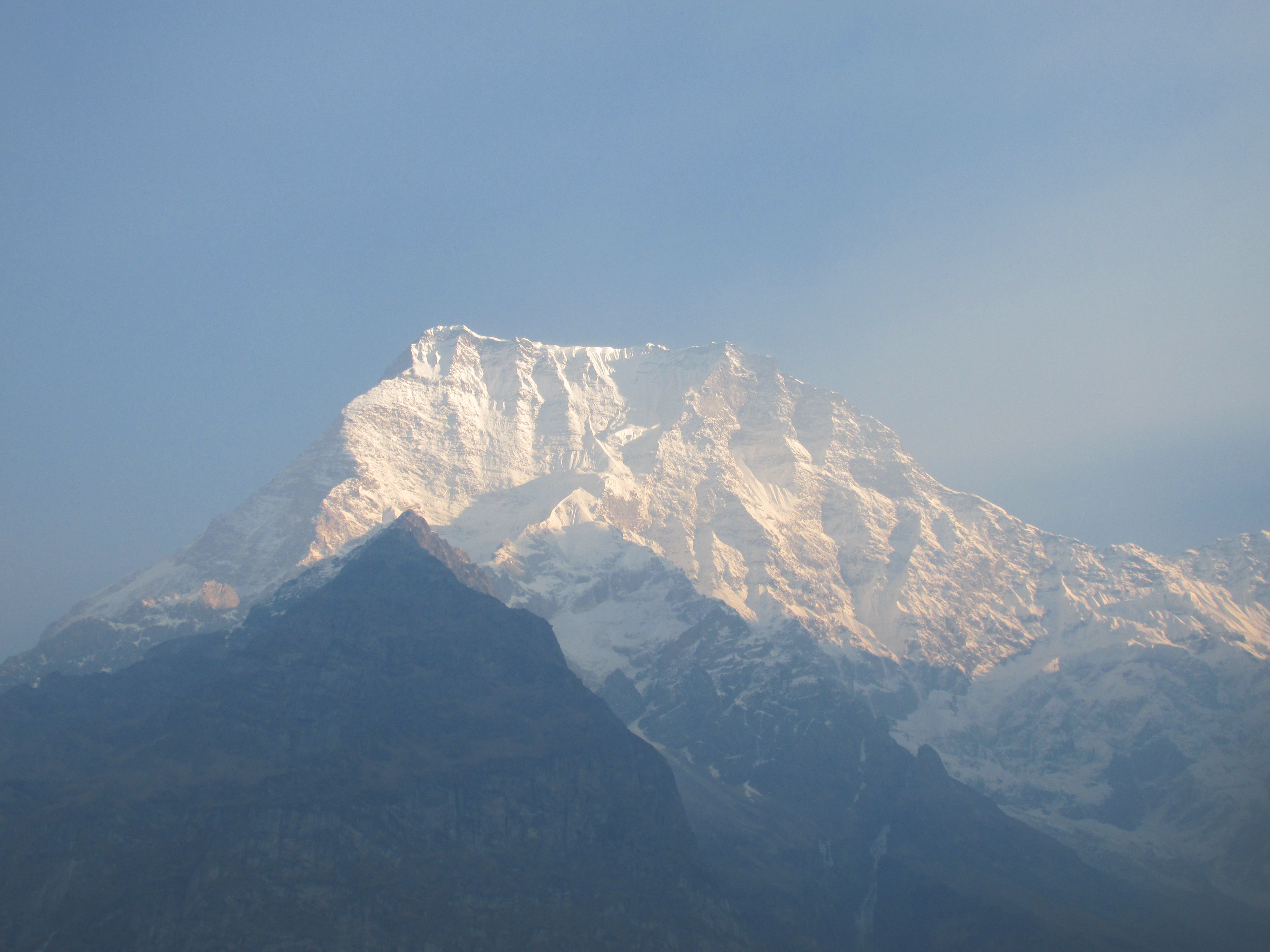
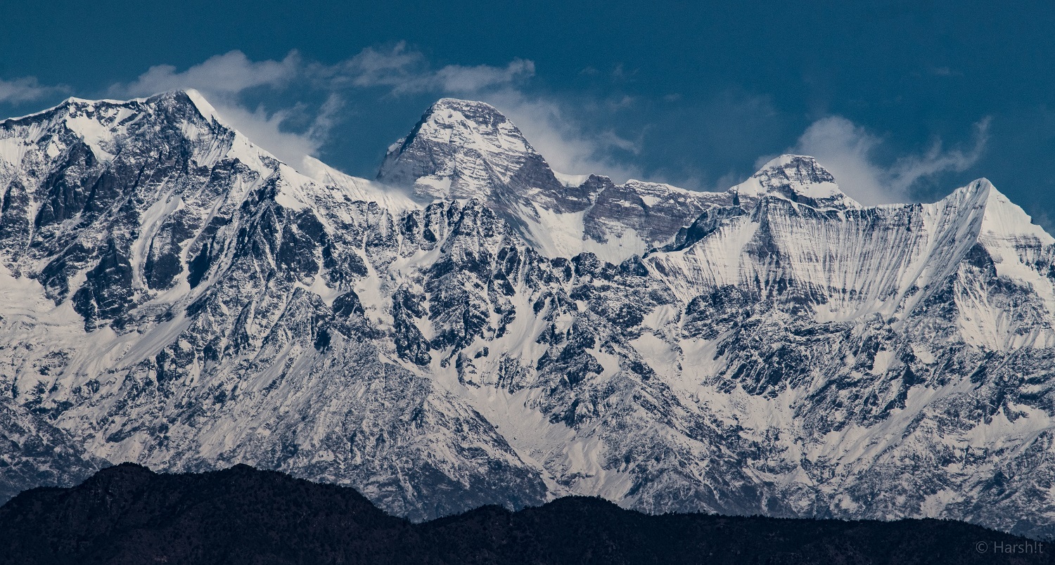
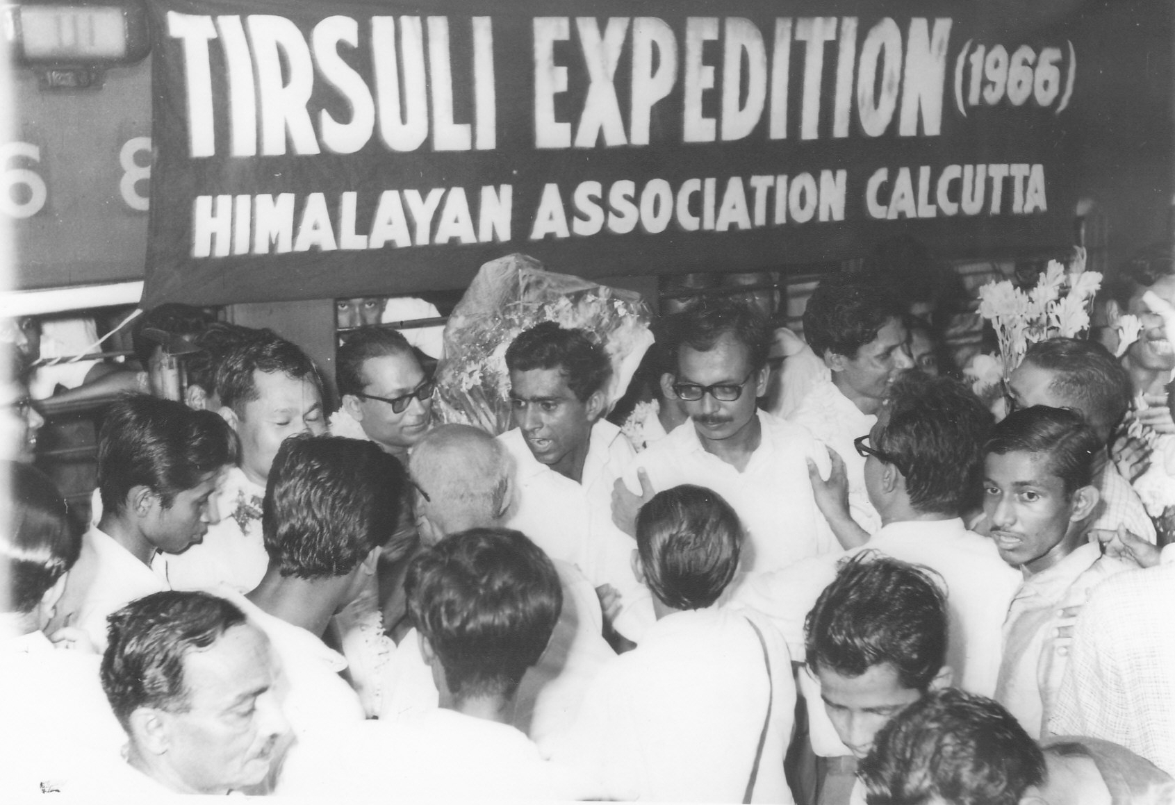
Tirsuli is a Himalayan mountain peak in the Pithoragarh district of Uttarakhand, India. It is part of the complex of mountains, including Tirsuli West, Hardeol, Dunagiri, Changabang, and Kalanka, which make up the northeast wall of the Nanda Devi Sanctuary, in the Garhwal Himalaya. It rises at the northern end of the Johar Valley, which drains into the Gori Ganga. This peak should not be confused with nearby Trisul, which is on the southwest side of the Sanctuary. In 1939, a serious attempt on this peak by the successful Polish expedition to Nanda Devi East was abandoned after a night avalanche buried leader Adam Karpinski and climber Stefan Bernadzikiewicz at Camp 3.Jill Neate, ''High Asia: An illustrated history of the 7000 metre peaks'', The Mountaineers, 1989, 0-89886-238-8, p. 89. Indian team led by Mohan Singh Kohli from Indian Mountaineering Foundation, under Ministry of Defence, Government of India tried an unsuccessful attempt to the peak in 1964. Another team led by K ... [...More Info...] [...Related Items...] OR: [Wikipedia] [Google] [Baidu] |


.jpg)


