|
Satsunan Islands
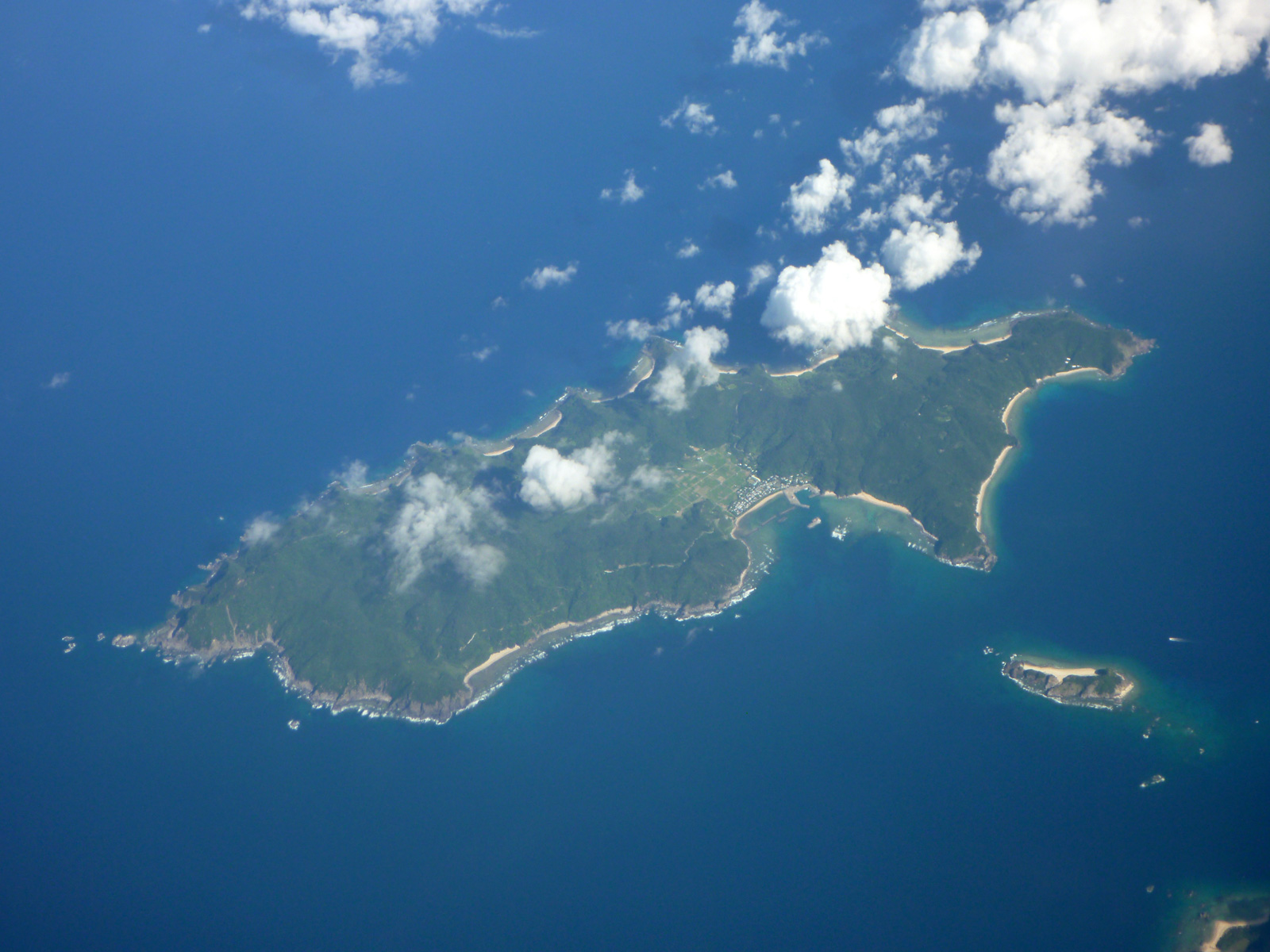
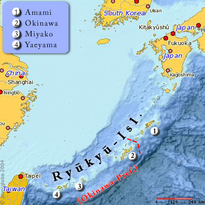
The is a geopolitical name for a group of islands that forms the northern part of the Ryukyu Islands. The whole island group belongs to Kagoshima Prefecture, Japan. Major islands * Satsunan Islands ** Ōsumi Islands with: *** Tanegashima, Yakushima, Kuchinoerabu-jima, Mageshima in the North-Eastern Group, *** Takeshima, Iōjima, Kuroshima in the North-Western Group. ** Tokara Islands (The ''Shichi-tō''): Kuchi-no-shima, Naka-no-shima, Gajajima, Suwanose-jima, Akuseki-jima, Tairajima, Kodakara-jima, Takara-jima ** Amami Islands: Amami Ōshima, Kikaigashima, Kakeromajima, Yoroshima, Ukeshima, Tokunoshima, Okinoerabujima, Yoronjima History Although Satsunan literally means the south of Satsuma Province, the north-eastern group of the Ōsumi Islands formed Tane Province for a brief period in the 8th and 9th centuries and then were merged into Ōsumi Province. The Tokara Islands and the northwestern group of the Ōsumi Islands belonged to Kawanabe District of Satsuma P ... [...More Info...] [...Related Items...] OR: [Wikipedia] [Google] [Baidu] |
Suwanose-jima
is one of the Tokara Islands, belonging to Kagoshima Prefecture. The island covers 27.66 km² in area and has a population of 48 people. Although the island has an airport, there are no regularly scheduled services, and access is normally by ferry to the city of Kagoshima on the mainland. The island is about nine hours by boat from the mainland. The islanders are dependent mainly on agriculture, fishing and seasonal tourism. Geography Suwanosejima is the second largest of the islands in the Tokara archipelago, and is located southwest from Nakanoshima. The highest elevation is , with a height of above sea level, which is the exposed cone of an active stratovolcano arising from the ocean floor. The local climate is classified as subtropical, with a rainy season from May through September. History Suwanosejima has been populated sporadically (depending on volcanic activity), for several thousand years. The island was once part of the Ryukyu Kingdom. During the Edo perio ... [...More Info...] [...Related Items...] OR: [Wikipedia] [Google] [Baidu] |
Yoronjima
, also known as Yoron, is one of the Amami Islands.''Teikoku's Complete Atlas of Japan'', Teikoku-Shoin Co., Ltd., Tokyo, The island, 20.8 km² (8 sq. mi.) in area, has a population of approximately 6,000 people, and is administered as the town of Yoron, Kagoshima. Much of the island is within the borders of the Amami Guntō National Park. Geography Yoronjima is the southernmost of the Amami Islands and is located approximately north of Hedo Point, the northernmost point of Okinawa Island, and south of the southern tip of Kyushu. The island is an elevated coralline island with a highest point above sea level. The coast of the island is surrounded by a coral reef. Climate Yoronjima has a humid subtropical climate (Köppen climate classification ''Cfa'') with very warm summers and mild winters. Precipitation is significant throughout the year, but is somewhat lower in winter. The island is subject to frequent typhoons. History It is uncertain when Yoron Island was fi ... [...More Info...] [...Related Items...] OR: [Wikipedia] [Google] [Baidu] |
Okinoerabujima
, also known as Okinoerabu, is one of the Satsunan Islands, classed with the Amami archipelago between Kyūshū and Okinawa. The island, 93.63 km² in area, has a population of approximately 14,000 persons. Administratively it is divided into the towns of Wadomari and China in Kagoshima Prefecture. Much of the island is within the borders of the Amami Guntō National Park. Geography Okinoerabujima is isolated from the other Amami islands, and is located in between Tokunoshima and Yoronjima, approximately south of the southern tip of Kyūshū and north of Okinawa. The island is an elevated coralline island with a length of approximately and width of , with Mount Ōyama at above sea level at its highest peak. In the eastern part of the island is an extensive limestone cave system, one of the largest in Asia. The coast of the island is surrounded by a coral reef. Climate Okinoerabujima has a humid subtropical climate (Köppen climate classification ''Cfa'') with very warm su ... [...More Info...] [...Related Items...] OR: [Wikipedia] [Google] [Baidu] |
Tokunoshima
, also known in English as is an island in the Amami archipelago of the southern Satsunan Islands of Kagoshima Prefecture, Japan. The island, in area, has a population of approximately 27,000. The island is divided into three administrative towns: Tokunoshima, Isen, and Amagi. The largest population center on the island is the town of Kametsu, located along the eastern shore of the island within the administrative town of Tokunoshima. Much of the island is within the borders of Amami Guntō National Park. The island is known for having the highest birth rates in Japan as well as a significant population of supercentenarians (people living significantly beyond the age of 100). Geography Tokunoshima is the second largest island in the Amami islands, after Amami Ōshima, and the 15th largest island in Japan. It is more generally included within the Satsunan and Ryukyu archipelagos. Isolated from the other Amami islands, Tokunoshima is located halfway between Amami Ōshima an ... [...More Info...] [...Related Items...] OR: [Wikipedia] [Google] [Baidu] |
Ukejima
Uke Island, or , is one of the Satsunan Islands of Japan, classed with the Amami archipelago between Kyūshū and Okinawa.''Teikoku's Complete Atlas of Japan'', Teikoku-Shoin Co., Ltd., Tokyo, The island, 13.34 km² in area, has a population of approximately 200 persons. Administratively it is part of the town of Setouchi in Kagoshima Prefecture. Much of the island is within the borders of the Amami Guntō Quasi-National Park. Economically, the islanders engage in commercial fishing and seasonal tourism. Geography Ukejima is an island southeast of Kakeromajima, from which it is separated by a narrow strait. The second smallest inhabited island in the archipelago, the island has an area of . The highest point, Mount Ōyama is above sea level. The coast of the island is surrounded by a coral reef. As with nearby Yoroshima to the northwest, the island is noted for its high density of ''habu'' poisonous vipers. The climate of Ukejima is classified as has a humid subtropica ... [...More Info...] [...Related Items...] OR: [Wikipedia] [Google] [Baidu] |
Yoroshima
is one of the Satsunan Islands, classed with the Amami archipelago between Kyūshū and Okinawa.''Teikoku's Complete Atlas of Japan'', Teikoku-Shoin Co., Ltd., Tokyo, , The island, 9.35 km² in area, has a population of approximately 140 persons, and is administered as the town of Setouchi, Kagoshima, on neighboring Amami-Oshima. Much of the island is within the borders of the Amami Guntō Quasi-National Park. Geography Yorojima is the smallest inhabited island in the Amami archipelago, and is located offshore to the south of Amami-Ōshima, from which it can be reached by ferry in 80 minutes. The island is an elevated coralline island with its highest point, Okachiyama, at above sea level. The island is noted for a high population density of ''habu'' poisonous vipers. Climate Yorojima has a humid subtropical climate (Köppen climate classification ''Cfa'') with very warm summers and mild winters. Precipitation is significant throughout the year, but is somewhat lower ... [...More Info...] [...Related Items...] OR: [Wikipedia] [Google] [Baidu] |
Kakeromajima
or Kakeroma-tō is one of the Satsunan Islands, classed with the Amami archipelago between Kyūshū and Okinawa. The island, in area, has a population of approximately 1,600 persons. Administratively it is part of the town of Setouchi in Kagoshima Prefecture. Much of the island is within the borders of the Amami Guntō Quasi-National Park. Geography Kakeromajima is a rugged island southeast of Amami Ōshima, from which it is separated by a narrow strait. The island has an area of , but a coastline approximately . The highest point is above sea level. The coast of the island is surrounded by a coral reef. The climate of Kakeromajima is classified as a humid subtropical climate (Köppen climate classification ''Cfa'') with very warm summers and mild winters. The rainy season lasts from May through September. The island is subject to frequent typhoons. History It is uncertain when Kakeromajima was first settled. The island came under the control of the Satsuma Domain in ... [...More Info...] [...Related Items...] OR: [Wikipedia] [Google] [Baidu] |
Kikaigashima
is one of the Satsunan Islands, classed with the Amami archipelago between Kyūshū and Okinawa. The island, in area, has a population of approximately 7,657 persons. Administratively the island forms the town of Kikai, Kagoshima Prefecture. Much of the island is within the borders of the Amami Guntō Quasi-National Park. Geography Kikaijima is isolated from the other Amami islands, and is located approximately east of Amami Ōshima and approximately south of the southern tip of Kyūshū. It is the easternmost island in the Amami chain. Compared with Amami Ōshima and Tokunoshima, Kikaijima is a relatively flat island, with its highest point at above sea level. It is a raised coral island with limestone cliffs, and draws the attention of geologists as it is one of the fastest rising coral islands in the world. Climate The climate of Kikaijima is classified as has a humid subtropical climate (Köppen climate classification ''Cfa'') with very warm summers and mild wint ... [...More Info...] [...Related Items...] OR: [Wikipedia] [Google] [Baidu] |
Amami Ōshima
, also known as Amami, is the largest island in the Amami archipelago between Kyūshū and Okinawa. It is one of the Satsunan Islands. The island, 712.35 km2 in area, has a population of approximately 73,000 people. Administratively it is divided into the city of Amami, the towns of Tatsugō, Setouchi, and the villages of Uken and Yamato in Kagoshima Prefecture. Much of the island is within the borders of the Amami Guntō National Park. In 2021, it was listed as part of the serial UNESCO World Heritage Site of Amami-Ōshima Island, Tokunoshima Island, northern part of Okinawa Island, and Iriomote Island. History It is uncertain when Amami Ōshima was first settled. Stone tools indicate settlement in the Japanese Paleolithic period, and other artifacts, including pottery, indicate a constant contact with Jōmon, Yayoi and Kofun period Japan. The island is mentioned in the ancient Japanese chronicle '' Nihon Shoki'' in an entry for the year 657 AD. During the Nara peri ... [...More Info...] [...Related Items...] OR: [Wikipedia] [Google] [Baidu] |
Amami Islands
The The name ''Amami-guntō'' was standardized on February 15, 2010. Prior to that, another name, ''Amami shotō'' (奄美諸島), was also used. is an archipelago in the Satsunan Islands, which is part of the Ryukyu Islands, and is southwest of Kyushu. Administratively, the group belongs to Kagoshima Prefecture, Japan. The Geospatial Information Authority of Japan and the Japan Coast Guard agreed on February 15, 2010, to use the name of for the Amami Islands. Prior to that, was also used. The name of Amami is probably cognate with , the goddess of creation in the Ryukyuan creation myth. Geography The Amami Islands are limestone islands of coralline origin and have a total area of approximately , of which constitute the city (''-shi'') of Amami, and constitute the district (''-gun'') of Oshima. The highest elevation is ''Yuwandake'' with a height of on Amami Ōshima. The climate is a humid subtropical climate (Köppen climate classification ''Cfa'') with very warm summer ... [...More Info...] [...Related Items...] OR: [Wikipedia] [Google] [Baidu] |
Takara-jima
, literally "treasure island", is one of the Tokara Islands, belonging to Kagoshima Prefecture. The island, 7.14 km² in area, has a population of 116 persons. The island can only be reached by boat as it has no airport; there is regular ferry service to the city of Kagoshima on the mainland of Kyushu. Travel time is about 13 hours. The islanders are dependent mainly on fishing and seasonal tourism. Geography Takarajima is the southernmost inhabited island in the Tokara archipelago, and is located from Kagoshima Port and north from Amami Ōshima. The highest peak, Imakiradake has a height of above sea level The island is surrounded by a coral reef. Its climate is classified as subtropical, with a rainy season from May through September. History Numerous ceramic shards and the foundations of dwellings from the late Jōmon period and Yayoi period indicate that Takarajima has been continuously inhabited for at least the past 2000 years. Until 1624, the island was part of the ... [...More Info...] [...Related Items...] OR: [Wikipedia] [Google] [Baidu] |


