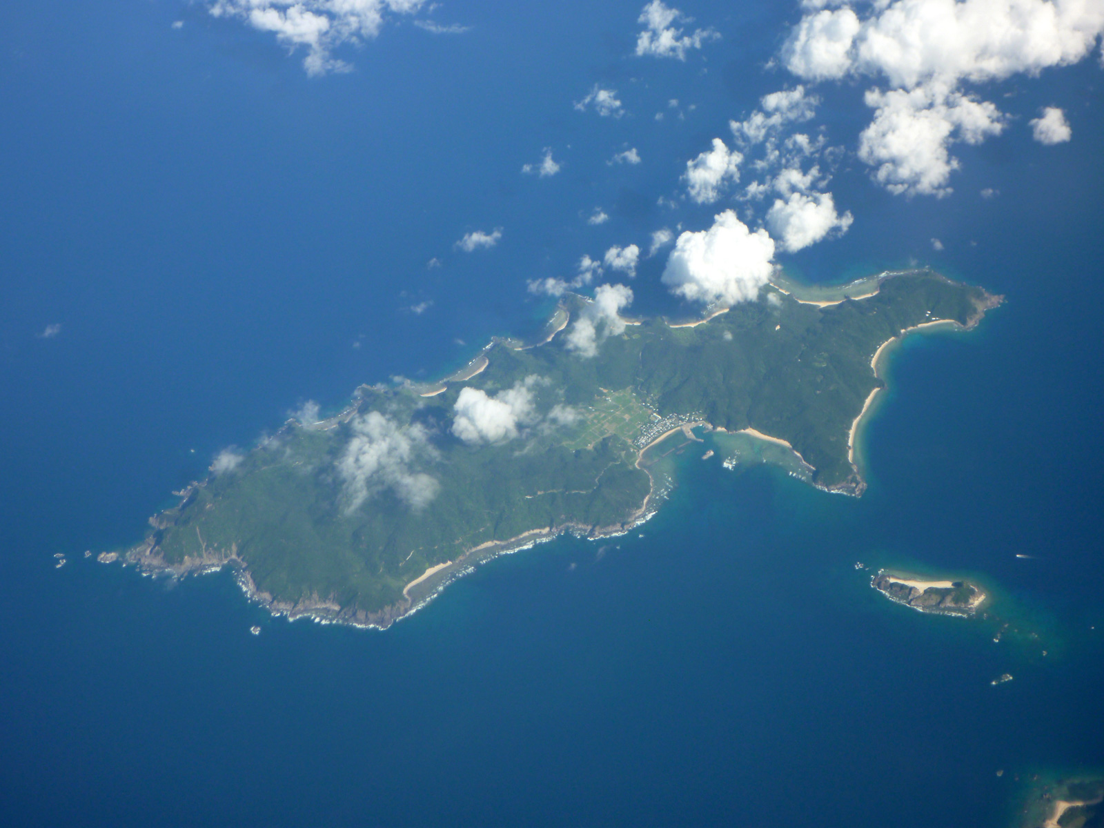
Yoroshima on:
[Wikipedia]
[Google]
[Amazon]
 is one of the
 is one of the
 Satsunan Islands
The is a geopolitical name for a group of islands that forms the northern part of the Ryukyu Islands. The whole island group belongs to Kagoshima Prefecture, Japan.
Major islands
* Satsunan Islands
** ĹŚsumi Islands with:
*** Tanegashima, Yak ...
, classed with the Amami archipelago between Kyūshū and Okinawa
is a prefecture of Japan. Okinawa Prefecture is the southernmost and westernmost prefecture of Japan, has a population of 1,457,162 (as of 2 February 2020) and a geographic area of 2,281 km2 (880 sq mi).
Naha is the capital and largest city ...
.''Teikoku's Complete Atlas of Japan'', Teikoku-Shoin Co., Ltd., Tokyo, ,
The island, 9.35 km² in area, has a population of approximately 140 persons, and is administered as the town of Setouchi, Kagoshima
is a town located primarily on Amami ĹŚshima, in ĹŚshima District, Kagoshima Prefecture, Japan.
As of June 2013, the town had an estimated population of 9,379 and a population density of 39.1 persons per km². The total area was 239.91 ...
, on neighboring Amami-Oshima. Much of the island is within the borders of the Amami GuntĹŤ Quasi-National Park
The The name ''Amami-guntō'' was standardized on February 15, 2010. Prior to that, another name, ''Amami shotō'' (奄美諸島), was also used. is an archipelago in the Satsunan Islands, which is part of the Ryukyu Islands, and is southwest of ...
.
Geography
Yorojima is the smallest inhabited island in the Amami archipelago, and is located offshore to the south of Amami-ĹŚshima, from which it can be reached by ferry in 80 minutes. The island is an elevated coralline island with its highest point, Okachiyama, at above sea level. The island is noted for a high population density of '' habu'' poisonous vipers.Climate
Yorojima has a humid subtropical climate (Köppen climate classification
The Köppen climate classification is one of the most widely used climate classification systems. It was first published by German-Russian climatologist Wladimir Köppen (1846–1940) in 1884, with several later modifications by Köppen, nota ...
''Cfa'') with very warm summers and mild winters. Precipitation is significant throughout the year, but is somewhat lower in winter. The island is subject to frequent typhoon
A typhoon is a mature tropical cyclone that develops between 180° and 100°E in the Northern Hemisphere. This region is referred to as the Northwestern Pacific Basin, and is the most active tropical cyclone basin on Earth, accounting for a ...
s.
History
After theMeiji Restoration
The , referred to at the time as the , and also known as the Meiji Renovation, Revolution, Regeneration, Reform, or Renewal, was a political event that restored practical imperial rule to Japan in 1868 under Emperor Meiji. Although there were r ...
the island was incorporated into ĹŚsumi Province
was an old province of Japan in the area that is today the eastern part of Kagoshima Prefecture. It was sometimes called . Ōsumi bordered on Hyūga and Satsuma Provinces.
Osumi's ancient capital was near modern Kokubu. During the Sengoku ...
and later became part of Kagoshima Prefecture. Following World War II
World War II or the Second World War, often abbreviated as WWII or WW2, was a world war that lasted from 1939 to 1945. It involved the World War II by country, vast majority of the world's countries—including all of the great power ...
, although with the other Amami Islands, it was occupied by the United States
The United States of America (U.S.A. or USA), commonly known as the United States (U.S. or US) or America, is a country primarily located in North America. It consists of 50 U.S. state, states, a Washington, D.C., federal district, five ma ...
until 1953, at which time it reverted to the control of Japan.
References
*National Geospatial Intelligence Agency (NGIA). ''Prostar Sailing Directions 2005 Japan Enroute''. Prostar Publications (2005).External links
{{DEFAULTSORT:Yorojima Amami Islands Islands of Kagoshima Prefecture