|
Saskatchewan Highway 956
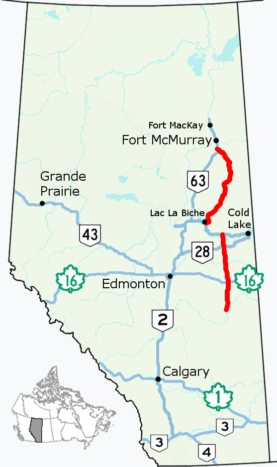
Highway 956, also known as the Garson Lake Road, is a provincial highway in the Canadian province of Saskatchewan. It runs from the Alberta border until Highway 155. The highway is 44 km (27 mi.) long. Highway 956 is meant to connect the community of La Loche to Fort McMurray, Alberta. Beyond the Alberta border, the same route continues west as the 65-km La Loche Winter Trail winter road to Alberta Highway 881, about 25 km south of Anzac, Alberta and about 75 km south of Fort McMurray. History *Construction began in 1986 and completed in 1999. *In 1999, as part of the Saskatchewan provincial budget, a project was begun to gravel 30 km of Highway 956. *In September 2005, to celebrate the centennials of Saskatchewan and Alberta, Saskatchewan Premier Lorne Calvert and Alberta Premier Ralph Klein announced a project costing $45 million to connect La Loche and Fort McMurray with an all-season road. The premiers explained that this would create economic ... [...More Info...] [...Related Items...] OR: [Wikipedia] [Google] [Baidu] |
Alberta
Alberta ( ) is one of the thirteen provinces and territories of Canada. It is part of Western Canada and is one of the three prairie provinces. Alberta is bordered by British Columbia to the west, Saskatchewan to the east, the Northwest Territories (NWT) to the north, and the U.S. state of Montana to the south. It is one of the only two landlocked provinces in Canada (Saskatchewan being the other). The eastern part of the province is occupied by the Great Plains, while the western part borders the Rocky Mountains. The province has a predominantly continental climate but experiences quick temperature changes due to air aridity. Seasonal temperature swings are less pronounced in western Alberta due to occasional Chinook winds. Alberta is the fourth largest province by area at , and the fourth most populous, being home to 4,262,635 people. Alberta's capital is Edmonton, while Calgary is its largest city. The two are Alberta's largest census metropolitan areas. More tha ... [...More Info...] [...Related Items...] OR: [Wikipedia] [Google] [Baidu] |
Fort McMurray
Fort McMurray ( ) is an urban service area in the Regional Municipality of Wood Buffalo in Alberta, Canada. It is located in northeast Alberta, in the middle of the Athabasca oil sands, surrounded by boreal forest. It has played a significant role in the development of the national petroleum industry. The 2016 Fort McMurray wildfire led to the evacuation of its residents and caused widespread damage. Formerly a city, Fort McMurray became an urban service area when it amalgamated with Improvement District No. 143 on April 1, 1995, to create the Municipality of Wood Buffalo (renamed the RM of Wood Buffalo on August 14, 1996). Despite its current official designation of urban service area, many locals, politicians and the media still refer to Fort McMurray as a city. Fort McMurray was known simply as McMurray between 1947 and 1962. History Before the arrival of Europeans in the late 18th century, the Cree were the dominant First Nations people in the Fort McMurray area. T ... [...More Info...] [...Related Items...] OR: [Wikipedia] [Google] [Baidu] |
Roads In Saskatchewan
Saskatchewan, the middle of Canada's three prairie provinces, has an area of and population of 1,150,632 (according to 2016 estimates), mostly living in the southern half of the province. Currently Ministry of Highways and Infrastructure operates over 26,000 km of highways and divided highways, over 800 bridges, 12 separate ferries, one barge. There are also municipal roads which comprise different surfaces. Asphalt concrete pavements comprise almost 9,000 km, granular pavement almost 5,000 km, non structural or thin membrane surface TMS are close to 7,000 km and finally gravel highways make up over 5,600 km through the province. TMS roads are maintained by the provincial government department: Saskatchewan Highways and Transportation. In the northern sector, ice roads which can only be navigated in the winter months comprise another approximately 150 km of travel. Dirt roads also still exist in rural areas and would be maintained by the local resi ... [...More Info...] [...Related Items...] OR: [Wikipedia] [Google] [Baidu] |
Ralph Klein
Ralph Philip Klein (November 1, 1942 – March 29, 2013) was a Canadian politician and journalist who served as the 12th premier of Alberta and leader of the Progressive Conservative Association of Alberta from 1992 until his retirement in 2006. Klein also served as the 32nd mayor of Calgary from 1980 to 1989. Ralph was born and mostly grew up in Calgary, Alberta. After dropping out of High School in grade 11, Klein joined the Royal Canadian Air Force reserves for one year and then attended the Calgary Business College. Klein later worked as a teacher and principal at the Calgary Business College, and later public relations with non-profits. After that, Klein became a prominent local journalist in Calgary where he reported on the challenges of the working class, social outcasts and First Nations, endearing himself to those groups. In 1980, Klein turned his attention to politics and as an underdog was elected Mayor of Calgary, where he oversaw the boom and bust of the oil indu ... [...More Info...] [...Related Items...] OR: [Wikipedia] [Google] [Baidu] |
Lorne Calvert
Lorne Albert Calvert (born December 24, 1952) was the 13th premier of Saskatchewan, from 2001 to 2007. Calvert served as leader of the Saskatchewan New Democratic Party from 2001 to June 6, 2009, when he was succeeded by Dwain Lingenfelter. Early life and career Calvert was born in Moose Jaw, Saskatchewan. In 1975, Calvert married Betty Sluzalo of Perdue, Saskatchewan. He received his undergraduate degree in economics at the University of Regina. He originally was going to study law, but felt the calling to the ministry of the United Church of Canada. After attending the then- Regina Campus and the St. Andrew's College seminary in Saskatoon, he was ordained as minister of the United Church of Canada in 1976 and served as minister of several rural congregations. From 1979 to 1986, Calvert was the minister of the substantial pastoral charge of Zion United Church in Moose Jaw. Entry into provincial politics He entered provincial politics in the 1986 provincial election, running a ... [...More Info...] [...Related Items...] OR: [Wikipedia] [Google] [Baidu] |
Anzac, Alberta
Anzac is a hamlet in northern Alberta, Canada within the Regional Municipality (RM) of Wood Buffalo. It is located on Highway 881 along the east shore of Gregoire Lake, approximately southeast of Fort McMurray. History Anzac was named for the Australian and New Zealand Army Corps during World War I, when the Alberta and Great Waterways Railway was being built from Carbondale to Waterways. Originally named after Willow Lake, the previous name of Gregoire Lake, the community were mostly non-status or non-treaty Cree whose ancestors had migrated to the Athabasca Basin area from what was to become northern Manitoba, mostly displacing the original Beaver and Chipewyan occupants of the area. During World War II a road was built from the rail siding to service and construct a US Army base on Stoney Mountain. The area has seen significant growth corresponding to that of Fort McMurray and the oil industry. The hamlet was ordered to be evacuated on May 5, 2016, due to the spread ... [...More Info...] [...Related Items...] OR: [Wikipedia] [Google] [Baidu] |
Alberta Highway 881
Alberta Provincial Highway No. 881, commonly referred to as Highway 881, is a highway split into two sections in northeast Alberta, Canada. Each section is over in length; the southern portion runs from Highway 13 in Hardisty to Highway 55 northwest of Bonnyville, while the northern section stretches from Highway 55 in Lac La Biche to the south side of Fort McMurray, serving as an important alternate route to Highway 63. A section of Highway 55 joins the two sections. Lac La Biche County is lobbying the Government of Alberta to renumber the section of Highway 881 between Lac La Biche and Fort McMurray to Highway 36. Both sections are entirely paved. This highway is also 49 Street in Hardisty, 53 Street in Irma, 47 Street in Mannville, 50 Street in Myrnam, and 40 Street in St. Paul. Future In October 2012, the Government of Alberta announced $158 million in funding to improve Highway 881 be ... [...More Info...] [...Related Items...] OR: [Wikipedia] [Google] [Baidu] |
Winter Road
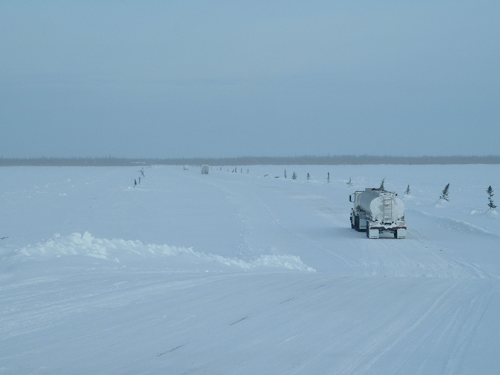
A winter road is a seasonal road only usable during the winter, i.e. it has to be re-built every year. This road typically runs over land and over frozen lakes, rivers, swamps, and sea ice.Proskin et al, 2011. Guidelines for the Construction and Operation of Winter Roads, Transportation Association of Canada.- IHSA, 2014. Best practices for building and working safely on ice covers in Ontario, Mississauga, Ontario, 43 p.- NorthWest Territories Transportation, 2015. Guidelines for safe ice construction, Yellowknife, NWT, Canada, 44 p.Spencer, P.A., Strandberg, A.G. and Maddock, W.A., 2008. Ice and toundra road design for module transport, Proceedings of the 8th International Conference on Ships and Marine Structures in Cold Regions (ICETECH), Banff. Segments of a winter road that cross an expanse of floating ice are also referred to as an ice road or an ice bridge. The foundations underlying over-land segments is most often native soil or muskeg frozen to a given depth, and local ... [...More Info...] [...Related Items...] OR: [Wikipedia] [Google] [Baidu] |
Saskatchewan Highway 155
Highway 155 is a paved undivided highway in the Canadian province of Saskatchewan. It runs from Highway 55 near Green Lake until La Loche, where it intersects with Highway 955. Highway 155 is about long. Communities accessible directly from Highway 155 are Green Lake, Buffalo Narrows, Landing, Bear Creek, and La Loche. Many provincial recreation sites are also accessible from Highway 155. Highway 155 connects with Highways 55, 165, 965, 908, 925, 909, 956, and 955. History Highway 155 was begun in 1947 as a development road. It reached Buffalo Narrows in 1957 where a ferry was needed to cross the Kisis Channel. The road closely followed the path of the old wagon trail established by the Hudson's Bay Company. The official opening of Highway 155 from Green Lake to Buffalo Narrows was held in August 1963 in Green Lake. The old trail to La Loche was rebuilt soon after to become part of Highway 155. A bridge built in 1981 now crosses the Kisis Channel next to where the ... [...More Info...] [...Related Items...] OR: [Wikipedia] [Google] [Baidu] |
Garson Lake, Saskatchewan
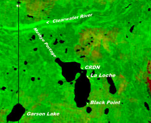
Garson Lake is a northern settlement in Saskatchewan on the eastern shore of Garson Lake. It is located near the Alberta border and can be accessed by Highway 956 off of Highway 155. A winter road connects it to Fort McMurray, Alberta in the winter months. Garson Lake is from La Loche and from Fort McMurray. The population of this northern settlement is 34 and is led by Chairman Donald A. Laprise. The northern settlement is an unincorporated community in the Northern Saskatchewan Administration District. History The lake has been called Swan Lake then Whitefish Lake (Lac Poisson Blanc in French). In 1911 the lake was renamed Garson Lake after a Hudson's Bay Company post manager at Onion Lake, Saskatchewan. Mgr. Grandin O.M.I. wrote in 1880 that there were 200 people at La Loche Lake and Whitefish Lake. In 1895, Father Penard of the La Loche Mission wrote that there was a settlement of 50 people at Whitefish Lake. On August 4, 1899 the Dene residents of Garson Lake s ... [...More Info...] [...Related Items...] OR: [Wikipedia] [Google] [Baidu] |
Saskatchewan
Saskatchewan ( ; ) is a Provinces and territories of Canada, province in Western Canada, western Canada, bordered on the west by Alberta, on the north by the Northwest Territories, on the east by Manitoba, to the northeast by Nunavut, and on the south by the United States, U.S. states of Montana and North Dakota. Saskatchewan and Alberta are the only landlocked provinces of Canada. In 2022, Saskatchewan's population was estimated at 1,205,119. Nearly 10% of Saskatchewan’s total area of is fresh water, mostly rivers, reservoirs and List of lakes in Saskatchewan, lakes. Residents primarily live in the southern prairie half of the province, while the northern half is mostly forested and sparsely populated. Roughly half live in the province's largest city Saskatoon or the provincial capital Regina, Saskatchewan, Regina. Other notable cities include Prince Albert, Saskatchewan, Prince Albert, Moose Jaw, Yorkton, Swift Current, North Battleford, Melfort, Saskatchewan, Melfort, and ... [...More Info...] [...Related Items...] OR: [Wikipedia] [Google] [Baidu] |
Provinces And Territories Of Canada
Within the geographical areas of Canada, the ten provinces and three territories are sub-national administrative divisions under the jurisdiction of the Canadian Constitution. In the 1867 Canadian Confederation, three provinces of British North America—New Brunswick, Nova Scotia, and the Province of Canada (which upon Confederation was divided into Ontario and Quebec)—united to form a federation, becoming a fully independent country over the next century. Over its history, Canada's international borders have changed several times as it has added territories and provinces, making it the world's second-largest country by area. The major difference between a Canadian province and a territory is that provinces receive their power and authority from the ''Constitution Act, 1867'' (formerly called the ''British North America Act, 1867''), whereas territorial governments are creatures of statute with powers delegated to them by the Parliament of Canada. The powers flowing from t ... [...More Info...] [...Related Items...] OR: [Wikipedia] [Google] [Baidu] |


