|
Sangin District
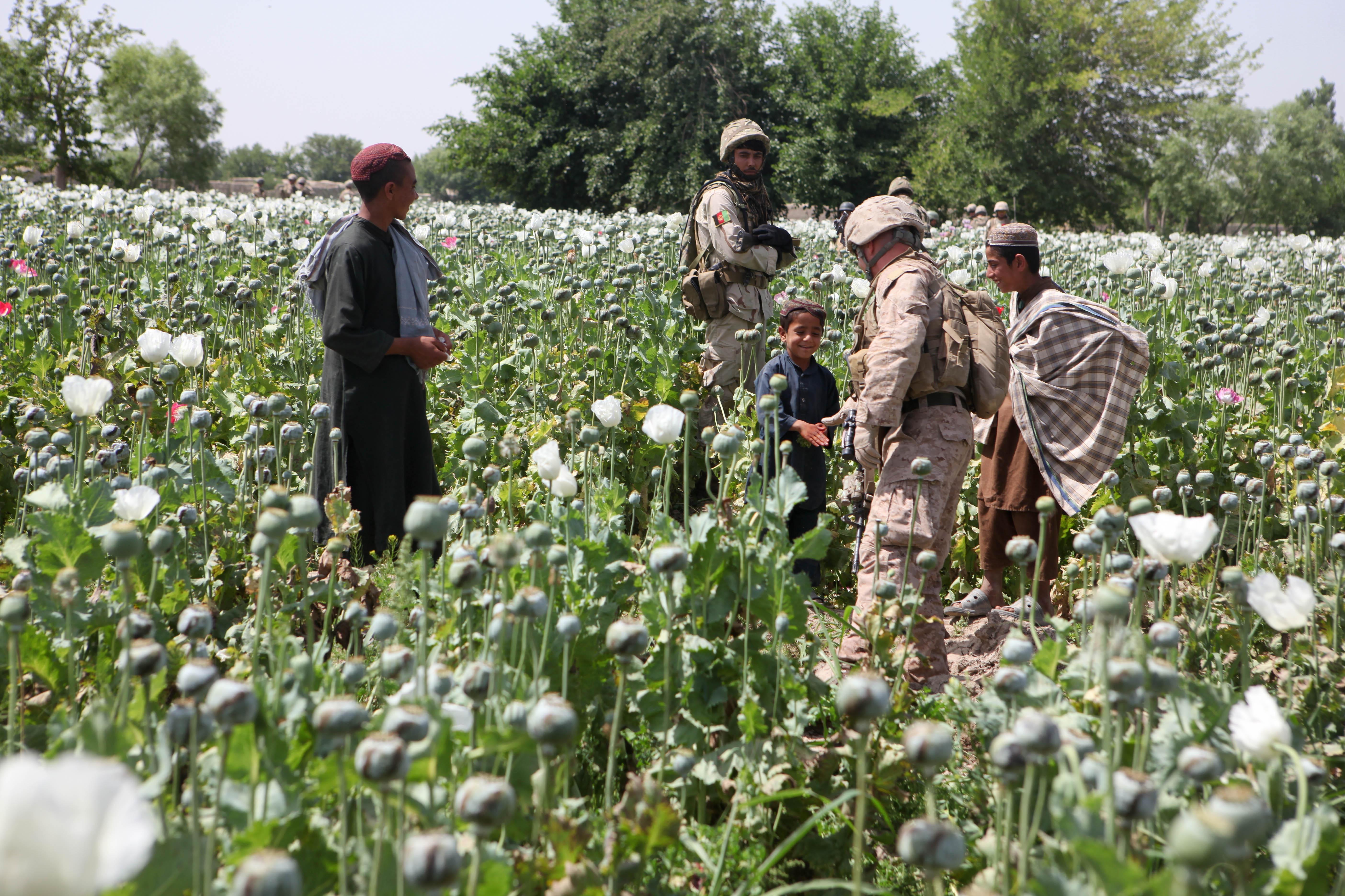
Sangin is a Districts of Afghanistan, district in the east of Helmand Province, Afghanistan. Its population was reported at 58,100 in 2012, all of which belong to Pashtun people, Pashtun ethnic group. The district centre is the town of Sangin. The area is irrigated by the Helmand and Arghandab Valley Authority.(pdf) The Helmand Valley Project in Afghanistan: A.I.D. Evaluation Special Study No. 18 C Clapp-Wicek & E Baldwin, U.S. Agency for International Development, published December 1983 See also *Districts of AfghanistanReferences External links [...More Info...] [...Related Items...] OR: [Wikipedia] [Google] [Baidu] |
Georgia (country)
Georgia (, ; ) is a transcontinental country at the intersection of Eastern Europe and Western Asia. It is part of the Caucasus region, bounded by the Black Sea to the west, by Russia to the north and northeast, by Turkey to the southwest, by Armenia to the south, and by Azerbaijan to the southeast. The country covers an area of , and has a population of 3.7 million people. Tbilisi is its capital as well as its largest city, home to roughly a third of the Georgian population. During the classical era, several independent kingdoms became established in what is now Georgia, such as Colchis and Iberia. In the early 4th century, ethnic Georgians officially adopted Christianity, which contributed to the spiritual and political unification of the early Georgian states. In the Middle Ages, the unified Kingdom of Georgia emerged and reached its Golden Age during the reign of King David IV and Queen Tamar in the 12th and early 13th centuries. Thereafter, the kingdom decl ... [...More Info...] [...Related Items...] OR: [Wikipedia] [Google] [Baidu] |
ISAF
' ps, کمک او همکاري ' , allies = Afghanistan , opponents = Taliban Al-Qaeda , commander1 = , commander1_label = Commander , commander2 = , commander2_label = , commander3 = , commander3_label = Chief of Staff , notable_commanders = Gen. John F. Campbell (2014) , identification_symbol = , identification_symbol_label = Flags The International Security Assistance Force (ISAF) was a multinational military mission in Afghanistan from 2001 to 2014. It was established by United Nations Security Council Resolution 1386 pursuant to the Bonn Agreement, which outlined the establishment of a permanent Afghan government following the U.S. invasion in October 2001. ISAF's primary goal was to train the Afghan National Security Forces (ANSF) and assist Afghanistan in rebuilding key government institutions; it gradually took part in the broader war in Afghanistan against the Taliban insurgency. ISAF's initial mandate was to ... [...More Info...] [...Related Items...] OR: [Wikipedia] [Google] [Baidu] |
Helmand Province
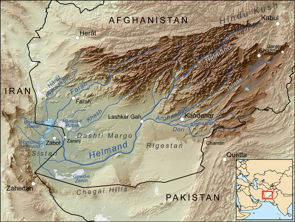
Helmand (Pashto/Dari: ; ), also known as Hillmand, in ancient times, as Hermand and Hethumand, is one of the 34 provinces of Afghanistan Afghanistan is divided into 34 provinces (, '' wilåyat''). The provinces of Afghanistan are the primary administrative divisions. Each province encompasses a number of districts or usually over 1,000 villages. Provincial governors played a cr ..., in the south of the country. It is the largest province by area, covering area. The province contains 13 Districts of Afghanistan, districts, encompassing over 1,000 villages, and roughly 1,446,230 settled people. Lashkargah serves as the provincial capital. Helmand was part of the ''Loy Kandahar, Greater Kandahar'' region until made into a separate province by the Politics of Afghanistan, Afghan government in the 20th century. The Helmand River flows through the mainly desert region of the province, providing water used for irrigation. The Kajaki Dam, which is one of List of dams and reservoi ... [...More Info...] [...Related Items...] OR: [Wikipedia] [Google] [Baidu] |
Afghanistan
Afghanistan, officially the Islamic Emirate of Afghanistan,; prs, امارت اسلامی افغانستان is a landlocked country located at the crossroads of Central Asia and South Asia. Referred to as the Heart of Asia, it is bordered by Pakistan to the Durand Line, east and south, Iran to the Afghanistan–Iran border, west, Turkmenistan to the Afghanistan–Turkmenistan border, northwest, Uzbekistan to the Afghanistan–Uzbekistan border, north, Tajikistan to the Afghanistan–Tajikistan border, northeast, and China to the Afghanistan–China border, northeast and east. Occupying of land, the country is predominantly mountainous with plains Afghan Turkestan, in the north and Sistan Basin, the southwest, which are separated by the Hindu Kush mountain range. , Demographics of Afghanistan, its population is 40.2 million (officially estimated to be 32.9 million), composed mostly of ethnic Pashtuns, Tajiks, Hazaras, and Uzbeks. Kabul is the country's largest city and ser ... [...More Info...] [...Related Items...] OR: [Wikipedia] [Google] [Baidu] |
Country
A country is a distinct part of the world, such as a state, nation, or other political entity. It may be a sovereign state or make up one part of a larger state. For example, the country of Japan is an independent, sovereign state, while the country of Wales is a component of a multi-part sovereign state, the United Kingdom. A country may be a historically sovereign area (such as Korea), a currently sovereign territory with a unified government (such as Senegal), or a non-sovereign geographic region associated with certain distinct political, ethnic, or cultural characteristics (such as the Basque Country). The definition and usage of the word "country" is flexible and has changed over time. ''The Economist'' wrote in 2010 that "any attempt to find a clear definition of a country soon runs into a thicket of exceptions and anomalies." Most sovereign states, but not all countries, are members of the United Nations. The largest country by area is Russia, while the smallest is ... [...More Info...] [...Related Items...] OR: [Wikipedia] [Google] [Baidu] |
Provinces Of Afghanistan
Afghanistan is divided into 34 provinces (, '' wilåyat''). The provinces of Afghanistan are the primary administrative divisions. Each province encompasses a number of districts or usually over 1,000 villages. Provincial governors played a critical role in the reconstruction of the Afghan state following the creation of the new government under Hamid Karzai. According to international security scholar Dipali Mukhopadhyay, many of the provincial governors of the western-backed government were former warlords who were incorporated into the political system. Provinces of Afghanistan Regions of Afghanistan UN Regions Former provinces of Afghanistan During Afghanistan's history it had a number of provinces in it. It started out as just Kabul, Herat, Qandahar, and Balkh but the number of provinces increased and by 1880 the provinces consisted of Balkh, Herat, Qandahar, Ghazni, Jalalabad, and Kabul. * Southern Province – dissolved in 1964 to create Paktia Provinc ... [...More Info...] [...Related Items...] OR: [Wikipedia] [Google] [Baidu] |
Helmand Province
Helmand (Pashto/Dari: ; ), also known as Hillmand, in ancient times, as Hermand and Hethumand, is one of the 34 provinces of Afghanistan Afghanistan is divided into 34 provinces (, '' wilåyat''). The provinces of Afghanistan are the primary administrative divisions. Each province encompasses a number of districts or usually over 1,000 villages. Provincial governors played a cr ..., in the south of the country. It is the largest province by area, covering area. The province contains 13 Districts of Afghanistan, districts, encompassing over 1,000 villages, and roughly 1,446,230 settled people. Lashkargah serves as the provincial capital. Helmand was part of the ''Loy Kandahar, Greater Kandahar'' region until made into a separate province by the Politics of Afghanistan, Afghan government in the 20th century. The Helmand River flows through the mainly desert region of the province, providing water used for irrigation. The Kajaki Dam, which is one of List of dams and reservoi ... [...More Info...] [...Related Items...] OR: [Wikipedia] [Google] [Baidu] |
Districts Of Afghanistan
The districts of Afghanistan, known as ''wuleswali'' ( ps, ولسوالۍ, ''wuləswāləi''; fa, شهرستان, ''shahrestān'') are secondary-level administrative units, one level below provinces. The Afghan government issued its first district map in 1973.''Afghanistan; Districts and Codes by Province'', Edition 2.0, AID / Rep. DC&A Mapping Unit, October 1991, Peshawar, Pakista/ref> It recognized 325 districts, counting ''wuleswalis'' (districts), ''alaqadaries'' (sub-districts), and ''markaz-e-wulaiyat'' (provincial center districts). In the ensuing years, additional districts have been added through splits, and some eliminated through merges. In June 2005, the Afghan government issued a map of 398 districts. It was widely adopted by many information management systems, though usually with the addition of ''Sharak-e-Hayratan'' for 399 districts in total. It remains the ''de facto'' standard as of late 2018, despite a string of government announcements of the creation of ... [...More Info...] [...Related Items...] OR: [Wikipedia] [Google] [Baidu] |
Pashtun People
Pashtuns (, , ; ps, پښتانه, ), also known as Pakhtuns or Pathans, are an Iranian ethnic group who are native to the geographic region of Pashtunistan in the present-day countries of Afghanistan and Pakistan. They were historically referred to as Afghans () or xbc, αβγανο () until the 1970s, when the term's meaning officially evolved into that of a demonym for all residents of Afghanistan, including those outside of the Pashtun ethnicity. The group's native language is Pashto, an Iranian language in the Indo-Iranian branch of the Indo-European language family. Additionally, Dari Persian serves as the second language of Pashtuns in Afghanistan while those in the Indian subcontinent speak Urdu and Hindi (see Hindustani language) as their second language. Pashtuns are the 26th-largest ethnic group in the world, and the largest segmentary lineage society; there are an estimated 350–400 Pashtun tribes and clans with a variety of origin theories. The total popu ... [...More Info...] [...Related Items...] OR: [Wikipedia] [Google] [Baidu] |
Sangin
Sangin ( ps, سنگين) is a town in Helmand province of Afghanistan, with a population of approximately 20,000 people. It is located on in the valley of the Helmand River at altitude, to the north-east of Lashkargah. Sangin is notorious as one of the central locations of the opium trade in the south of the country, and is also a town that has traditionally supported the Taliban. It was described by British newspaper ''The Guardian'' as "the deadliest area in Afghanistan" in 2010. Sangin also houses the main bazaar for Sangin District. Route 611 passes through Sangin. Climate Sangin has a hot desert climate (Köppen ''BWh''), characterised by little precipitation and high variation between summer and winter temperatures. The average temperature in Sangin is 18.8 °C, while the annual precipitation averages 143 mm. July is the hottest month of the year with an average temperature of 31.6 °C. The coldest month January has an average temperature of 6.1 °C. ... [...More Info...] [...Related Items...] OR: [Wikipedia] [Google] [Baidu] |
Helmand And Arghandab Valley Authority
The Helmand and Arghandab Valley Authority (HAVA) based in Lashkar Gah, Afghanistan, originally named the Helmand Valley Authority (HVA) until its expansion in 1965,(pdf) The Helmand Valley Project in Afghanistan: A.I.D. Evaluation Special Study No. 18 C Clapp-Wicek & E Baldwin, U.S. Agency for International Development, published December 1983 was established on December 4, 1952, as an agency of the Afghan Government.Report on Development of Helmand Valley, Afghanistan, 1956 Tudor En ... [...More Info...] [...Related Items...] OR: [Wikipedia] [Google] [Baidu] |


