|
Sandstad
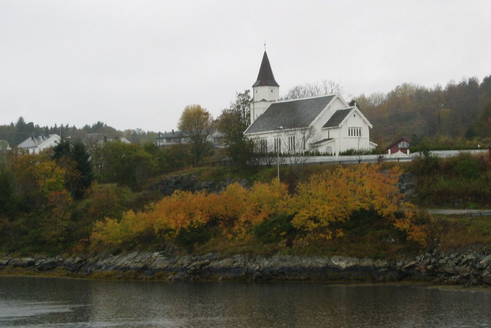
Sandstad is a village in Hitra municipality in Trøndelag county, Norway. The village is located along the Trondheimsleia on the southeastern coast of the island of Hitra, about southwest of the village of Hestvika. The north entrance to the Hitra Tunnel lies just south of the village of Sandstad. The Terningen lighthouse lies in the Trondheimsleia, about southwest of the village. In 2018, there were about 229 residents in the village. Sandstad Church is located here. The village was the administrative centre An administrative center is a seat of regional administration or local government, or a county town, or the place where the central administration of a commune is located. In countries with French as administrative language (such as Belgium, Lu ... of the old municipality of Sandstad which existed from 1 July 1914 until its dissolution on 1 January 1964. References Hitra Villages in Trøndelag {{Trøndelag-geo-stub ... [...More Info...] [...Related Items...] OR: [Wikipedia] [Google] [Baidu] |
Sandstad (municipality)
Sandstad is a former municipality in the old Sør-Trøndelag county, Norway. The municipality existed from 1914 until its dissolution in 1964 when it was merged into what is now Hitra municipality in Trøndelag county. The former municipality of Sandstad included all of the southern and southeastern parts of the island of Hitra, plus the several islands in the Trondheimsleia off the shores of Hitra. The municipality had one church, Sandstad church, located in the village of Sandstad. History On 1 July 1914, the southern district of the municipality Fillan was separated to form a municipality of its own called Sandstad. The initial population was 947. During the 1960s, there were many municipal mergers across Norway due to the work of the Schei Committee. On 1 January 1964, the municipalities of Sandstad, Fillan, Kvenvær, and Hitra were merged to form a new, larger municipality of Hitra. Prior to the merger, the population of Sandstad was 1,028. Government All municipalities ... [...More Info...] [...Related Items...] OR: [Wikipedia] [Google] [Baidu] |
Sandstad Church
Sandstad Church ( no, Sandstad kirke) is a parish church of the Church of Norway in Hitra municipality in Trøndelag county, Norway. It is located in the village of Sandstad on the southeastern coast of the island of Hitra. It is one of the churches for the ''Kvenvær og Sandstad'' parish which is part of the Orkdal prosti (deanery) in the Diocese of Nidaros. The white, wooden church was built in a long church design in 1888 using plans drawn up by the architect Henrik Nissen. It was built using the same plans that were used by the nearby Hallaren Church about seven years earlier. The church seats about 350 people. History A royal resolution from 7 February 1883, granted permission to build a cemetery in Sandstad. The construction of a chapel in Sandstad was authorized by a royal resolution from the King on 10 June 1887. The annex chapel was consecrated on 11 July 1888 by the Bishop Nils Jacob Laache. Then on 1 January 1890, the chapel was upgraded to being a parish church. There ... [...More Info...] [...Related Items...] OR: [Wikipedia] [Google] [Baidu] |
Hitra
Hitra is a municipality in Trøndelag county, Norway. The municipality covers the island of Hitra and hundreds smaller islands, islets, and skerries. It is part of the Fosen region. The administrative centre of the municipality is the village of Fillan. Other villages include Andersskogan, Ansnes, Forsnes, Hestvika, Knarrlagsund, Kvenvær, Melandsjøen, Nordbotn, Sandstad, and Ulvan. The municipality is the 149th largest by area out of the 356 municipalities in Norway. Hitra is the 179th most populous municipality in Norway with a population of 5,156. The municipality's population density is and its population has increased by 14.6% over the previous 10-year period. Hitra is famous in Norway for its large and dense population of Red Deer (as symbolised in its coat of arms — see image right). Hitra is a member of the International Island Games Association. General information The prestegjeld of Hitra was established as a municipality on 1 January 1838 (see formannskap ... [...More Info...] [...Related Items...] OR: [Wikipedia] [Google] [Baidu] |
Hitra (island)
Hitra is an island in Hitra municipality in Trøndelag county, Norway. The island is the 7th largest island in Norway (excluding Svalbard) and it is the largest island south of the Lofoten archipelago. The island lies between the Trondheimsleia strait and the Frøyfjorden, just southwest of the entrance to the Trondheimsfjorden. Hitra is surrounded by many islands such as Smøla to the southwest; Bispøyan, Helgbustadøya, Dolmøya, and Frøya to the north; Ulvøya, Fjellværsøya, and Leksa to the east; and Hemnskjela and the mainland of Norway to the south. The tall Mørkdalstuva is the highest point on the island. Most of the island's residents live near the coastline. The largest villages on the island are Fillan, Sandstad, Hestvika, Kvenvær, Ansnes, and Melandsjøen. In 2004, Statkraft completed the construction of the Hitra Wind Farm on the island. The farm has 24 windmills and it produces a maximum power output of of power. The island is now all a part of ... [...More Info...] [...Related Items...] OR: [Wikipedia] [Google] [Baidu] |
Hitra Tunnel
The Hitra Tunnel ( no, Hitratunnelen) is an undersea tunnel in Hitra Municipality in Trøndelag county, Norway. The tunnel connects the island of Hitra to the mainland. The tunnel is long and reaches a depth of below sea level, making it the deepest tunnel in the world when it was built. The tunnel begins on the island of Jøsnøya, just south of the village of Sandstad. The tunnel then runs under the Trondheimsleia to the island of Hemnskjela. There is a small bridge connecting Hemnskjela to the mainland. The tunnel was built as part of a large project called "Fastlandsforbindelsen Hitra–Frøya". The project also included the construction of the Frøya Tunnel The Frøya Tunnel ( no, Frøyatunnelen) is an undersea tunnel connecting the municipalities of Frøya and Hitra in Trøndelag county, Norway. The tunnel is located about south of the village of Sistranda on Frøya. The long road tunnel reach ... and the construction of a road and bridge network connecting the is ... [...More Info...] [...Related Items...] OR: [Wikipedia] [Google] [Baidu] |
Hestvika
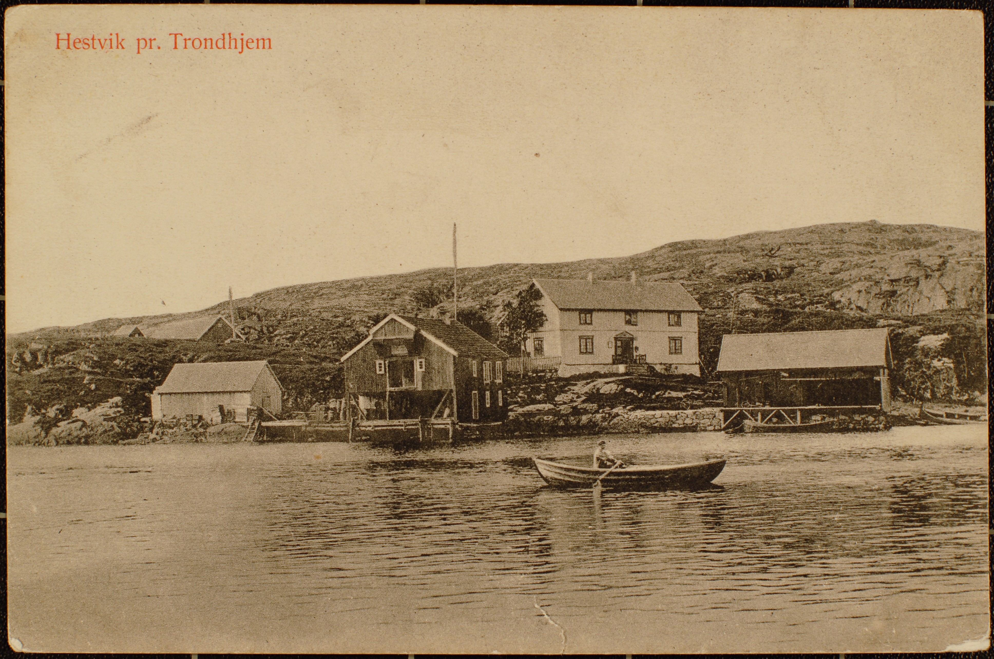
Hestvika is a village in the municipality of Hitra in Trøndelag county, Norway. The village is located on the eastern tip of the island of Hitra along the Trondheimsleia, about east of the village of Sandstad and the entrance to the Hitra Tunnel. The village has a population (2018) of 263 and a population density of . Hestvika has a marina suitable for light watercraft. The Børøyholmen Lighthouse lies about to the northeast of the marina. The fishing village has various industries including fish processing The term fish processing refers to the processes associated with fish and fish products between the time fish are caught or harvested, and the time the final product is delivered to the customer. Although the term refers specifically to fish, in .... References Hitra Villages in Trøndelag {{Trøndelag-geo-stub ... [...More Info...] [...Related Items...] OR: [Wikipedia] [Google] [Baidu] |
Administrative Centre
An administrative center is a seat of regional administration or local government, or a county town, or the place where the central administration of a commune is located. In countries with French as administrative language (such as Belgium, Luxembourg, Switzerland and many African countries), a (, plural form , literally 'chief place' or 'main place'), is a town or city that is important from an administrative perspective. Algeria The capital of an Algerian province is called a chef-lieu. The capital of a district, the next largest division, is also called a chef-lieu, whilst the capital of the lowest division, the municipalities, is called agglomération de chef-lieu (chef-lieu agglomeration) and is abbreviated as A.C.L. Belgium The chef-lieu in Belgium is the administrative centre of each of the ten provinces of Belgium. Three of these cities also give their name to their province ( Antwerp, Liège and Namur). France The chef-lieu of a département is known as the ''pr ... [...More Info...] [...Related Items...] OR: [Wikipedia] [Google] [Baidu] |
Kunnskapsforlaget
Kunnskapsforlaget () is a Norwegian publishing company based in Oslo. Kunnskapsforlaget was established in 1975, as a partnership between H. Aschehoug & Co. (W. Nygaard) and Gyldendal Norsk Forlag. The purpose was to co-operate on publishing encyclopaedias and dictionaries. The first volume of Store norske leksikon (SNL) was published in 1978. A total of four editions was published (the last one in 2004), before the online version was transferred to Institusjonen Fritt Ord og Sparebankstiftelsen DnB in 2011. Kunnskapsforlaget is the largest dictionary publisher in Norway. They publish both printed books, and digital dictionaries that are available through the online service Ordnett (launched in 2004). Their main languages are English and Norwegian, but they also have dictionaries in 21 other languages. In September 2018, Gyldendal Norsk Forlag became the single owner of the company. As of 2018, the publisher has eight full-time employees. The CEO is Thomas Nygaard Thomas m ... [...More Info...] [...Related Items...] OR: [Wikipedia] [Google] [Baidu] |
Store Norske Leksikon
The ''Great Norwegian Encyclopedia'' ( no, Store Norske Leksikon, abbreviated ''SNL''), is a Norwegian-language online encyclopedia. The online encyclopedia is among the most-read Norwegian published sites, with more than two million unique visitors per month. Paper editions 1978–2007 The ''SNL'' was created in 1978, when the two publishing houses Aschehoug and Gyldendal merged their encyclopedias and created the company Kunnskapsforlaget. Up until 1978 the two publishing houses of Aschehoug and Gyldendal, Norway's two largest, had published ' and ', respectively. The respective first editions were published in 1907–1913 (Aschehoug) and 1933–1934 (Gyldendal). The slump in sales for paper-based encyclopedias around the turn of the 21st century hit Kunnskapsforlaget hard, but a fourth edition of the paper encyclopedia was secured by a grant of ten million Norwegian kroner from the foundation Fritt Ord in 2003. The fourth edition consisted of 16 volumes, a t ... [...More Info...] [...Related Items...] OR: [Wikipedia] [Google] [Baidu] |
Sør-Trøndelag
Sør-Trøndelag () was a county comprising the southern portion of the present-day Trøndelag county in Norway. It bordered the old Nord-Trøndelag county as well as the counties of Møre og Romsdal, Oppland, and Hedmark. To the west is the Norwegian Sea (Atlantic Ocean), and to the east is Jämtland in Sweden. The county was separated into a northern and southern part by the Trondheimsfjord. Slightly over 200,000 of the county's population (or around 55%) lives in the city of Trondheim and its suburbs. The Norwegian dialect of the region is Trøndersk. The region was divided into two administrative counties in 1804. In 2016, the two county councils voted to merge into a single county on 1 January 2018. Name The name ''Sør-Trøndelag'' was created in 1919. It means '(the) southern (part of) Trøndelag'. Until 1919 the name of the county was ''Søndre Trondhjems amt''. The meaning of this name was '(the) southern (part of) Trondhjems amt'. (The old ''Trondhjems amt'', cr ... [...More Info...] [...Related Items...] OR: [Wikipedia] [Google] [Baidu] |
Trondheimsleia
The Trondheimsleia is a strait in Møre og Romsdal and Trøndelag counties in Norway. The long strait runs between the islands of Smøla and Hitra and the mainland municipalities of Aure, Heim, and Orkland. The strait has several fjords which branch off it including the Ramsøyfjorden, Hemnfjorden, and Trondheimsfjorden. The islands of Leksa are located in the Trondheimsleia in Orkland. The Hitra Tunnel is a road tunnel underneath the Trondheimsleia connecting the island of Hitra Hitra is a municipality in Trøndelag county, Norway. The municipality covers the island of Hitra and hundreds smaller islands, islets, and skerries. It is part of the Fosen region. The administrative centre of the municipality is the village ... to the mainland. References Smøla Hitra Aure, Norway Heim, Norway Orkland Fjords of Møre og Romsdal Fjords of Trøndelag {{Trøndelag-geo-stub ... [...More Info...] [...Related Items...] OR: [Wikipedia] [Google] [Baidu] |


_(10004827914).jpg)