|
Sandford, Somerset
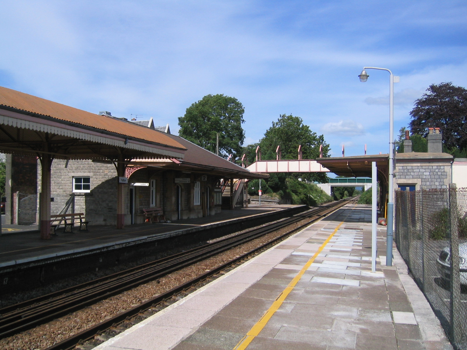
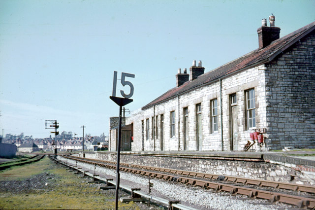
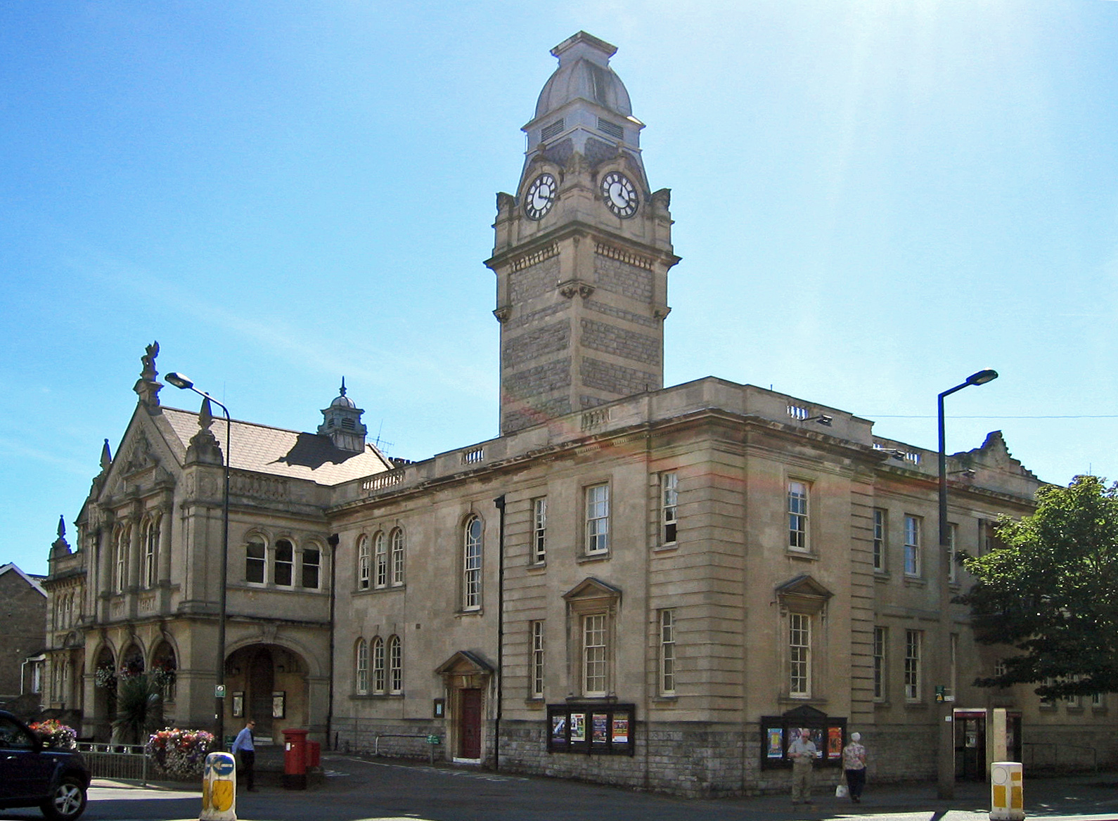
Sandford is a village between Churchill and Banwell on the A368 in North Somerset, England. The Parish of Winscombe and Sandford, centred on the Parish Church of Saint James, includes the villages of Barton, Oakridge, Sandford, Sidcot and Woodborough. The Sandford Parish Church of All Saints was built in 1883–85 by Hans Price, and is a Grade II listed building. It was constructed as a Chappel of ease to St James the Great in Winscombe It is believed the name Sandford means 'The sand ford' from the Old English ''sand'' and ''ford''. Sandford is home to one of the region's main cider producers, Thatchers Cider. Sandford once had its own railway station on the Cheddar Valley line, which ran from Yatton to Wells. The now-disused station is a Grade II listed building. It is the subject of some controversy in the village as developers submit plans for its redevelopment. The ''Railway Inn'' is the only public house A pub (short for public house) is a kind of dr ... [...More Info...] [...Related Items...] OR: [Wikipedia] [Google] [Baidu] |
Winscombe And Sandford
Winscombe and Sandford is a civil parish in Somerset, England. It includes the villages of Winscombe and Sandford. The parish has a population of 4,546. Governance The parish council has responsibility for local issues, including setting an annual precept (local rate) to cover the council's operating costs and producing annual accounts for public scrutiny. The parish council evaluates local planning applications and works with the local police, district council officers, and neighbourhood watch groups on matters of crime, security, and traffic. The parish council's role also includes initiating projects for the maintenance and repair of parish facilities, such as the village hall or community centre, playing fields and playgrounds, as well as consulting with the district council on the maintenance, repair, and improvement of highways, drainage, footpaths, public transport, and street cleaning. Conservation matters (including trees and listed buildings) and environmental issue ... [...More Info...] [...Related Items...] OR: [Wikipedia] [Google] [Baidu] |
Winscombe
Winscombe is a large village in the North Somerset unitary district of Somerset, South West England, close to the settlements of Axbridge and Cheddar, on the western edge of the Mendip Hills, southeast of Weston-super-Mare and southwest of Bristol. The Parish of Winscombe and Sandford, centred on the Parish Church of Church of St James the Great, includes the villages/hamlets of Barton, Hale, Oakridge, Nye, Sidcot and Woodborough. Winscombe has a few shops and businesses focused in the centre of the village, along Woodborough Road and Sandford Road. There is a doctor's surgery in the village, a vet and two dentists. West of the village is the Max Bog biological Site of Special Scientific Interest. History It has been suggested that the name means a valley belonging to a Saxon named Wine. The parish was part of the Winterstoke Hundred. Winscombe was the subject of a historical and archaeological study led by Professor Mick Aston, published in the ''Proceedings of the Somer ... [...More Info...] [...Related Items...] OR: [Wikipedia] [Google] [Baidu] |
Wells, Somerset
Wells () is a cathedral city and civil parish in the Mendip district of Somerset, located on the southern edge of the Mendip Hills, south-east of Weston-super-Mare, south-west of Bath and south of Bristol. Although the population recorded in the 2011 census was only 10,536, (increased to 12,000 by 2018) and with a built-up area of just , Wells has had city status since medieval times, because of the presence of Wells Cathedral. Often described as England's smallest city, it is actually second smallest to the City of London in area and population, but unlike London it is not part of a larger urban agglomeration. Wells takes its name from three wells dedicated to Saint Andrew, one in the market place and two within the grounds of the Bishop's Palace and cathedral. A small Roman settlement surrounded them, which grew in importance and size under the Anglo-Saxons when King Ine of Wessex founded a minster church there in 704. The community became a trading centre based on ... [...More Info...] [...Related Items...] OR: [Wikipedia] [Google] [Baidu] |
Yatton
Yatton is a village and civil parish within the unitary authority of North Somerset, which falls within the ceremonial county of Somerset, England. It is located south-west of Bristol. Its population in 2011 was 7,552. The parish includes Claverham, a small village which was originally a farming hamlet. The origins of the village and its name are unclear; however, there is evidence of Iron Age hill fort and a Roman villa in the area. The arrival of the railway in the 19th century and more recent road building have led to expansion of the village with Yatton now acting as a home to many commuters, while also supporting manufacturing industry and commerce. The village is located on the North Somerset Levels, where the low-lying land, a mixture of peat, estuarine alluvium and low hills of sand and gravel, is crossed by a myriad of watercourses, providing a habitat for several scarce species. St Mary's Church dates from the 14th century and there are a range of other places of w ... [...More Info...] [...Related Items...] OR: [Wikipedia] [Google] [Baidu] |
Cheddar Valley Line
The Cheddar Valley line was a railway line in Somerset, England, running between Yatton and Witham. It was opened in parts: the first section connecting Shepton Mallet to Witham, later extended to Wells, was built by the East Somerset Railway from 1858. Later the Bristol and Exeter Railway built their branch line from Yatton to Wells, but the two lines were prevented for a time from joining up. Eventually the gap was closed, and the line became a simple through line, operated by the Great Western Railway. The line became known as ''The Strawberry Line'' because of the volume of locally-grown strawberries that it carried. It closed in 1963. Sections of the former trackbed have been opened as the ''Strawberry Line Trail'', which runs from Yatton to Cheddar. The southern section operates as a heritage railway using the name East Somerset Railway. History Main line railways Important inland market towns suddenly found themselves at a huge disadvantage when trunk railways connected ... [...More Info...] [...Related Items...] OR: [Wikipedia] [Google] [Baidu] |
Thatchers Cider
Thatchers Cider is a family-owned cider maker in Sandford, North Somerset, England. History The Thatchers company was founded by William Thatcher in 1904. His son Stanley Thatcher, born in 1910, began selling draught cider to pubs in Somerset and the company's presence in the area grew. The company is still family owned and employs around 200 people. In 1992 Martin took over from his father, John Thatcher, as managing director. It has 500 acres of its own orchard, as well as using apples from other growers in the area. Alongside its bush orchards, Thatchers has pioneered a method of growing its apple trees in a hedgerow style. Trained on wires, this enables easier harvesting and also helps to ensure the fruit has the optimum combination of sunlight and rain. It has also led to the development of a new bespoke harvester. At the height of season, Thatchers can press 500 tonnes of apples per day. Thatchers also maintains an exhibition orchard in which over 458 different var ... [...More Info...] [...Related Items...] OR: [Wikipedia] [Google] [Baidu] |
Cider
Cider ( ) is an alcoholic beverage made from the fermented juice of apples. Cider is widely available in the United Kingdom (particularly in the West Country) and the Republic of Ireland. The UK has the world's highest per capita consumption, as well as the largest cider-producing companies. Ciders from the South West of England are generally higher in alcoholic content. Cider is also popular in many Commonwealth countries, such as India, Canada, Australia, and New Zealand. As well as the UK and its former colonies, cider is popular in Portugal (mainly in Minho and Madeira), France (particularly Normandy and Brittany), Friuli, and northern Spain (specifically Asturias). Central Europe also has its own types of cider with Rhineland-Palatinate and Hesse producing a particularly tart version known as Apfelwein. In the U.S., varieties of fermented cider are often called ''hard cider'' to distinguish alcoholic cider from non-alcoholic apple cider or "sweet cider", also made from ... [...More Info...] [...Related Items...] OR: [Wikipedia] [Google] [Baidu] |
Ford (crossing)
A ford is a shallow place with good footing where a river or stream may be crossed by wading, or inside a vehicle getting its wheels wet. A ford may occur naturally or be constructed. Fords may be impassable during high water. A low-water crossing is a low bridge that allows crossing over a river or stream when water is low but may be treated as a ford when the river is high and water covers the crossing. Description A ford is a much cheaper form of river crossing than a bridge, and it can transport much more weight than a bridge, but it may become impassable after heavy rain or during flood conditions. A ford is therefore normally only suitable for very minor roads (and for paths intended for walkers and horse riders etc.). Most modern fords are usually shallow enough to be crossed by cars and other wheeled or tracked vehicles (a process known as "fording"). Fords may be accompanied by stepping stones for pedestrians. The United Kingdom has more than 2,000 fords, and most ... [...More Info...] [...Related Items...] OR: [Wikipedia] [Google] [Baidu] |
Old English
Old English (, ), or Anglo-Saxon, is the earliest recorded form of the English language, spoken in England and southern and eastern Scotland in the early Middle Ages. It was brought to Great Britain by Anglo-Saxon settlement of Britain, Anglo-Saxon settlers in the mid-5th century, and the first Old English literature, Old English literary works date from the mid-7th century. After the Norman conquest of 1066, English was replaced, for a time, by Anglo-Norman language, Anglo-Norman (a langues d'oïl, relative of French) as the language of the upper classes. This is regarded as marking the end of the Old English era, since during this period the English language was heavily influenced by Anglo-Norman, developing into a phase known now as Middle English in England and Early Scots in Scotland. Old English developed from a set of Anglo-Frisian languages, Anglo-Frisian or Ingvaeonic dialects originally spoken by Germanic peoples, Germanic tribes traditionally known as the Angles, Sa ... [...More Info...] [...Related Items...] OR: [Wikipedia] [Google] [Baidu] |
Listed Building
In the United Kingdom, a listed building or listed structure is one that has been placed on one of the four statutory lists maintained by Historic England in England, Historic Environment Scotland in Scotland, in Wales, and the Northern Ireland Environment Agency in Northern Ireland. The term has also been used in the Republic of Ireland, where buildings are protected under the Planning and Development Act 2000. The statutory term in Ireland is " protected structure". A listed building may not be demolished, extended, or altered without special permission from the local planning authority, which typically consults the relevant central government agency, particularly for significant alterations to the more notable listed buildings. In England and Wales, a national amenity society must be notified of any work to a listed building which involves any element of demolition. Exemption from secular listed building control is provided for some buildings in current use for worship, ... [...More Info...] [...Related Items...] OR: [Wikipedia] [Google] [Baidu] |
North Somerset
North Somerset is a unitary authorities of England, unitary district in Somerset, South West England. Whilst its area covers part of the Ceremonial counties of England, ceremonial county of Somerset, it is administered independently of the non-metropolitan county. Its administrative headquarters is in the town hall in Weston-super-Mare. North Somerset, which was renamed from the Woodspring district in 1996, borders the city and county of Bristol and the local government areas of Bath and North East Somerset, Mendip District, Mendip and Sedgemoor. The area comprises the parliamentary constituencies of Weston-super-Mare (UK Parliament constituency), Weston-super-Mare and North Somerset (UK Parliament constituency), North Somerset. History Between 1 April 1974 and 31 March 1996, this area was the Woodspring Districts of England, district of the county of Avon (named after Woodspring Priory, an isolated medieval church near the coast just north east of Weston-super-Mare). The dist ... [...More Info...] [...Related Items...] OR: [Wikipedia] [Google] [Baidu] |
Hans Price
Hans Price (1835–1912) was the architect responsible for much of the development of Weston-super-Mare, in North Somerset, England, during the Victorian era. Life Hans Fowler Price was born in St James's parish, Bristol. He studied under Thomas Barry in Liverpool. By the time that he married Jane Baker in 1862 he had already established his own architectural practice in Weston-super-Mare. Jane's father was the solicitor to the Smyth Pigott family who were major landowners in the town. Price used these connections to build his business and his personal standing. He spent time as a Town Commissioner, a director of the Gaslight Company, and on many other boards and committees. Style Price was an eclectic architect who successfully mixed styles such as Classical, Gothic, Moorish and Flemish in different buildings, his works invariably used materials characteristic of the area. Grey Mendip limestone from local quarries formed the walls, generally as squared rubble blocks. Th ... [...More Info...] [...Related Items...] OR: [Wikipedia] [Google] [Baidu] |


