|
Samuel Addison Bishop
Samuel Addison Bishop (1825 – 1893) was a settler of the Owens Valley and is the namesake of Bishop Creek in Inyo County, California. He fought as a first sergeant in the Mariposa Battalion and later was a banker and a founder of the San Jose streetcar system. Biography Bishop was born in Albemarle County, Virginia on September 2, 1825. Seeking gold, he headed to California in 1849. In 1851 he fought in the Mariposa War and aided in the capture of the Ahwahnechee. In 1861, Bishop drove over 500 cattle into the Owens Valley and founded San Frances Ranch on what would later be named Bishop Creek, about three miles southwest of the present town of Bishop. The ranch was named after his wife, Frances Elle Young, who is reported to be the first white woman to live in the valley. The ranch provided food for the Aurora Mining District in nearby Nevada. The Bishops only stayed on the ranch for about 18 months before moving to Kern County where Samuel became one of the county’s first ... [...More Info...] [...Related Items...] OR: [Wikipedia] [Google] [Baidu] |
Owens Valley
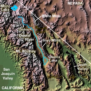
Owens Valley (Numic Numic is a branch of the Uto-Aztecan language family. It includes seven languages spoken by Native American peoples traditionally living in the Great Basin, Colorado River basin, Snake River basin, and southern Great Plains. The word Numic com ...: ''Payahǖǖnadǖ'', meaning "place of flowing water") is an arid valley of the Owens River in eastern California in the United States. It is located to the east of the Sierra Nevada (U.S.), Sierra Nevada, west of the White Mountains (California), White Mountains and Inyo Mountains, and north of the Mojave Desert. It sits on the west edge of the Great Basin section, Great Basin. The mountain peaks on the West side (including Mount Whitney) reach above in elevation, while the floor of the Owens Valley is about , making the valley the deepest in the United States. The Sierra Nevada casts the valley in a rain shadow, which makes Owens Valley "the Land of Little Rain." The bed of Owens Lake, now a predominantly dr ... [...More Info...] [...Related Items...] OR: [Wikipedia] [Google] [Baidu] |
Bishop Creek (Inyo County)
:''Bishop Creek is also a dated variant of Baxter Creek in Richmond/El Cerrito, California'' Bishop Creek is a U.S. Geological Survey. National Hydrography Dataset high-resolution flowline dataThe National Map, accessed March 17, 2011 stream in Inyo County, California. It is the largest tributary of the Owens River. It has five hydroelectric plants owned by Southern California Edison, Bishop Creek #2–6. Bishop Creek #1 was never completed. Parts of the creek run through pipelines, or penstocks, to increase output at the power plants. Bishop Creek has three forks, North, Middle and South. All have their headwaters in the eastern Sierra Nevada, near the border with Fresno County. The forks all flow into lakes while still at high elevations. The North Fork flows into North Lake, the Middle Fork flows into Lake Sabrina. The North and Middle forks combine above and flow through the community of Aspendell and below it the combined creeks are dammed at Intake Two, a reservoir. The Sou ... [...More Info...] [...Related Items...] OR: [Wikipedia] [Google] [Baidu] |
Inyo County, California
Inyo County () is a county in the eastern central part of the U.S. state of California, located between the Sierra Nevada and the state of Nevada. In the 2020 census, the population was 19,016. The county seat is Independence. Inyo County is on the east side of the Sierra Nevada and southeast of Yosemite National Park in Central California. It contains the Owens River Valley; it is flanked to the west by the Sierra Nevada and to the east by the White Mountains and the Inyo Mountains. With an area of 10,192 square miles (26,397 km2), Inyo County is the second-largest county by area in California, after San Bernardino County. Almost one-half of that area is within Death Valley National Park. However, with a population density of 1.8 people per square mile, it also has the second-lowest population density in California, after Alpine County. History Present-day Inyo county has been the historic homeland for thousands of years of the Mono, Timbisha, Kawaiisu, and Nort ... [...More Info...] [...Related Items...] OR: [Wikipedia] [Google] [Baidu] |
Mariposa Battalion
Mariposa Battalion was a California State Militia unit formed in 1851 to defeat the Ahwahnechee and Chowchillas in the Mariposa War, a part of the California genocide. After a force under Mariposa County Sheriff James Burney was found unequal to the task of defeating the Native Californians, Burney made an appeal to Governor John McDougal for help. This led to authorizing an organization of two hundred men into the Mariposa Battalion. The Mariposa Battalion was mustered 12 February 1851. Sheriff Burney was the first choice for the major to command the unit, but Burney declined due to his other responsibilities in Mariposa. Instead, James D. Savage was chosen as major, primarily due to his scouting abilities. The battalion was divided into three companies: Company A commanded by John J. Kuykendall, with seventy men; Company B under John Boling, with seventy-two men; and Company C, under William Dill, with fifty-five men. Other officers elected included M. B. Lewis as Adjutant, A. ... [...More Info...] [...Related Items...] OR: [Wikipedia] [Google] [Baidu] |
Albemarle County, Virginia
Albemarle County is a county located in the Piedmont region of the Commonwealth of Virginia. Its county seat is Charlottesville, which is an independent city and enclave entirely surrounded by the county. Albemarle County is part of the Charlottesville Metropolitan Statistical Area. As of the 2020 census, the population was 112,395. Albemarle County was created in 1744 from the western portion of Goochland County, though portions of Albemarle were later carved out to create other counties. Albemarle County was named in honor of Willem Anne van Keppel, 2nd Earl of Albemarle. Its most famous inhabitant was Thomas Jefferson, who built his estate home, Monticello, in the county. History At the time of European encounter, the inhabitants of the area that became Albemarle County were a Siouan-speaking tribe called the Saponi. In 1744, the Virginia General Assembly created Albemarle County from the western portion of Goochland County. The county was named in honor of Will ... [...More Info...] [...Related Items...] OR: [Wikipedia] [Google] [Baidu] |
Mariposa War
The Mariposa War (December 1850 - June 1851), also known as the Yosemite Indian War, was a conflict between the United States and the indigenous people of California's Sierra Nevada in the 1850s. The war was fought primarily in Mariposa County and surrounding areas, and was sparked by the discovery of gold in the region. As a result of the military expedition, the Mariposa Battalion became the first non-indigenous group to enter Yosemite Valley and the Nelder Grove. The war began in 1850 when miners entered the area of the Sierra Nevada foothills, which was traditionally occupied by the Ahwahnechee, a band of the Southern Sierra Miwok people. The miners began to take over the Ahwahnechee's land and resources, leading to tensions between the two groups. The Ahwahnechee, led by their chief Tenaya, fought back against the miners, resulting in a series of skirmishes that escalated into a full-scale war. The California state government, under Governor John McDougall, sent the Marip ... [...More Info...] [...Related Items...] OR: [Wikipedia] [Google] [Baidu] |
Ahwahnechee
The Ahwahnechee are a Native American people who traditionally lived in the Yosemite Valley and still live in surrounding area. They are the seven tribes of Yosemite Miwok, Northern Paiute, Kucadikadi Mono Lake people. As one of the most documented tribes the tribe still fights for Federal Recognition. The Ahwahnechee people's heritage can be found all over Yosemite National Park. History The Ahwahnechee lived in Yosemite Valley for centuries. It is believed that they may have lived in the area for as long as 7,000 years. According to NPS historians, they were primarily Southern Miwok, with related Miwok tribes living North and South and West. They routinely traded with both Paiute and Mono tribes across the mountains to the east, and intermarried with those people. Initial contacts European-American contact began after 1833. In 1850 a settler named James D. Savage set up a mining camp down below the valley, and spent most of his time mining for gold and trading with the few ... [...More Info...] [...Related Items...] OR: [Wikipedia] [Google] [Baidu] |
Bishop, California
Bishop (formerly Bishop Creek) is a city in California, United States. It is the largest populated place and only incorporated city in Inyo County. Bishop is located near the northern end of the Owens Valley, at an elevation of . The city was named after Bishop Creek, flowing out of the Sierra Nevada; the creek was named after Samuel Addison Bishop, a settler in the Owens Valley. Bishop is a commercial and residential center, while many vacation destinations and tourist attractions in the Sierra Nevada are located nearby. The population of the city was 3,879 at the 2010 Census, up from 3,575 at the 2000 Census. The population of the built-up zone containing Bishop is much larger; more than 14,500 people live in a compact area that includes Bishop, West Bishop, Dixon Lane-Meadow Creek, and the Bishop Paiute Reservation. It is by far the largest settlement in Inyo County. A number of western films were shot in Bishop, including movies starring John Wayne, Charlton Heston and J ... [...More Info...] [...Related Items...] OR: [Wikipedia] [Google] [Baidu] |
Aurora, Nevada
Aurora is a ghost town in Mineral County in the west central part of the US state of Nevada, approximately southwest of the town of Hawthorne, three miles from the California border. Today the townsite is much diminished, having been damaged by vandals. After World War II many of the buildings were razed for their brick. The road to Aurora was once difficult to navigate except via four-wheel drive, as the winter snows and spring run-off damaged the road in the canyon leading to the town. In recent years the operations of a nearby mine have improved the road so that even non-4WD vehicles can reach the town site. History Early Aurora James M. Cory, James M. Braly and E.R. Hicks founded the town in 1860. When Esmeralda County was founded a few years later, Aurora was one of the few places that were explored in the county. Cory is credited with having named the strike Esmeralda but, in the late 1860s, he is reported to have changed the name to Aurora for the goddess of dawn ... [...More Info...] [...Related Items...] OR: [Wikipedia] [Google] [Baidu] |
Kern County, California
Kern County is a county (United States), county located in the U.S. state of California. As of the 2020 United States Census, 2020 census, the population was 909,235. Its county seat is Bakersfield, California, Bakersfield. Kern County comprises the Bakersfield, California, Metropolitan statistical area. The county spans the southern end of the Central Valley (California), Central Valley. Covering , it ranges west to the southern slope of the California Coast Ranges, Coast Ranges, and east beyond the southern slope of the eastern Sierra Nevada (U.S.), Sierra Nevada into the Mojave Desert, at the city of Ridgecrest, California, Ridgecrest. Its northernmost city is Delano, California, Delano, and its southern reach extends to just beyond Frazier Park, California, Frazier Park, and the northern extremity of the parallel Antelope Valley. The county's economy is heavily linked to agriculture and to petroleum extraction. There is also a strong aviation, space, and military presence, s ... [...More Info...] [...Related Items...] OR: [Wikipedia] [Google] [Baidu] |
San Jose, California
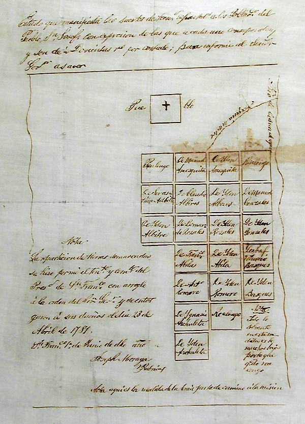
San Jose, officially San José (; ; ), is a major city in the U.S. state of California that is the cultural, financial, and political center of Silicon Valley and largest city in Northern California by both population and area. With a 2020 population of 1,013,240, it is the most populous city in both the Bay Area and the San Jose–San Francisco–Oakland, CA Combined Statistical Area, San Jose-San Francisco-Oakland Combined Statistical Area, which contain 7.7 million and 9.7 million people respectively, the List of largest California cities by population, third-most populous city in California (after Los Angeles and San Diego and ahead of San Francisco), and the List of United States cities by population, tenth-most populous in the United States. Located in the center of the Santa Clara Valley on the southern shore of San Francisco Bay, San Jose covers an area of . San Jose is the county seat of Santa Clara County, California, Santa Clara County and the main component of the San ... [...More Info...] [...Related Items...] OR: [Wikipedia] [Google] [Baidu] |
California Pioneers
California is a state in the Western United States The Western United States (also called the American West, the Far West, and the West) is the region comprising the westernmost states of the United States. As American settlement in the U.S. expanded westward, the meaning of the term ''the Wes ..., located along the West Coast of the United States, Pacific Coast. With nearly 39.2million residents across a total area of approximately , it is the List of states and territories of the United States by population, most populous U.S. state and the List of U.S. states and territories by area, 3rd largest by area. It is also the most populated Administrative division, subnational entity in North America and the 34th most populous in the world. The Greater Los Angeles area and the San Francisco Bay Area are the nation's second and fifth most populous Statistical area (United States), urban regions respectively, with the former having more than 18.7million residents and the latte ... [...More Info...] [...Related Items...] OR: [Wikipedia] [Google] [Baidu] |


