|
Sakha Avia
Sakha Avia was an airline that operated in the Sakha Republic of Russia from 1992 until 2001. History Sakha Avia was founded in 1992 after the dissolution of the Soviet Union. As Aeroflot was undergoing the upheavals brought about by the dissolution, its operations in Sakha were spun off as Yakutian Air Enterprises, and then later renamed Sakha Airlines. The airline rebranded to Yakutia in 2002. Fleet The airline operated the following aircraft types before it ceased operations: *Airbus A310 * Antonov An-12 *Antonov An-24 * Ilyushin Il-76M *Let L-410 Turbolet * Tupolev Tu-154M *Yakovlev Yak-40 *A number of helicopters Destinations Sakha Avia till 2001 operated a number of routes: *Barnaul - Barnaul Airport *Beijing - Beijing Capital International Airport *Blagoveshchensk - Ignatyevo Airport * Chita - Kadala Airport * Irkutsk - International Airport Irkutsk * Khabarovsk - Khabarovsk Novy Airport *Krasnoyarsk - Krasnoyarsk Cheremshanka Airport *Krasnoyarsk - Yeme ... [...More Info...] [...Related Items...] OR: [Wikipedia] [Google] [Baidu] |
Airline
An airline is a company that provides civil aviation, air transport services for traveling passengers and freight. Airlines use aircraft to supply these services and may form partnerships or Airline alliance, alliances with other airlines for codeshare agreements, in which they both offer and operate the same flight. Generally, airline companies are recognized with an Air operator's certificate, air operating certificate or license issued by a governmental aviation body. Airlines may be scheduled or Air charter, charter operators. The List of airlines by foundation date, first airline was the German airship company DELAG, founded on November 16, 1909. The four oldest non-airship airlines that still exist are the Netherlands' KLM (1919), Colombia's Avianca (1919), Australia's Qantas (1920) and the Czech Republic's Czech Airlines (1923). Airline ownership has seen a shift from mostly personal ownership until the 1930s to government-ownership of major airlines from the 1940s to ... [...More Info...] [...Related Items...] OR: [Wikipedia] [Google] [Baidu] |
Let L-410 Turbolet
The Let L-410 Turbolet is a twin-engine short-range transport aircraft, manufactured by the Czech aircraft manufacturer Let Kunovice (named Aircraft Industries since 2005), often used as an airliner. The aircraft is capable of landing on short and unpaved runways and operating under extreme conditions from . By 2016, 1,200 L-410s had been built, and over 350 are in service in more than 50 countries. Development Development of the L-410 was started in the 1960s by the Czechoslovak aircraft manufacturer Let Kunovice. The Soviet airline Aeroflot was looking for a turboprop-powered replacement for the Antonov An-2 aircraft, initiating the design development by Let. After preliminary studies of an aircraft called the L-400, a new version was introduced called the L-410 Turbolet. The first prototype, designated XL-410, flew on April 16, 1969. Because of delays in the development of a suitable Czech engine (Walter M601), the prototype and first production version were powered by Pra ... [...More Info...] [...Related Items...] OR: [Wikipedia] [Google] [Baidu] |
Khabarovsk
Khabarovsk ( rus, Хабaровск, a=Хабаровск.ogg, r=Habárovsk, p=xɐˈbarəfsk) is the largest types of inhabited localities in Russia, city and the administrative centre of Khabarovsk Krai, Russia,Law #109 located from the China–Russia border, at the confluence of the Amur River, Amur and Ussuri Rivers, about north of Vladivostok. With a Russian Census (2010), 2010 population of 577,441 it is Russia's easternmost city with more than half a million inhabitants. The city was the administrative center of the Far Eastern Federal District of Russia from 2002 until December 2018, when Vladivostok took over that role. It is the largest city in the Russian Far East, having overtaken Vladivostok in 2015. It was known as ''Khabarovka'' until 1893. As is typical of the interior of the Russian Far East, Khabarovsk has an #Climate, extreme climate with very strong seasonal swings resulting in strong cold winters and relatively hot and humid summers. History Earliest record ... [...More Info...] [...Related Items...] OR: [Wikipedia] [Google] [Baidu] |
International Airport Irkutsk
Irkutsk International Airport (Russian: Международный Аэропорт Иркутск) is an international airport on the outskirts of Irkutsk, Russia, at a distance of 60 kilometers (37 miles) from Lake Baikal. Operations The airport has daily domestic flights to Moscow, Vladivostok, Krasnoyarsk, Novosibirsk, Yakutsk, Saint Petersburg, Yekaterinburg, and Sochi. It has regional daily flights to Ust-Kut, Bratsk, Bodaybo, Kirensk and other Russian cities. Due to its proximity to the Angara Reservoir, the airport is subject to a microclimate of foggy weather. When the airport is closed due to bad weather conditions, Bratsk Airport, Ulan-Ude Airport, Irkutsk Northwest Airport, and Belaya (air base) serve as diversion airports. History 1920s to 1930s The Irkutsk Airport opened on 24 June 1925. Six aircraft from Moscow landed at the airport as part of a flight to Beijing. Of these six planes, four were domestic and two were foreign. This flight was headed by capt ... [...More Info...] [...Related Items...] OR: [Wikipedia] [Google] [Baidu] |
Irkutsk
Irkutsk ( ; rus, Иркутск, p=ɪrˈkutsk; Buryat language, Buryat and mn, Эрхүү, ''Erhüü'', ) is the largest city and administrative center of Irkutsk Oblast, Russia. With a population of 617,473 as of the 2010 Census, Irkutsk is the List of cities and towns in Russia by population, 25th-largest city in Russia by population, the fifth-largest in the Siberian Federal District, and one of the largest types of inhabited localities in Russia, cities in Siberia. Located in the south of the eponymous oblast, the city proper lies on the Angara River, a tributary of the Yenisei River, Yenisei, about 850 kilometres (530 mi) to the south-east of Krasnoyarsk and about 520 kilometres (320 mi) north of Ulaanbaatar. The Trans-Siberian Highway (Federal M53 and M55 Highways) and Trans-Siberian Railway connect Irkutsk to other regions in Russia and Mongolia. Many distinguished Russians were sent into exile in Irkutsk for their part in the Decembrist revolt of 1825, and t ... [...More Info...] [...Related Items...] OR: [Wikipedia] [Google] [Baidu] |
Kadala Airport
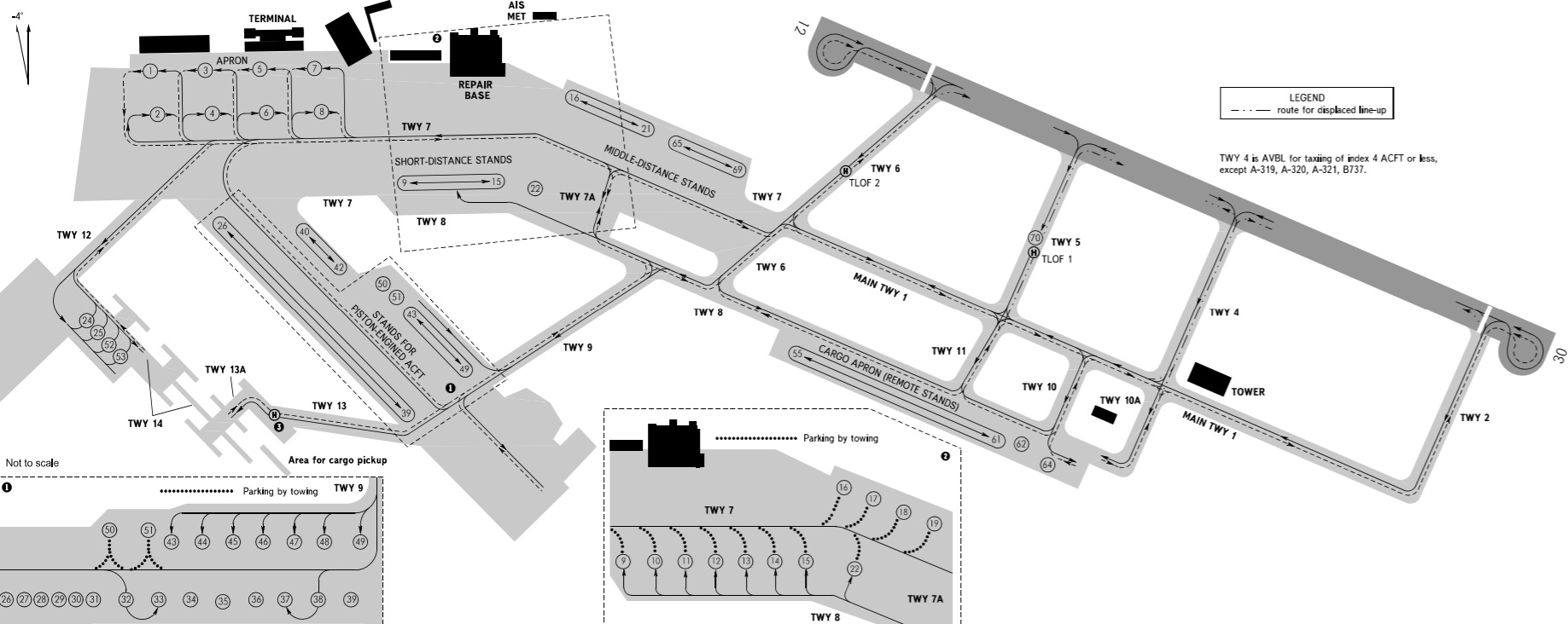
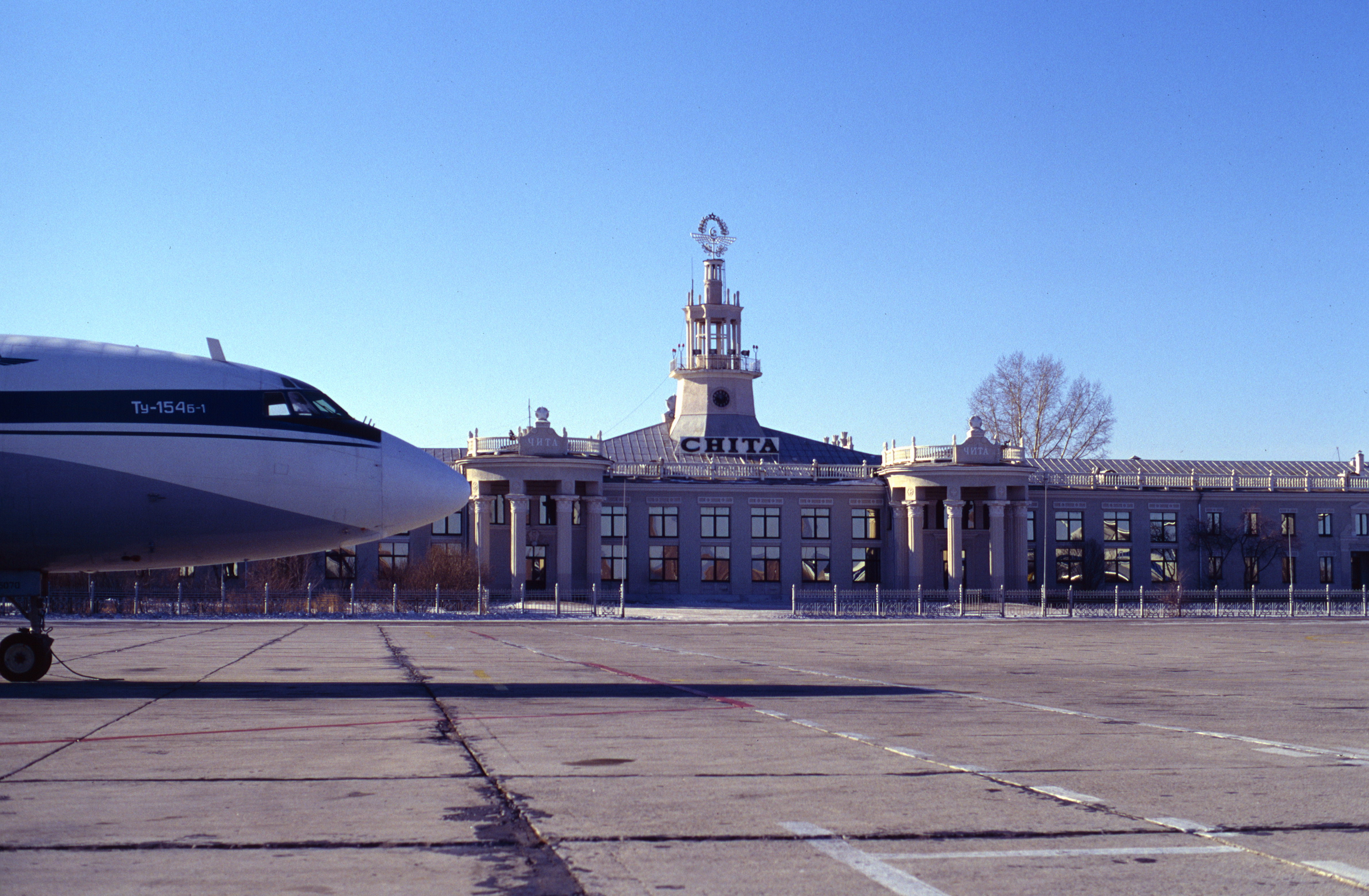
Chita-Kadala International Airport is a single runway airport, located in Chita ( rus, Чита, p=tɕɪˈta), the administrative center of Zabaykalsky Krai Zabaykalsky Krai ( rus, Забайкальский край, r=Zabaikal'skii krai, p=zəbɐjˈkalʲskʲɪj kraj, lit. "Transbaikal krai"; bua, Yбэр Байгалай хизаар, Uber Baigalai Xizaar) is a federal subject of Russia (a krai) t ..., Russia. The airport handles about 150,000 passengers per year. Airlines and destinations Statistics Annual Traffic Annual Passenger Traffic Busiest routes References External linksChita Airport official site Airports built in the Soviet Union Airports in Zabaykalsky Krai Novaport {{Russia-airport-stub ... [...More Info...] [...Related Items...] OR: [Wikipedia] [Google] [Baidu] |
Chita, Zabaykalsky Krai
Chita ( rus, Чита, p=tɕɪˈta, , ) is a city and the administrative center of Zabaykalsky Krai, Russia, located on the Trans-Siberian Railway route, roughly east of Irkutsk. Geography Chita lies at the confluence of the Chita and Ingoda Rivers, between the Yablonoi Mountains to the west and the Chersky Range to the east. Lake Kenon is located to the west, within the city limits, and the Ivan-Arakhley Lake System is a group of lakes lying about west of Chita.Google Earth History Pyotr Beketov's Cossacks founded Chita in 1653. The name of the settlement apparently came from the local River Chita. Following the Decembrist revolt of 1825, from 1827 several of the Decembrists suffered exile to Chita. According to George Kennan, who visited the area in the 1880s, "Among the exiles in Chita were some of the brightest, most cultivated, most sympathetic men and women that we had met in Eastern Siberia." When Richard Maack visited the city in 1855, he saw a wooden town, w ... [...More Info...] [...Related Items...] OR: [Wikipedia] [Google] [Baidu] |
Ignatyevo Airport
Ignatyevo Airport (russian: Аэропорт Игнатьево) is an international airport in Amur Oblast, Russia, located near the village of Ignatyevo north-west of Blagoveshchensk. The large airport services up to medium-sized airliners with parking space for 44 civilian aircraft, and conducts 24-hour flight operation. Ignatyevo Airport is state-owned by Amur Oblast and jointly operated with the Russian Air Force, with a military pad on the north-west side of the airport. History The construction of Ignatyevo Airport began in 1959 next to the village of Ignatyevo, after which the airport is named. The first terminal was made of wood and was located approximately on the spot where the current terminal stands. During the early 1990s the airport's activity declined as the new emerging Russian state was suffering from economic decline following the dissolution of the Soviet Union. In July 1997, the Governor of Amur Oblast signed a decree on the establishment of Airport Blagove ... [...More Info...] [...Related Items...] OR: [Wikipedia] [Google] [Baidu] |
Blagoveshchensk
Blagoveshchensk ( rus, Благове́щенск, p=bləgɐˈvʲeɕːɪnsk, meaning ''City of the Annunciation'') is a city and the administrative center of Amur Oblast, Russia. It is located at the confluence of the Amur and the Zeya Rivers, opposite to the Chinese city of Heihe. Population: The Amur has formed Russia's border with China since the 1858 Aigun Treaty and the 1860 Treaty of Peking. The area north of the Amur belonged to the Manchu Qing dynasty by the Treaty of Nerchinsk of 1689 until it was ceded to Russia by the Aigun Treaty in 1858. History Early history of the region The early residents of both sides of the Amur in the region of today's Blagoveshchensk were the Daurs and Duchers. An early settlement in the area of today's Blagoveshchensk was the Ducher town whose name was reported by the Russian explorer Yerofey Khabarov as Aytyun in 1652, as Aigun from 1683 to 1685, and as Aigun Old Town from 1685 until the massacre in 1900, which known to Russian archaeolo ... [...More Info...] [...Related Items...] OR: [Wikipedia] [Google] [Baidu] |
Beijing Capital International Airport
Beijing Capital International Airport is one of two international airports serving Beijing, the other one being Beijing Daxing International Airport (PKX). It is located northeast of Beijing's city center, in an exclave of Chaoyang District and the surroundings of that exclave in suburban Shunyi District. The airport is owned and operated by the Beijing Capital International Airport Company Limited, a state-controlled company. The airport's IATA Airport code, PEK, is based on the city's former romanized name, Peking. Beijing Capital has rapidly ascended in rankings of the world's busiest airports in the past decade. It had become the busiest airport in Asia in terms of passenger traffic and total traffic movements by 2009. It was the world's second busiest airport in terms of passenger traffic between 2010 and 2021. The airport registered 557,167 aircraft movements (takeoffs and landings), ranking 6th in the world in 2012. In terms of cargo traffic, Beijing airport has a ... [...More Info...] [...Related Items...] OR: [Wikipedia] [Google] [Baidu] |
Beijing
} Beijing ( ; ; ), alternatively romanized as Peking ( ), is the capital of the People's Republic of China. It is the center of power and development of the country. Beijing is the world's most populous national capital city, with over 21 million residents. It has an administrative area of , the third in the country after Guangzhou and Shanghai. It is located in Northern China, and is governed as a municipality under the direct administration of the State Council with 16 urban, suburban, and rural districts.Figures based on 2006 statistics published in 2007 National Statistical Yearbook of China and available online at archive. Retrieved 21 April 2009. Beijing is mostly surrounded by Hebei Province with the exception of neighboring Tianjin to the southeast; together, the three divisions form the Jingjinji megalopolis and the national capital region of China. Beijing is a global city and one of the world's leading centres for culture, diplomacy, politics, finance, busi ... [...More Info...] [...Related Items...] OR: [Wikipedia] [Google] [Baidu] |
Barnaul Airport
Barnaul Gherman Titov International Airport (russian: Международный аэропорт Барнаул имени Германа Титова) (sometimes referred to as Barnaul West or Mikhaylovka) is a major airport in Altai Krai, Russia located 17 km west of Barnaul. It contains large facilities and a remote tarmac for military use. The airport services airliners and helicopters of all sizes, including planes as large as the Boeing 747, and the Il-96. Barnaul Airport is named after Soviet cosmonaut Gherman Titov, an Altai Krai native who was the second human being (after Yuri Gagarin) to visit outer space.Barnaul Airport Gets the Name of Cosmonaut German Titov http://www.federalspace.ru/main.php?id=2&nid=9529&lang=en History * The first airport in this location was built in 1937 as a base for Soviet Po-2 biplanes. * On 12 March 1967, a new modern airport complex was opened with a runway, taxiways, an apron, hotel, and office space. That same year, direct flights ... [...More Info...] [...Related Items...] OR: [Wikipedia] [Google] [Baidu] |

.jpg)
.jpg)


