|
Saaremaa
Saaremaa is the largest island in Estonia, measuring . The main island of Saare County, it is located in the Baltic Sea, south of Hiiumaa island and west of Muhu island, and belongs to the West Estonian Archipelago. The capital of the island is Kuressaare, which in January 2018 had 13,276 inhabitants. The whole island had a recorded population in January 2020 of 31,435. Etymology In old Scandinavian sources, Saaremaa is called ''Eysysla'' and in the Icelandic Sagas ''Eysýsla'' (Old Norse: ), meaning "the district (land) of island". The island is called ''Saaremaa'' in Estonian language, Estonian, and in Finnish language, Finnish ''Saarenmaa''—literally "isle land" or "island land",Toomse, Liine. "10 Estonian Islands You Should Visit." http://www.traveller.ee/blog/tallinn/10-estonian-islands-you-should-visit. Retrieved 8 March 2016. i.e. the same as the Scandinavian name for the island. The old Scandinavian name is also the origin of the island's name in Danish language, D ... [...More Info...] [...Related Items...] OR: [Wikipedia] [Google] [Baidu] |
Saare County
Saare County ( et, Saare maakond or ''Saaremaa''; la, Oesel; german: Ösel; sv, Ösel) is one of 15 counties of Estonia. It consists of Saaremaa, the largest island of Estonia, and several smaller islands near it, most notably Muhu, Ruhnu, Abruka and Vilsandi. The county borders Lääne County to the east, Hiiu County to the north, and Latvia to the south. In January 2013 Saare County had a population of 30,966, which was 2.4% of the population of Estonia. Municipalities The county is subdivided into municipalities. There are 3 rural municipalities ( et, vallad – parishes) in Saare County. Geography The largest islands of the county are Saaremaa, Muhu, Ruhnu, Abruka and Vilsandi. Arable land is and it has a mild maritime climate. The mean annual air temperature is and the mean annual precipitation is . Religious affiliations The main religious affiliations are Lutheran, Orthodox and Baptist, but only 33.6% consider themselves religious. Ancient Saare county (Oese ... [...More Info...] [...Related Items...] OR: [Wikipedia] [Google] [Baidu] |
Kuressaare
Kuressaare () is a town on Saaremaa island in Estonia. It is the administrative centre of Saaremaa Parish and the capital of Saare County. Kuressaare is the westernmost town in Estonia. The recorded population on 1 January 2018 was 13,276. The town is situated on the southern coast of Saaremaa island, facing the Gulf of Riga of the Baltic Sea, and is served by the Kuressaare Airport, Roomassaare harbour, and Kuressaare yacht harbour. Names Kuressaare's historic name Arensburg (from Middle High German ''a(a)r:'' eagle, raptor) renders the Latin denotation ''arx aquilae'' for the city's castle. The fortress and the eagle, tetramorph symbol of Saint John the Evangelist, are also depicted on Kuressaare's coat of arms. The town, which grew around the fortress, was simultaneously known as Arensburg and Kuressaarelinn; the latter name being a combination of ''Kuressaare''—an ancient name of the Saaremaa Island—and ''linn'', which means ''town''.Pospelov, p. 28 Alternative ... [...More Info...] [...Related Items...] OR: [Wikipedia] [Google] [Baidu] |
Estonia
Estonia, formally the Republic of Estonia, is a country by the Baltic Sea in Northern Europe. It is bordered to the north by the Gulf of Finland across from Finland, to the west by the sea across from Sweden, to the south by Latvia, and to the east by Lake Peipus and Russia. The territory of Estonia consists of the mainland, the larger islands of Saaremaa and Hiiumaa, and over 2,200 other islands and islets on the eastern coast of the Baltic Sea, covering a total area of . The capital city Tallinn and Tartu are the two largest urban areas of the country. The Estonian language is the autochthonous and the official language of Estonia; it is the first language of the majority of its population, as well as the world's second most spoken Finnic language. The land of what is now modern Estonia has been inhabited by '' Homo sapiens'' since at least 9,000 BC. The medieval indigenous population of Estonia was one of the last " pagan" civilisations in Europe to adopt Ch ... [...More Info...] [...Related Items...] OR: [Wikipedia] [Google] [Baidu] |
Kuressaare Castle
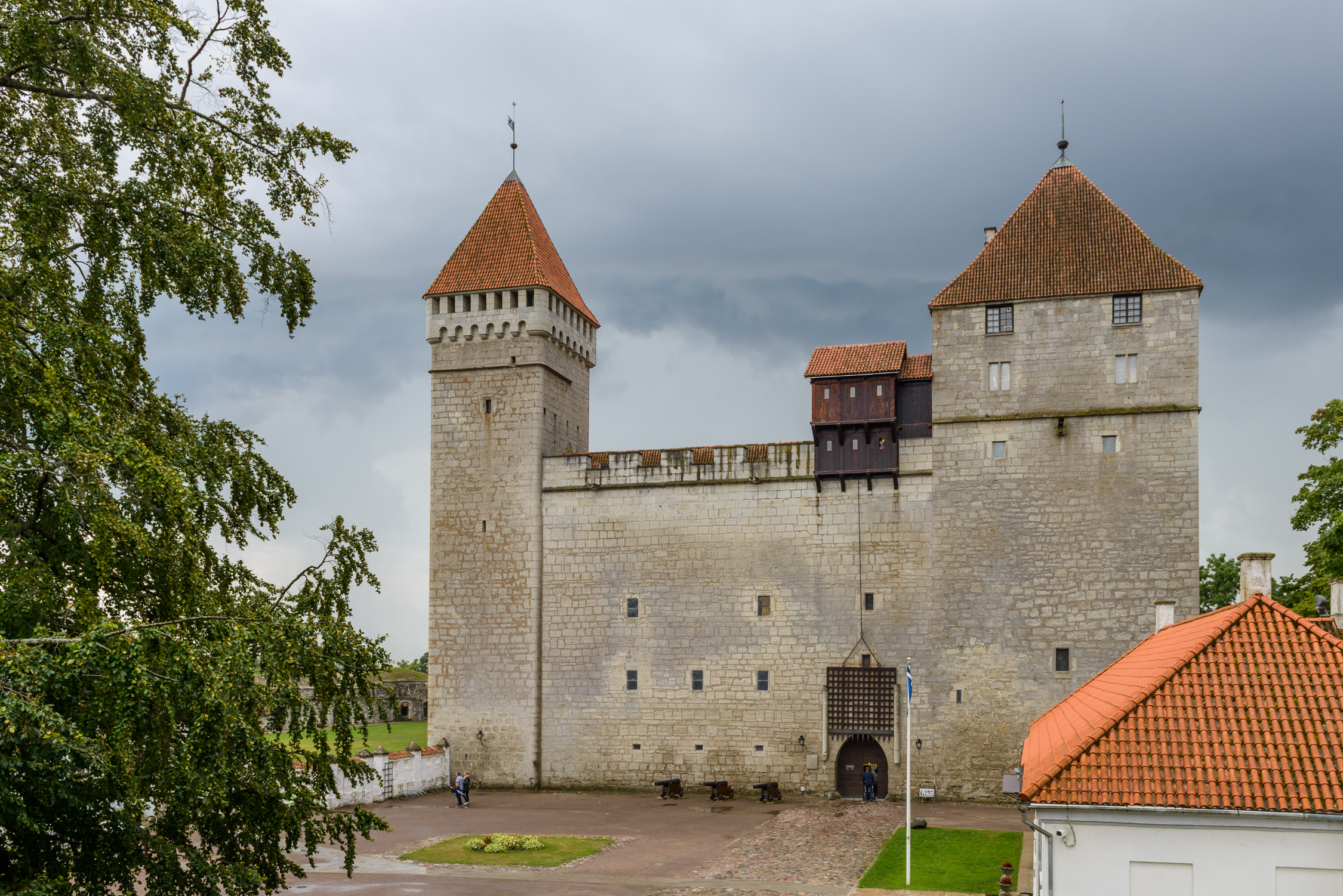
Kuressaare Castle ( et, Kuressaare linnus; german: Schloss Arensburg), also Kuressaare Episcopal Castle, ( et, Kuressaare piiskopilinnus), is a castle in Kuressaare on Saaremaa island, in western Estonia. History The earliest written record mentioning Kuressaare castle is from the 1380s, when the Teutonic Order began its construction for the bishops of Ösel-Wieck. Some sources claim that the first castle was built of wood. As the inhabitants of Saaremaa put up stiff resistance to foreign efforts to Christianise them, the castle was undoubtedly built as part of a wider effort by the crusaders to gain control over the island. From the outset, it was a stronghold belonging to the bishop of Saare-Lääne (german: Ösel-Wiek) and remained one of the most important castles of the Bishopric until its dissolution during the Livonian War. In 1559, Denmark-Norway seized control over Saaremaa and Kuressaare castle. During this time, the fortifications were modernised. Following the Pea ... [...More Info...] [...Related Items...] OR: [Wikipedia] [Google] [Baidu] |
Salme Ships
The Salme ships are two clinker-built ships of Scandinavian origin discovered in 2008 and 2010 near the village of Salme on the island of Saaremaa, Estonia. Both ships were used for ship burials here around AD 700–750 in the Nordic Iron Age and contained the remains of 41 warriors killed in battle, as well as 6 dogs, 2 hunting hawks and numerous weapons and other artifacts. Discovery and excavation The first ship was discovered in 2008 during earth removal for infrastructure construction. An archaeological expedition has been working on the site since 2008. The second ship was discovered in 2010. There is some indirect evidence pointing to the possibility that at least one more ship is yet to be discovered during future excavations. Location The ships were located near the ancient coastline, about above water level. The location is from the present coastline and above present water level. Description Both Salme ships are clinker-built and archaeologists have estim ... [...More Info...] [...Related Items...] OR: [Wikipedia] [Google] [Baidu] |
Hiiumaa
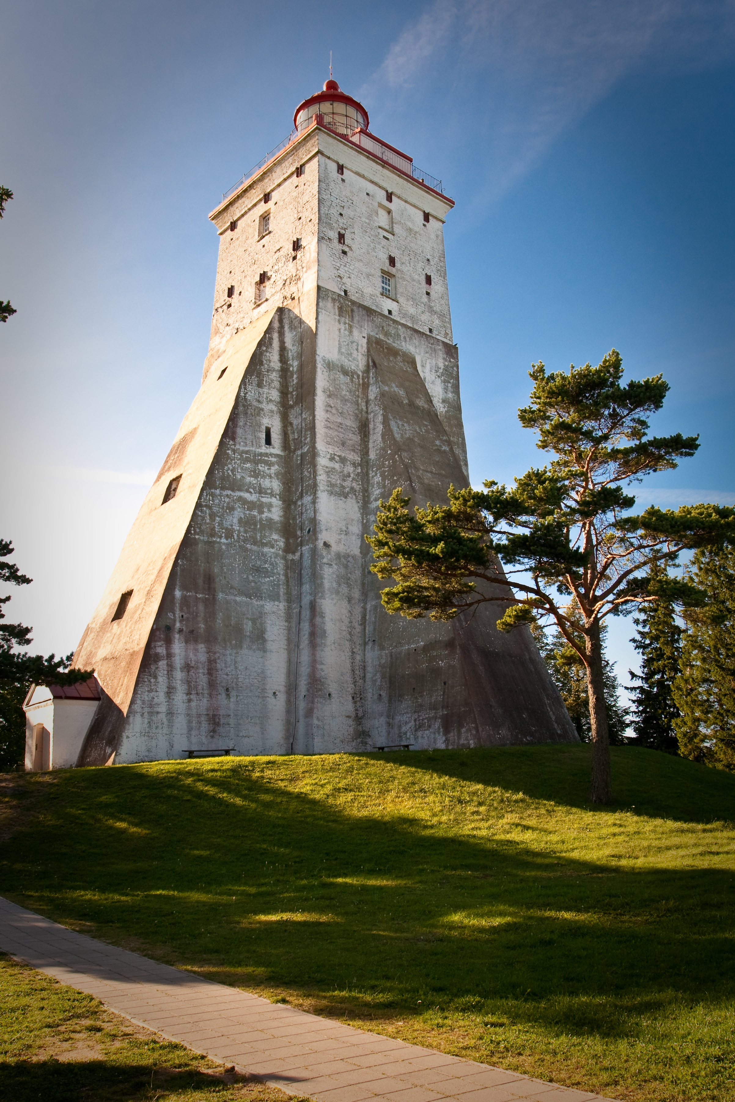
Hiiumaa (, ) is the second largest island in Estonia and is part of the West Estonian archipelago, in the Baltic Sea. It has an area of 989 km2 and is 22 km from the Estonian mainland. Its largest town is Kärdla. It is located within Hiiu County. Names Hiiumaa is the main island of Hiiu County, called or in Estonian. The Swedish and German name of the island is or ('Day' island) and in Danish. In modern Finnish, it is called , literally 'Hiisi's Land'. In Russian it is known as (). In Old Gutnish, it was ('day isthmus'), from which the local North Germanic name is derived. History Prehistory Hiiumaa emerged from the Baltic Sea 8500 years ago due to isostatic uplift after the retreat of the ice cap. Mesolithic settlements are found on the island's Kõpu Peninsula from about 5500 BC. These settlements seem to be related mostly to seal hunting and extend into the earliest Neolithic. As Hiiumaa is constantly uplifting the local sea level was 20 m higher ... [...More Info...] [...Related Items...] OR: [Wikipedia] [Google] [Baidu] |
Thule
Thule ( grc-gre, Θούλη, Thoúlē; la, Thūlē) is the most northerly location mentioned in ancient Greek literature, ancient Greek and Latin literature, Roman literature and cartography. Modern interpretations have included Orkney, Shetland, northern Scotland, the island of Saaremaa (Ösel) in Estonia, and the Norwegian island of Smøla (island), Smøla.Andreas Kleineberg, Christian Marx, Eberhard Knobloch und Dieter Lelgemann: ''Germania und die Insel Thule. Die Entschlüsselung von Ptolemaios' "Atlas der Oikumene".'' Wissenschaftliche Buchgesellschaft, Darmstadt 2010. In Classics, classical and medieval literature, ''ultima Thule'' (Latin "farthest Thule") acquired a metaphorical meaning of any distant place located beyond the "borders of the known world". By the Late Middle Ages and early modern period, the Greco-Roman Thule was often identified with the real Iceland or Greenland. Sometimes ''Ultima Thule'' was a Latin name for Greenland, when ''Thule'' was used for ... [...More Info...] [...Related Items...] OR: [Wikipedia] [Google] [Baidu] |
Valjala Maalinn 2
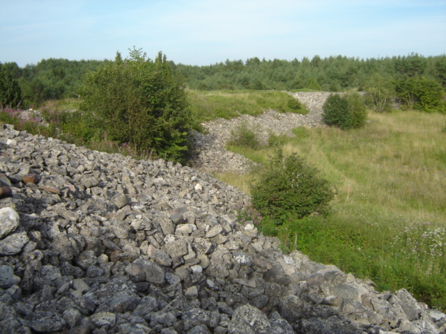
Valjala is a small borough (') in Saare County, Estonia, on the island of Saaremaa. It is the administrative centre of Saaremaa Parish. As of 2011 Census, the settlement's population was 410. The Valjala St. Martin's Church lies in centre of Valjala and is the oldest stone church in Estonia. Ruins of Valjala Stronghold The Valjala Stronghold ( la, Castrum Waldia, et, Valjala Maalinn) was a major ringfort on the island of Saaremaa in Estonia. Established in the 12th century, at the time it was the most important Oeselian stronghold. Its surrender in 1227 final ... are about 700 meters south from Valjala. References Boroughs and small boroughs in Estonia Saaremaa Parish {{Saare-geo-stub ... [...More Info...] [...Related Items...] OR: [Wikipedia] [Google] [Baidu] |
Muhu
Muhu (also called Muhumaa in Estonian), is an island in the West Estonian archipelago of the Baltic Sea. With an area of it is the third largest island belonging to Estonia, after Saaremaa and Hiiumaa. Together with neighbouring smaller islands of Kesselaid, Viirelaid, Võilaid and Suurlaid it forms Muhu Parish ( et, Muhu vald), the rural municipality within Saare County. The municipality has a population of 1,697 (as of 19 April 2010) and covers an area of . The population density is . History and geography The German names for the island are Mohn and Moon. Moon is also the Swedish name for the island. The most important villages in Muhu are Kuivastu, Liiva (where the school can be found) and Koguva. In Pädaste, an internationally renowned luxury hotel and spa operates in the restored manor house. The island is divided from mainland Estonia by the Suur Strait (''Moonsund'') and from Saaremaa by the Väike Strait. It is linked by ferry to Virtsu in the mainland, and to S ... [...More Info...] [...Related Items...] OR: [Wikipedia] [Google] [Baidu] |
Baltic Sea
The Baltic Sea is an arm of the Atlantic Ocean that is enclosed by Denmark, Estonia, Finland, Germany, Latvia, Lithuania, Poland, Russia, Sweden and the North and Central European Plain. The sea stretches from 53°N to 66°N latitude and from 10°E to 30°E longitude. A marginal sea of the Atlantic, with limited water exchange between the two water bodies, the Baltic Sea drains through the Danish Straits into the Kattegat by way of the Øresund, Great Belt and Little Belt. It includes the Gulf of Bothnia, the Bay of Bothnia, the Gulf of Finland, the Gulf of Riga and the Bay of Gdańsk. The " Baltic Proper" is bordered on its northern edge, at latitude 60°N, by Åland and the Gulf of Bothnia, on its northeastern edge by the Gulf of Finland, on its eastern edge by the Gulf of Riga, and in the west by the Swedish part of the southern Scandinavian Peninsula. The Baltic Sea is connected by artificial waterways to the White Sea via the White Sea–Baltic Canal and to the German ... [...More Info...] [...Related Items...] OR: [Wikipedia] [Google] [Baidu] |
Counties Of Estonia
Counties ( et, maakond, plural ') are the first-level administrative subdivisions of Estonia. Estonian territory is composed of 15 counties, including 13 on the mainland and 2 on islands. The government (') of each county is led by a ' (governor) who represents the national government (') at the regional level. Governors are appointed by the national government for a term of five years. Each county is further divided into municipalities of two types: urban municipalities (towns, ') and rural municipalities (parishes, '). The number and name of the counties were not affected. However, their borders were changed by the administrative reform at the municipal elections Sunday 15 October 2017, which brought the number of municipalities down from 213 to 79. List Population figures as of 1 January 2021. The sum total of the figures in the table is 42,644 km2, of which the land area is 42,388 km2, so that 256 km2 of water is included in the figures. History In the first ... [...More Info...] [...Related Items...] OR: [Wikipedia] [Google] [Baidu] |
West Estonian Archipelago
West Estonian archipelago ( et, Lääne-Eesti saarestik, also Moonsund archipelago) is a group of Estonian islands located in the Baltic Sea around Väinameri. The total area is about . The archipelago is composed of the islands Saaremaa, Hiiumaa, Muhu, Vormsi and about 900 other smaller islands. Protected areas UNESCO established the West Estonian Archipelago Biosphere Reserve in 1990 under the Man and the Biosphere Programme. See also *List of islands of Estonia *Estonian Swedes References External linksThe Väinameri SeaEstonica Archipelagoes of the Baltic Sea • In typography, a bullet or bullet point, , is a typographical symbol or glyph used to introduce items in a list. For example: *Point 1 *Point 2 *Point 3 The bullet symbol may take any of a variety of shapes, such as circular, square, diamo ... Biosphere reserves of Estonia Gulf of Riga {{estonia-geo-stub ... [...More Info...] [...Related Items...] OR: [Wikipedia] [Google] [Baidu] |


.jpg)