|
SS Empire Driver
''Empire Driver'' was a cargo ship that was built in 1942 by William Gray & Company, William Gray & Co Ltd, West Hartlepool, Co Durham, United Kingdom for the Ministry of War Transport (MoWT). In 1945, she was transferred to the French Government and renamed ''Radiotélégraphiste Biard''. She was sold to an Italian company in 1950 and renamed ''Dea Mazzella''. In 1956, she was renamed ''Maria Mazzella''. Further sales in 1960 and 1964 saw her renamed ''Falzarego'' and ''Grazia Prima'' respectively. In 1965, she was sold to Liberia and renamed ''Missouri''. She served until 1969 when she was scrapped. Description The ship was built in 1942 by William Gray & Co Ltd, West Hartlepool. She was yard number 1137. The ship was long, with a beam of . She had a depth of and a draught of . She was assessed at . . Her deadweight tonnage, DWT was 10,300. The ship was propelled by a 510 nominal horsepower, nhp triple expansion steam engine, which had cylinders of , and diameter by st ... [...More Info...] [...Related Items...] OR: [Wikipedia] [Google] [Baidu] |
William Gray & Company
William Gray & Company Ltd. was a British shipbuilding company located in West Hartlepool, County Durham, in North East England. Founded in 1863 by John Denton and William Gray as a partnership, it became a private and then a public limited company under the leadership of three generations of the Gray family until finally wound up in 1962. Company history Denton, Gray & Co. In 1839 John Punshon Denton established a shipyard in Middleton, Hartlepool to build and repair wooden-hulled sailing ships. In 1863 Denton entered into a partnership with William Gray, a successful businessman with a chain of stores in Hartlepool, to form Denton, Gray and Company. The shipyard was modernised and extended, and began to build iron-hulled ships. Their first ship was launched on 23 January 1864. In 1865 Denton, Gray and Co. established a new partnership with the shipbuilders Richardson, Duck and Co. of Stockton-on-Tees, and marine engine builders T. Richardson and Sons called Richardson, De ... [...More Info...] [...Related Items...] OR: [Wikipedia] [Google] [Baidu] |
Methil
Methil (Scottish Gaelic: Meadhchill) is an eastern coastal town in Scotland. It was first recorded as "Methkil" in 1207, and belonged to the Bishop of St Andrews. Two Bronze Age cemeteries have been discovered which date the settlement as over 8,000 years old. Famous for its High Street having the most pubs per mile in Scotland, it was part of its own barony in 1614 and also part of the former burgh of Buckhaven and Methil. This burgh existed between 1891 and 1975 (following the reorganisation of local government). It is situated within a continuous urban area described as Levenmouth. Methil lies geographically between Largo Bay to the east and Wemyss Bay to the west. Previously an industrial maritime powerhouse of the region and once Scotland's greatest coal port, it is now redirecting itself towards a green energy future. The River Leven delineates Methil from adjacent towns. Toponymy The name, Methil, is from Scottish Gaelic, and appears to derive from ''meadh(on)'' me ... [...More Info...] [...Related Items...] OR: [Wikipedia] [Google] [Baidu] |
Montevideo
Montevideo () is the Capital city, capital and List of cities in Uruguay, largest city of Uruguay. According to the 2011 census, the city proper has a population of 1,319,108 (about one-third of the country's total population) in an area of . Montevideo is situated on the southern coast of the country, on the northeastern bank of the Río de la Plata. The city was established in 1724 by a Spanish soldier, Bruno Mauricio de Zabala, as a strategic move amidst the Spanish people, Spanish-Portuguese people, Portuguese dispute over the La Plata Basin, platine region. It was also under brief British invasions of the Río de la Plata, British rule in 1807, but eventually the city was retaken by Spanish criollos who defeated the British invasions of the River Plate. Montevideo is the seat of the administrative headquarters of Mercosur and ALADI, Latin America's leading trade blocs, a position that entailed comparisons to the role of Brussels in Europe. The 2019 Mercer's report on qual ... [...More Info...] [...Related Items...] OR: [Wikipedia] [Google] [Baidu] |
Freetown
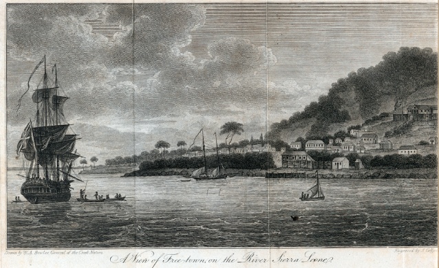
Freetown is the capital and largest city of Sierra Leone. It is a major port city on the Atlantic Ocean and is located in the Western Area of the country. Freetown is Sierra Leone's major urban, economic, financial, cultural, educational and political centre, as it is the seat of the Government of Sierra Leone. The population of Freetown was 1,055,964 at the 2015 census. The city's economy revolves largely around its harbour, which occupies a part of the estuary of the Sierra Leone River in one of the world's largest natural deep water harbours. Although the city has traditionally been the homeland of the Sierra Leone Creole people, the population of Freetown is ethnically, culturally, and religiously diverse. The city is home to a significant population of all of Sierra Leone's ethnic groups, with no single ethnic group forming more than 27% of the city's population. As in virtually all parts of Sierra Leone, the Krio language of the Sierra Leone Creole people is Freetown's ... [...More Info...] [...Related Items...] OR: [Wikipedia] [Google] [Baidu] |
Bône
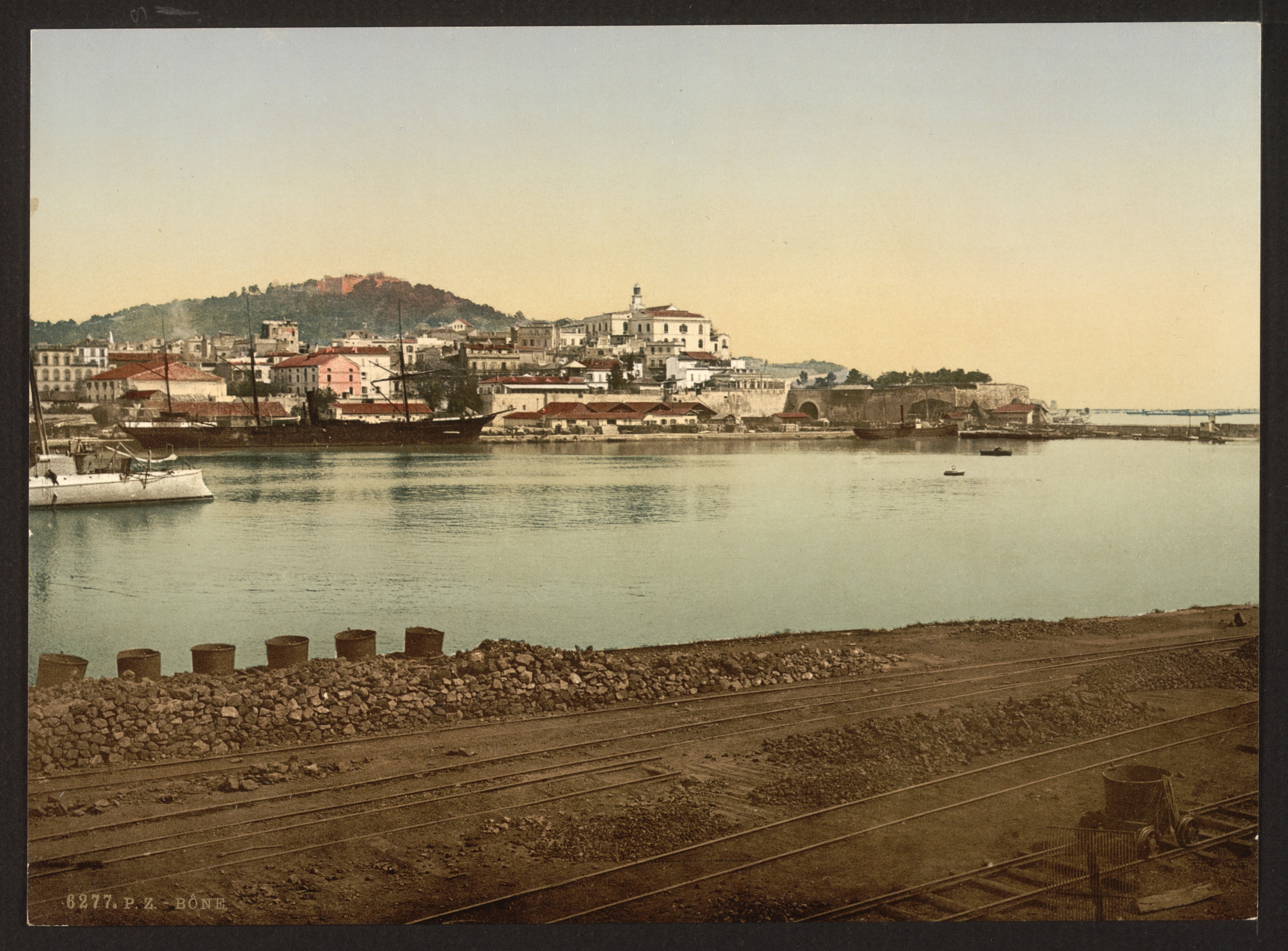
Annaba ( ar, عنّابة, "Place of the Jujubes"; ber, Aânavaen), formerly known as Bon, Bona and Bône, is a seaport city in the northeastern corner of Algeria, close to the border with Tunisia. Annaba is near the small Seybouse River and is in the Annaba Province. With a population of about 464,740 (2019) and 1,000,000 for the metropole, Annaba is the third-largest city and the leading industrial center in Algeria. Annaba is a coastal city that underwent significant growth during the 20th century. Annaba has a metropolitan area with a higher population density than the other metropolitan areas of the Algerian coastline, such as Oran and Algiers. Much of eastern and southern Algeria uses the services, equipment and infrastructure of Annaba. Economically, it is the centre for various economic activities, such as industry, transportation, finance, and tourism. Names Present-day Annaba grew up on the site of Aphrodisium, the seaport of the Roman city . (The modern city ... [...More Info...] [...Related Items...] OR: [Wikipedia] [Google] [Baidu] |
Lancashire
Lancashire ( , ; abbreviated Lancs) is the name of a historic county, ceremonial county, and non-metropolitan county in North West England. The boundaries of these three areas differ significantly. The non-metropolitan county of Lancashire was created by the Local Government Act 1972. It is administered by Lancashire County Council, based in Preston, and twelve district councils. Although Lancaster is still considered the county town, Preston is the administrative centre of the non-metropolitan county. The ceremonial county has the same boundaries except that it also includes Blackpool and Blackburn with Darwen, which are unitary authorities. The historic county of Lancashire is larger and includes the cities of Manchester and Liverpool as well as the Furness and Cartmel peninsulas, but excludes Bowland area of the West Riding of Yorkshire transferred to the non-metropolitan county in 1974 History Before the county During Roman times the area was part of the Bri ... [...More Info...] [...Related Items...] OR: [Wikipedia] [Google] [Baidu] |
Liverpool
Liverpool is a city and metropolitan borough in Merseyside, England. With a population of in 2019, it is the 10th largest English district by population and its metropolitan area is the fifth largest in the United Kingdom, with a population of 2.24 million. On the eastern side of the Mersey Estuary, Liverpool historically lay within the ancient hundred of West Derby in the county of Lancashire. It became a borough in 1207, a city in 1880, and a county borough independent of the newly-created Lancashire County Council in 1889. Its growth as a major port was paralleled by the expansion of the city throughout the Industrial Revolution. Along with general cargo, freight, and raw materials such as coal and cotton, merchants were involved in the slave trade. In the 19th century, Liverpool was a major port of departure for English and Irish emigrants to North America. It was also home to both the Cunard and White Star Lines, and was the port of registry of the ocean li ... [...More Info...] [...Related Items...] OR: [Wikipedia] [Google] [Baidu] |
Algiers
Algiers ( ; ar, الجزائر, al-Jazāʾir; ber, Dzayer, script=Latn; french: Alger, ) is the capital and largest city of Algeria. The city's population at the 2008 Census was 2,988,145Census 14 April 2008: Office National des Statistiques de l'Algérie (web). and in 2020 was estimated to be around 4,500,000. Algiers is located on the Mediterranean Sea and in the north-central portion of Algeria. Algiers is situated on the west side of a bay of the Mediterranean Sea. The modern part of the city is built on the level ground by the seashore; the old part, the ancient city of the deys, climbs the steep hill behind the modern town and is crowned by the Casbah or citadel (a UNESCO World Heritage Site), above the sea. The casbah and the two quays form a triangle. Names The city's name is derived via French and Catalan ''Origins of Algiers'' by Louis Leschi, speech delivered June 16, 1941, published in ''El Djezair Sheets'', July 194History of Algeria . from the Arabic name '' ... [...More Info...] [...Related Items...] OR: [Wikipedia] [Google] [Baidu] |
Gibraltar
) , anthem = " God Save the King" , song = " Gibraltar Anthem" , image_map = Gibraltar location in Europe.svg , map_alt = Location of Gibraltar in Europe , map_caption = United Kingdom shown in pale green , mapsize = , image_map2 = Gibraltar map-en-edit2.svg , map_alt2 = Map of Gibraltar , map_caption2 = Map of Gibraltar , mapsize2 = , subdivision_type = Sovereign state , subdivision_name = , established_title = British capture , established_date = 4 August 1704 , established_title2 = , established_date2 = 11 April 1713 , established_title3 = National Day , established_date3 = 10 September 1967 , established_title4 = Accession to EEC , established_date4 = 1 January 1973 , established_title5 = Withdrawal from the EU , established_date5 = 31 January 2020 , official_languages = English , languages_type = Spoken languages , languages = , capital = Westside, Gibraltar (de facto) , coordinates = , largest_settlement_type = largest district , l ... [...More Info...] [...Related Items...] OR: [Wikipedia] [Google] [Baidu] |
Petrol
Gasoline (; ) or petrol (; ) (see ) is a transparent, petroleum-derived flammable liquid that is used primarily as a fuel in most spark-ignited internal combustion engines (also known as petrol engines). It consists mostly of organic compounds obtained by the fractional distillation of petroleum, enhanced with a variety of additives. On average, U.S. refineries produce, from a barrel of crude oil, about 19 to 20 gallons of gasoline; 11 to 13 gallons of distillate fuel (most of which is sold as diesel fuel); and 3 to 4 gallons of jet fuel. The product ratio depends on the processing in an oil refinery and the crude oil assay. A barrel of oil is defined as holding 42 US gallons, which is about 159 liters or 35 imperial gallons. The characteristic of a particular gasoline blend to resist igniting too early (which causes knocking and reduces efficiency in reciprocating engines) is measured by its octane rating, which is produced in several grades. Tetraethyl lead and other ... [...More Info...] [...Related Items...] OR: [Wikipedia] [Google] [Baidu] |
Pembrokeshire
Pembrokeshire ( ; cy, Sir Benfro ) is a Local government in Wales#Principal areas, county in the South West Wales, south-west of Wales. It is bordered by Carmarthenshire to the east, Ceredigion to the northeast, and the rest by sea. The county is home to Pembrokeshire Coast National Park. The Park occupies more than a third of the area of the county and includes the Preseli Hills in the north as well as the Pembrokeshire Coast Path. Historically, mining and fishing were important activities, while industry nowadays is focused on agriculture (86 per cent of land use), oil and gas, and tourism; Pembrokeshire's beaches have won many awards. The county has a diverse geography with a wide range of geological features, habitats and wildlife. Its prehistory and modern history have been extensively studied, from tribal occupation, through Roman times, to Welsh, Irish, Norman, English, Scandinavian and Flemish influences. Pembrokeshire County Council's headquarters are in the county ... [...More Info...] [...Related Items...] OR: [Wikipedia] [Google] [Baidu] |
Milford Haven
Milford Haven ( cy, Aberdaugleddau, meaning "mouth of the two Rivers Cleddau") is both a town and a community in Pembrokeshire, Wales. It is situated on the north side of the Milford Haven Waterway, an estuary forming a natural harbour that has been used as a port since the Middle Ages. The town was founded in 1790 by Sir William Hamilton, who designed a grid pattern. It was originally intended to be a whaling centre, though by 1800 it was developing as a Royal Navy dockyard which it remained until the dockyard was transferred to Pembroke in 1814. It then became a commercial dock, with the focus moving in the 1960s, after the construction of an oil refinery built by Esso, to logistics for fuel oil and liquid gas. By 2010, the town's port had become the fourth largest in the United Kingdom in terms of tonnage, and continues its important role in the United Kingdom's energy sector with several oil refineries and one of the biggest LNG terminals in the world. Milford Haven is the ... [...More Info...] [...Related Items...] OR: [Wikipedia] [Google] [Baidu] |


