|
Syrmia Oblast
Syrmia Oblast ( sr, Sremska oblast, script=Latn or ; hr, Srijemska oblast) was one of the oblasts of the Kingdom of Serbs, Croats and Slovenes from 1922 to 1929. Its administrative center was Vukovar. History The Kingdom of Serbs, Croats and Slovenes was formed in 1918 and was initially divided into counties and districts (this division was inherited from previous state administrations). In 1922, new administrative units known as oblasts (Serbo-Croatian: ''oblasti'' / области) were introduced and the whole country was divided into 33 oblasts. Before 1922, territory of Syrmia Oblast was part of the Syrmia County. In 1929, 33 oblasts were administratively replaced with 9 banovinas and one district, and territory of Syrmia Oblast was divided between the Danube Banovina, the Drina Banovina, and the Belgrade City Administration. Geography The Syrmia Oblast included the entire region of Syrmia. It shared borders with the Bačka Oblast in the north, the Belgrade O ... [...More Info...] [...Related Items...] OR: [Wikipedia] [Google] [Baidu] |
Oblast
An oblast (; ; Cyrillic (in most languages, including Russian and Ukrainian): , Bulgarian: ) is a type of administrative division of Belarus, Bulgaria, Kazakhstan, Kyrgyzstan, Russia, and Ukraine, as well as the Soviet Union and the Kingdom of Yugoslavia. Official terms in successor states of the Soviet Union differ, but some still use a cognate of the Russian term, e.g., ''vobłasć'' (''voblasts'', ''voblasts'', official orthography: , Taraškievica: , ) is used for regions of Belarus, ' (plural: ') for regions of Kazakhstan, and ''oblusu'' (') for regions of Kyrgyzstan. The term is often translated as "area", "zone", "province" or "region". The last translation may lead to confusion, because "raion" may be used for other kinds of administrative division, which may be translated as "region", "district" or "county" depending on the context. Unlike "province", translations as "area", "zone", and "region" may lead to confusion because they have very common meanings other t ... [...More Info...] [...Related Items...] OR: [Wikipedia] [Google] [Baidu] |
Osijek Oblast
The Osijek Oblast ( hr, Osječka oblast) was an administrative division of the Kingdom of Serbs, Croats and Slovenes. It existed from 1922 to 1929 and its capital was the city of Osijek. Oblast elections Elections to oblasts were held once on January 23, 1927. ''Veliki župan'' The oblast was headed by a ''veliki župan'' (Slovenian for "Great mayor"). These were: *Franjo Gabrek (1922 – 1924) *Ante Perković (1924 – 1925) *Ljudevit Gaj (1925 – 1927) *Radmilo Vujović (1927 – 1928) *Ladislav Hanžeković (1928 – 1929) *Juraj Kučić (1929) *Ante Perković (1929) See also *Osijek-Baranja County Osijek-Baranja County (, hr, Osječko-baranjska županija, hu, Eszék-Baranya megye) is a county in Croatia, located in northeastern Slavonia and Baranja. Its center is Osijek. Other towns include Đakovo, Našice, Valpovo, Belišće, and Beli ... References {{coord missing, Croatia Osijek History of Slavonia 20th century in Croatia Oblasts of the Kingd ... [...More Info...] [...Related Items...] OR: [Wikipedia] [Google] [Baidu] |
Petrovaradin
Petrovaradin ( sr-cyr, Петроварадин, ) is a historic town in the Serbian province of Vojvodina, now a part of the city of Novi Sad. As of 2011, the urban area has 14,810 inhabitants. Lying on the right bank of the Danube, across from the main part of Novi Sad, it is built around the Petrovaradin Fortress, historical anchor of the modern city. Name Petrovaradin was founded by the Celts, but its original name is unknown. During Roman administration it was known as ''Cusum''. After the Romans conquered the region from the Celtic tribe of Scordisci, they built the Cusum fortress where present Petrovaradin Fortress now stands. In addition, the town received its name from the Byzantines, who called it ''Petrikon or Petrikov (Πετρικον)'' and who presumably named it after Saint Peter. In documents from 1237, the town was first mentioned under the name ''Peturwarod'' (''Pétervárad''), which was named after Hungarian lord Peter, son of Töre. Petrovaradin was known un ... [...More Info...] [...Related Items...] OR: [Wikipedia] [Google] [Baidu] |
Županja
Županja (, hu, Zsupanya, german: Schaupanie) is a town in eastern Slavonia, Croatia, located 254 km east of Zagreb. It is administratively part of the Vukovar-Syrmia County. It is inhabited by 12,090 people (2011). Županja lies on the Sava river opposite Bosnia and Herzegovina, and is the site of a border-crossing bridge with the town of Orašje in Bosnia and Herzegovina. The A3 highway Zagreb-Slavonski Brod-Belgrade passes north of it, and the city is also reachable by a local railroad from Vinkovci as well as the state road D55. The 2011 census recorded 96.72% Croats in the municipality. History Županja was ruled by Ottoman Empire between 1536 and 1687 as part of Sanjak of Syrmia. Since the Treaty of Karlowitz in 1699, until 1918, Županja (named ''ZUPANJE'' when a post-office was opened in 1861)Handbook of Austria and Lombardy-Venetia Cancellations on the Postage Stamp Issues 1850-1864, by Edwin MUELLER, 1961. remained in the Austrian monarchy (Kingdom of Croatia-S ... [...More Info...] [...Related Items...] OR: [Wikipedia] [Google] [Baidu] |
Zemun
Zemun ( sr-cyrl, Земун, ; hu, Zimony) is a municipality in the city of Belgrade. Zemun was a separate town that was absorbed into Belgrade in 1934. It lies on the right bank of the Danube river, upstream from downtown Belgrade. The development of New Belgrade in the late 20th century expanded the continuous urban area of Belgrade and merged it with Zemun. The town was conquered by the Kingdom of Hungary in the 12th century and in the 15th century it was given as a personal possession to the Serbian despot Đurađ Branković. After the Serbian Despotate fell to the Ottoman Empire in 1459, Zemun became an important military outpost. Its strategic location near the confluence of the Sava and the Danube placed it in the center of the continued border wars between the Habsburg and the Ottoman empires. The Treaty of Belgrade of 1739 finally placed the town into Habsburg possession, the Military Frontier was organized in the region in 1746, and the town of Zemun was granted the rig ... [...More Info...] [...Related Items...] OR: [Wikipedia] [Google] [Baidu] |
Vinkovci
Vinkovci () is a city in Slavonia, in the Vukovar-Syrmia County in eastern Croatia. The city's registered population was 28,247 in the 2021 census, the total population of the city was 31,057, making it the largest town of the county. Surrounded by many large villages, it is a local transport hub, particularly because of its railways. Name The name comes from the Croatian given name Vinko, cognate to the name Vincent. It has been in use following a dedication of the oldest town church of Saint Elijah () to Saint Vincent the Deacon () in the Middle Ages. The name of the city in Croatian is plural. It was called in antiquity. There is no known Latin or Greek etymology for , so it is assumed to be inherited from an earlier time. ''Cibale'' is a toponym derived from geomorphology, from Indo-European meaning "ascension" or "head". It is assumed that the root is in Proto-Indo-European (head), in the sense of a hill, meaning a place that was protected from the flooding of Bosu ... [...More Info...] [...Related Items...] OR: [Wikipedia] [Google] [Baidu] |
Šid
Šid ( sr-cyr, Шид, ) is a town and municipality located in the Srem District of the autonomous province of Vojvodina, Serbia. It has a population of 14,893, while the municipality has 34,188 inhabitants. A border crossing between Serbia and Croatia is located in the town. Name In Serbian, the town is known as ''Šid'' (Шид), in Hungarian as ''Sid'', in German as ''Schid'', in Slovak as ''Šíd'', and in Rusyn as Шид. History Šid was firstly mentioned in 1702. At first, settlement was part of Danubian Military Frontier, but since the middle of the 18th century, it was part of the Syrmia County of the Habsburg Kingdom of Slavonia. In 1848-1849, Šid was part of Serbian Vojvodina, and in 1849-1860 part of Voivodeship of Serbia and Banat of Temeschwar. After the abolishment of the voivodeship in 1860, Šid was again incorporated into Syrmia County of the Kingdom of Slavonia. In 1868, Kingdom of Slavonia was joined with the Kingdom of Croatia into the Kingdom of Croatia- ... [...More Info...] [...Related Items...] OR: [Wikipedia] [Google] [Baidu] |
Stara Pazova
Stara Pazova (, ; hu, Ópazova) is a town and municipality located in the Srem District of the autonomous province of Vojvodina, Serbia. The town has a population of 64792, while Stara Pazova municipality has 65,792 inhabitants. The entrance into town from Inđija lies on 45th parallel north, it is half-way between the North pole and the equator. Name In Serbian, the town is known as ''Stara Pazova'' (Стара Пазова), formerly also ''Pazova'' (Пазова); in Slovak as ''Stará Pazova''; in German as ''Alt-Pasua'', ''Alt-Pazua'' or ''Pazua''; and in Hungarian as ''Ópazova''. History During the Ottoman administration (16th-18th century), Pazova was populated by ethnic Serbs and was part of the Ottoman Sanjak of Syrmia. In 1718, the town became part of the Habsburg monarchy. In the 18th century (after 1760) Lutheran Slovaks settled in Pazova, and in 1791 Germans arrived here as well. The Germans lived in a separate settlement known as Nova Pazova ("New Pazova"), thu ... [...More Info...] [...Related Items...] OR: [Wikipedia] [Google] [Baidu] |
Sremska Mitrovica
Sremska Mitrovica (; sr-Cyrl, Сремска Митровица, hu, Szávaszentdemeter, la, Sirmium) is a city and the administrative center of the Srem District in the autonomous province of Vojvodina, Serbia. It is situated on the left bank of the Sava river. , the city has a total population of 37,751 inhabitants, while its administrative area has a population of 79,940 inhabitants. As Sirmium, it was a capital of the Roman Empire during the Tetrarchy of 4th century CE. Ten Roman emperors were born in or near this city, Emperors Herennius Etruscus (251), Hostilian (251), Decius Traian (249–251), Claudius Gothicus (268–270), Quintillus (270), Aurelian (270–275), Probus (276–282), Maximian (285–310), Constantius II (337–361) and Gratian (367–383). Name The modern town name is ''Sremska Mitrovica'' ( sr, Сремска Митровица). The Hungarian name was ''Szávaszentdemeter'' while in Croatian it is referred to as ''Srijemska Mitrovica''. Mitrov ... [...More Info...] [...Related Items...] OR: [Wikipedia] [Google] [Baidu] |
Ruma
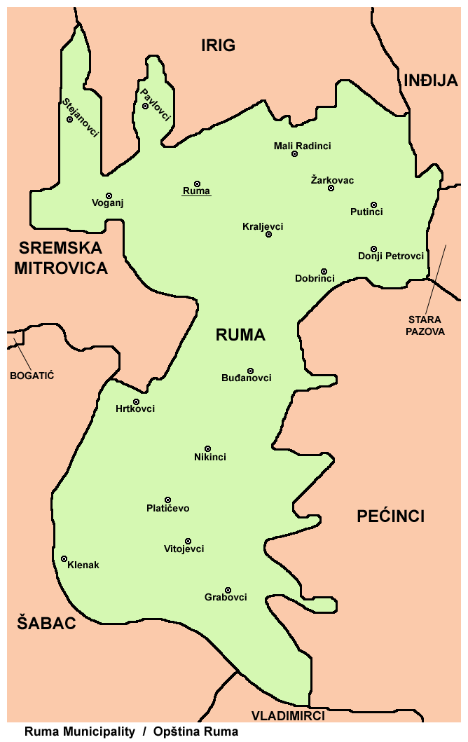
Ruma (; hu, Árpatarló) is a town and municipality in the Srem District of the Autonomous Province of Vojvodina, Serbia. As of 2011, the town has a population of 30,076, while the municipality has a population of 54,339. History Traces of organized human life on the territory of Ruma municipality date back as far as prehistory. The most important archaeological locality in the municipality is Bronze Age Gomolava near Hrtkovci, with two exclusive tombs of Bosut culture dating to the 9th century BC and 3000BC Vučedol culture pottery. The first known inhabitants of this area were various peoples of Illyrian and Celtic origin, such as the Amantini, Breuci, Scordisci, etc. During the Roman rule, local inhabitants lost their ethnic character and adopted Roman culture. There were no larger Roman settlements on the territory of Ruma, but a certain number of agricultural estates known as "villae rusticae" were located there. Migrations of Huns, Germanic peoples, Avars and Slavs des ... [...More Info...] [...Related Items...] OR: [Wikipedia] [Google] [Baidu] |
Irig, Serbia
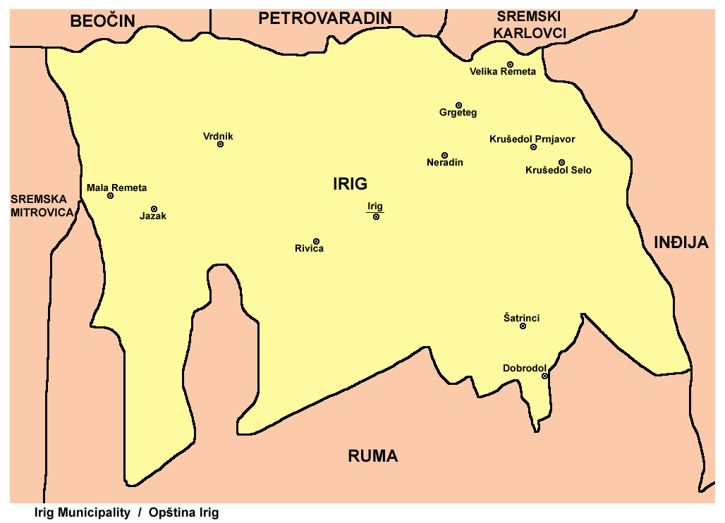
Irig (, ; hu, Ürög) is a town and municipality located in the Srem District of the autonomous province of Vojvodina, Serbia. The town has a population of 4,415, while Irig municipality has 10,866 inhabitants. Name In Serbian, the town is known as ''Irig'' (Ириг), in Croatian as ''Irig'', in Hungarian as ''Ireg'' or ''Ürög'', in German as ''Irick'', in Slovak as ''Irig'', and in Rusyn as Ириґ. History Irig was first mentioned in the historical documents in 1225. In the 15th century, the masters of the town were Serbian despots Vuk Grgurević, Đorđe Branković, and Jovan Branković. During the 15th and 16th century, ten Orthodox monasteries were built in the surrounding of Irig (Two of those were located just near the town). Between 1526 and 1699, the town was under Ottoman administration. During this time, it belonged to the Sanjak of Syrmia, and was the administrative seat of one of the seven nahijas in that sanjak. In 1665, the town had 2,000 houses, one m ... [...More Info...] [...Related Items...] OR: [Wikipedia] [Google] [Baidu] |
Ilok
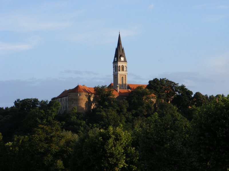
Ilok () is the easternmost town in Croatia forming a geographic salient surrounded by Vojvodina. Located in the Syrmia region, it lies on a hill overlooking the Danube river, which forms the border with the Bačka region of Serbia. The population of the settlement of Ilok is 5,072, while the total town population is 3,407 (census 2021). The town is home to a Franciscan monastery and Ilok Castle, which is a popular day trip for domestic tourists. Name In Croatian, the town is known as ''Ilok'', in German as ''Illok'', in Hungarian as ''Újlak'', in Serbian Cyrillic as Илок and in Turkish as ''Uyluk''. In Hungarian language "Újlak" means "new dwelling or lodge". History The area of present-day Ilok was populated since the neolithic and Bronze Ages. One Scordisci archaeological site dating back to late La Tène culture was excavated in the 1970s and 1980s as a part of rescue excavations in eastern Croatia. The Romans settled there in the 1st or 2nd century and built Cuc ... [...More Info...] [...Related Items...] OR: [Wikipedia] [Google] [Baidu] |


