|
Sycamore Canyon Wilderness
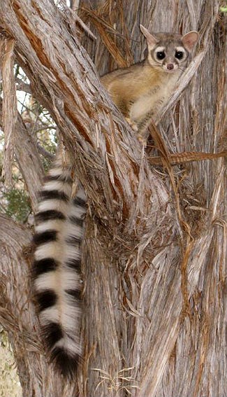
Sycamore Canyon Wilderness is a 56,000-acre (22,662 ha) wilderness area in the Coconino, Kaibab and Prescott national forests in the U.S. state of Arizona. Encompassing Sycamore Canyon and its surrounds from south of Williams to the confluence of Sycamore Creek with the Verde River, the wilderness is about 40 miles (64 km) southwest of Flagstaff. The canyon is one of several in Arizona that cut through the Mogollon Rim. Relevant United States Geological Survey (USGS) map quadrangles are Davenport Hill, White Horse Lake, May Tank Pocket, Perkinsville, Sycamore Basin, and Clarkdale. Red Rock-Secret Mountain Wilderness borders Sycamore Canyon Wilderness on the east. Ring-tailed cats, black bears, mountain lions, elk, deer, rattlesnakes, scorpions, canyon wrens, hermit thrushes, and many other creatures frequent the wilderness. Vegetation, which varies with elevation and the availability of water, includes stands of pine, fir, sycamore, walnut, and cottonwood. The canyon wall ... [...More Info...] [...Related Items...] OR: [Wikipedia] [Google] [Baidu] |
Coconino County, Arizona
Coconino County is a County (United States), county in the north-central part of the U.S. state of Arizona. Its population was 145,101 at the 2020 United States census, 2020 census. The county seat is Flagstaff, Arizona, Flagstaff. The county takes its name from ''Cohonino'', a name applied to the Havasupai people. It is the List of the largest counties in the United States by area, second-largest county by area in the contiguous United States, behind San Bernardino County, California. It has , or 16.4% of Arizona's total area, and is larger than each of the nine smallest states in the U.S. Coconino County comprises the Flagstaff metropolitan statistical area, Grand Canyon National Park, the federally recognized Havasupai Nation, and parts of the federally recognized Navajo Nation, Navajo, Hualapai, and Hopi nations. As a result, its relatively large Native Americans in the United States, Native American population makes up nearly 30% of the county's total population; it is m ... [...More Info...] [...Related Items...] OR: [Wikipedia] [Google] [Baidu] |
Ring-tailed Cat
The ringtail (''Bassariscus astutus'') is a mammal of the Procyonidae, raccoon family native to arid regions of North America. It is widely distributed and well adapted to disturbed areas. It has been legally trapped for its fur. It is listed as Least Concern on the IUCN Red List. It is also known as the ringtail cat, ring-tailed cat, miner's cat or bassarisk, and is sometimes called a cacomistle, though this term seems to be more often used to refer to ''cacomistle, Bassariscus sumichrasti''. The ringtail is the state mammal of Arizona. Description The ringtail is black to dark brown in color with pale underparts. The animal has a pointed muzzle with long whiskers, similar to that of a fox (its Latin name means ‘clever little fox’) and its body resembles that of a cat. The ringtailed's face resembles a mask as dark brown and black hair surround its eyes. These animals are characterized by a long black and white "ringed" tail with 14–16 stripes, which is about the same ... [...More Info...] [...Related Items...] OR: [Wikipedia] [Google] [Baidu] |
Aquilegia
''Aquilegia'' (common names: granny's bonnet, columbine) is a genus of about 60–70 species of perennial plants that are found in meadows, woodlands, and at higher altitudes throughout the Northern Hemisphere, known for the spurred petals Puzey, J.R., Gerbode, S.J., Hodges, S.A., Kramer, E.M., Mahadevan, L. (2011) Evolution of ''Aquilegia'' spur length diversity through changes in cell anisotropy. Proceedings of the Royal Society B. of their flowers. Etymology The genus name Aquilegia comes from the Latin “Aquila”, or “eagle”; this is in obvious reference to the spurred, “hook” shapes within the blooms, that many gardeners say resemble an eagle's talons. Description Perennial herbs, with woody, erect stock, roots forming thick rhizomes. The basal leaves are compound, 1–3 ternate, blades 3-lobed -partite, and lobes lobulate and obtuse. The cauline leaves are similar to the basal ones, while the upper ones are bract like. The hermaphrodite (bisexual) flowers ... [...More Info...] [...Related Items...] OR: [Wikipedia] [Google] [Baidu] |
Mesquite
Mesquite is a common name for several plants in the genus ''Prosopis'', which contains over 40 species of small leguminous trees. They are native to dry areas in the Americas. They have extremely long roots to seek water from very far under ground. As a legume, mesquites are one of the few sources of fixed nitrogen in the desert habitat. These trees bloom from spring to summer. They often produce fruits known as "pods". ''Prosopis'' spp. are able to grow up to tall, depending on site and climate. They are deciduous and depending on location and rainfall have either deep or shallow roots. ''Prosopis'' is considered long-lived because of the low mortality rate after the dicotyledonous stage and juveniles are also able to survive in conditions with low light and drought. The Cahuilla indigenous people of western North America were known to eat the seeds of mesquite. History ''Prosopis'' spp. have been in North America since the Pliocene era and their wood has been dated to 3300 ... [...More Info...] [...Related Items...] OR: [Wikipedia] [Google] [Baidu] |
Tuzigoot National Monument
Tuzigoot National Monument ( yuf-x-yav, ʼHaktlakva, Western Apache: ''Tú Digiz'') preserves a 2- to 3-story pueblo ruin on the summit of a limestone and sandstone ridge just east of Clarkdale, Arizona, 120 feet (36 m) above the Verde River floodplain. The Tuzigoot Site is an elongated complex of stone masonry rooms that were built along the spine of a natural outcrop in the Verde Valley. The central rooms stand higher than the others and they appear to have served public functions. The pueblo has 110 rooms. The National Park Service currently administers 58 acres (23 ha), within an authorized boundary of 834 acres (338 ha). ″Tú Digiz/Tuzigoot″ is a Tonto Apache term for "crooked waters," from nearby Pecks Lake, a cutoff meander of the Verde River; from Tú Digiz one principal Tonto Apache clan gets its name. The pueblo was built by the Sinagua people between 1125 and 1400 CE. Tuzigoot is the largest and best preserved of the many Sinagua pueblo ruins in the Verde Valley. Th ... [...More Info...] [...Related Items...] OR: [Wikipedia] [Google] [Baidu] |
Agave
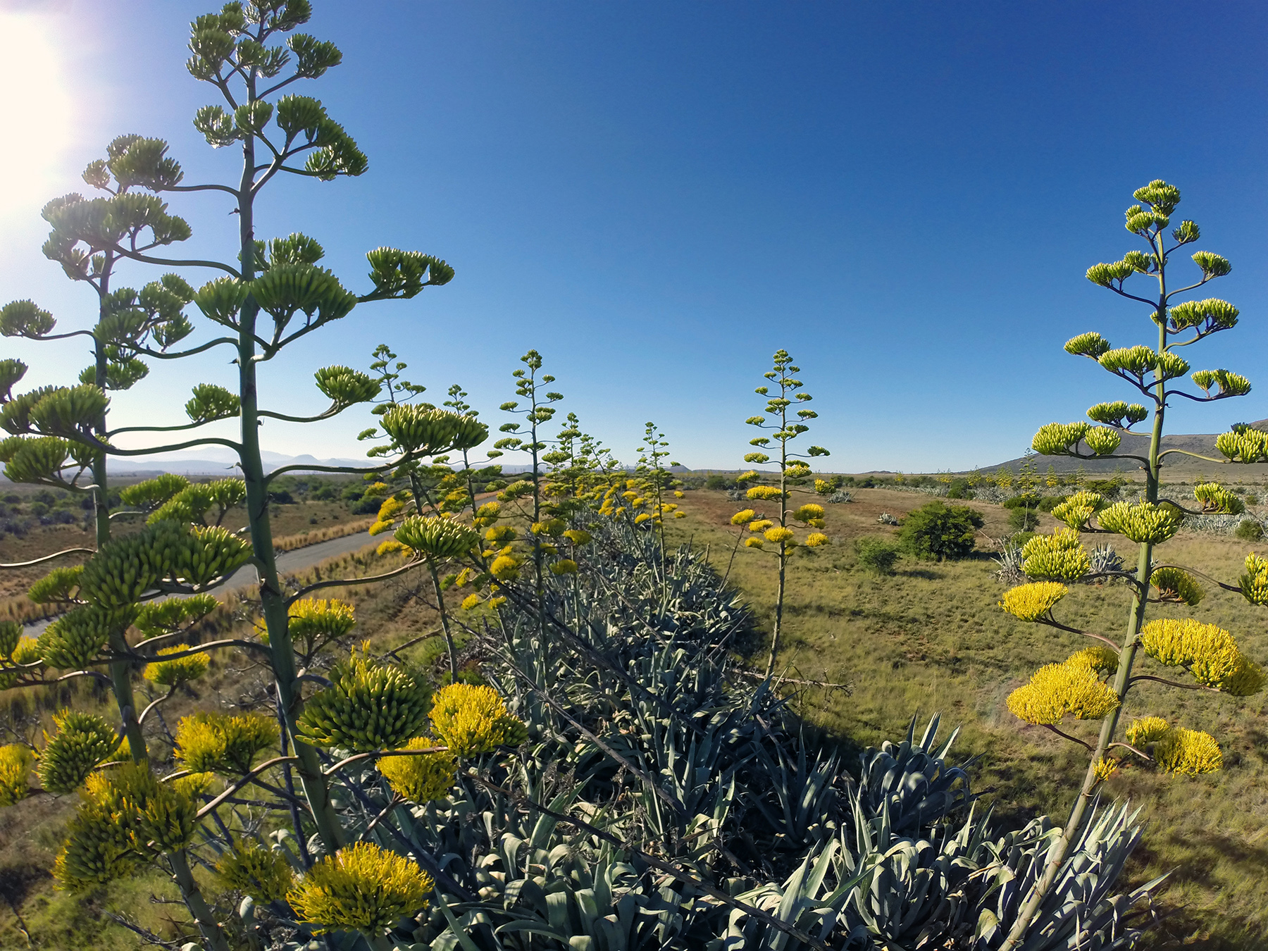
''Agave'' (; ; ) is a genus of monocots native to the hot and arid regions of the Americas and the Caribbean, although some ''Agave'' species are also native to tropical areas of North America, such as Mexico. The genus is primarily known for its succulent and xerophytic species that typically form large rosettes of strong, fleshy leaves. ''Agave'' now includes species formerly placed in a number of other genera, such as ''Manfreda'', ×''Mangave'', ''Polianthes'' and ''Prochnyanthes''. Many plants in this genus may be considered perennial, because they require several to many years to mature and flower. However, most ''Agave'' species are more accurately described as monocarpic rosettes or multiannuals, since each individual rosette flowers only once and then dies; a small number of ''Agave'' species are polycarpic. Maguey flowers are considered edible in many indigenous culinary traditions of Mesoamerica. Along with plants from the closely related genera ''Yucca'', ''Hes ... [...More Info...] [...Related Items...] OR: [Wikipedia] [Google] [Baidu] |
Sedona, Arizona
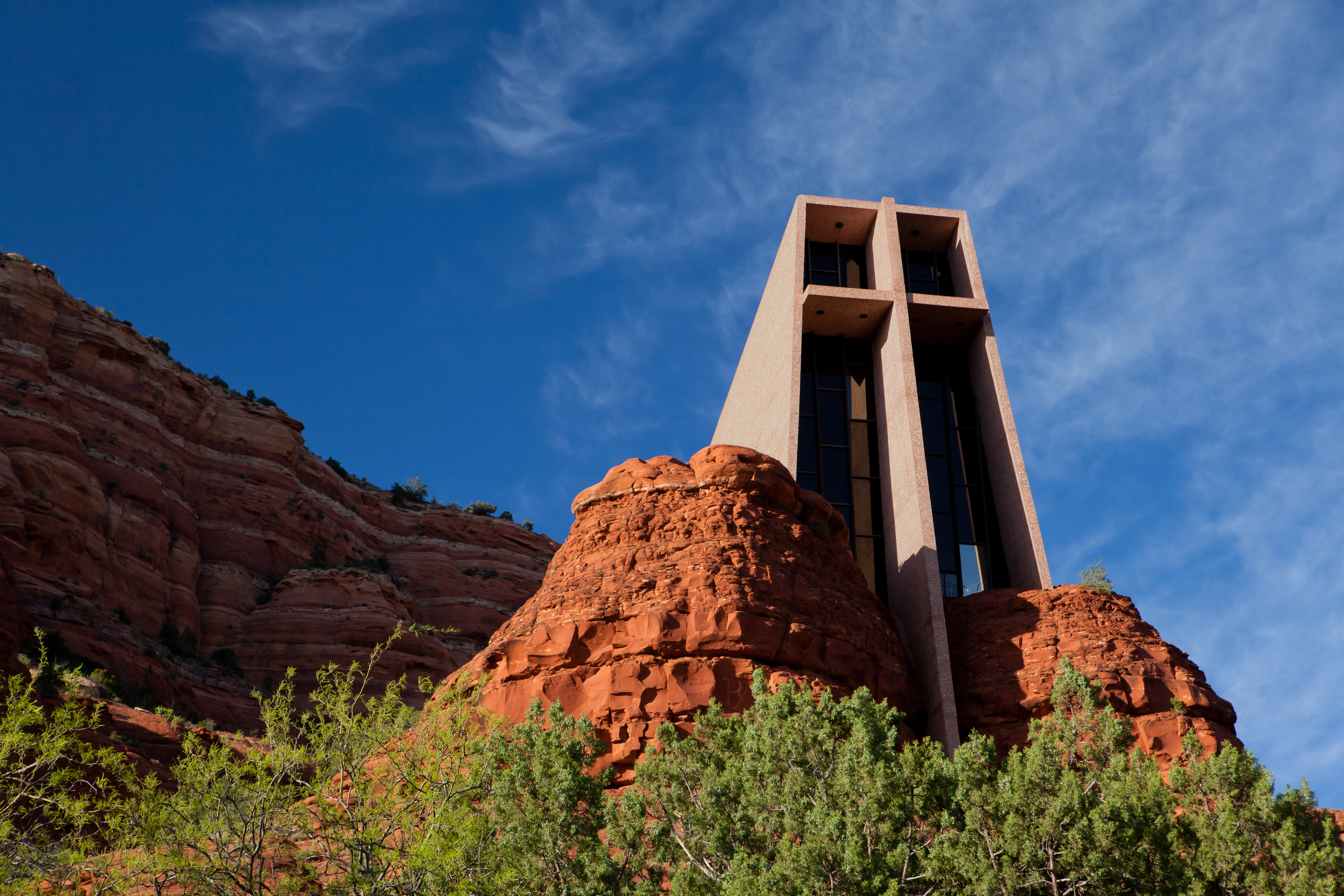
Sedona is a city that straddles the county line between Coconino and Yavapai counties in the northern Verde Valley region of the U.S. state of Arizona. As of the 2010 census, its population was 10,031. It is within the Coconino National Forest. Sedona's main attraction is its array of red sandstone formations. The formations appear to glow in brilliant orange and red when illuminated by the rising or setting sun. The red rocks form a popular backdrop for many activities, ranging from spiritual pursuits to the hundreds of hiking and mountain biking trails. Sedona is also the home to the nationally recognized McDonald's with turquoise arches, instead of the traditional Golden Arches. Sedona was named after Sedona Arabella Miller Schnebly (1877–1950), the wife of Theodore Carlton Schnebly, the city's first postmaster. She was celebrated for her hospitality and industriousness. Her mother, Amanda Miller, claimed to have made the name up because "it sounded pretty". Histor ... [...More Info...] [...Related Items...] OR: [Wikipedia] [Google] [Baidu] |
National Register Of Historic Places
The National Register of Historic Places (NRHP) is the United States federal government's official list of districts, sites, buildings, structures and objects deemed worthy of preservation for their historical significance or "great artistic value". A property listed in the National Register, or located within a National Register Historic District, may qualify for tax incentives derived from the total value of expenses incurred in preserving the property. The passage of the National Historic Preservation Act (NHPA) in 1966 established the National Register and the process for adding properties to it. Of the more than one and a half million properties on the National Register, 95,000 are listed individually. The remainder are contributing resources within historic districts. For most of its history, the National Register has been administered by the National Park Service (NPS), an agency within the U.S. Department of the Interior. Its goals are to help property owners and inte ... [...More Info...] [...Related Items...] OR: [Wikipedia] [Google] [Baidu] |
Chaparral
Chaparral ( ) is a shrubland plant community and geographical feature found primarily in the U.S. state of California, in southern Oregon, and in the northern portion of the Baja California Peninsula in Mexico. It is shaped by a Mediterranean climate (mild wet winters and hot dry summers) and infrequent, high-intensity crown fires. Chaparral features summer-drought-tolerant plants with hard sclerophyllous evergreen leaves, as contrasted with the associated soft-leaved, drought-deciduous, scrub community of coastal sage scrub, found often on drier, southern facing slopes within the chaparral biome. Three other closely related chaparral shrubland systems occur in central Arizona, western Texas, and along the eastern side of central Mexico's mountain chains (mexical), all having summer rains in contrast to the Mediterranean climate of other chaparral formations. Chaparral comprises 9% of California's wildland vegetation and contains 20% of its plant species. The name comes from th ... [...More Info...] [...Related Items...] OR: [Wikipedia] [Google] [Baidu] |
Quercus Gambelii
''Quercus gambelii'', with the common name Gambel oak, is a deciduous small tree or large shrub that is widespread in the foothills and lower mountains of western North America. It is also regionally called scrub oak, oak brush, and white oak. The common and scientific names, Gambel oak and ''Quercus gambelii'', were named after the American naturalists, naturalist William Gambel (1821–1849). Description ''Quercus gambelii'' trees differ in size from one location to another. The average mature height is from , but occasionally reaches heights of in some locations. Dwarf stands of plants under tall are common in marginal areas where heavy browsing occurs. The largest trees are found in the southern range of the species along streams. These trees reach up to 100 feet tall. The champion tree is in Arizona at tall. Although the wood is hard and dense, its branches are irregular and crooked, making them flexible enough to bend without breaking when covered with heavy sno ... [...More Info...] [...Related Items...] OR: [Wikipedia] [Google] [Baidu] |
Pinus Ponderosa
''Pinus ponderosa'', commonly known as the ponderosa pine, bull pine, blackjack pine, western yellow-pine, or filipinus pine is a very large pine tree species of variable habitat native to mountainous regions of western North America. It is the most widely distributed pine species in North America.Safford, H.D. 2013. Natural Range of Variation (NRV) for yellow pine and mixed conifer forests in the bioregional assessment area, including the Sierra Nevada, southern Cascades, and Modoc and Inyo National Forests. Unpublished report. USDA Forest Service, Pacific Southwest Region, Vallejo, CA/ref> ''Pinus ponderosa'' grows in various erect forms from British Columbia southward and eastward through 16 western U.S. states and has been successfully introduced in temperate regions of Europe, and in New Zealand. It was first documented in modern science in 1826 in eastern Washington near present-day Spokane (of which it is the official city tree). On that occasion, David Douglas misidenti ... [...More Info...] [...Related Items...] OR: [Wikipedia] [Google] [Baidu] |
Campsite
A campsite, also known as a campground or camping pitch, is a place used for overnight stay in an outdoor area. In British English, a ''campsite'' is an area, usually divided into a number of pitches, where people can camp overnight using tents, campervans or caravans; this British English use of the word is synonymous with the US English expression ''campground''. In American English, the term ''campsite'' generally means an area where an individual, family, group, or military unit can pitch a tent or park a camper; a campground may contain many campsites. There are two types of campsites: an impromptu area (as one might decide to stop while backpacking or hiking, or simply adjacent to a road through the wilderness), and a designated area with various facilities. Campgrounds The term ''camp'' comes from the Latin word ''campus'', meaning "field". Therefore, a campground consists typically of open pieces of ground where a camper can pitch a tent or park a camper. More ... [...More Info...] [...Related Items...] OR: [Wikipedia] [Google] [Baidu] |
.jpg)


