|
SurreyLive
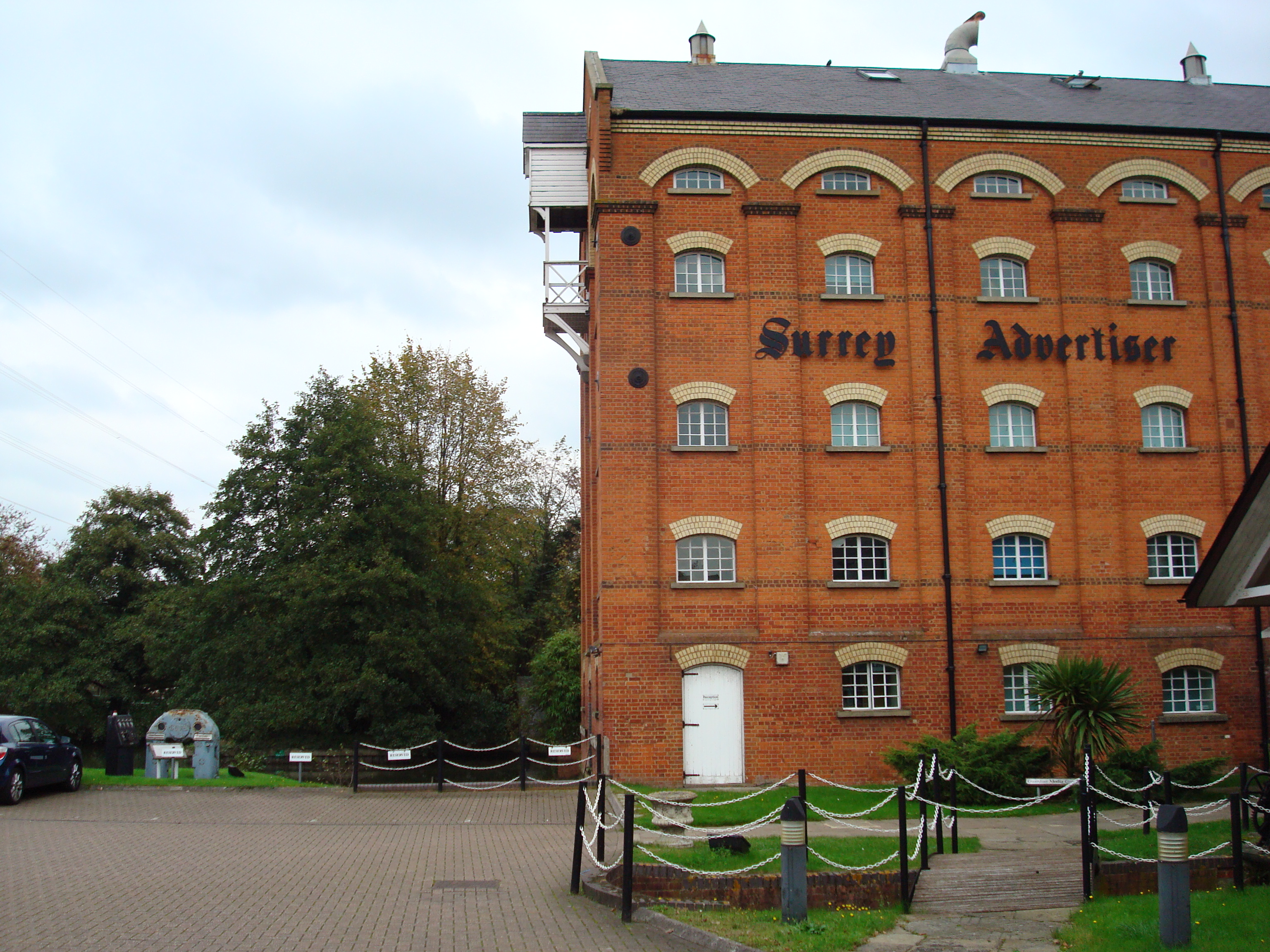
The ''Surrey Advertiser'' is a newspaper for Surrey, England which was established in 1864 and gradually evolved into the Surrey Advertiser Group of seven more localised titles. Guardian Media Group sold the Group to Trinity Mirror in 2010. The owners are now known as Reach plc. The head office is in Stoke Mill, Guildford. In March 2009 the ''News and Mail Series'' ended in the light of the more recent parallel titles within the same group which covered the same areas, principally the '' Surrey Herald: (various locality editions)'' and ''Guardian'' series. These three current titles, altogether, have the highest local paper circulation in Surrey. The series has moved universally to colour format. The Group is collectively branded also as the ''Get Surrey'' group, particularly its web presence. Its history is one of multiple acquisitions to expand its territory. The largest single expansion was in 2009 when GMG bought the Esher News & Mail Group another broadsheet weekly n ... [...More Info...] [...Related Items...] OR: [Wikipedia] [Google] [Baidu] |
Dorking
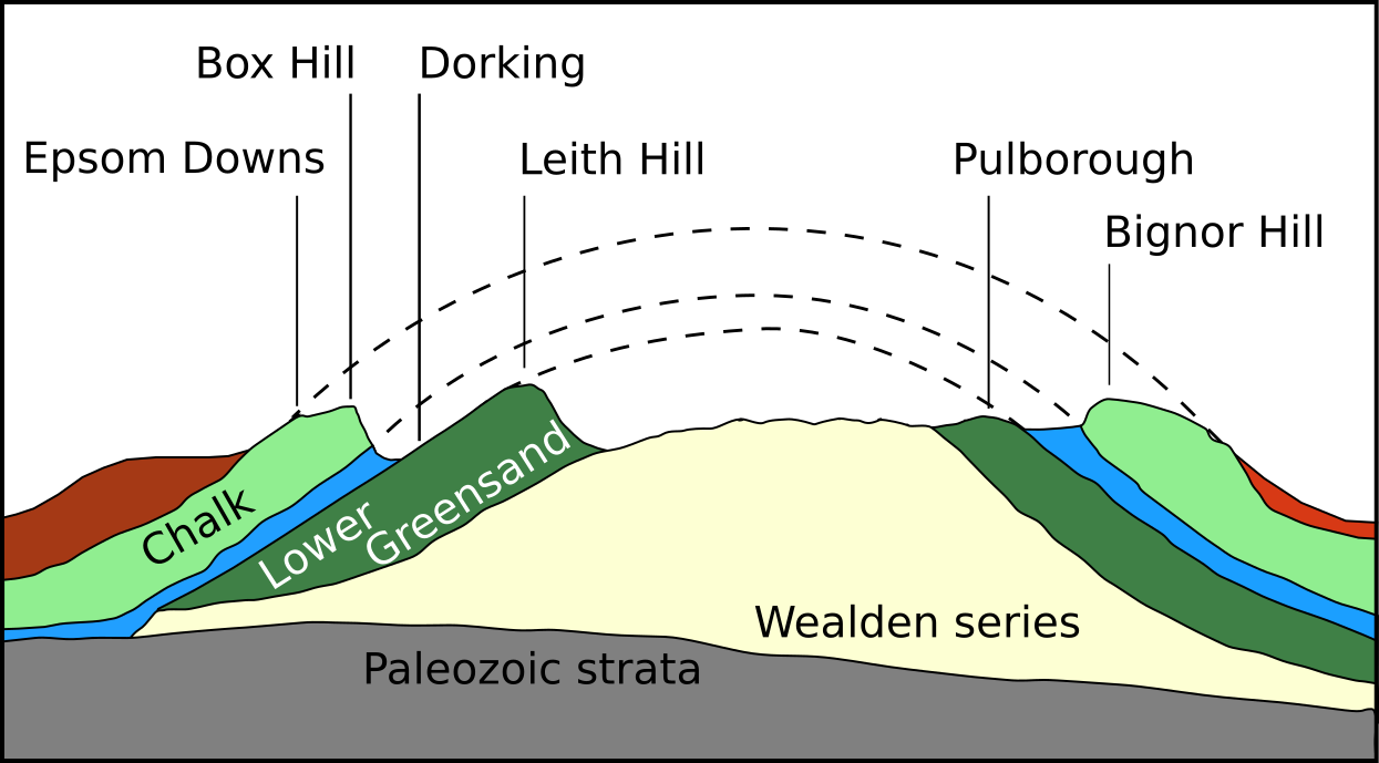
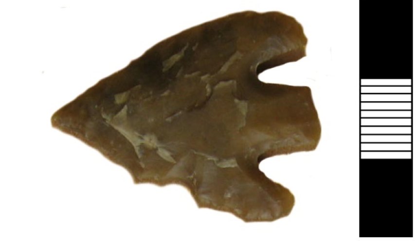
Dorking () is a market town in Surrey in South East England, about south of London. It is in Mole Valley District and the council headquarters are to the east of the centre. The High Street runs roughly east–west, parallel to the Pipp Brook and along the northern face of an outcrop of Lower Greensand. The town is surrounded on three sides by the Surrey Hills Area of Outstanding Natural Beauty and is close to Box Hill and Leith Hill. The earliest archaeological evidence of human activity is from the Mesolithic and Neolithic periods, and there are several Bronze Age bowl barrows in the local area. The town may have been the site of a staging post on Stane Street during Roman times, however the name 'Dorking' suggests an Anglo-Saxon origin for the modern settlement. A market is thought to have been held at least weekly since early medieval times and was highly regarded for the poultry traded there. The Dorking breed of domestic chicken is named after the town. The loca ... [...More Info...] [...Related Items...] OR: [Wikipedia] [Google] [Baidu] |
Staines Upon Thames
Staines-upon-Thames is a market town in northwest Surrey, England, around west of central London. It is in the Borough of Spelthorne, at the confluence of the River Thames and Colne. Historically part of Middlesex, the town was transferred to Surrey in 1965. Staines is close to Heathrow Airport and is linked to the national motorway network by the M25 and M3. The earliest evidence of human activity in the area is from the Paleolithic and, during the Neolithic, there was a causewayed enclosure on Staines Moor. The first bridge across the Thames at Staines is thought to have been built by the Romans and there was a settlement in the area around the modern High Street by the end of the 1st century CE. Throughout the middle ages, Staines was primarily an agricultural settlement and was held by Westminster Abbey. The first surviving record of a market is from 1218, but one may have taken place near St Mary's Church in the Anglo-Saxon period. The industrialisation of Staines ... [...More Info...] [...Related Items...] OR: [Wikipedia] [Google] [Baidu] |
Guildford
Guildford () is a town in west Surrey, around southwest of central London. As of the 2011 census, the town has a population of about 77,000 and is the seat of the wider Borough of Guildford, which had around inhabitants in . The name "Guildford" is thought to derive from a crossing of the River Wey, a tributary of the River Thames that flows through the town centre. The earliest evidence of human activity in the area is from the Mesolithic and Guildford is mentioned in the will of Alfred the Great from . The exact location of the main Anglo-Saxon settlement is unclear and the current site of the modern town centre may not have been occupied until the early 11th century. Following the Norman Conquest, a motte-and-bailey castle was constructed, which was developed into a royal residence by Henry III. During the late Middle Ages, Guildford prospered as a result of the wool trade and the town was granted a charter of incorporation by Henry VII in 1488. The River Wey Navig ... [...More Info...] [...Related Items...] OR: [Wikipedia] [Google] [Baidu] |
Godalming
Godalming is a market town and civil parish in southwest Surrey, England, around southwest of central London. It is in the Borough of Waverley, at the confluence of the Rivers Wey and Ock. The civil parish covers and includes the settlements of Farncombe, Binscombe and Holloway Hill. Much of the area lies on the strata of the Lower Greensand Group and Bargate stone was quarried locally until the Second World War. The earliest evidence of human activity is from the Paleolithic and the River Wey floodplain at Charterhouse was settled in the middle Iron Age and Roman period. The modern town is thought to have its origins in the 6th or early 7th centuries and its name is thought to derive from that of a Saxon landowner. Kersey, a woollen cloth, dyed blue, was produced at Godalming for much of the Middle Ages, but the industry declined in the early modern period. In the 17th century, the town began to specialise in the production of knitted textiles and in the manufactur ... [...More Info...] [...Related Items...] OR: [Wikipedia] [Google] [Baidu] |
Surrey Advertiser 1
Surrey () is a ceremonial county, ceremonial and non-metropolitan county, non-metropolitan counties of England, county in South East England, bordering Greater London to the south west. Surrey has a large rural area, and several significant urban areas, urban areas which form part of the Greater London Built-up Area. With a population of approximately 1.2 million people, Surrey is the 12th-most populous county in England. The most populated town in Surrey is Woking, followed by Guildford. The county is divided into eleven districts with borough status. Between 1893 and 2020, Surrey County Council was headquartered at County Hall, Kingston upon Thames, County Hall, Kingston-upon-Thames (now part of Greater London) but is now based at Woodhatch Place, Reigate. In the 20th century several alterations were made to Surrey's borders, with territory ceded to Greater London upon its creation and some gained from the abolition of Middlesex. Surrey is bordered by Greater London to ... [...More Info...] [...Related Items...] OR: [Wikipedia] [Google] [Baidu] |
Weybridge
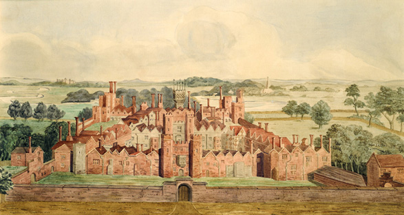
Weybridge () is a town in the Borough of Elmbridge in Surrey, England, around southwest of central London. The settlement is recorded as ''Waigebrugge'' and ''Weibrugge'' in the 7th century and the name derives from a crossing point of the River Wey, which flows into the River Thames to the north of the town centre. The earliest evidence of human activity is from the Bronze Age. During the Anglo-Saxon and medieval periods, Weybridge was held by Chertsey Abbey. In the 1530s, Henry VIII constructed Oatlands Palace to the north of the town centre, which he intended to be the residence of his fourth wife, Anne of Cleves. He married Catherine Howard there in July 1540 and the palace remained a royal residence until the Civil War. The buildings were demolished in the early 1650s and a new mansion, Oatlands House, was constructed to the east of Weybridge later the same century. Prince Frederick, Duke of York and Albany owned the mansion in the 18th century. The town began to ex ... [...More Info...] [...Related Items...] OR: [Wikipedia] [Google] [Baidu] |
Publications Established In 1864
To publish is to make content available to the general public.Berne Convention, article 3(3) URL last accessed 2010-05-10.Universal Copyright Convention, Geneva text (1952), article VI . URL last accessed 2010-05-10. While specific use of the term may vary among countries, it is usually applied to text, images, or other content, including paper ( |
Newspapers Published In Surrey
A newspaper is a periodical publication containing written information about current events and is often typed in black ink with a white or gray background. Newspapers can cover a wide variety of fields such as politics, business, sports and art, and often include materials such as opinion columns, weather forecasts, reviews of local services, obituaries, birth notices, crosswords, editorial cartoons, comic strips, and advice columns. Most newspapers are businesses, and they pay their expenses with a mixture of subscription revenue, newsstand sales, and advertising revenue. The journalism organizations that publish newspapers are themselves often metonymically called newspapers. Newspapers have traditionally been published in print (usually on cheap, low-grade paper called newsprint). However, today most newspapers are also published on websites as online newspapers, and some have even abandoned their print versions entirely. Newspapers developed in the 17th century ... [...More Info...] [...Related Items...] OR: [Wikipedia] [Google] [Baidu] |
Esher
Esher ( ) is a town in Surrey, England, to the east of the River Mole. Esher is an outlying suburb of London near the London-Surrey Border, and with Esher Commons at its southern end, the town marks one limit of the Greater London Built-Up Area. Esher has a linear commercial high street and is otherwise suburban in density, with varying elevations, few high rise buildings and very short sections of dual carriageway within the ward itself. Esher covers a large area, between 13 and 15.4 miles southwest of Charing Cross. In the south it is bounded by the A3 Portsmouth Road which is of urban motorway standard and buffered by the Esher Commons. Esher is bisected by the A307, historically the Portsmouth Road, which for approximately forms its high street. Esher railway station (served by the South West Main Line) connects the town to London Waterloo. Sandown Park Racecourse is in the town near the station. In the south, Claremont Landscape Garden owned and managed by the National ... [...More Info...] [...Related Items...] OR: [Wikipedia] [Google] [Baidu] |
Parish
A parish is a territorial entity in many Christian denominations, constituting a division within a diocese. A parish is under the pastoral care and clerical jurisdiction of a priest, often termed a parish priest, who might be assisted by one or more curates, and who operates from a parish church. Historically, a parish often covered the same geographical area as a manor. Its association with the parish church remains paramount. By extension the term ''parish'' refers not only to the territorial entity but to the people of its community or congregation as well as to church property within it. In England this church property was technically in ownership of the parish priest ''ex-officio'', vested in him on his institution to that parish. Etymology and use First attested in English in the late, 13th century, the word ''parish'' comes from the Old French ''paroisse'', in turn from la, paroecia, the latinisation of the grc, παροικία, paroikia, "sojourning in a foreign ... [...More Info...] [...Related Items...] OR: [Wikipedia] [Google] [Baidu] |
Addlestone
Addlestone ( or ) is a town in Surrey, England. It is located approximately southwest of London. The town is the administrative centre of the Borough of Runnymede, of which it is the largest settlement. History The town is recorded as ''Attelsdene'' in 1241 and its name is probably derived from that of a Saxon landowner. Previously part of the parish of neighbouring Chertsey, it began to grow as significant settlement in its own right from the mid-18th century. The Civic Centre, which houses the offices of Runnymede Borough Council, Addlestone Police Station and the local library, opened in 2008. Geography Addlestone is approximately northeast of Guildford and southwest of London. Narrow green buffers separate the town with Weybridge, Chertsey and Ottershaw. There is no precisely defined southern boundary with New Haw. Addlestone is home to the ancient Crouch Oak tree, under which it is said Queen Elizabeth I picnicked. It also marked the edge of Windsor Forest before it ... [...More Info...] [...Related Items...] OR: [Wikipedia] [Google] [Baidu] |
Chertsey
Chertsey is a town in the Borough of Runnymede, Surrey, England, south-west of central London. It grew up round Chertsey Abbey, founded in 666 CE, and gained a market charter from Henry I. A bridge across the River Thames first appeared in the early 15th century. The River Bourne through the town meets the Thames at Weybridge. The Anglican church has a medieval tower and chancel roof. The 18th-century listed buildings include the current stone Chertsey Bridge and Botleys Mansion. A curfew bell, rung at 8 pm on weekdays from Michaelmas to Lady Day ties with the romantic local legend of Blanche Heriot, marked by a statue of her and the bell at Chertsey Bridge. Green areas include the Thames Path National Trail, Chertsey Meads and a round knoll (St Ann's Hill) with remains of a prehistoric hill fort known as Eldebury Hill. Pyrcroft House dates from the 18th century and Tara from the late 20th. Train services are run between Chertsey railway station and London Waterloo by Sout ... [...More Info...] [...Related Items...] OR: [Wikipedia] [Google] [Baidu] |


.jpg)


.jpg)