|
Surmalu Uezd
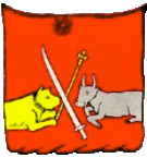
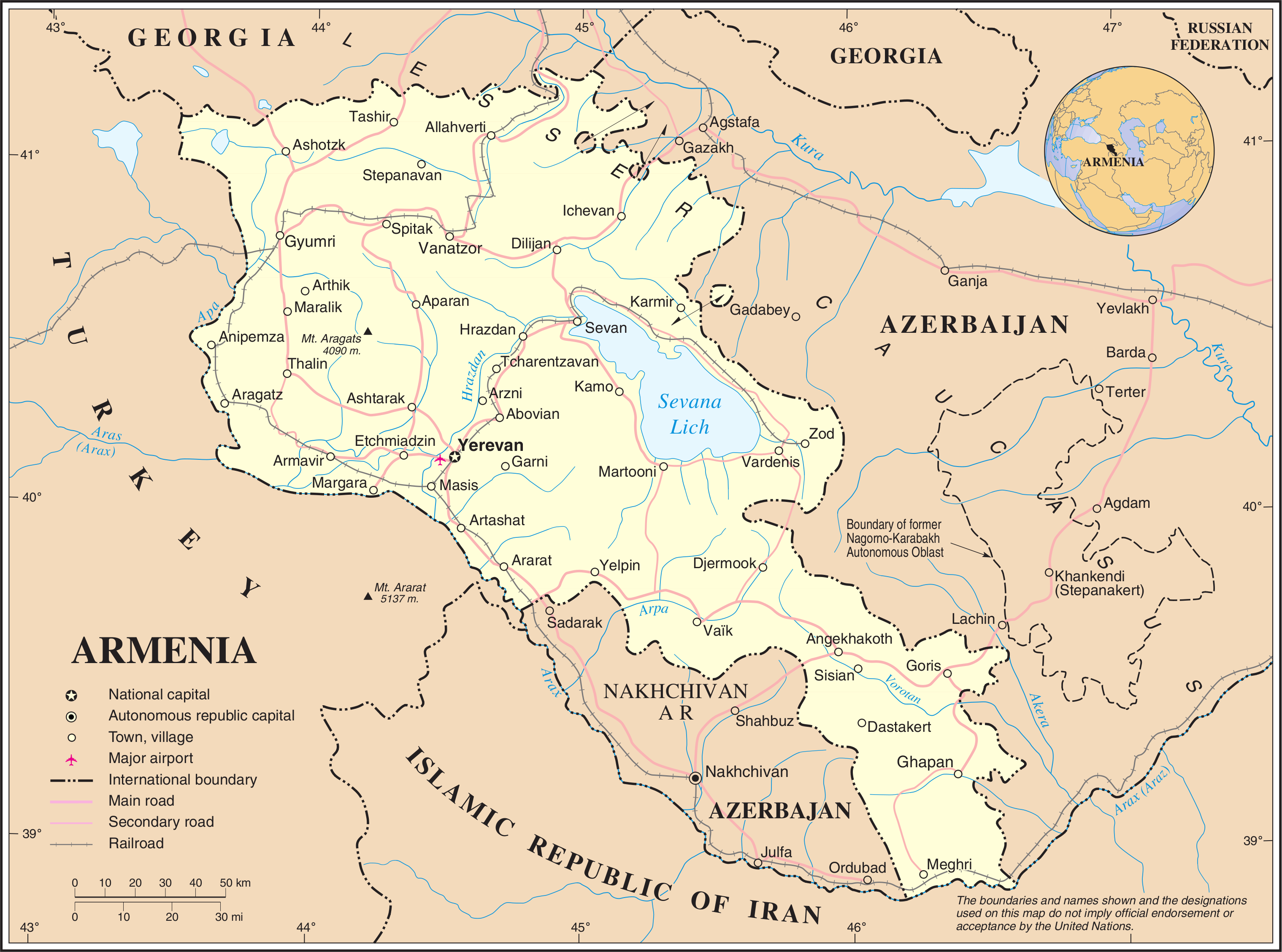
The Surmalu uezd was a county (''uezd'') of the Erivan Governorate of the Caucasus Viceroyalty of the Russian Empire. It bordered the governorate's Etchmiadzin and Erivan uezds to the north, the Kars Oblast to the west, Persia to the east, and the Ottoman Empire to the south. The district made up most of the Iğdır Province of present-day Turkey. As part of the Russian Transcaucasus, the Surmalu uezd possessed economical importance for its abundantly rich salt mines in Kulp (Tuzluca), and spiritual importance to Armenians as the location of the culturally significant Mount Ararat. The administrative center of the ''uezd'' was the town Igdyr (present-day Iğdır). Etymology The district's name derives from the old Armenian city Surmari which evolved from ''Surb Mari'' ( hy, Սուրբ Մարի, lit=Saint Mary). The castle of Surmari still stands today in the village near the Armenia–Turkey border within the Tuzluca district of Turkey's Iğdır Province Iğdır Province ( tr ... [...More Info...] [...Related Items...] OR: [Wikipedia] [Google] [Baidu] |
Russian Empire
The Russian Empire was an empire and the final period of the Russian monarchy from 1721 to 1917, ruling across large parts of Eurasia. It succeeded the Tsardom of Russia following the Treaty of Nystad, which ended the Great Northern War. The rise of the Russian Empire coincided with the decline of neighbouring rival powers: the Swedish Empire, the Polish–Lithuanian Commonwealth, Qajar Iran, the Ottoman Empire, and Qing China. It also held colonies in North America between 1799 and 1867. Covering an area of approximately , it remains the third-largest empire in history, surpassed only by the British Empire and the Mongol Empire; it ruled over a population of 125.6 million people per the 1897 Russian census, which was the only census carried out during the entire imperial period. Owing to its geographic extent across three continents at its peak, it featured great ethnic, linguistic, religious, and economic diversity. From the 10th–17th centuries, the land ... [...More Info...] [...Related Items...] OR: [Wikipedia] [Google] [Baidu] |
Tuzluca
Tuzluca ( az, Duzluca; ku, Qulp; hy, Կողբ ''Koghb''; russian: Кульп or Тузлуджа) is a town and district of the Iğdır Province in the Eastern Anatolia region of Turkey. The northern portion of the district forms part of the international border between Turkey and Armenia. Etymology ''Tuz'' means ''salt'' in the Turkish language. The Turkish name ''Tuzluca'' is derived from the salt mines that have existed here since at least medieval times; a salt mine still operates. History Known by Armenians as ''Koghb'', Tuzluca was historically part of various Armenian kingdoms. The town and the surrounding area later became an Ottoman frontier Kurdish chiefdom and a scene of constant warfare between the Ottoman Empire and Persia. It was especially renowned for its salt mines. In 1746, the region was finally ceded to Persia and became part of the Erivan Khanate. After the Russo-Persian War, 1826–1828 and Treaty of Turkmenchay, it passed from Persian to Russian cont ... [...More Info...] [...Related Items...] OR: [Wikipedia] [Google] [Baidu] |
University Of Tartu
The University of Tartu (UT; et, Tartu Ülikool; la, Universitas Tartuensis) is a university in the city of Tartu in Estonia. It is the national university of Estonia. It is the only classical university in the country, and also its biggest and most prestigious university. It was founded under the name of ''Academia Gustaviana'' in 1632 by Baron Johan Skytte, the Swedish Governors-General, Governor-General (1629–1634) of Swedish Livonia, Swedish Ingria, Ingria, and Karelia (historical province of Finland), Karelia, with the required ratification provided by his long-time friend and former student – from age 7 –, King Gustavus Adolphus of Sweden, Gustavus Adolphus, shortly before the king's death on 6 November in the Battle of Lützen (1632), during the Thirty Years' War (1618–1648). Nearly 14,000 students are at the university, of whom over 1,300 are foreign students. The language of instruction in most curricula is Estonian, some more notable exceptions are taught in ... [...More Info...] [...Related Items...] OR: [Wikipedia] [Google] [Baidu] |
Friedrich Parrot
Johann Jacob Friedrich Wilhelm Parrot (14 October 1791) was a Baltic German naturalist, explorer, and mountaineer, who lived and worked in Dorpat (today Tartu, Estonia) in what was then the Governorate of Livonia of the Russian Empire. A pioneer of Russian and Estonian scientific mountaineering, Parrot is best known for leading the first expedition to the summit of Mount Ararat in recorded history. Early career Born in Karlsruhe, in the Margraviate of Baden, Parrot was the son of Georg Friedrich Parrot, the first rector of the University of Dorpat (today the University of Tartu) and a close friend of Tsar Alexander I. He studied medicine and natural science at Dorpat and, in 1811, undertook an expedition to the Crimea and the Caucasus with Moritz von Engelhardt. There he used a barometer to measure the difference in sea level between the Caspian Sea and Black Sea. On his return he was appointed assistant doctor and, in 1815, surgeon in the Imperial Russian Army. In 1816 and ... [...More Info...] [...Related Items...] OR: [Wikipedia] [Google] [Baidu] |
Baltic Germans
Baltic Germans (german: Deutsch-Balten or , later ) were ethnic German inhabitants of the eastern shores of the Baltic Sea, in what today are Estonia and Latvia. Since their coerced resettlement in 1939, Baltic Germans have markedly declined as a geographically determined ethnic group. However, it is estimated that several thousand people with some form of (Baltic) German identity still reside in Latvia and Estonia. Since the Middle Ages, native German-speakers formed the majority of merchants and clergy, and the large majority of the local landowning nobility who effectively constituted a ruling class over indigenous Latvian and Estonian non-nobles. By the time a distinct Baltic German ethnic identity began emerging in the 19th century, the majority of self-identifying Baltic Germans were non-nobles belonging mostly to the urban and professional middle class. In the 12th and 13th centuries, Catholic German traders and crusaders (''see '') began settling in the eas ... [...More Info...] [...Related Items...] OR: [Wikipedia] [Google] [Baidu] |
Armenian Oblast
The Armenian Oblast was a province (''oblast'') of the Caucasus Viceroyalty of the Russian Empire that existed from 1828 to 1840. It corresponded to most of present-day central Armenia, the Iğdır Province of Turkey Turkey ( tr, Türkiye ), officially the Republic of Türkiye ( tr, Türkiye Cumhuriyeti, links=no ), is a list of transcontinental countries, transcontinental country located mainly on the Anatolia, Anatolian Peninsula in Western Asia, with ..., and the Nakhchivan exclave of Azerbaijan. Its administrative center was Yerevan, referred to as ''Erivan'' in Russian language, Russian. History The Armenian Oblast was created out of the territories of the former Erivan Khanate, Erivan and Nakhichevan Khanate, Nakhchivan khanates, which were ceded to Russia by Qajar Iran under the Treaty of Turkmenchay after the Russo-Persian War (1826–28), Russo-Iranian War of 1826-1828. Ivan Paskevich, the Ukraine, Ukrainian-born military leader and hero of the war, was made ... [...More Info...] [...Related Items...] OR: [Wikipedia] [Google] [Baidu] |
Russo-Persian War (1826–28)
The Russo-Persian Wars or Russo-Iranian Wars were a series of conflicts between 1651 and 1828, concerning Persia (Iran) and the Russian Empire. Russia and Persia fought these wars over disputed governance of territories and countries in the Caucasus. The main territories disputed were Aran, Georgia and Armenia, as well as much of Dagestan – generally referred to as Transcaucasia – and considered part of the Safavid Iran prior to the Russo-Persian Wars. Over the course of the five Russo-Persian Wars, the governance of these regions transferred between the two empires. Between the Second and Third Russo-Persian Wars, there was an interbellum period in which a number of treaties were drawn up between the Russian and the Persian Empires, as well as between both parties and the Ottoman Empire. Ottoman interest in these territories further complicated the wars, with both sides forming alliances with the Ottoman Empire at different points throughout the wars. Following the Treat ... [...More Info...] [...Related Items...] OR: [Wikipedia] [Google] [Baidu] |
Treaty Of Turkmenchay
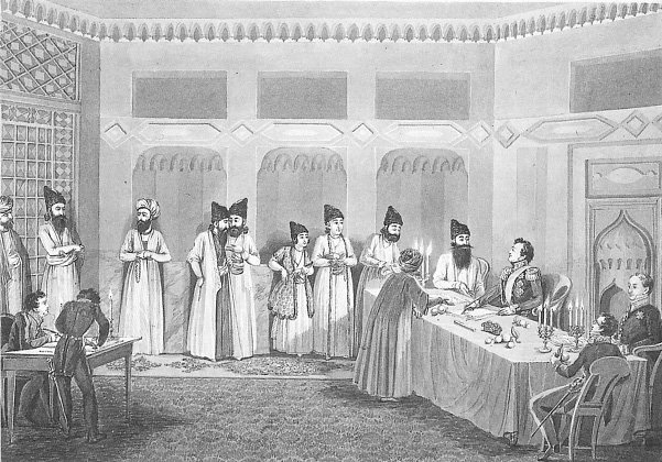
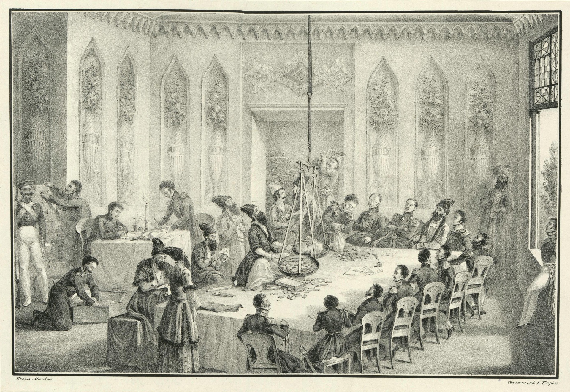
The Treaty of Turkmenchay ( fa, عهدنامه ترکمنچای; russian: Туркманчайский договор) was an agreement between Qajar Iran and the Russian Empire, which concluded the Russo-Persian War (1826–28). It was second of the series of treaties (the first was the 1813 Treaty of Gulistan and the last, the 1881 Treaty of Akhal) signed between Qajar Iran and Imperial Russia that forced Persia to cede or recognize Russian influence over the territories that formerly were Greater Iran, part of Iran. The treaty was signed on 21 February 1828 (5 Sha'ban 1243) in Torkamanchay (a village between Tabriz and Tehran). It made Persia cede the control of several areas in the South Caucasus to Russia: the Erivan Khanate, the Nakhichevan Khanate, Nakhchivan Khanate and the remainder of the Talysh Khanate. The boundary between Russia and Persia was set at the Aras (river), Aras River. The territories are now Armenia, the south of the Republic of Azerbaijan, Nakhchivan A ... [...More Info...] [...Related Items...] OR: [Wikipedia] [Google] [Baidu] |
Erivan Khanate
The Erivan Khanate ( fa, خانات ایروان, translit=Xānāt-e Iravān; hy, Երեւանի խանութիւն, translit=Yerevani xanut'iwn; az, ایروان خانلیغی, translit=İrəvan xanlığı), also known as Chokhur-e Sa'd, was a khanate (i.e. province) that was established in Afsharid Iran in the 18th century. It covered an area of roughly 19,500 km2, and corresponded to most of present-day central Armenia, the Iğdır Province and the Kars Province's Kağızman district in present-day Turkey and the Sharur and Sadarak districts of the Nakhchivan Autonomous Republic of present-day Azerbaijan. The provincial capital of Erivan was a center of the Iranian defenses in the Caucasus during the Russo-Iranian Wars of the 19th century. As a result of the Iranian defeat in the last Russo-Iranian War, it was occupied by Russian troops in 1827 and then ceded to the Russian Empire in 1828 in accordance with the Treaty of Turkmenchay. Immediately following this, the territ ... [...More Info...] [...Related Items...] OR: [Wikipedia] [Google] [Baidu] |
Gomidas Institute
The Gomidas Institute (GI; hy, ԿԻ) is an independent academic institution "dedicated to modern Armenian and regional studies." Its activities include research, publications and educational programmes. It publishes documents, monographs, memoirs and other works on modern Armenian history and organizes lectures and conferences. The institute was founded in 1992 at the University of Michigan in Ann Arbor. It is based in London and maintains a United States branch in Cleveland. British-Armenian historian Ara Sarafian serves as its executive director. Since 1998, the institute has been publishing a quarterly journal titled ''Armenian Forum'' ( ). The institute is named after Komitas (''Gomidas'' in Western Armenian pronunciation). Noteworthy publications Ottoman/Turkish Armenia and the Armenian genocide * * * * * * * * * * * * * * * * * Russian/Soviet/Post-Soviet Armenia and the Caucasus * * * * * * * * * * Armenian Literature * * * * * Armenian ... [...More Info...] [...Related Items...] OR: [Wikipedia] [Google] [Baidu] |
William Desborough Cooley
William Desborough Cooley (c. 1795 – 1883) was an Irish geographer. Discoveries by European explorers gradually showed that a number of his theories about Central Africa, though strongly held, were incorrect. In other controversies his position is now considered to have had some justification. His major contributions are now seen as relating to source criticism of historical records, the understanding of West Africa, and as a perceptive historian of globalisation. Life Cooley was born in Dublin, the son of William Cooley, a barrister, and grandson of Thomas Cooley the architect. He studied at Trinity College, Dublin from 1811 to 1816. He was elected a fellow of the Royal Geographical Society (RGS) of London in 1830, being made an honorary free member in 1864. On the publication of Jean Baptiste Douville's ''Voyage au Congo'' in 1832, Cooley wrote an article in the ''Foreign Quarterly Review'', which was instrumental in exposing the fraud practised by Douville. After the D ... [...More Info...] [...Related Items...] OR: [Wikipedia] [Google] [Baidu] |
Armenia–Turkey Border
The Armenia–Turkey border ( hy, Հայաստան–Թուրքիա սահման, translit=Hayastan–T’urk’ia sahman, tr, Ermenistan–Türkiye sınırı) is 311 km (193 m) in length and runs from the tripoint with Georgia (country), Georgia in the north to the tripoint with Azerbaijan in the south. The land border has been closed since April 3rd, 1993. Description The border starts in the north at the tripoint with Georgia just west of Lake Arpi and proceeds southwards via series of irregular lines through the Armenian Highlands. Upon reaching the Akhurian River it follows the river south down to the confluence with the Aras river, and then follows the Aras as it flows east and then south-east, down to the tripoint with Azerbaijan's Nakhchivan Autonomous Republic. The ancient ruins of Ani lie directly adjacent to the border on the Turkish side. History During the 19th century, the Caucasus region was contested between the declining Ottoman Empire, Qajar Iran, Persia ... [...More Info...] [...Related Items...] OR: [Wikipedia] [Google] [Baidu] |


