|
Sulimana
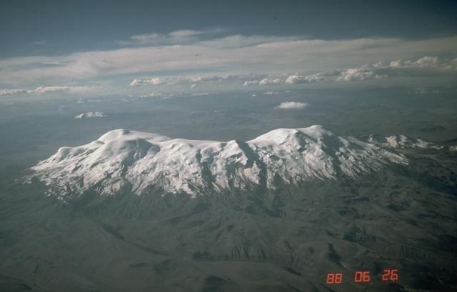
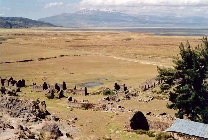
Solimana is a volcanic massif in the Andes of Peru, South America, that is approximately high. It is considered an extinct stratovolcano that is part of the Central Volcanic Zone, one of the volcanic belts of the Andes. It features a caldera as well as traces of a sector collapse and subsequent erosion. The volcano is glaciated. Geomorphology and geography Regional It is situated in the Arequipa Region, Condesuyos Province, in the districts of Chichas and Salamanca, and in the La Unión Province, in the districts of Cotahuasi and Toro. Several towns lie around the volcano. Solimana is part of the Peruvian segment of the Central Volcanic Zone of the Andes. The Central Volcanic Zone in this segment has both generated large composite volcanoes which rise above their basement and monogenetic volcanoes and volcanic fields. This zone of volcanoes includes, from northwest to southeast, Sara Sara, Solimana, Coropuna, Andagua volcanic field, Huambo volcanic field, Ampato, Sab ... [...More Info...] [...Related Items...] OR: [Wikipedia] [Google] [Baidu] |
Toro District
Toro District is one of eleven districts of the province La Unión in Peru , image_flag = Flag of Peru.svg , image_coat = Escudo nacional del Perú.svg , other_symbol = Great Seal of the State , other_symbol_type = Seal (emblem), National seal , national_motto = "Fi .... Geography One of the highest peaks of the district is Sulimana at . Other mountains are listed below:escale.minedu.gob.pe/ UGEL map La Unión Province (Arequipa Region) References {{coord, 15.2644, S, 72.9258, W, source:wikidata, display=title ... [...More Info...] [...Related Items...] OR: [Wikipedia] [Google] [Baidu] |
Condesuyos Province
Condesuyos Province is one of eight Provinces of Peru, provinces in the Arequipa Region of Peru. Its seat is Chuquibamba. Geography The Andean Volcanic Belt and the Wansu mountain range, Wansu mountain range traverse the province. Some of the highest peaks of the province are listed below: Political division The province is divided into eight Districts of Peru, districts which are: * Andaray District, Andaray (Andaray) * Cayarani District, Cayarani (Cayarani) * Chichas District, Chichas (Chichas) * Chuquibamba District, Condesuyos, Chuquibamba (Chuquibamba) * Iray District, Iray (Iray) * Río Grande District, Condesuyos, Río Grande (Iquipi) * Salamanca District, Salamanca (Salamanca, Condesuyos Province, Salamanca) * Yanaquihua District, Yanaquihua (Yanaquihua) Ethnic groups The province is inhabited by Indigenous peoples of the Americas, indigenous citizens of Quechua people, Quechua descent. Spanish language, Spanish, however, is the language which the majority of the po ... [...More Info...] [...Related Items...] OR: [Wikipedia] [Google] [Baidu] |
Cotahuasi District
Cotahuasi District is one of eleven districts of the province La Unión in Peru. Instituto Nacional de Estadística e Informática. Banco de Información Distrital''. Retrieved April 11, 2008. Cotahuasi is located at the highest Andean point of the department of Arequipa, in southern Peruvian. This province is characterized by its steep relief: cut here and as far back as rivers and gullies, with an altitude that ranges between 1,000 and 6,093 meters above sea level, with 19 different ecosystems. Its customs and traditions have been preserved partly on account of its relative isolation, something that has not happened in neighboring villages (REF). See also * Cotahuasi Subbasin Landscape Reserve The Cotahuasi Subbasin Landscape Reserve ( es, Reserva Paisajística Sub Cuenca del Cotahuasi) is a protected area in Peru located in the Arequipa Region, La Unión Province. It protects part of the Central Andean puna and Sechura Desert ecoreg ... * Saraqutu * Sulimana * Wiña ... [...More Info...] [...Related Items...] OR: [Wikipedia] [Google] [Baidu] |
Salamanca District
Salamanca District is one of eight districts of the province Condesuyos in Peru , image_flag = Flag of Peru.svg , image_coat = Escudo nacional del Perú.svg , other_symbol = Great Seal of the State , other_symbol_type = Seal (emblem), National seal , national_motto = "Fi .... Geography Some of the highest mountains of the district are listed below:escale.minedu.gob.pe - UGEL map of the Condesuyos Province (Arequipa Region) References {{coord, 15.5061, S, 72.8380, W, source:wikidata, display=title ... [...More Info...] [...Related Items...] OR: [Wikipedia] [Google] [Baidu] |
Coropuna
Coropuna is a dormant compound volcano located in the Andes mountains of southeast-central Peru. The upper reaches of Coropuna consist of several perennially snowbound conical summits, lending it the name Nevado Coropuna in Spanish. The complex extends over an area of and its highest summit reaches an altitude of above sea level. This makes the Coropuna complex the third-highest of Peru. Its thick ice cap is the most extensive in Earth's tropical zone, with several outlet glaciers stretching out to lower altitudes. Below an elevation of , there are various vegetation belts which include trees, peat bogs, grasses and also agricultural areas and pastures. The Coropuna complex consists of several stratovolcanos. These are composed chiefly of ignimbrites and lava flows on a basement formed by Middle Miocene ignimbrites and lava flows. The Coropuna complex has been active for at least five million years, with the bulk of the current cone having been formed during the Quat ... [...More Info...] [...Related Items...] OR: [Wikipedia] [Google] [Baidu] |
Ampato
Ampato (possibly from Quechua ''hamp'atu'' or from Aymara ''jamp'atu'', both meaning "frog") is a dormant stratovolcano in the Andes of southern Peru. It lies about northwest of Arequipa and is part of a north-south chain that includes the volcanoes Hualca Hualca and Sabancaya, the last of which has been active in historical time. Ampato consists of three volcanic cones, which lie on top of an older eroded volcanic edifice. They were formed sequentially by extrusion of lava flows, but Ampato has also had explosive eruptions which have deposited ash, lapilli and pumice in the surrounding landscape. One young lava flow has been dated to 17,000 ± 6,000 years before present, but a summit lava dome is even younger, and Holocene ash layers in surrounding peat bogs may testify to the occurrence of recent eruptions. The present-day volcano is covered by an ice cap, and during the last glacial maximum glaciers advanced to low altitudes. In 1995, an Inca mummy known as Mummy Juanita was ... [...More Info...] [...Related Items...] OR: [Wikipedia] [Google] [Baidu] |
Huambo Volcanic Field
Huambo volcanic field is a volcanic field in Peru. Andahua-Orcopampa lies north-northeast and Sabancaya east of Huambo, east of the Rio Colca. The town of Huambo lies between the two fields. The northern part of the field was active 700 BCE ± 50 years, forming a large lava flow field and a cinder cone Cerro Keyocc. The southern part of the field contains other cinder cones and lava flows. Some may be of Holocene age. Lava flows are a few thick. Four among the volcanoes of the southern field are Marbas Grande, Marbas, Marbas Chico I and Marbas Chico II. The formation of these fields may have been influenced by magma ascent along deep fault systems. Trachyandesite is the major eruption product of Huambo. The magmas forming this field formed in deep magma chambers with little modification in shallower magma chambers. Basement lava flows have been dated at 1.05±0.04 mya Mya may refer to: Brands and product names * Mya (program), an intelligent personal assistant created by ... [...More Info...] [...Related Items...] OR: [Wikipedia] [Google] [Baidu] |
Andagua Volcanic Field
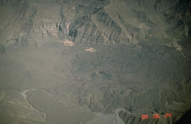
The Andagua volcanic field (also known as Andahua) is a volcanic field in southern Peru which includes a number of cinder cones, lava domes and lava flows which have filled the Andagua Valley (which is also known as Valley of the Volcanoes for this reason). The volcanic field is part of a larger volcanic province that clusters around the Colca River and is mostly of Pleistocene age, although the Andagua sector also features volcanic cones with historical activity, with the last eruption about 370 years ago. Eruptions were mostly effusive, generating lava flows, cones and small eruption columns. Future eruptions are possible, and there is ongoing fumarolic activity. Volcanic activity in the field has flooded the Andahua valley with lava flows, damming local watersheds in the Laguna de Chachas, Laguna Mamacocha and Laguna Pumajallo lakes and burying the course of the Andagua River. The Andahua valley segment of the larger volcanic province was declared a geopark in 2015. History a ... [...More Info...] [...Related Items...] OR: [Wikipedia] [Google] [Baidu] |
Sara Sara
Sara Sara is a volcano lying between Lake Parinacochas and the Ocoña River in Peru. It is situated in the Parinacochas Province and the Paucar del Sara Sara Province. The volcano formed during the Pleistocene during four different stages of volcanic activity, which constructed a volcanic edifice with an oval outline consisting of lava flows and lava domes. The volcano was glaciated during the last glacial maximum; it may still feature glaciers. The last eruption was about 14,000 years ago and future eruptions are possible. The volcano was worshipped by the local population, and an Inca mummy of a 15-year old girl was found on the summit by archaeologists. Geography and geomorphology Sara Sara lies within the sub-range of the Andes. Administratively, it is located in the Parinacochas and Paucar del Sara Sara Provinces of the Ayacucho Region, Peru. The town of Pausa lies away from the volcano, and agriculture occurs in the valleys of the area. A disused road passes over th ... [...More Info...] [...Related Items...] OR: [Wikipedia] [Google] [Baidu] |
Volcanic Field
A volcanic field is an area of Earth's crust that is prone to localized volcanic activity. The type and number of volcanoes required to be called a "field" is not well-defined. Volcanic fields usually consist of clusters of up to 100 volcanoes such as cinder cones. Lava flows may also occur. They may occur as a monogenetic volcanic field or a polygenetic volcanic field. Description Alexander von Humboldt observed in 1823 that geologically young volcanoes are not distributed uniformly across the Earth's surface, but tend to be clustered into specific regions. Young volcanoes are rarely found within cratons, but are characteristic of subduction zones, rift zones, or in ocean basins. Intraplate volcanoes are clustered along hotspot traces. Within regions of volcanic activity, volcanic fields are clusters of volcanoes that share a common magma source. Scoria cones are particularly prone to cluster into volcanic fields, which are typically in diameter and consist of several tens ... [...More Info...] [...Related Items...] OR: [Wikipedia] [Google] [Baidu] |
Monogenetic Volcanic Field
A monogenetic volcanic field is a type of volcanic field consisting of a group of small monogenetic volcanoes, each of which erupts only once, as opposed to polygenetic volcanoes, which erupt repeatedly over a period of time. The small monogenetic volcanoes of these fields are the most common subaerial volcanic landform. Many monogenetic volcanoes are cinder cones, often with lava flows, such as Parícutin in the Michoacán-Guanajuato volcanic field, which erupted from 1943 to 1952. Some monogenetic volcanoes are small lava shields, such as Rangitoto Island in the Auckland volcanic field. Other monogenetic volcanoes are tuff rings or maars. A monogenetic field typically contains between ten and a hundred volcanoes. The Michoacán-Guanajuato field in Mexico contains more than a thousand volcanoes and is exceptionally large. Monogenetic fields occur only where the magma supply to the volcano is low or where vents are not close enough or large enough to develop plumbing systems f ... [...More Info...] [...Related Items...] OR: [Wikipedia] [Google] [Baidu] |
Composite Volcano
A stratovolcano, also known as a composite volcano, is a conical volcano built up by many layers (strata) of hardened lava and tephra. Unlike shield volcanoes, stratovolcanoes are characterized by a steep profile with a summit crater and periodic intervals of explosive eruptions and effusive eruptions, although some have collapsed summit craters called calderas. The lava flowing from stratovolcanoes typically cools and hardens before spreading far, due to high viscosity. The magma forming this lava is often felsic, having high-to-intermediate levels of silica (as in rhyolite, dacite, or andesite), with lesser amounts of less-viscous mafic magma. Extensive felsic lava flows are uncommon, but have travelled as far as . Stratovolcanoes are sometimes called composite volcanoes because of their composite stratified structure, built up from sequential outpourings of erupted materials. They are among the most common types of volcanoes, in contrast to the less common shield volcanoes ... [...More Info...] [...Related Items...] OR: [Wikipedia] [Google] [Baidu] |


