|
Suhmata
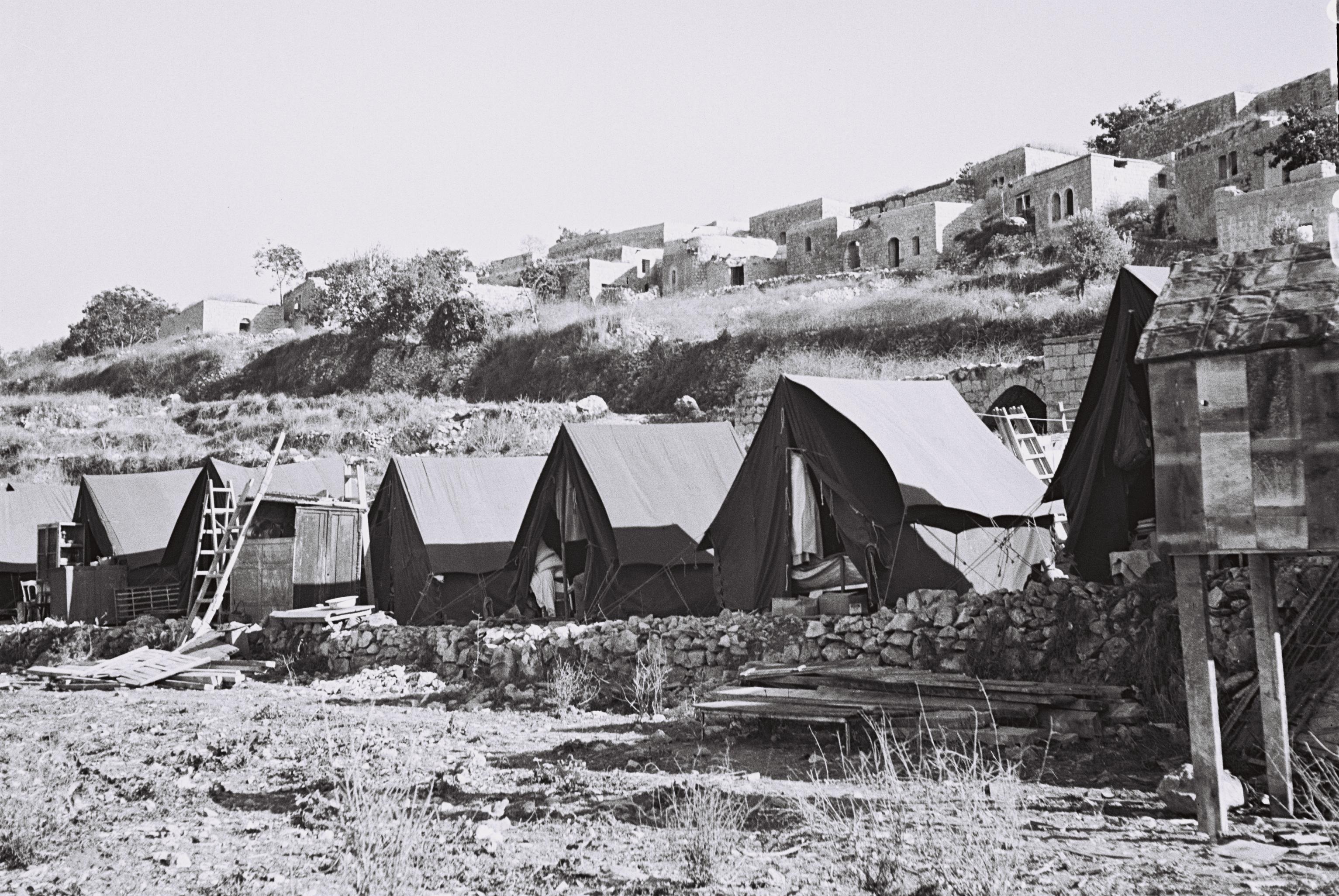
Suhmata ( ar, سحماتا), was a Palestinian village, located northeast of Acre. It was depopulated by the Golani Brigade during the 1948 Arab-Israeli war. History Separated from the neighboring village of Tarshiha by a deep gorge, the ruins of a Byzantine era church lay within Suhmata's village lands.Robinson and Smith, 1856, p 76/ref>Pringle, 1997, p. 118/ref> Underground water reservoir and a burial cave that apparently dates to the Roman period have been found at the village site. Suhmata had a Christian population at least until the Persian invasion of Palestine (A.D. 614–627) and presumably many people remained Christian for some time after that.Khalidi, 1992, p.29 What was earlier termed a Crusader-era castle constructed in the village was (rebuilt by Zahir al-Umar in the latter half of the 18th century), turned out to be the Byzantine church. Excavations in 1932 revealed an inscription in the church's mosaic floor that dates to 555 CE. The Crusaders referred ... [...More Info...] [...Related Items...] OR: [Wikipedia] [Google] [Baidu] |
Hosen
Hosen ( he, חֹסֶן, חוסן, ''lit.'' Strength) is a moshav in northern Israel. Located near Ma'alot-Tarshiha, it falls under the jurisdiction of Ma'ale Yosef Regional Council. In it had a population of . History The village was established in 1949 by members of Herut on land which had belonged to the depopulated Palestinian village of Suhmata Suhmata ( ar, سحماتا), was a Palestinian village, located northeast of Acre. It was depopulated by the Golani Brigade during the 1948 Arab-Israeli war. History Separated from the neighboring village of Tarshiha by a deep gorge, the ruins .... References {{Israel-geo-stub Moshavim Populated places established in 1949 Populated places in Northern District (Israel) 1949 establishments in Israel ... [...More Info...] [...Related Items...] OR: [Wikipedia] [Google] [Baidu] |
Dhaher El Amer
Zahir al-Umar al-Zaydani, alternatively spelled Daher al-Omar or Dahir al-Umar ( ar, ظاهر العمر الزيداني, translit=Ẓāhir al-ʿUmar az-Zaydānī, 1689/90 – 21 or 22 August 1775) was the autonomous Arab ruler of northern Palestine in the mid-18th century, while the region was part of the Ottoman Empire. For much of his reign, starting in the 1730s, his domain mainly consisted of the Galilee, with successive headquarters in Tiberias, Deir Hanna and finally Acre, in 1750. He fortified Acre, and the city became the center of the cotton trade between Palestine and Europe. In the mid-1760s, he reestablished the port town of Haifa nearby. Zahir withstood sieges and assaults by the Ottoman governors of Damascus, who attempted to limit or eliminate his influence. He was often supported in these confrontations by the Shia Muslim clans of Jabal Amil. In 1771, in alliance with Ali Bey al-Kabir of the Egypt Eyalet and with backing from Russia, Zahir captured Sidon, while ... [...More Info...] [...Related Items...] OR: [Wikipedia] [Google] [Baidu] |
Acre Subdistrict, Mandatory Palestine
The Acre Subdistrict ( ar, قضاء عكا Qadaa Akka, he, נפת עכו Nefat Akko) was one of the subdistricts of Mandatory Palestine. It was located in modern-day northern Israel, having nearly the same territory as the modern-day Acre County. The city of Acre was the district's capital. The subdistrict was transformed into Northern District's Acre Subdistrict. Borders * Safad Subdistrict (East) * Tiberias Subdistrict (East) * Nazareth Subdistrict (South) * Haifa Subdistrict (South West) * Lebanon (North) History of attachment to a district The layout of the districts of Mandatory Palestine changed several times: * 1922 Northern District * 1937 Galilee District * 1939 Galilee and Acre District * 1940 Galilee District * 1948 dissolution The territory is now covered by the Northern District of Israel. Depopulated towns and villages (current localities in parentheses) * Amqa ( Amka) * Arab al-Samniyya (Ya'ara) * al-Bassa ( Betzet, Rosh HaNikra, Shlomi, Tzaha ... [...More Info...] [...Related Items...] OR: [Wikipedia] [Google] [Baidu] |
Tzuriel
Tzuriel ( he, צוּרִיאֵל) is a moshav in northern Israel. Located in the Galilee, it falls under the jurisdiction of Ma'ale Yosef Regional Council. In it had a population of . History The moshav was established in 1949 on land which had belonged to the depopulated Palestinian village of Suhmata. The founders were Yemenite Jews from the town of Beit 'Adaqah, led by spiritual leader Rabbi Shalom Nehorai HaLevi. It was named for the biblical figure Zuriel, son of Abihail Abihail may refer to one of five different people mentioned in the Bible: # Abihail the Levite lived during the time of the wandering of the Israelites in the wilderness. He was the head of the house of Merari and Levi's youngest son. (Numbers 3 ... (Num 3:35). After a number of years the founders left and a group of Moroccan immigrants moved in. References {{Ma'ale Yosef Regional Council Moshavim Populated places established in 1950 Populated places in Northern District (Israel) 1950 estab ... [...More Info...] [...Related Items...] OR: [Wikipedia] [Google] [Baidu] |
Ronnie Ellenblum
Ronnie Ellenblum (born June 21, 1952, Haifa, Israel; died January 7, 2021, Jerusalem, Israel) was an Israeli professor at the department of geography at the Hebrew University of Jerusalem, and a member of the Israel Academy of Sciences and Humanities, specializing in Medieval geographies, the history of the Levant in the Middle Ages, and the history of the Crusades. His latest studies deal also with environmental and climatic history, the history of Jerusalem, and the development of historic cities in general. Ellenblum headed the Vadum Iacob Research Project and was involved in the creation of several databases dealing with the history of Jerusalem (together with al-Quds University); with the maps of Jerusalem and with English translations of documents and charters of the Crusader Period. Ellenblum has developed a comprehensive theoretical approach to 'Fragility,' claiming that a decade or two of climatic disturbance (droughts, untimely rains and severely cold winters) could lead ... [...More Info...] [...Related Items...] OR: [Wikipedia] [Google] [Baidu] |
Mi'ilya
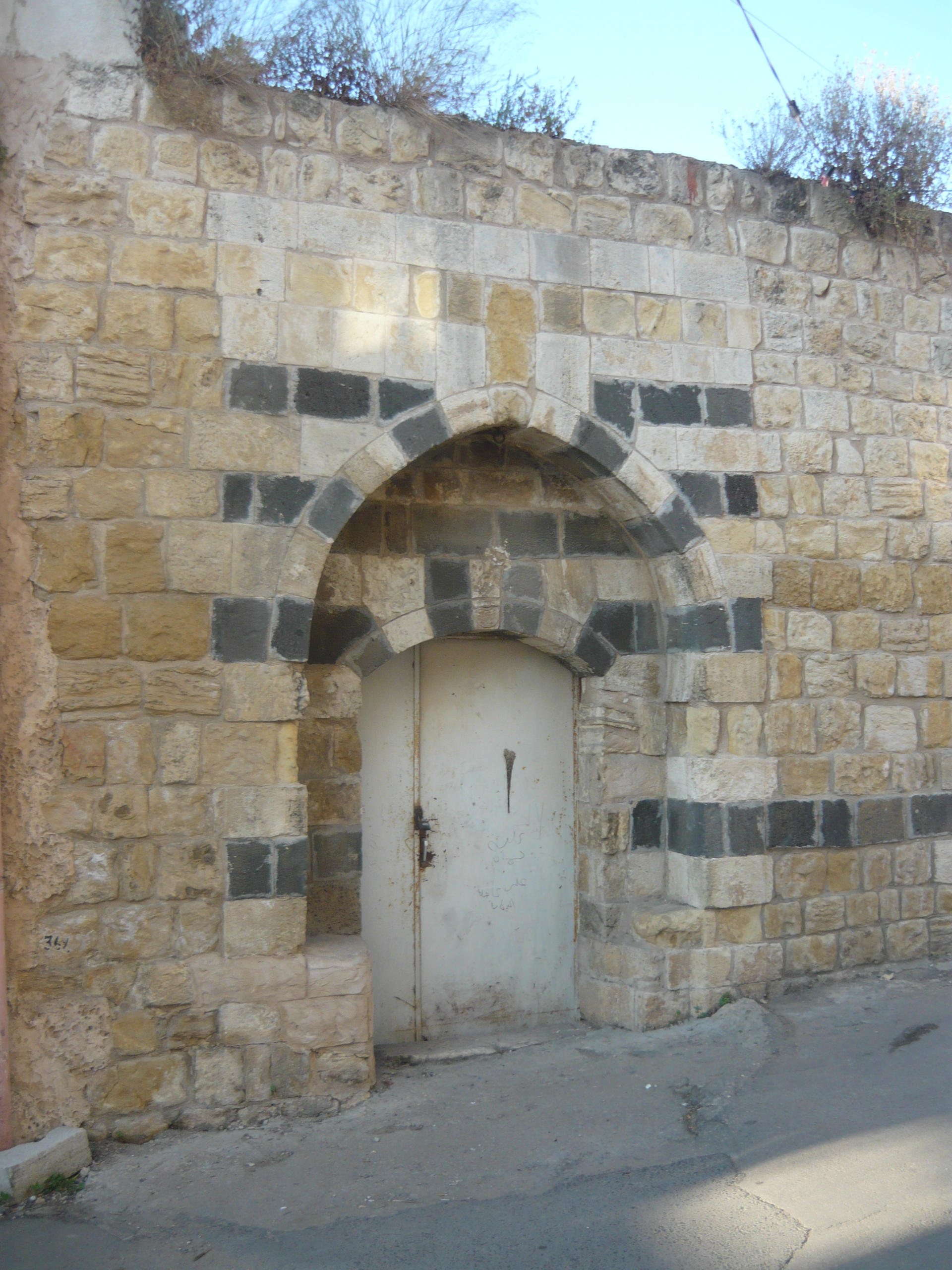
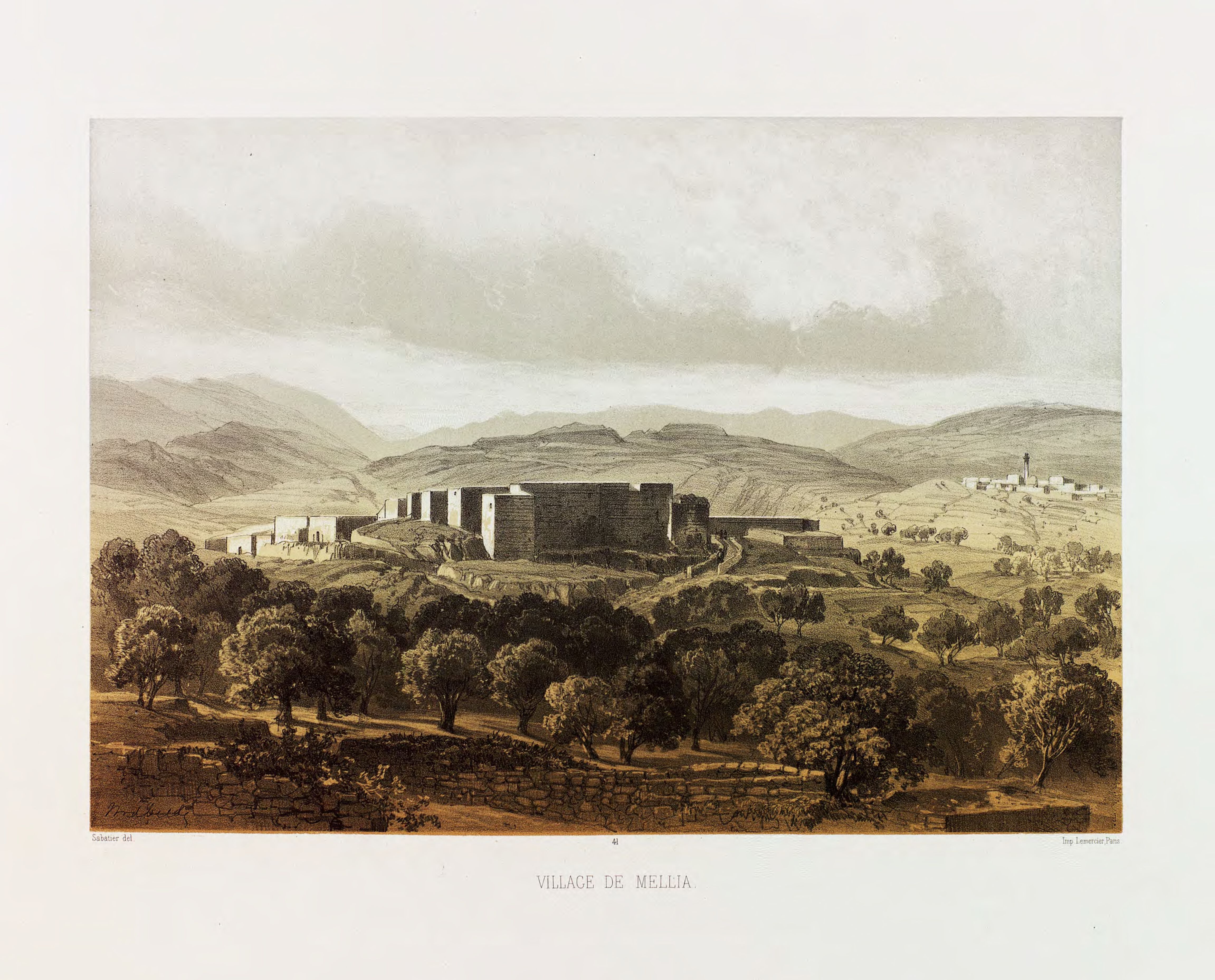
Mi'ilya ( ar, معليا, he, מִעִלְיָא) is an Arab local council in the western Galilee in the Northern District of Israel. Its name during the Kingdom of Jerusalem era in Galilee was Castellum Regis. In it had a population of , all of whom are Melkite Greek Catholics. The town is located immediately to the northwest of Ma'alot-Tarshiha. History Archaeological excavations in Mi'ilya gives indication of inhabitation from the Late Bronze Age and Iron Age, as well as Hellenistic, Roman, Byzantine, Crusader, Mamluk and Ottoman periods. Crusader period In the Crusader period, Mi'ilya was first mentioned in 1160, when it and several surrounding villages was transferred to a Crusader named ''Iohanni de Caypha'' (Johannes of Haifa). In 1179 Viscountess Petronella of Acre sold the houses, vineyards and gardens of Mi'ilya to Count Jocelyn III, uncle of Baldwin IV,Strehlke, 1869, pp1112, No. 11; cited in Röhricht, 1893, RRH, p156 No. 587; cited in Pringle, 1997, p 71/ref> ... [...More Info...] [...Related Items...] OR: [Wikipedia] [Google] [Baidu] |
Jocelyn III
Joscelin III of Edessa (1139 – after 1190) was the titular Count of Edessa, who during his lifetime managed to amass enough land to establish the '' Seigneurie of Joscelin.'' Early life He was the son of Joscelin II and his wife Beatrice of Saone. He inherited the title of Count of Edessa from his father, Joscelin II, although Edessa had been captured in 1144 and its remnants (including the Lordship of Turbessel) conquered or sold years before he took the title. Joscelin lived in the Kingdom of Jerusalem and managed to gather enough land around Acre to set up the '' Seigneurie of Joscelin.'' Royal Guardian His sister, Agnes of Courtenay, had been the first wife of King Amalric I before he succeeded to the throne, and was the mother of Baldwin IV and Sibylla. In 1164 Joscelin was taken captive by Nur ad-Din Zengi at the Battle of Harim. He remained a prisoner until 1176 when Agnes paid his ransom of 50,000 dinars, probably with support from the royal treasury. His nep ... [...More Info...] [...Related Items...] OR: [Wikipedia] [Google] [Baidu] |
Bezant
In the Middle Ages, the term bezant ( Old French ''besant'', from Latin ''bizantius aureus'') was used in Western Europe to describe several gold coins of the east, all derived ultimately from the Roman ''solidus''. The word itself comes from the Greek Byzantion, ancient name of Constantinople, the capital of the Byzantine Empire. The original "bezants" were the gold coins produced by the government of the Byzantine Empire, first the '' nomisma'' and from the 11th century the '' hyperpyron''. Later, the term was used to cover the gold dinars produced by Islamic governments. In turn, the gold coins minted in the Kingdom of Jerusalem and County of Tripoli were termed "Saracen bezants", since they were modelled on the gold dinar. A completely different electrum coin based on Byzantine '' trachea'' was minted in the Kingdom of Cyprus and called the "white bezant". The term "bezant" in reference to coins is common in sources from the 10th through 13th centuries. Thereaft ... [...More Info...] [...Related Items...] OR: [Wikipedia] [Google] [Baidu] |
Mandatory Palestine
Mandatory Palestine ( ar, فلسطين الانتدابية '; he, פָּלֶשְׂתִּינָה (א״י) ', where "E.Y." indicates ''’Eretz Yiśrā’ēl'', the Land of Israel) was a geopolitical entity established between 1920 and 1948 in the Palestine (region), region of Palestine under the terms of the League of Nations Mandate for Palestine. During the First World War (1914–1918), an Arab uprising against Ottoman Empire, Ottoman rule and the British Empire's Egyptian Expeditionary Force under General Edmund Allenby drove the Ottoman Turks out of the Levant during the Sinai and Palestine Campaign. The United Kingdom had agreed in the McMahon–Hussein Correspondence that it would honour Arab independence if the Arabs revolted against the Ottoman Turks, but the two sides had different interpretations of this agreement, and in the end, the United Kingdom and French Third Republic, France divided the area under the Sykes–Picot Agreementan act of betrayal in the eyes of ... [...More Info...] [...Related Items...] OR: [Wikipedia] [Google] [Baidu] |
Ottoman Empire
The Ottoman Empire, * ; is an archaic version. The definite article forms and were synonymous * and el, Оθωμανική Αυτοκρατορία, Othōmanikē Avtokratoria, label=none * info page on book at Martin Luther University) // CITED: p. 36 (PDF p. 38/338) also known as the Turkish Empire, was an empire that controlled much of Southeast Europe, Western Asia, and North Africa, Northern Africa between the 14th and early 20th centuries. It was founded at the end of the 13th century in northwestern Anatolia in the town of Söğüt (modern-day Bilecik Province) by the Turkoman (ethnonym), Turkoman tribal leader Osman I. After 1354, the Ottomans crossed into Europe and, with the Ottoman wars in Europe, conquest of the Balkans, the Ottoman Anatolian beyliks, beylik was transformed into a transcontinental empire. The Ottomans ended the Byzantine Empire with the Fall of Constantinople, conquest of Constantinople in 1453 by Mehmed the Conqueror. Under the reign of Sule ... [...More Info...] [...Related Items...] OR: [Wikipedia] [Google] [Baidu] |
Victor Guérin
Victor Guérin (15 September 1821 – 21 Septembe 1890) was a French intellectual, explorer and amateur archaeologist. He published books describing the geography, archeology and history of the areas he explored, which included Greece, Asia Minor, North Africa, Lebanon, Syria and Palestine. Biography Guérin, a devout Catholic, graduated from the ''École normale supérieure'' in Paris in 1840. After graduation, he began working as a teacher of rhetoric and member of faculty in various colleges and high schools in France, then in Algeria in 1850, and 1852 he became a member of the French School of Athens. While exploring Samos, he identified the spring that feeds the Tunnel of Eupalinos and the beginnings of the channel. His doctoral thesis of 1856 dealt with the coastal region of Palestine, from Khan Yunis to Mount Carmel. With the financial help of Honoré Théodoric d'Albert de Luynes he was able to explore Greece and its islands, Asia Minor, Egypt, Nubia, Tunisia, and ... [...More Info...] [...Related Items...] OR: [Wikipedia] [Google] [Baidu] |


