|
Stubaier Alps
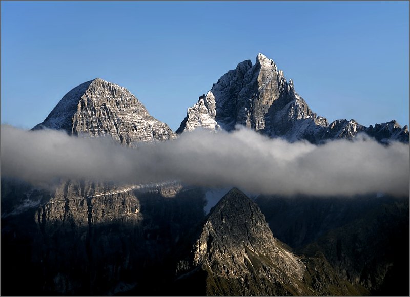
The Stubai Alps (in German ''Stubaier Alpen'') is a mountain range in the Central Eastern Alps of Europe. It derives its name from the Stubaital valley to its east and is located southwest of Innsbruck, Austria. Several peaks form the border between Austria and Italy. The range is bounded by the Inn River valley to the north; the Sill River valley (''Wipptal'') and the Brenner Pass to the east (separating it from the Zillertal Alps); the Ötztal and Timmelsjoch to the west (separating it from the Ötztal Alps), and to the south by tributaries of the Passer River and Eisack. Geography Important parts of the Stubai Alps show signs of glaciation. The northern part around the Sellrain valley and the Kühtai is now only lightly glaciated and a popular ski touring destination (Zischgeles, Lampsenspitze, Pirchkogel, Sulzkogel). The High Stubai around the upper Stubai valley is still heavily glaciated and a classic high mountain touring region in the Eastern Alps. Here there is a glacier ... [...More Info...] [...Related Items...] OR: [Wikipedia] [Google] [Baidu] |
Tyrol (state)
Tyrol (; german: Tirol ; it, Tirolo) is a States of Austria, state (''Land'') in western Austria. It comprises the Austrian part of the historical County of Tyrol, Princely County of Tyrol. It is a constituent part of the present-day Euroregion Tyrol–South Tyrol–Trentino (together with South Tyrol and Trentino in Italy). The capital of Tyrol is Innsbruck. Geography The state of Tyrol is separated into two parts, divided by a strip. The larger territory is called North Tyrol (''Nordtirol'') and the smaller area is called East Tyrol (''Osttirol''). The neighbouring Austrian state of Salzburg (state), Salzburg stands to the east, while on the south Tyrol has a border with the Italy, Italian province of South Tyrol (Trentino-Alto Adige/Südtirol) which was part of the Austro-Hungarian Empire before the First World War. With a land area of , Tyrol is the third-largest state in Austria. Tyrol shares its borders with the federal state of Salzburg in the east and Vorarlberg in th ... [...More Info...] [...Related Items...] OR: [Wikipedia] [Google] [Baidu] |
Timmelsjoch
Timmelsjoch ( it, Passo del Rombo), (elevation ) is a high mountain pass that creates a link through the Ötztal Alps along the border between Austria and Italy. The Timmelsjoch connects the Ötztal valley in the Austrian state of Tyrol (state), Tyrol to the Passeier Valley in the Italian province of South Tyrol, as it bridges the saddle point between the Jochköpfl () and Wurmkogl () peaks to its northeast and southwest, respectively. The pass is sometimes called the "secret passage" because it is little-used compared to the much easier and lower Brenner Pass some to its east, and Reschen Pass some to its west. History During the early Stone Age, shepherds and their flocks lived in the Obergurgl area near Timmelsjoch. By the early Bronze Age, the glaciers of the last Ice Age were retreating and various hunters, adventurers, and wandering tribes entered the higher elevations in the area in search of game and treasure. The discovery of a brooch near the Schönbodenlacke dating fr ... [...More Info...] [...Related Items...] OR: [Wikipedia] [Google] [Baidu] |
Imst
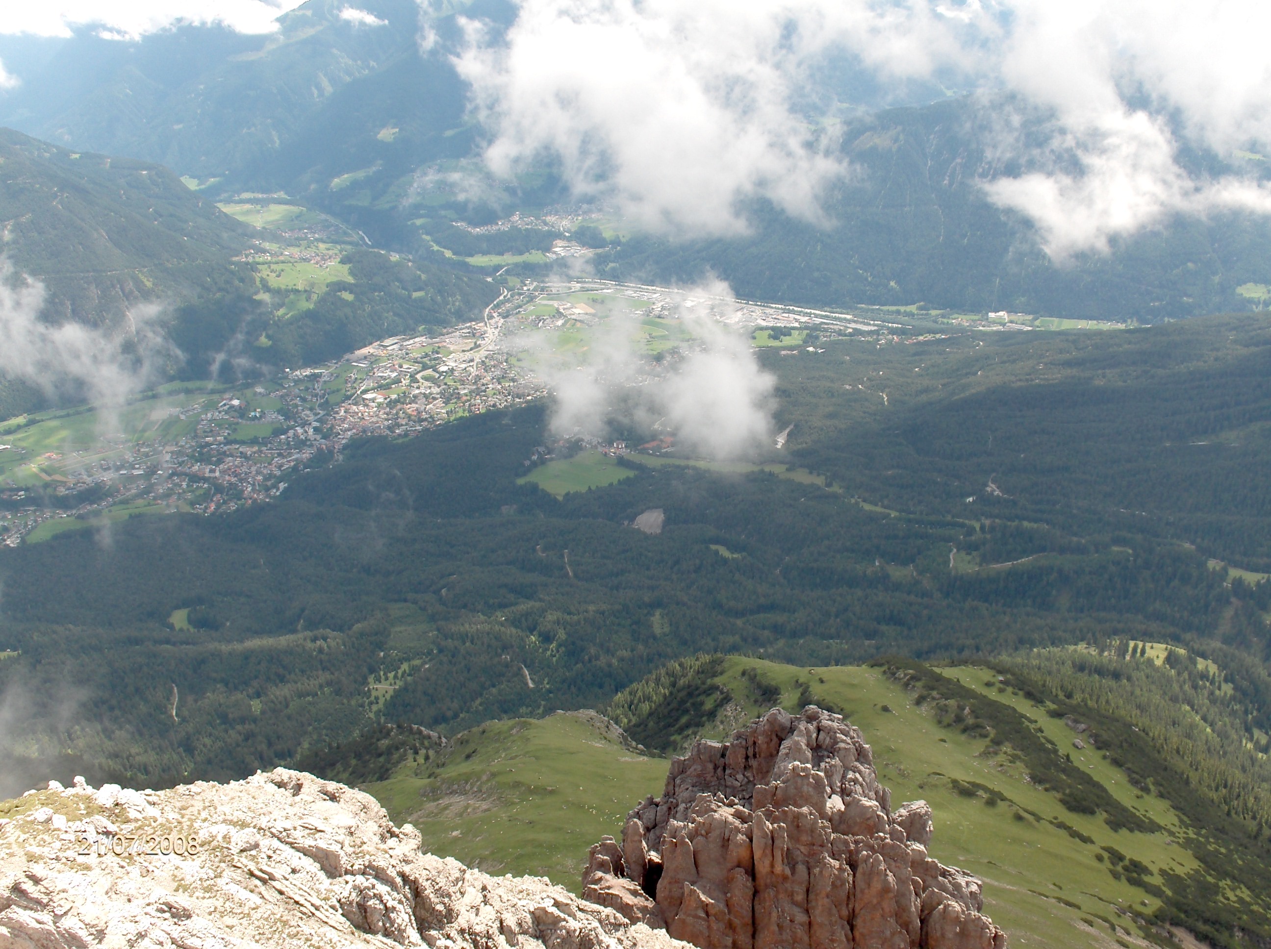
Imst (; Southern Bavarian: ''Imscht'') is a town in the Austrian federal state of Tyrol. It lies on the River Inn in western Tyrol, some west of Innsbruck and at an altitude of above sea level. With a current population (2013) of 9,552, Imst is the administrative centre of Imst District. History Licensed since 1282 to hold a regular market. Until 1918, the town (named earlier also ''JMST'') was part of the Austrian monarchy (Austria side after the compromise of 1867), head of the district of the same name, one of the 21 ''Bezirkshauptmannschaften'' in the Tyrol province. Imst received full town rights in 1898. Schemenlaufen Every four years Imst hosts their Fasnacht, or carnival before Lent. This carnival is listed by UNESCO as one of their Lists of Intangible Cultural Heritage. As part of Schemenlaufen pairs of men wear bells, tuned differently, while performing dances of jumps and bows. They are accompanied by masked characters imitating their dance. Luge track In ... [...More Info...] [...Related Items...] OR: [Wikipedia] [Google] [Baidu] |
Ötztal Railway Station
Ötztal is a railway station on the Arlberg railway between Innsbruck and Bludenz in Tyrol, Austria. In Ötztal the second track coming from Innsbruck ends and the Arlberg line continues as a single-track railway till Landeck. Services Rail services Ötztal provides regional connections to Innsbruck–Hall in Tirol–Rosenheim and Landeck as well as international destinations like Zürich, Basel, Dortmund and Vienna. It is serviced by: *InterCityExpress: Vienna–Innsbruck–Bregenz *ÖBB-EuroCity: Vienna/Graz–Innsbruck–Feldkirch–Bregenz/Zürich–Basel (CH) *EuroNight: Vienna/Graz–Innsbruck–Feldkirch–Bregenz/Zürich (CH) *InterCity: Innsbruck–Dortmund/Münster (D) Bus services Coach lines departing from the station forecourt: *Oetz–Umhausen–Längenfeld–Sölden–Obergurgl *Oetz–Ochsengarten *Roppen–Imst * Haiming– Silz– Mötz See also *Arlberg railway *Ötztal The Ötztal is an alpine valley located in Tyrol, Austria. The Ötztal ... [...More Info...] [...Related Items...] OR: [Wikipedia] [Google] [Baidu] |
Inn (river)
, image = UnterinntalWest.JPG , image_caption = Lower Inn valley from Rattenberg castle , source1_location = Swiss Alps (Lägh dal Lunghin) , source1_elevation = , source1_coordinates= , mouth_location = Danube (Passau) , mouth_elevation = , mouth_coordinates = , progression = , subdivision_type1 = Countries , subdivision_name1 = , subdivision_type2 = Cities , subdivision_name2 = , length = , discharge1_location= mouth , discharge1_avg = , basin_size = The Inn ( la, Aenus; rm, En) is a river in Switzerland, Austria and Germany. The river is long. It is a right tributary of the Danube and it is the third largest tributary of the Danube by discharge. The highest point of its drainage basin is the summit of Piz Bernina at . The Engadine, the valley of the En, is the only Swiss valley whose waters end up in the Black Sea (via the Danube). Etymology The name Inn is derived from the old Celtic words ''en'' and ''enios'', ... [...More Info...] [...Related Items...] OR: [Wikipedia] [Google] [Baidu] |
Stubai Glacier (German: Stubaitalbahn), an 18.2 km (11.31 mi) long narrow gauge interurban tram from Innsbruck to Fulpmes in Tyrol, Austria
* Stubai Bergsport-Mountaineering, an Austrian manufacturer of mountaineering equipment.
{{disambiguation ...
Stubai may mean: * Stubai Alps, (German: Stubaier Alpen), a mountain range in the Central Eastern Alps of Europe * Stubaital, the central valley of the Stubai Alps * Stubai Valley Railway The Stubaitalbahn (Stubai Valley Railway) is an long narrow gauge interurban tram from Innsbruck to Fulpmes in Tyrol, Austria. In the city of Innsbruck, it uses the local tramway tracks. At the Stubaital station, the branch line-rated part begin ... [...More Info...] [...Related Items...] OR: [Wikipedia] [Google] [Baidu] |
Sulzkogel
The Sulzkogel is a mountain, , in the Stubai Alps in the Austrian state of Tyrol. Topography The Sulzkogel lies about 3.5 kilometres south of the winter sports resort of Kühtai. To the west a sharp arête drops away from the summit of the Sulzkogel into the valley of ''Längental'', separating the cirques of ''Mittagskar'' in the northwest and ''Stierkar'' in the south. To the northeast below the steep northeast face and east arête lies the ''Finstertal'' valley and the ''Finstertalspeicher'', a reservoir belonging to the Sellrain-Silz Power Station. To the north along a sharp arête are the ''Mittagsturm'' pinnacle (), the twin peaks of the ''Mittagsköpfe'' ( and ) and the Zwölferkogel (). To the south is the ''Gamskogel'' (). Between the Sulzkogel and the Gamskogel below a wide rocky ridge lies the Gamskogelferner, a glacier that descends to an elevation of . Paths The normal route, in winter a popular ski tour, runs up the northern edge of the Gamskogelferner glacier ... [...More Info...] [...Related Items...] OR: [Wikipedia] [Google] [Baidu] |
Pirchkogel
The Pirchkogel (or also Pirchkogl) is a mountain, 2,828 m, in the Stubai Alps in Tyrol.''Gossenköllesee'' University of Innsbruck, retrieved 31 July 2014. It is a good viewing mountain. Geography The Pirchkogel rises north of (2,017 m) and the Dortmunder Hut (1,948 m) immediately above the road over the Kühtai Saddle. Together with the rock faces of the ''Irzwänden'' (2,757 m) to the east and the twin peaks of the ''Grießkogel'' (''Vorderer'' 2,666 m and ''Hinterer Grie� ...[...More Info...] [...Related Items...] OR: [Wikipedia] [Google] [Baidu] |
Zischgeles
Zischgeles is a summit in the Stubai Alps in the Austrian state of Tyrol. Climbing The normal route starts from Praxmar and is an alpine mountain hike without glacier travel. Only the last part of the track close to the summit might require the use of hands. The Zischgeles is considered an easy three-thousander Three-thousanders are mountains with a height of between , but less than above sea level. Similar terms are commonly used for mountains of other height brackets e. g. four-thousanders or eight-thousanders. In Britain, the term may refer to .... Ski tours are common at the Zischgeles in wintertime. References {{reflist, refs= {{cite book , title = Leichte 3000er , editor = Seibert, Dieter , publisher = Bruckmann Verlag , location = München , year = 2001 , isbn = 3-7654-3677-1 , language = German Alpine three-thousanders Mountains of the Alps ... [...More Info...] [...Related Items...] OR: [Wikipedia] [Google] [Baidu] |
Kühtai
Kühtai is a winter sports village in the Stubai Alps on the Kühtai Saddle between the Nedertal valley in the west and the Sellrain valley in the east. It is part of the municipality of Silz, in the district of Imst, in the Austrian state of Tyrol. Location and population The village is located at a height of around 2,020 metres and is one of the highest ski resorts in Austria. History Originally there was a ' here, the ''Chutay'' ("cow alp"). This was first mentioned around 1280 in an urbarium of the counts of Tyrol. In 1497 the later Emperor Maximilian I was give the right to hunt in the area of the Kühtai. In 1622, Archduke Leopold V had the ''schwaighof'' converted into a hunting lodge and, in 1624, a road was built from Sellrain. Emperor Franz Joseph I bought the hunting lodge back in 1893 and used it as a base for hunting Alpine marmots. The property passed via his granddaughter, Hedwig to the counts of Stolberg-Stolberg, who turned it into ... [...More Info...] [...Related Items...] OR: [Wikipedia] [Google] [Baidu] |
Sellrain Valley
Sellrain is a municipality in the district of Innsbruck-Land in the Austrian state of Tyrol Tyrol (; historically the Tyrole; de-AT, Tirol ; it, Tirolo) is a historical region in the Alps - in Northern Italy and western Austria. The area was historically the core of the County of Tyrol, part of the Holy Roman Empire, Austrian Emp ... located 14.40 km southwest of Innsbruck in the Sellrain Valley. The Melach River and its tributary the Fotscherbach flow through it. Most people in the village are farmers and also have another job in the neighboring Innsbruck. There are two Catholic churches in the village St. Quirin and St. Anna. They are both over 300 years old. Population History The first settlement developed around the ferruginous healing spring Rothenbrunn, which was used by Innsbruck nobles and citizens since the Middle Ages. The place name is first mentioned in a document in 1271 as Selrain. The origin of the name is disputed. It may be based on the ancie ... [...More Info...] [...Related Items...] OR: [Wikipedia] [Google] [Baidu] |


.jpg)