|
Streetly
Streetly is an area in the county of West Midlands, England which lies around to the north of Birmingham City Centre. It is uniquely located within the borders of Birmingham, Lichfield and Walsall district authorities, and is part of the West Midlands conurbation. It is adjacent to, New Oscott, Great Barr, Four Oaks, Little Aston and Aldridge. Streetly is a semi-rural district, lying close to many farms and is separated from Walsall by open fields and the North Birmingham green belt. The local area includes Sutton Park of which Streetly has its own dedicated gate. Streetly is part of the Birmingham Metropolitan Area and the Birmingham Urban Area. Bus services provide links to Birmingham, Walsall and Sutton Coldfield. Most are operated by National Express West Midlands. The area was served by trains on the Sutton Park Line. However while the line remains open for freight, Streetly railway station closed in 1965 and the nearest station now is in Four Oaks railway station on ... [...More Info...] [...Related Items...] OR: [Wikipedia] [Google] [Baidu] |
The Streetly Academy
The Streetly Academy (formerly known as The Streetly School) is a large co-educational secondary school in Streetly, West Midlands, England, on the border of Birmingham and Walsall local authorities. It was established in 1961. In December 2012, the school was ranked as “Good” by OFSTED and became the first school in England to move from "Satisfactory" to "Outstanding" in 3 years under the new, more challenging framework introduced in 2012. In 2019, after an Ofsted inspection, the school was given a "Needs to improve". In 2014 Streetly was designated a National Teaching School, known as The Sutton Park Teaching School. It is also a National Support School. The current headteacher is Billy Downie, a National Leader of Education. Previous headteachers include Debbie Hunton, Pat Walters (interim head) and David Binnie. Notable former students include swimmer Tully Kearney, who won gold for Great Britain at the 2020 Tokyo Paralympics and Connie Talbot, an English singer wh ... [...More Info...] [...Related Items...] OR: [Wikipedia] [Google] [Baidu] |
Streetly Railway Station
Streetly railway station is a disused station on the Midland Railway in England England is a country that is part of the United Kingdom. It shares land borders with Wales to its west and Scotland to its north. The Irish Sea lies northwest and the Celtic Sea to the southwest. It is separated from continental Europe b .... It was opened in 1879 and closed in 1965, although the track through the station is still in use for freight. It was located on the corner of Foley Road and Thornhill Road. There was a booking office and a ladies' waiting room located on the Birmingham-bound platform, whilst the Walsall-bound platform had a signal box upon it. References Disused railway stations in Walsall Railway stations in Great Britain opened in 1879 Railway stations in Great Britain closed in 1965 1879 establishments in England 1965 disestablishments in England Beeching closures in England Former Midland Railway stations {{WestMidlands-railstation-stub ... [...More Info...] [...Related Items...] OR: [Wikipedia] [Google] [Baidu] |
Sutton Coldfield
Sutton Coldfield or the Royal Town of Sutton Coldfield, known locally as Sutton ( ), is a town and civil parish in the City of Birmingham, West Midlands, England. The town lies around 8 miles northeast of Birmingham city centre, 9 miles south of Lichfield, 7 miles southwest of Tamworth and 7 miles east of Walsall. Sutton Coldfield and its surrounding suburbs are governed under Birmingham City Council for local government purposes but the town has its own town council which governs the town and its surrounding areas by running local services and electing a mayor to the council. It is in the Historic county of Warwickshire, and in 1974 it became part of Birmingham and the West Midlands metropolitan county under the Local Government Act 1972. History Etymology The etymology of the name Sutton appears to be from "South Town". The name "Sutton Coldfield" appears to come from this time, being the "south town" (i.e. south of Tamworth and/or Lichfield) on the edge of the "col f ... [...More Info...] [...Related Items...] OR: [Wikipedia] [Google] [Baidu] |
Sutton Park, West Midlands
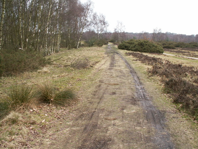
Sutton Park is a large urban park located in Sutton Coldfield, Birmingham, West Midlands, England. Most of the park is a national nature reserve; large parts are also a scheduled monument. Sutton Park is one of the largest urban parks in the United Kingdom. The park covers more than according to one source, or according to another. It consists of a mix of heathland, wetlands and marshes, seven lakes, extensive ancient woodlands (covering approximately a quarter of the park), several restaurants, a private 18-hole golf course on its western edge and a municipal golf course to the south, a donkey sanctuary, children's playgrounds and a visitors' centre. There is no entrance charge to the Park, however there is a parking charge for cars on Saturdays and Sundays during the summer. A wide range of leisure activities are undertaken in the park including dog walking, pony trekking, bike riding and kite flying and there are areas to fly model aeroplanes and helicopters. Additionally ... [...More Info...] [...Related Items...] OR: [Wikipedia] [Google] [Baidu] |
Little Aston
Little Aston is a village in Staffordshire, England. It is located within the Lichfield District and is approximately south of the city of Lichfield. Formerly a separate settlement, it is in modern times contiguous with the built-up area of the neighbouring town of Sutton Coldfield. At the 2011 United Kingdom census the population of Little Aston ward was 2,920 people living in 1,104 households. At the last UK census there were 935 homes in the village, well over 10% of which were multimillion-pound properties, and the village is known for its footballers and successful businesspeople. Location and boundaries Little Aston is located in the very south of Staffordshire. Little Aston is contained within four corners, formed by local landmarks: Blake Street Station rail bridge in the east, by Little Aston Golf Club's grounds to the west, the Little Aston Severn Trent sewage treatment works to the north and the Rosemary Hill Road/Thornhill Road traffic island in the south. A ... [...More Info...] [...Related Items...] OR: [Wikipedia] [Google] [Baidu] |
Metropolitan Borough Of Walsall
The Metropolitan Borough of Walsall is a metropolitan borough in the West Midlands (county), West Midlands, England. It is named after its largest settlement, Walsall, but covers a larger area which also includes Aldridge, Bloxwich, Brownhills, Darlaston, Pelsall and Willenhall. The borough had an estimated population of 254,500 in 2007. The borough was created on 1 April 1974 under the Local Government Act 1972. It is bounded on the west by the Wolverhampton, City of Wolverhampton, the south by the Sandwell, Metropolitan Borough of Sandwell, to the south east by the Birmingham, City of Birmingham, and by the Staffordshire districts of Lichfield (district), Lichfield, Cannock Chase (district), Cannock Chase and South Staffordshire to the east, north and northwest respectively. Most of the borough is highly industrialised and densely populated, but areas around the north and east of the borough are open space. In 1986 the borough became an effective unitary authority when the ... [...More Info...] [...Related Items...] OR: [Wikipedia] [Google] [Baidu] |
Aldridge-Brownhills (UK Parliament Constituency)
Aldridge-Brownhills () is a constituency in the West Midlands, represented in the House of Commons of the UK Parliament since 2015 by Wendy Morton, a Conservative. Constituency profile Unlike the name suggests, the constituency does not just cover Aldridge and Brownhills but also a patchwork of smaller towns and villages within Walsall, West Midlands. The seat is described as a safe seat for the Conservative party. Residents are around average in terms of wealth for the UK.Electoral Calculus https://www.electoralcalculus.co.uk/fcgi-bin/seatdetails.py?seat=Aldridge-Brownhills Boundaries 1974–1983: The Urban District of Aldridge-Brownhills. 1983–2010: The Metropolitan Borough of Walsall wards of Aldridge Central and South, Aldridge North and Walsall Wood, Brownhills, Hatherton Rushall, Pelsall, and Streetly. 2010–present: The Metropolitan Borough of Walsall wards of Aldridge Central and South, Aldridge North and Walsall Wood, Brownhills, Pelsall, Rushall-Shelfield, and ... [...More Info...] [...Related Items...] OR: [Wikipedia] [Google] [Baidu] |
Aldridge
Aldridge is an industrial town in the Walsall borough, West Midlands, England. It is historically a village that was part of Staffordshire until 1974. The town is from Brownhills, from Walsall, from Sutton Coldfield and from Lichfield. The town is also the second-largest town in the Walsall Borough (By population after Walsall). History The name "Aldridge" is derived from the Anglo-Saxon ''alr'' or ''alre'' + ''wīc'' meaning 'alder (tree) + village'. Another suggestion is that the name "Aldridge" means "outlying farm among alder-trees", from the Old English ''alor'' and ''wīc''. It was recorded as ''Alrewic'' in the Domesday Book of 1086 when it was valued at 15 shillings and had a population of seven households; the Lord was Robert (d'Oilly) and the tenant-in-chief was William son of Ansculf. The name was recorded as ''Alrewich'' and ''Allerwych'' in the 12th century. Aldridge began as a small agricultural settlement, with farming being the most common occupatio ... [...More Info...] [...Related Items...] OR: [Wikipedia] [Google] [Baidu] |
Four Oaks, Birmingham
Four Oaks is an affluent residential area in Sutton Coldfield, West Midlands, lying along the north and east borders of Sutton Park. Four Oaks is situated approximately north of Birmingham City Centre, and is bordered by Sutton Park, Streetly, Mere Green, Little Aston, Roughley and Aldridge. Four Oaks has a population of 21,690 as of 2004, and is part of the Sutton Four Oaks electoral ward. Four Oaks Estate In 1677, Henry Folliott, 1st Baron Folliott of Ballyshannon bought of woodland and built Four Oaks Hall. Folliott died in 1716, but his widow continued to live in Four Oaks Hall until her death in 1751. The estate was sold to Simon Luttrell, 1st Earl of Carhampton, who remodelled and modernised the house. In 1757, he bought a further of woodland to annex his estate and form a deer park. He sold the estate to Thomas Gresley in 1778, who sold the estate to Sir Hugh Bateman, 1st Baronet of Hartington Hall in 1785, who in turn sold the estate to Sir Edmund Cradock-Hartopp, ... [...More Info...] [...Related Items...] OR: [Wikipedia] [Google] [Baidu] |
Icknield Street
Icknield Street or Ryknild Street is a Roman road in England, with a route roughly south-west to north-east. It runs from the Fosse Way at Bourton on the Water in Gloucestershire () to Templeborough in South Yorkshire (). It passes through Alcester, Studley, Redditch, Metchley Fort, Birmingham, Sutton Coldfield, Lichfield, Burton upon Trent and Derby. Names Four Roman roads having the King's protection are named in the Laws of Edward the Confessor: Watling Street, Ermine Street, the Fosse Way, and Hikenild or Icknield Street. Hikenild Strete is generally supposed to be connected with the country of the Iceni. Various forms of the name (the earliest in Anglo-Saxon charters are Icenhilde Weg or Icenilde Weg) designate other roads from the borders of Norfolk through Cambridgeshire, Bucks, Berks, Hants and Wilts into Dorset. These locations, however, would identify the route as Icknield Way an Iron Age trackway running from Norfolk to Dorset. What is today referred to as the ... [...More Info...] [...Related Items...] OR: [Wikipedia] [Google] [Baidu] |
Four Oaks Railway Station
Four Oaks railway station serves the Four Oaks area of Sutton Coldfield, West Midlands, England. It is situated on the Cross-City Line. The station, and all trains serving it, are operated by West Midlands Railway. History The station opened in 1884, when the London and North Western Railway's line from Birmingham to Sutton Coldfield was extended to Lichfield. More recently, in May 1978 Four Oaks became the northern terminus of the newly inaugurated Cross-City Line from via Birmingham New Street, with trains running up to every 10 minutes in each direction. The line to the north towards Lichfield City had a less frequent service to begin with (Lichfield being outside the West Midlands PTE boundary), but the growing popularity of the route led to it gaining additional services by the mid-1980s. Eventually, the line was extended to Lichfield Trent Valley in November 1988. Electric operation at the station commenced in 1992 (as far as New Street), with the full line through ... [...More Info...] [...Related Items...] OR: [Wikipedia] [Google] [Baidu] |


.png)


