|
Strang, Isle Of Man
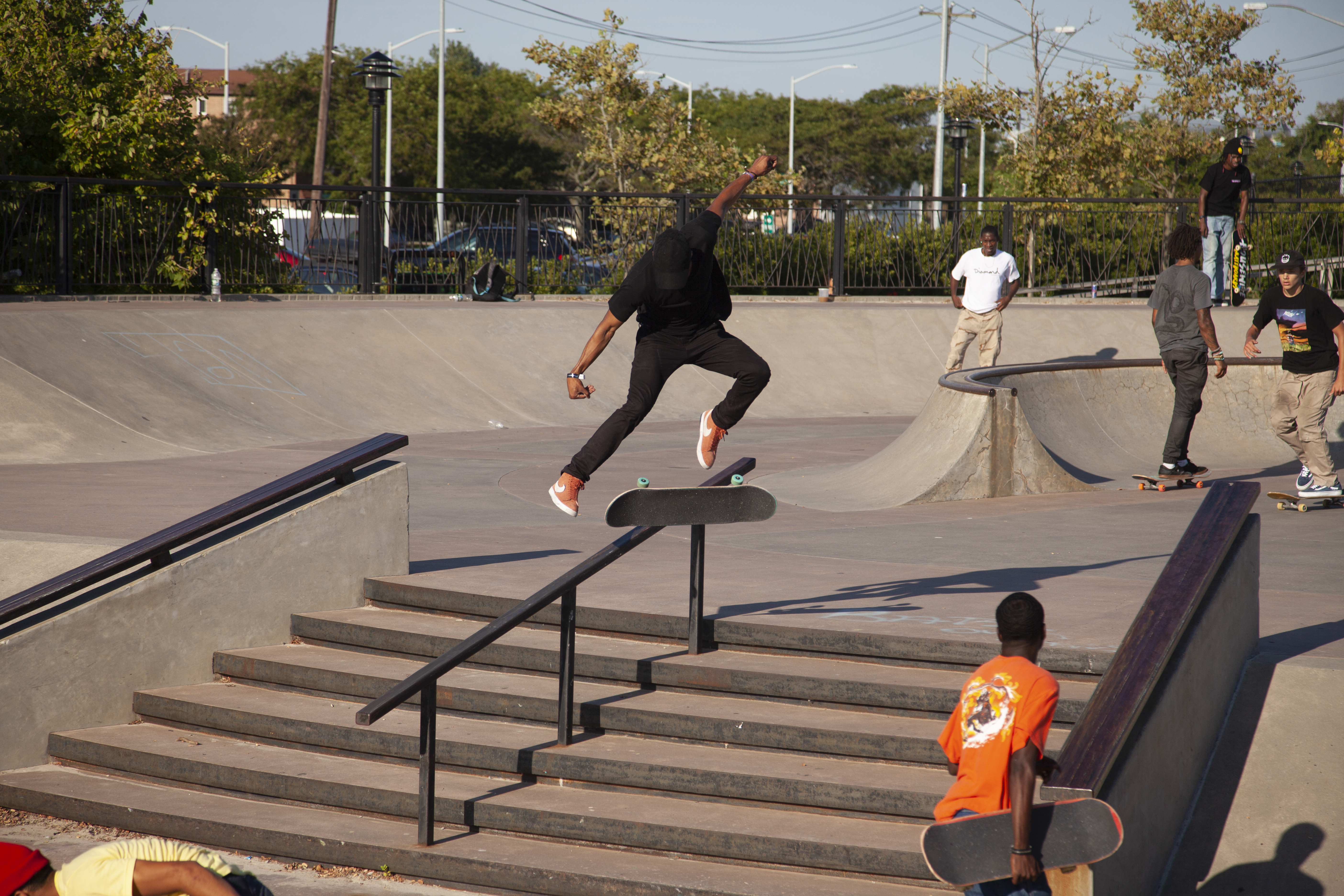
Strang or The Strang ( glv, Strang) is a settlement within the parish of Braddan on the Isle of Man. It is almost contiguous with Douglas, the largest town on the island, and with the village of Union Mills. Nearby is Noble's Hospital, the island's only general hospital, sited on land which was originally purchased for an asylum in 1862, with completion in 1868, known as Ballamona Hospital. Facilities As of August 2021, some facilities within Strang can be found in the hospital, including shop and coffee shop. Cronk Grianagh park has the only concrete urban skatepark on the island, a BMX track and playground. In 2017, Braddan Parish Commissioners sought expressions of interest in a proposed community centre to be built on the field opposite Strang Stores. Later that year, after interest was shown, the community centre was approved. The proposed facilities to be housed in the complex include a café, sports hall, pharmacy, nursery and the local commissioners' offices. Const ... [...More Info...] [...Related Items...] OR: [Wikipedia] [Google] [Baidu] |
Census In The Isle Of Man
) , anthem = "O Land of Our Birth" , image = Isle of Man by Sentinel-2.jpg , image_map = Europe-Isle_of_Man.svg , mapsize = , map_alt = Location of the Isle of Man in Europe , map_caption = Location of the Isle of Man (green) in Europe (dark grey) , subdivision_type = Sovereign state , subdivision_name = United Kingdom , established_title = Norse control , established_date = 9th century , established_title2 = Scottish control , established_date2 = 2 July 1266 , established_title3 = English control , established_date3 = 1399 , established_title4 = Revested into British Crown , established_date4 = 10 May 1765 , official_languages = , capital = Douglas , coordinates = , demonym = Manx; Manxman (plural, Manxmen); Manxwoman (plural, Manxwomen) , ethnic_groups = , ethnic_groups_year = 2021 , ethnic_groups_ref = Official census statistics provided by Statistics Isle of Man, Isle of Man Government: * * , religion = , religion_year = 2021 , religion ... [...More Info...] [...Related Items...] OR: [Wikipedia] [Google] [Baidu] |
Braddan
Braddan ( gv, Braddan) is one of the seventeen parishes of the Isle of Man. It is located on the east of the island (part of the traditional ''South Side'' division) in the sheading of Middle. Administratively, a small part of the historic parish of Braddan is now covered by part of the borough of Douglas, the capital and largest town of the Isle of Man. Other settlements in the parish include Port Soderick, Strang, Tromode and Union Mills. Local government For the purposes of local government, the ''majority'' of the historic parish forms a single parish district with five elected Commissioners: In 1896, a small area in the south-east of the historic parish of Braddan became part of the borough of Douglas, since when it has been governed by a municipal corporation with 18 councillors and an elected mayor. The Captain of the Parish (since 1996) is Thomas Philip Caley. Politics Braddan parish district is part of the Middle constituency, which elects two Members to th ... [...More Info...] [...Related Items...] OR: [Wikipedia] [Google] [Baidu] |
Middle (sheading)
Middle ( gv, Medall) is one of the six sheadings of the Isle of Man. It is located on the east of the island (part of the traditional ''South Side'' division) and consists of the four historic parishes of Braddan, Marown, Onchan and Santon. Historically, from 1796 until 1986 Marown was in the sheading of Glenfaba, and before 1796 Onchan was in the sheading of Garff. In addition to the current districts listed above, the sheading of Middle also includes the borough of Douglas, the capital and largest town of the Isle of Man. Other settlements in the sheading include Port Soderick, Strang, Tromode and Union Mills (all in the parish of Braddan), Braaid, Crosby and Glen Vine (all in the parish of Marown), and Newtown in the parish of Santon. MHKs & Elections It is also a House of Keys constituency. Originally, in the 19th century, the constituency included the whole of the sheading (excluding Douglas), and elected 3 members. In the more recent period up to 2011 it el ... [...More Info...] [...Related Items...] OR: [Wikipedia] [Google] [Baidu] |
Isle Of Man
) , anthem = "O Land of Our Birth" , image = Isle of Man by Sentinel-2.jpg , image_map = Europe-Isle_of_Man.svg , mapsize = , map_alt = Location of the Isle of Man in Europe , map_caption = Location of the Isle of Man (green) in Europe (dark grey) , subdivision_type = Sovereign state , subdivision_name = United Kingdom , established_title = Norse control , established_date = 9th century , established_title2 = Scottish control , established_date2 = 2 July 1266 , established_title3 = English control , established_date3 = 1399 , established_title4 = Revested into British Crown , established_date4 = 10 May 1765 , official_languages = , capital = Douglas , coordinates = , demonym = Manx; Manxman (plural, Manxmen); Manxwoman (plural, Manxwomen) , ethnic_groups = , ethnic_groups_year = 2021 , ethnic_groups_ref = Official census statistics provided by Statistics Isle of Man, Isle of Man Government: * * , religion = , religion_year = 2021 , relig ... [...More Info...] [...Related Items...] OR: [Wikipedia] [Google] [Baidu] |
Douglas, Isle Of Man
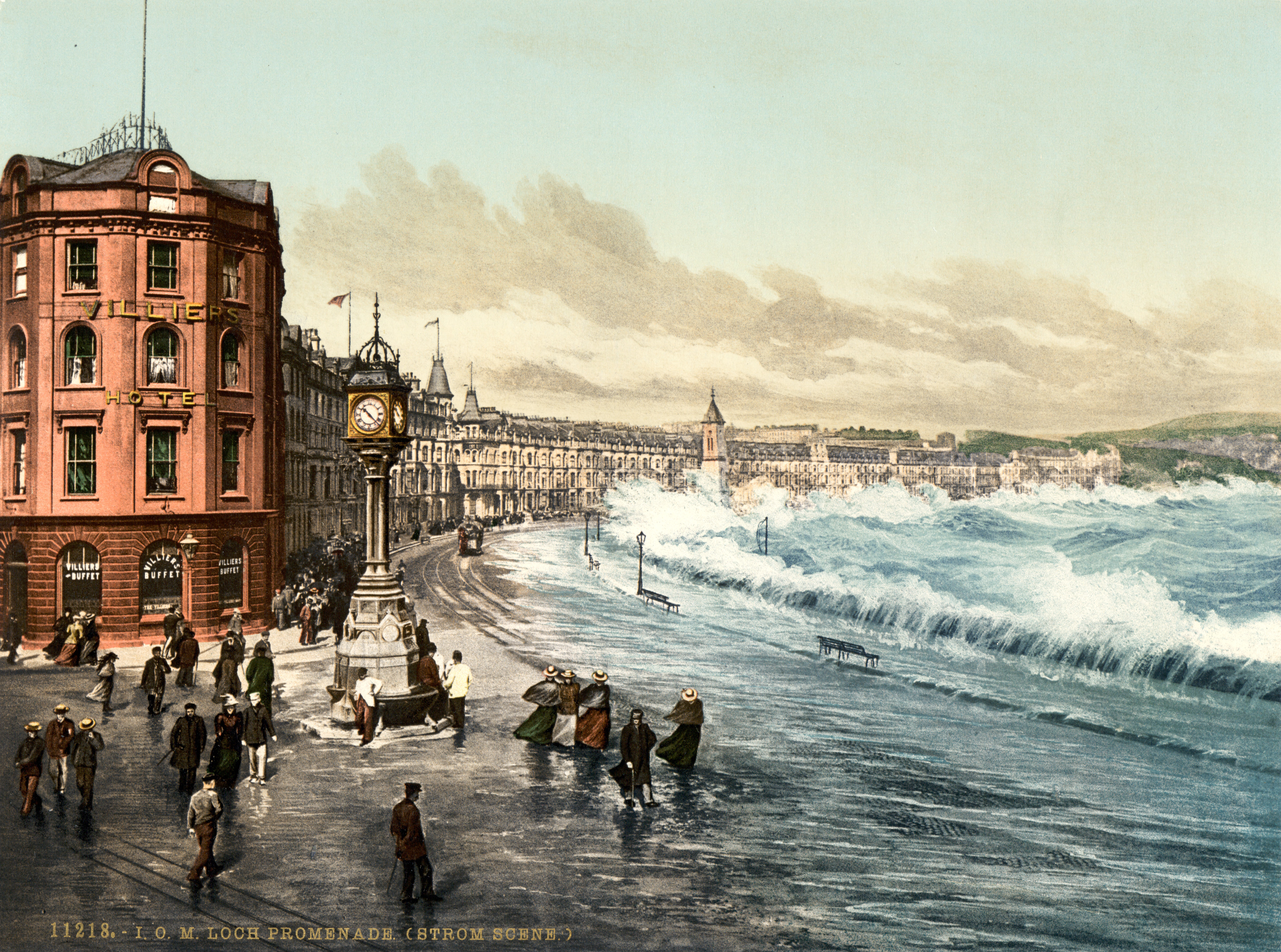
Douglas ( gv, Doolish, ) is the capital and largest town of the Isle of Man, with a population of 26,677 (2021). It is located at the mouth of the River Douglas, and on a sweeping bay of . The River Douglas forms part of the town's harbour and main commercial port. Douglas was a small settlement until it grew rapidly as a result of links with the English port of Liverpool in the 18th century. Further population growth came in the following century, resulting during the 1860s in a staged transfer of the High Courts, the Lieutenant Governor's residence, and finally the seat of the legislature, Tynwald, to Douglas from the ancient capital, Castletown. The town is the Island's main hub for business, finance, legal services, shipping, transport, shopping, and entertainment. The annual Isle of Man TT motorcycle races start and finish in Douglas. History Early history In the absence of any archaeological data, the origins of the town may be revealed by analysis of the origina ... [...More Info...] [...Related Items...] OR: [Wikipedia] [Google] [Baidu] |
Union Mills
Union commonly refers to: * Trade union, an organization of workers * Union (set theory), in mathematics, a fundamental operation on sets Union may also refer to: Arts and entertainment Music * Union (band), an American rock group ** ''Union'' (Union album), 1998 * ''Union'' (Chara album), 2007 * ''Union'' (Toni Childs album), 1988 * ''Union'' (Cuff the Duke album), 2012 * ''Union'' (Paradoxical Frog album), 2011 * ''Union'', a 2001 album by Puya * ''Union'', a 2001 album by Rasa * ''Union'' (The Boxer Rebellion album), 2009 * ''Union'' (Yes album), 1991 * "Union" (Black Eyed Peas song), 2005 Other uses in arts and entertainment * ''Union'' (Star Wars), a Dark Horse comics limited series * Union, in the fictional Alliance–Union universe of C. J. Cherryh * '' Union (Horse with Two Discs)'', a bronze sculpture by Christopher Le Brun, 1999–2000 * The Union (Marvel Team), a Marvel Comics superhero team and comic series Education * Union Academy (other) ... [...More Info...] [...Related Items...] OR: [Wikipedia] [Google] [Baidu] |
Noble’s Hospital
Noble’s Hospital is a hospital on the Isle of Man. It is one of only two hospitals on the island, and as of 1 April 2021, is run by Manx Care; having previously been run by the Department of Health and Social Care History In 1947 the hospital had 137 beds with an average occupancy of 122 patients. The Cubbon Wing, for chronically sick patients, financed by the estate of the late Thomas Cubbon, was added in 1951. A new Nurses' Home was built in 1953. At the end of 1955, there was a waiting list for admission of 279 patients. Some patients had to be transferred to the White Hoe. The hospital relocated in 2003 from its previous location at Westmoreland Road into a new building constructed on a greenfield site at the outskirts of the main town of Douglas. In October 2022 Tynwald allocated £18.3 million to reduce waiting times in orthopaedics, general surgery and ophthalmology. Funding had already been provided for knee and hip, endoscopy, and cataract procedures. Faciliti ... [...More Info...] [...Related Items...] OR: [Wikipedia] [Google] [Baidu] |
Ballamona Hospital
Ballamona Hospital was an asylum located in Braddan Braddan ( gv, Braddan) is one of the seventeen parishes of the Isle of Man. It is located on the east of the island (part of the traditional ''South Side'' division) in the sheading of Middle. Administratively, a small part of the historic p ..., Isle of Man. It was known as the Isle of Man Lunatic Asylum until 1934 when it became the Isle of Man Mental Hospital. From 1955 it was known as Ballamona Hospital. It was built in 1868, then called the Mental Hospital, and 76 patients were admitted. In 1925 there were 254 patients at the hospital with a further 65 at the nearby Home for the Poor. In 1948, there were 345 beds, and it had a farm and market gardens where patients worked. There was an annexe, Ard Aalin, for voluntary patients. It was renamed Ballamona Hospital on the establishment of the health service. It was demolished in 1998, to make way make way for the new Noble's Hospital installations. References {{c ... [...More Info...] [...Related Items...] OR: [Wikipedia] [Google] [Baidu] |
Skatepark
A skatepark, or skate park, is a purpose-built recreational environment made for skateboarding, BMX, scootering, wheelchairs, and aggressive inline skating. A skatepark may contain half-pipes, handrails, funboxes, vert ramps, stairsets, quarter pipes, ledges, spine transfers, pyramids, banked ramps, full pipes, pools, bowls, snake runs, and any number of other objects. History The first skatepark in the world, Surf City, opened for business at 5140 E. Speedway in Tucson, Arizona on September 3, 1965. Patti McGee, Women's National Champion, attended the grand opening. The park had concrete ramps and was operated by Arizona Surf City Enterprises, Inc. A skatepark for skateboarders and skaters made of plywood ramps on a half-acre lot in Kelso, Washington, USA opened in April 1966. It was lighted for night use. California's first skatepark, the Carlsbad Skatepark opened on March 3, 1976. The World Skateboard Championships were held here on April 10, 1977. It operated un ... [...More Info...] [...Related Items...] OR: [Wikipedia] [Google] [Baidu] |
Playground
A playground, playpark, or play area is a place designed to provide an environment for children that facilitates play, typically outdoors. While a playground is usually designed for children, some are designed for other age groups, or people with disabilities. A playground might exclude children below (or above) a certain age. Modern playgrounds often have recreational equipment such as the seesaw, merry-go-round, swingset, slide, jungle gym, chin-up bars, sandbox, spring rider, trapeze rings, playhouses, and mazes, many of which help children develop physical coordination, strength, and flexibility, as well as providing recreation and enjoyment and supporting social and emotional development. Common in modern playgrounds are ''play structures'' that link many different pieces of equipment. Playgrounds often also have facilities for playing informal games of adult sports, such as a baseball diamond, a skating arena, a basketball court, or a tether ball. Public playgro ... [...More Info...] [...Related Items...] OR: [Wikipedia] [Google] [Baidu] |
Manx Language
Manx ( or , pronounced or ), also known as Manx Gaelic, is a Gaelic language of the insular Celtic branch of the Celtic language family, itself a branch of the Indo-European language family. Manx is the historical language of the Manx people. Although only few children native to the Isle of Man speak Manx as a first language, there has been a steady increase in the number of speakers since the death of Ned Maddrell in 1974. He was considered to be the last speaker to grow up in a Manx-speaking community environment. Despite this, the language has never fallen completely out of use, with a minority having some knowledge of it as a heritage language, and it is still an important part of the island's culture and cultural heritage. Manx is often cited as a good example of language revival efforts; in 2015, around 1,800 people had varying levels of second-language conversational ability. Since the late 20th century, Manx has become more visible on the island, with increased si ... [...More Info...] [...Related Items...] OR: [Wikipedia] [Google] [Baidu] |
River Dhoo
The River Dhoo ( gv, Awin Doo) is a river on the Isle of Man. The river rises in Marown and flows east towards Douglas through the central valley of the island, passing Crosby and Union Mills before meeting with the River Glass on the outskirts of Douglas where it flows out to sea through Douglas Harbour Douglas Harbour ( gv, Purt Varrey Ghoolish) is located near Douglas Head at the southern end of Douglas, the capital of the Isle of Man. It is the island's main commercial shipping port. The Port of Douglas was the first in the world to be equ .... The Dhoo (meaning ''black'' or ''dark'' in Manx) and the Glass (meaning ''clear'' or ''green'') converge to form the River Douglas. It has a length of approx. . More recent research suggests that the name is one of the oldest place-names in the island and comes from the early Celtic term 'duboglassio’ meaning 'black/dark stream'. This is a common name throughout the British Isles and is Dulas in Wales and Dawlish in England ... [...More Info...] [...Related Items...] OR: [Wikipedia] [Google] [Baidu] |


.jpg)
