|
Stockerston
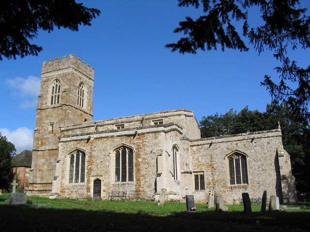
Stockerston is a village and civil parish in the Harborough district of Leicestershire, England, located on the border with Rutland, by the Eye Brook. According to the 2001 census the parish had a population of 35. The population remained less than 100 at the 2011 census and is included in the civil parish of Horninghold. Topography The Parish contains various woods including the large Bolt Wood and Park Wood, and the smaller Fishpond Spinney, Great Spinney, Little Merrible Wood, and Holyoaks Wood. Bolt Wood and Park Wood are fragments of the medieval Leighfield Forest and included in the sites of special scientific interest known as the Eye Brook Valley Woods. History Analysis of the name of the village name suggests it derives from the term 'made of wood'. Archaeologists state that the scatterings of Roman and Anglo-Saxon pottery discovered at Stockerston indicate occupation during that era. The village was in the Gartree Hundred and had two mentions in the Dom ... [...More Info...] [...Related Items...] OR: [Wikipedia] [Google] [Baidu] |
John Boyville
John Boyville (1391-c.1467) was a major landowner who served as a Member of Parliament for Leicestershire and for Rutland respectively in 1453-4 and 1460–1. Background and family The Boyville (Bovile, Boyvile, Boyvill, Boyvyle) family is recorded at Stockerston, Leicestershire as early as the 13th century. John was born on 24 June 1391, a son and the heir of Sir Thomas Boyville (c.1370-1401) and his wife Elizabeth Walsh. Career Offices that John held included Sheriff of Rutland for the years 1433 and 1447. John Boyvyle '' armiger'' was returned as Member of Parliament for Rutland in 1428, but he was described as of Stockerston when he served as Member of Parliament for Leicestershire in 1453–4. When he represented Rutland in the Parliament of 1460-1 he was described as an esquire of Ridlington. Although the parishes of Stockerston and Ridlington are in different counties, they are within a few miles of each other. Family John's first marriage was to Elizabeth, the wido ... [...More Info...] [...Related Items...] OR: [Wikipedia] [Google] [Baidu] |
Stockerston Hall
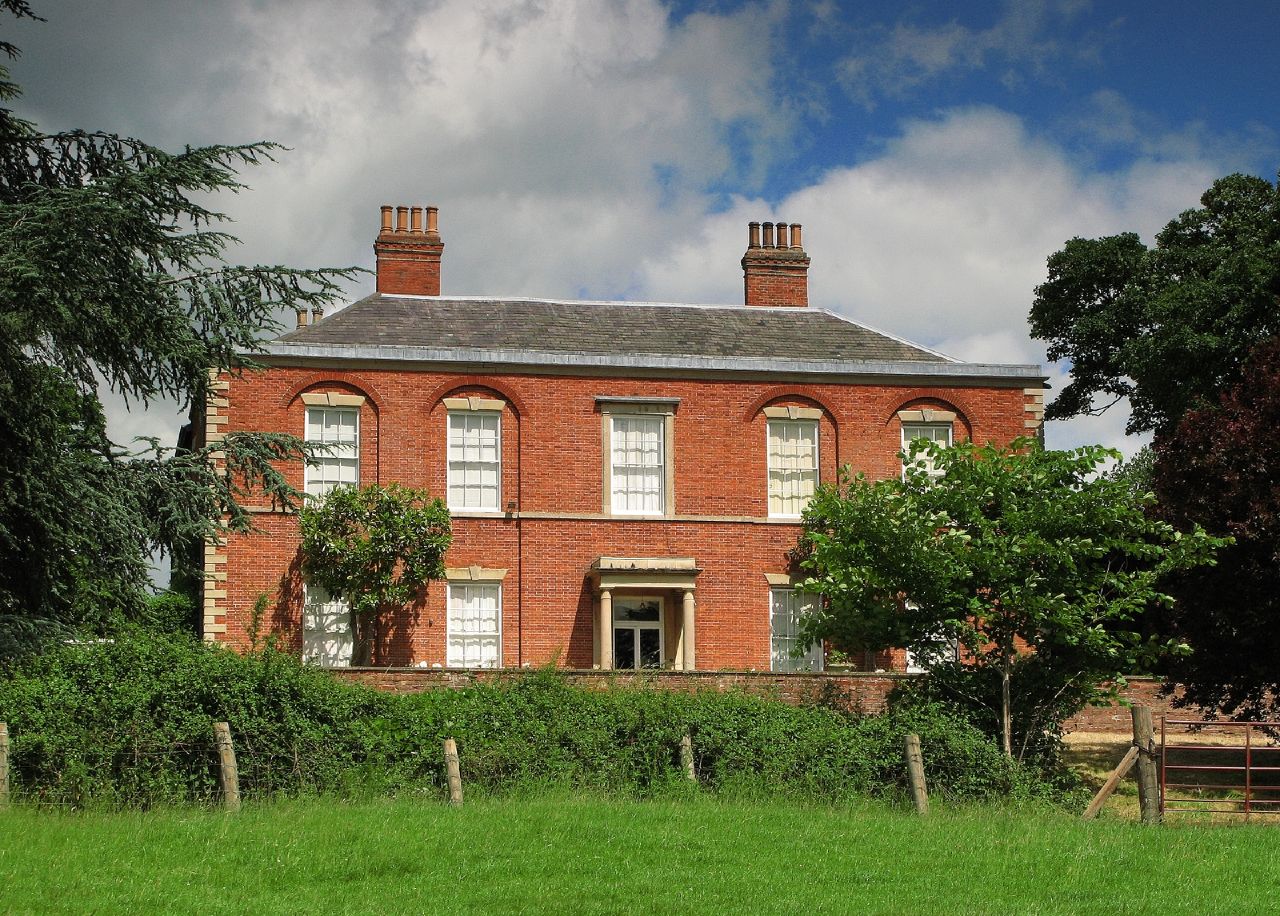
Stockerston Hall is a late-18th-century English country house in Leicestershire, near the town of Uppingham, Rutland. It is a Grade II listed building. The Manor of Stockerston was owned by the Boyville family in the 15th century and passed by marriage to Sothill and then to Drury. It was sold by Henry Drury in 1580 to John Burton of Braunston, whose son was the first of the Burton baronets of Stockerston. In 1633, Sir Thomas Burton Bt was High Sheriff of Leicestershire and in 1682 Sir Thomas Burton Bt had the same honour. The Burtons were impoverished by the English Civil War and sold the estate to Sir Charles Dunscombe in about 1685. The Dunscombes demolished the old manor house in about 1797 and built the present Georgian style mansion upon its foundations in about 1800. The attractive red brick and stone dressed entrance front of five bays has a central Tuscan order The Tuscan order (Latin ''Ordo Tuscanicus'' or ''Ordo Tuscanus'', with the meaning of Etruscan order) is one ... [...More Info...] [...Related Items...] OR: [Wikipedia] [Google] [Baidu] |
Burton Baronets
There have been two baronetcies created for persons with the surname Burton, one in the Baronetage of England and one in the Baronetage of Ireland. Both creations are extinct. The Burton Baronetcy, of Stockerston in the County of Leicester, was created in the Baronetage of England on 22 July 1622 for Sir Thomas Burton, son of John Burton of Braunston who had purchased the Stockerston Hall estate in 1580. He was knighted in Dublin in 1605. He served as High Sheriff of Leicestershire in 1633. His son, the second Baronet, served the Royalist cause during the English Civil War and his estate was subsequently sequestered. Following the Restoration his son the third Baronet served as high sheriff in 1682. He sold Stockerston in 1690. The fourth and last Baronet was imprisoned for debt in 1710 and following conviction for theft in 1722 was transported. The baronetcy presumably became extinct on his death in circa 1750. The Burton Baronetcy, of Pollacton in the County of Carlow, was c ... [...More Info...] [...Related Items...] OR: [Wikipedia] [Google] [Baidu] |
Bolt Wood
Bolt Wood is near to the western boundary of the Parish of Stockerston, Leicestershire, England. It is suggested that the woodland on this boundary is part of that mentioned in the Domesday Book. Bolt Wood was part of the extensive Royal medieval Leighfield Forest. The first written reference to Bolt Wood is in an undated charter probably dating before the reign of Henry VI, in which it is referred to as 'Boutewood'. An alternative date offered is between 1422 and 1461. Site of special scientific interest Bolt Wood is part of the Eye Brook Valley Woods Eye Brook Valley Woods is a biological Site of Special Scientific Interest east of Hallaton in Leicestershire. It is in three separate areas, Great Merrible Wood, which is managed by the Leicestershire and Rutland Wildlife Trust, Bolt Wood and ... Site of Special Scientific Interest (SSSI). The Eye Brook Valley Woods are designated as Sites of Specific Scientific Interest because they are the best existing examples of ash- ... [...More Info...] [...Related Items...] OR: [Wikipedia] [Google] [Baidu] |
Eye Brook Valley Woods
Eye Brook Valley Woods is a biological Site of Special Scientific Interest east of Hallaton in Leicestershire. It is in three separate areas, Great Merrible Wood, which is managed by the Leicestershire and Rutland Wildlife Trust, Bolt Wood and Park Wood. These are surviving fragments of the medieval Leighfield Forest. Park Wood is mainly ash and wych elm, while Bolt Wood and Great Merrible Wood are dominated by ash and field maple ''Acer campestre'', known as the field maple, is a flowering plant species in the family Sapindaceae. It is native to much of continental Europe, Britain, southwest Asia from Turkey to the Caucasus, and north Africa in the Atlas Mountains. It h .... The shrub flora is diverse, and there are also several small pools and marshes. There is access to Great Merrible Wood by a footpath from Stockerston Lane, but the other woods are private. References {{SSSIs Leicestershire Sites of Special Scientific Interest in Leicestershire ... [...More Info...] [...Related Items...] OR: [Wikipedia] [Google] [Baidu] |
Harborough District
Harborough () is a local government district of Leicestershire, England, named after its main town, Market Harborough. Covering , the district is by far the largest of the eight district authorities in Leicestershire and covers almost a quarter of the county. The district also covers the town of Lutterworth and villages of Broughton Astley and Ullesthorpe. The district extends south and east from the Leicester Urban Area; on the east it adjoins the county of Rutland; has a boundary on the north with the boroughs of Charnwood and Melton; on the south it has a long boundary with the county of Northamptonshire comprising the districts of North Northamptonshire and West Northamptonshire. To the west the boundary is with Warwickshire and the borough of Rugby, a boundary formed for much of its length by the line of Watling Street. The north-western boundary of the district adjoins Blaby District and the borough of Oadby and Wigston. The villages of Thurnby, Bushby and Scrapt ... [...More Info...] [...Related Items...] OR: [Wikipedia] [Google] [Baidu] |
Eye Brook
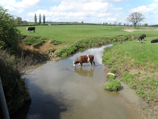
The Eye Brook is a watercourse in the East Midlands of England and a tributary of the River Welland. It is around long. Course The Eye Brook rises between Tilton on the Hill and Skeffington in Leicestershire and flows east through a narrow valley towards East Norton. Near where it crosses the A47, it starts to form the county boundary between Leicestershire and Rutland, with Belton-in-Rutland to the north, and Allexton to the south. It then proceeds south-eastwards, passing the village of Stockerston. Between Stoke Dry and Caldecott it has been dammed to form the Eyebrook Reservoir. Shortly after the reservoir outfall, it joins the River Welland (here forming the border with Northamptonshire). Wildlife Much of the land surrounding the area is a Site of Special Scientific Interest and a report by English Nature considered the river to be one of the most "natural" in the county having experienced very little human intervention. The river holds a variety of fish speci ... [...More Info...] [...Related Items...] OR: [Wikipedia] [Google] [Baidu] |
Horninghold
Horninghold is a small village and parish seven miles north-east of Market Harborough in the county of Leicestershire. The village's name means 'wood belonging to the people of Horning'. Following the Norman Conquest in 1066 the village was given to Robert de Todeni, Lord of Belvoir. In about 1076 he gave the parish to the priory of Belvoir where it remained until the Dissolution of the Monasteries in the 16th century. The population of the civil parish (including Allexton and Stockerston) was 316 at the 2011 census. At the beginning of the 20th century, the estate owners, the Hardcastle family remodelled the village as a garden village with many trees and shrubs. The church of St Peter was built in the 12th century and is a surviving example of a parish church without Victorian restoration The Victorian restoration was the widespread and extensive refurbishment and rebuilding of Church of England churches and cathedrals that took place in England and Wales during the ... [...More Info...] [...Related Items...] OR: [Wikipedia] [Google] [Baidu] |
Leighfield Forest
Leighfield is a civil parish in the county of Rutland in the East Midlands of England. There is no settlement centre in the parish, only a few isolated properties. In the 2001 census it had a population of 10, which was the fourth smallest of Rutland's parish populations. At the 2011 census the population remained less than 100 and was included in the civil parish of Ridlington. It shares its name with Leighfield Forest, a much larger area from Braunston-in-Rutland to Stockerston and from Skeffington to Ridlington, a triangle of land roughly in each direction. The village's name means 'Wood/clearing'. Spellings with the addition of the Old English word 'feld' meaning 'open land' started to appear from the 14th century. The Leighfield Way is a waymarked route joining the Leicestershire and Rutland Rounds at Belton-in-Rutland with the Hereward Way and Viking Way at Oakham. Leighfield Forest In the medieval period, Leighfield Forest was an extensive Royal forest straddling the ... [...More Info...] [...Related Items...] OR: [Wikipedia] [Google] [Baidu] |
William Burton (antiquary, Died 1645)
William Burton (24 August 1575 – 6 April 1645) was an English antiquarian, best known as the author of the ''Description of Leicester Shire'' (1622), the county's first published county history. Life Burton was the son of Ralph Burton, and elder brother of Robert Burton, born at Lindley in Leicestershire on 24 August 1575. At the age of nine he went to school at Nuneaton, and on 29 September 1591 entered Brasenose College, Oxford (B.A. 22 June 1594). He was admitted, on 20 May 1593, to the Inner Temple. He was one of a group of antiquaries there, including Sir John Ferne, Thomas Gainsford, and Peter Manwood. On 20 May 1603 he was called to the bar, but soon afterwards, owing to weak health, he retired to the village of Falde in Staffordshire, where he owned an estate. Among his particular friends were Sir Robert Cotton and William Somner. In his account of Fenny Drayton he speaks of his "old acquaintance" Michael Drayton. When the First English Civil War broke out ... [...More Info...] [...Related Items...] OR: [Wikipedia] [Google] [Baidu] |
Tithe Commutation
Tithe commutation was a 19th-century reform of land tenure in Great Britain and Ireland, which implemented an exchange of the payment of a tithe to the clergy of the established church, which were traditionally paid in kind, to a system based in an annual cash payment, or once-for-all payment. The system had become complex, with lay owners by impropriation entitled to some tithes, which were of a number of kinds. History In Scotland, a form of commutation of teinds applied from 1633. A full reform was carried out in the 1930s. Commutation of tithes occurred in England before the 19th century major reform, since it was an aspect of enclosure, a legal process under which rights to common land were modified by act of parliament. An estimate places 60% of enclosure acts as involving tithe commutation. In such cases, commissioners who dealt with the detail of enclosure acts handled tithes by allocation of land, as part of the division of ownership. By this mechanism, in the period 1750 t ... [...More Info...] [...Related Items...] OR: [Wikipedia] [Google] [Baidu] |
University Of Cambridge
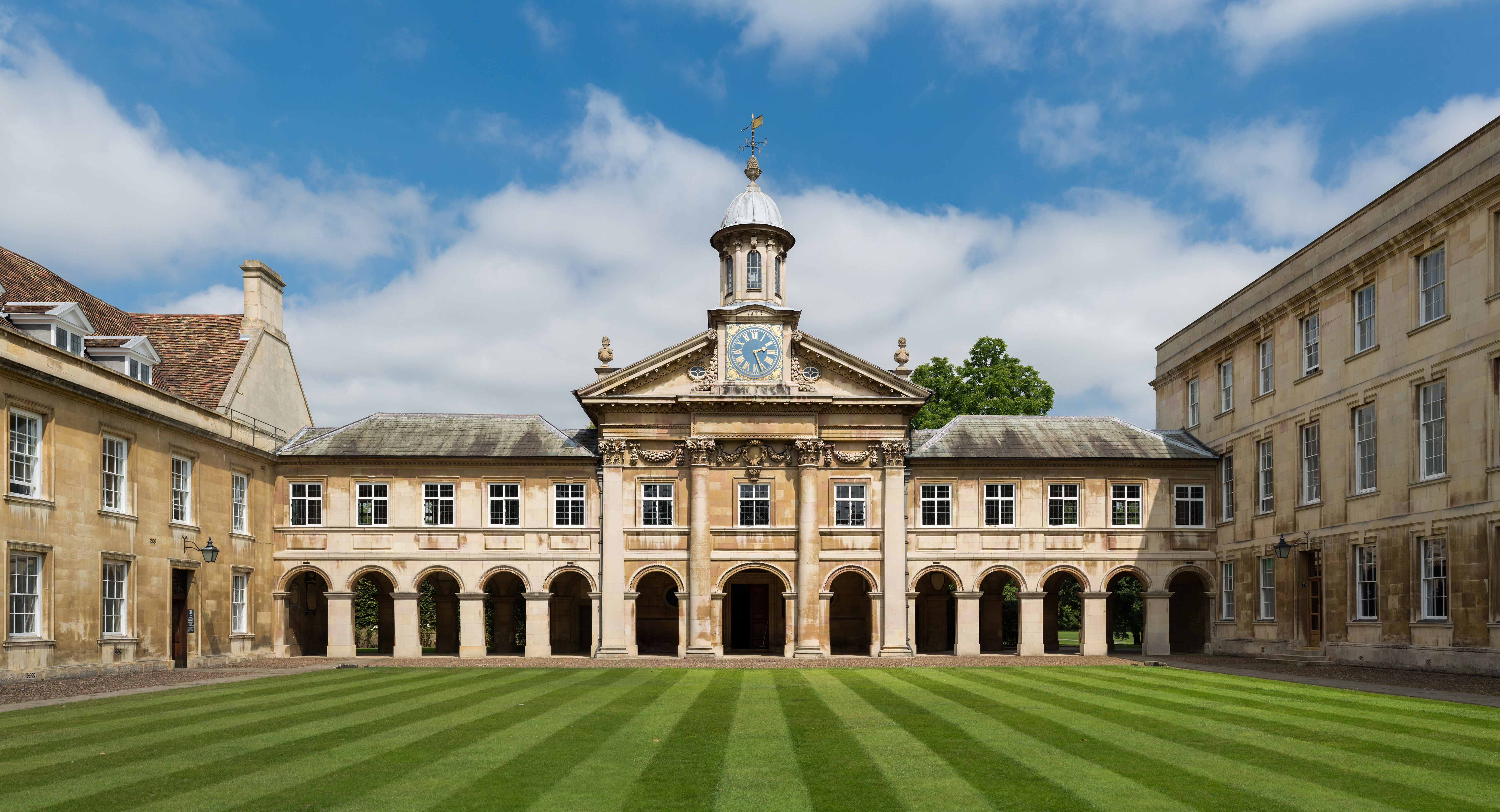
, mottoeng = Literal: From here, light and sacred draughts. Non literal: From this place, we gain enlightenment and precious knowledge. , established = , other_name = The Chancellor, Masters and Scholars of the University of Cambridge , type = Public research university , endowment = £7.121 billion (including colleges) , budget = £2.308 billion (excluding colleges) , chancellor = The Lord Sainsbury of Turville , vice_chancellor = Anthony Freeling , students = 24,450 (2020) , undergrad = 12,850 (2020) , postgrad = 11,600 (2020) , city = Cambridge , country = England , campus_type = , sporting_affiliations = The Sporting Blue , colours = Cambridge Blue , website = , logo = University of Cambridge log ... [...More Info...] [...Related Items...] OR: [Wikipedia] [Google] [Baidu] |


