|
Steeple Rock
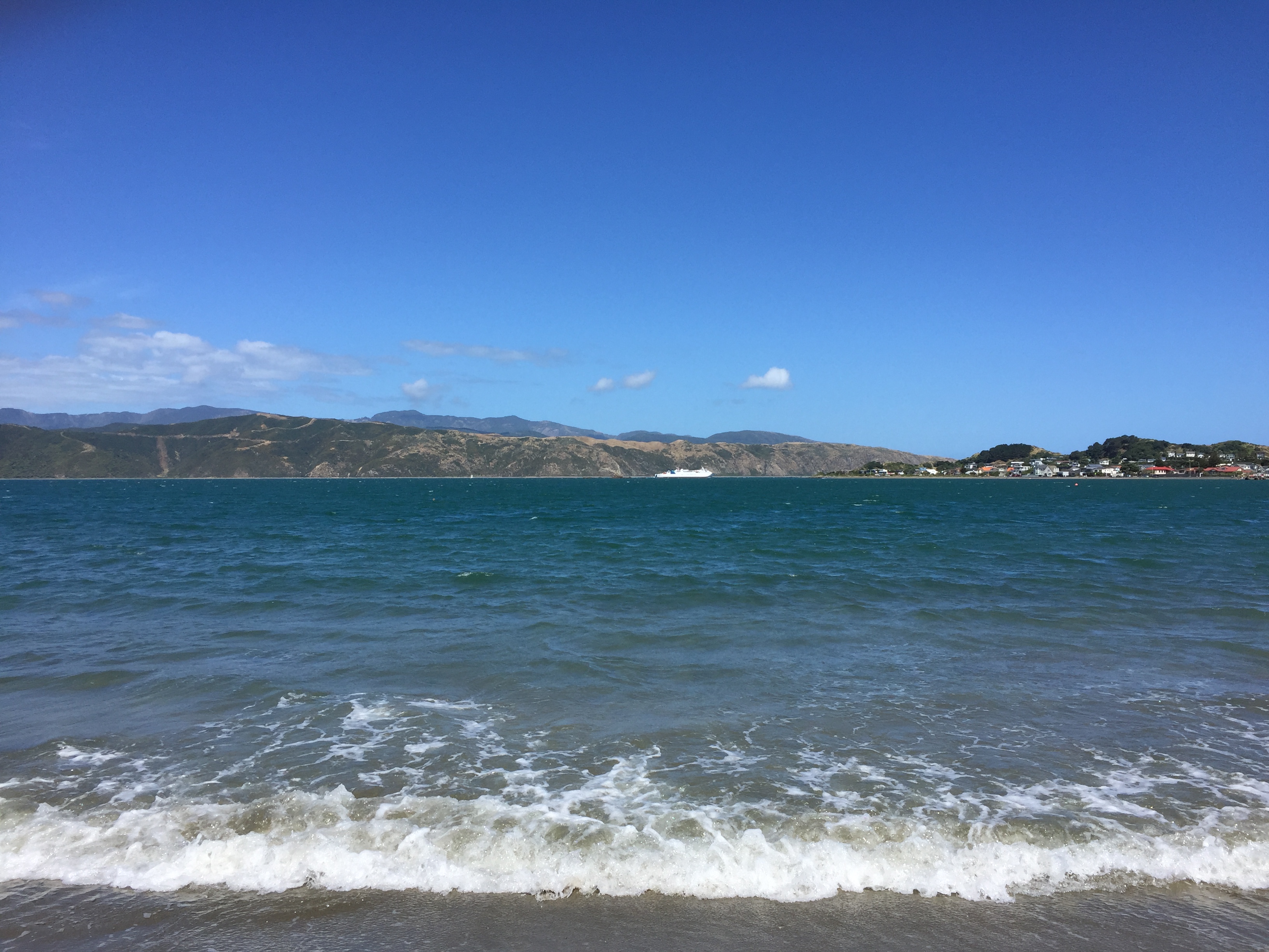
Steeple Rock/Te Aroaro-o-Kupe is a large rock off Seatoun at the west of the entrance to Wellington Harbour, rising above sea level. The rock plays a role in warning ships off the coast. It is the location of a marine light and an unbeaconed trig station (‘Steeple Rock Light’, geodetic code B0XX). Its Māori name is Te Aroaro-o-Kupe (The front of Kupe or The presence of Kupe). The name was officially changed in 2009 from Te Ure-o-Kupe (The penis of Kupe). Kupe, the legendary discoverer of Aotearoa, is said to have injured himself on the rock while swimming. In earlier times Steeple Rock was also known as Pinnacle Rock. This should not be confused with The Pinnacles, a group of rocks extending from the tip of Point Dorset, south of Steeple Rock. While Steeple Rock is not as much of a hazard to shipping as Barrett Reef to the south, several ships have got into trouble around the rock, for example: * 1844 ''Royal William'', sloop. Got stuck and had to be pulled off Steeple ... [...More Info...] [...Related Items...] OR: [Wikipedia] [Google] [Baidu] |
Steeple Rock, Wellington Harbour (8237683870)
In architecture, a steeple is a tall tower on a building, topped by a spire and often incorporating a belfry and other components. Steeples are very common on Christian churches and cathedrals and the use of the term generally connotes a religious structure. They might be stand-alone structures, or incorporated into the entrance or center of the building. Architecture Towers were not a part of Christian churches until about AD 600, when they were adapted from military watchtowers. At first they were fairly modest and entirely separate structures from churches. Over time, they were incorporated into the church building and capped with ever-more-elaborate roofs until the steeple resulted. Towers are a common element of religious architecture worldwide and are generally viewed as attempts to reach skyward toward heavens and the divine. Some wooden steeples are built with large wooden structural members arranged like tent poles and braced diagonally inside both with wood and stee ... [...More Info...] [...Related Items...] OR: [Wikipedia] [Google] [Baidu] |
Seatoun
Seatoun, an eastern suburb of Wellington, the capital city of New Zealand, lies on the east coast of the Miramar Peninsula, close to the entrance to Wellington Harbour (Port Nicholson), some seven kilometres southeast of the CBD. The suburb sits on an exposed promontory close to Barrett Reef, a dangerous area of rocky shallows upon which many ships have foundered, most notably the inter-island ferry in 1968. Europeans first settled the suburb in 1889. The name ''Seatoun'' comes from a locality in Forfarshire, Scotland linked with the family history of Coutts Crawford, the suburb's founder. Seatoun as a suburb looks out on to Steeple Rock, which is the largest rock of Barrett Reef at the west of the entrance to Wellington Harbour, rising above sea level. Its Māori name is Te Aroaro-o-Kupe (The front of Kupe), after being officially changed on 3 September 2009 from Te Ure-o-Kupe (The penis of Kupe). Kupe, the legendary discoverer of Aotearoa, is said to have injured himself o ... [...More Info...] [...Related Items...] OR: [Wikipedia] [Google] [Baidu] |
Survey Marker
Survey markers, also called survey marks, survey monuments, or geodetic marks, are objects placed to mark key survey points on the Earth's surface. They are used in geodetic and land surveying. A ''benchmark'' is a type of survey marker that indicates elevation (vertical position). Horizontal position markers used for triangulation are also known as ''triangulation stations''. '' Benchmarking'' is the hobby of "hunting" for these marks. Types All sorts of different objects, ranging from the familiar brass disks to liquor bottles, clay pots, and rock cairns, have been used over the years as survey markers. Some truly monumental markers have been used to designate tripoints, or the meeting points of three or more countries. In the 19th century, these marks were often drill holes in rock ledges, crosses or triangles chiselled in rock, or copper or brass bolts sunk into bedrock. Today in the United States, the most common geodetic survey marks are cast metal disks with stamped l ... [...More Info...] [...Related Items...] OR: [Wikipedia] [Google] [Baidu] |
Māori Language
Māori (), or ('the Māori language'), also known as ('the language'), is an Eastern Polynesian language spoken by the Māori people, the indigenous population of mainland New Zealand. Closely related to Cook Islands Māori, Tuamotuan, and Tahitian, it gained recognition as one of New Zealand's official languages in 1987. The number of speakers of the language has declined sharply since 1945, but a Māori-language revitalisation effort has slowed the decline. The 2018 New Zealand census reported that about 186,000 people, or 4.0% of the New Zealand population, could hold a conversation in Māori about everyday things. , 55% of Māori adults reported some knowledge of the language; of these, 64% use Māori at home and around 50,000 people can speak the language "very well" or "well". The Māori language did not have an indigenous writing system. Missionaries arriving from about 1814, such as Thomas Kendall, learned to speak Māori, and introduced the Latin alphabet. In 1 ... [...More Info...] [...Related Items...] OR: [Wikipedia] [Google] [Baidu] |
Kupe
Kupe ( ~1180-1320) was a legendary Polynesian explorer, navigator and great rangatira of Hawaiki, who is said to have been the first human to discover New Zealand. Whether Kupe existed historically is likely but difficult to confirm. He is generally held to have been born to a father from Rarotonga and a mother from Raiatea, and probably spoke a proto-Māori language similar to Cook Islands Māori or Tahitian. His voyage to New Zealand would ensure that the land would be known to the Polynesians, and he would therefore be responsible for the genesis of Māori civilisation. Kupe features prominently in the mythology and oral history of some Māori iwi (tribes), but the details of his life differ between iwi. Various legends and histories describe Kupe's extensive involvement in the settlement of Aotearoa, around 1000–1300 CE, with many talking of his achievements, such as the hunting and destruction of the great octopus, Te Wheke-a-Muturangi. Time of arrival Estimates of ... [...More Info...] [...Related Items...] OR: [Wikipedia] [Google] [Baidu] |
Aotearoa
''Aotearoa'' () is the current Māori-language name for New Zealand. The name was originally used by Māori in reference to only the North Island, with the name of the whole country being ''Aotearoa me Te Waipounamu'' ("North Island and South Island"). In the pre-European era, Māori did not have one name for the country as a whole. Several meanings for Aotearoa have been proposed for the name; the most popular translation usually given is "land of the long white cloud", or variations thereof. This refers to the cloud formations which helped early Polynesian navigators find the country. Beginning in the late 20th century, ''Aotearoa'' has become widespread in the bilingual names of national organisations and institutions. Since the 1990s, it has been customary for particular parties to sing the New Zealand national anthem, "God Defend New Zealand" (or "Aotearoa"), in both Māori and English, exposing the name to a wider audience. New Zealand English speakers pronounce the wo ... [...More Info...] [...Related Items...] OR: [Wikipedia] [Google] [Baidu] |
Barrett Reef
The cluster of rocks that is Barrett Reef (often known as ''Barrett's Reef'') is one of the most hazardous reefs in New Zealand. It lies on the western side of the entrance of Wellington Harbour, on the approaches to the city of Wellington, at coordinates . The reef is named after Richard (Dicky) Barrett (1807–1847), a whaler and trader. Its Māori name is ''Tangihanga-a-Kupe, (Mourning of Kupe)'', which may refer to the reef's similarity to a line of mourners at a tangi, the sad sound of the water around the reef, or Kupe crying for people he left behind in his travels. The reef is popular with recreational divers. Dangerous entrance The reef, much of which is exposed even at high tide, is located to the west of the two-kilometre-wide channel that links Cook Strait with Wellington Harbour, close to the shore of the Miramar Peninsula. The shipping channel lies between the reef and Pencarrow to the east. The area to the west between the reef and Point Dorset on the Miramar Pe ... [...More Info...] [...Related Items...] OR: [Wikipedia] [Google] [Baidu] |
Worser Bay
Worser Bay in Wellington, New Zealand is along the beach from Seatoun and over the hill from Miramar on the Miramar Peninsula. It has a calm sandy beach with a road running along the base of the Seatoun Heights hill. Houses run all along the hill side of the road, with only carparks and beach facilities opposite. The beach is subject to the windy conditions of Wellington with gusty northerlies often changing to cold, consistent southerlies. The waters are calm as the beach is within the natural harbour and in summer it is a popular destination for families, much like the nearby Scorching Bay. Named after James Heberley's frequent predictions of "worser" weather, the beach still has the original pilot's cottage that housed James and other pilots from 1866. Features The Worser Bay yacht club, scout hall and surf club buildings are located at the northern end of the beach. The Worser Bay Boating Club was founded in 1926 and has become a leader in the New Zealand-specific Sunbur ... [...More Info...] [...Related Items...] OR: [Wikipedia] [Google] [Baidu] |
Polly Woodside
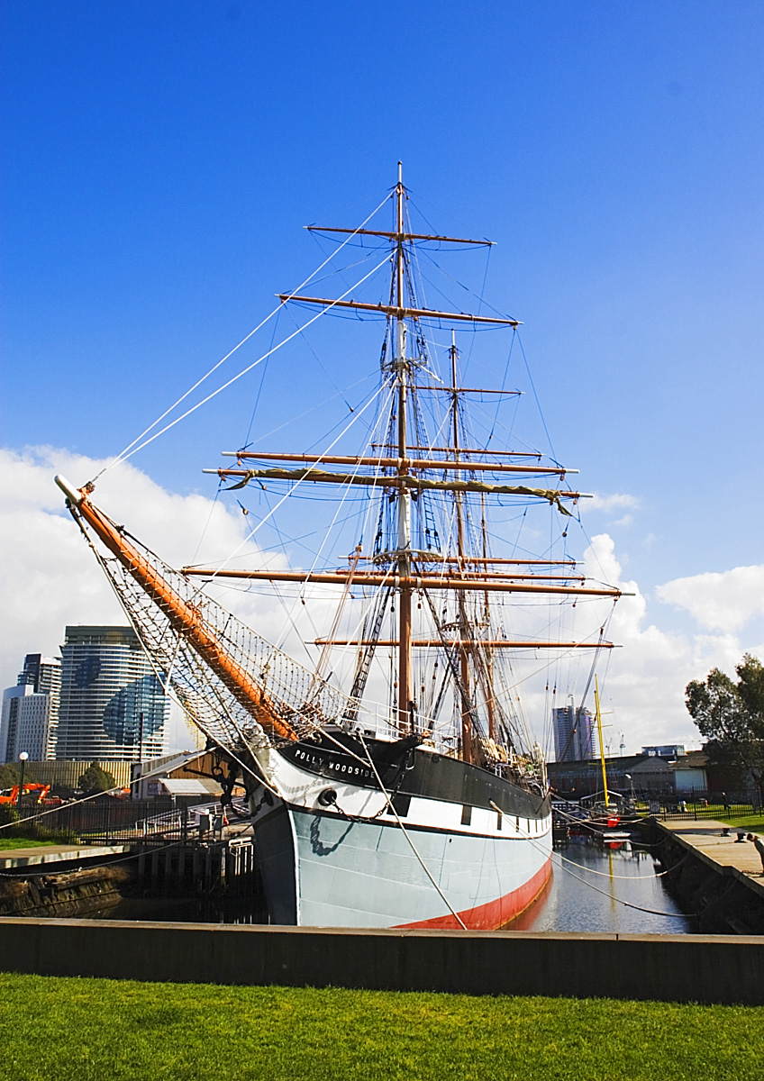
''Polly Woodside'' is a Belfast-built, three-masted, iron-hulled barque, preserved in Melbourne, Victoria (Australia), and forming the central feature of the South Wharf precinct. The ship was originally built in Belfast by William J. Woodside and was launched in 1885. ''Polly Woodside'' is typical of thousands of smaller iron barques built in the last days of sail, intended for deep water trade around the world and designed to be operated as economically as possible. Voyages 1885–1904 ''Polly Woodside'' was built at the north shipbuilding yard of Workman, Clark and Co, Queen's Island, Belfast during 1885, for William J. Woodside and Co. She was launched on 7 November 1885; the christening performed by the owner's wife, Mrs Marian ("Polly") Woodside, after whom the ship was named. ''Polly Woodside'' captained by Gilbert Yeates, operated as a cargo vessel carrying coal, nitrate, and wheat between British ports and the ports of South America, such as Montevideo, Valparaiso and ... [...More Info...] [...Related Items...] OR: [Wikipedia] [Google] [Baidu] |
TEV Wahine
} TEV ''Wahine'' was a Twin-screw steamer, twin-screw, turbo-electric transmission, turbo-electric, roll-on/roll-off ferry. Ordered in 1964, the Ship, vessel was built by the Fairfield Shipbuilding and Engineering Company, in Govan, Glasgow, Scotland for the Union Company, Union Steam Ship Company's Wellington-Lyttelton Steamer Express Service in New Zealand. The ship's name, ''Wahine (ship), Wahine'' (''pronounced wä-ˈhē-nē''), is a word for '''woman''' in some Polynesian languages, including Māori language, Māori. The ''Wahine'' began transporting passengers for day and overnight trips between New Zealand, New Zealand's Interislander, inter-island route between the ports of Wellington and Lyttelton, New Zealand, Lyttelton in 1966. The ''Wahine'' was permitted to carry a maximum of 1,100 passengers (or 924 Berth (sleeping), berthed passengers in 380 Cabin (ship), cabins spread over seven Deck (ship), decks). On 10 April 1968, near the end of a routine northbound overnigh ... [...More Info...] [...Related Items...] OR: [Wikipedia] [Google] [Baidu] |
.jpg)


