|
Steel Bridge
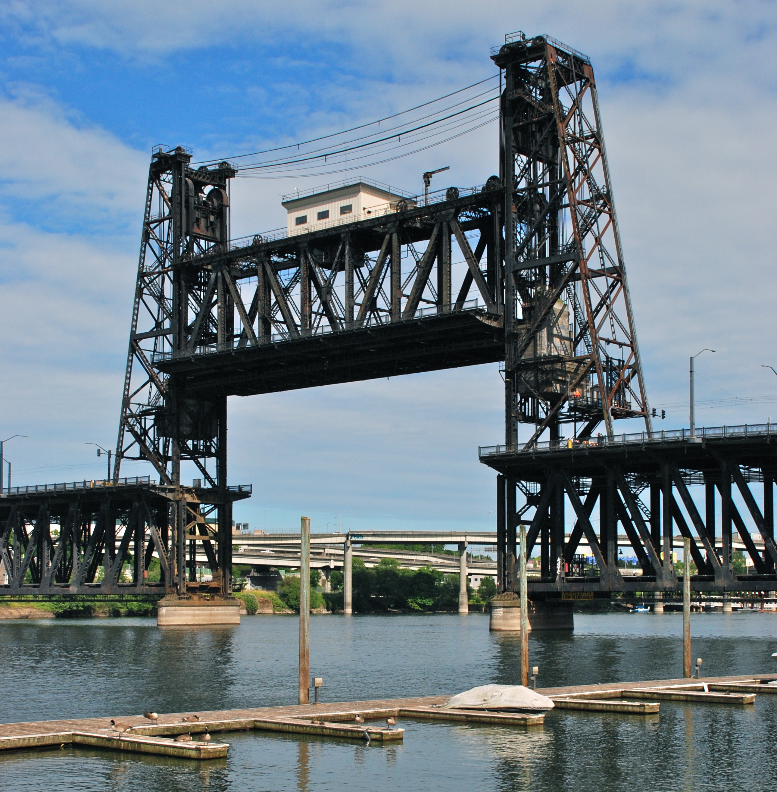
The Steel Bridge is a through truss, double-deck vertical-lift bridge across the Willamette River in Portland, Oregon, United States, opened in 1912. Its lower deck carries railroad and bicycle/pedestrian traffic, while the upper deck carries road traffic (on the Pacific Highway West No. 1W, former Oregon Route 99W), and light rail (MAX), making the bridge one of the most multimodal in the world. It is the only double-deck bridge with independent lifts in the world and the second oldest vertical-lift bridge in North America, after the nearby Hawthorne Bridge. The bridge links the Rose Quarter and Lloyd District in the east to Old Town Chinatown neighborhood in the west. History The bridge was completed in 1912 and replaced the Steel Bridge that was built in 1888 as a double-deck swing-span bridge. The 1888 structure was the first railroad bridge across the Willamette River in Portland. Its name originated because steel, instead of wrought iron, was used in its construction, ... [...More Info...] [...Related Items...] OR: [Wikipedia] [Google] [Baidu] |
MAX Light Rail
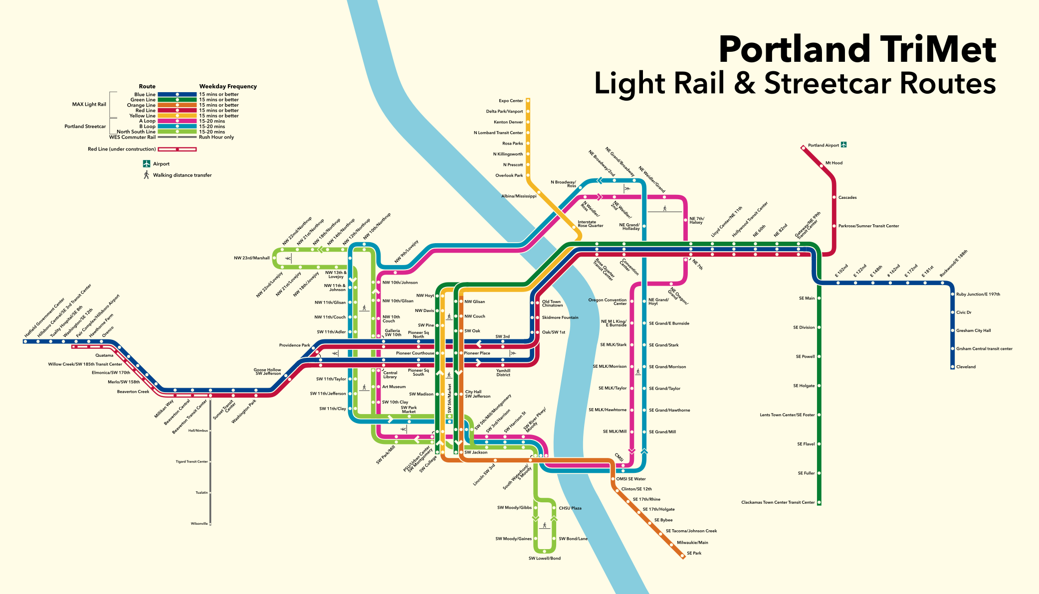
The Metropolitan Area Express (MAX) is a light rail system serving the Portland metropolitan area in the U.S. state of Oregon. Owned and operated by TriMet, it consists of five color-designated lines that altogether connect the six sections of Portland; the communities of Beaverton, Clackamas, Gresham, Hillsboro, Milwaukie, and Oak Grove; and Portland International Airport to Portland City Center. Service runs seven days a week with headways of between 30 minutes off-peak and three minutes during rush hours. In 2019, MAX had an average daily ridership of 120,900, or 38.8 million annually. Due to the COVID-19 pandemic, which impacted public transit use globally, annual ridership plummeted, with only 14.8 million riders recorded in 2021. MAX was among the first second-generation American light rail systems to be built, conceived from freeway revolts that took place in Portland in the early 1970s. Planning for the network's inaugural eastside segment, then re ... [...More Info...] [...Related Items...] OR: [Wikipedia] [Google] [Baidu] |
Old Town Chinatown, Portland, Oregon
Old Town Chinatown is the official Chinatown of the Northwest section of Portland, Oregon. The Willamette River forms its eastern boundary, separating it from the Lloyd District and the Kerns and Buckman neighborhoods. It includes the Portland Skidmore/Old Town Historic District and the Portland New Chinatown/Japantown Historic District, which are listed on the National Register of Historic Places. It has been referred to as the "skid row" of Portland. In the Northwest section, NW Broadway forms the western boundary, separating it from the Pearl District, and W Burnside Street forms the southern boundary, separating it from Downtown Portland. In the Southwest section, the neighborhood extends from SW 3rd Avenue east to the river and from SW Stark Street north to W Burnside Street (with the exception of areas south of SW Pine Street and west of SW 2nd Avenue, and south of SW Oak Street and west of SW 1st Avenue, which are part of Downtown). Despite the name, most Chinese-American ... [...More Info...] [...Related Items...] OR: [Wikipedia] [Google] [Baidu] |
Interstate 5 In Oregon
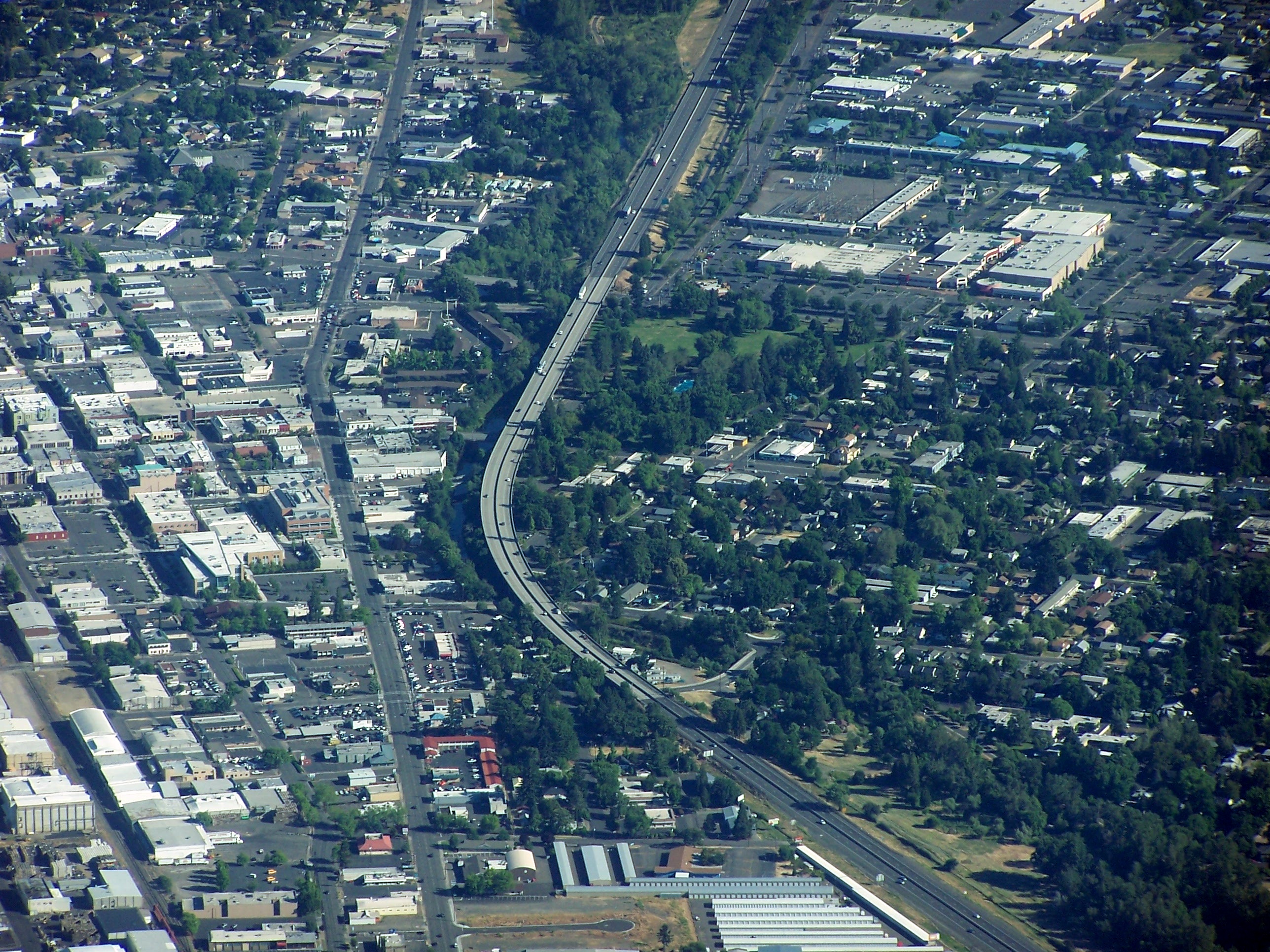
Interstate 5 (I-5) in the U.S. state of Oregon is a major Interstate Highway that traverses the state from north to south. It travels to the west of the Cascade Mountains, connecting Portland to Salem, Eugene, Medford, and other major cities in the Willamette Valley and across the northern Siskiyou Mountains. The highway runs from the California state line near Ashland to the Washington state line in northern Portland, forming the central part of Interstate 5's route between Mexico and Canada. I-5 was designated in 1957 and replaced U.S. Route 99 (US 99) for most of its length, itself preceded by the Pacific Highway and various wagon roads. The freeway incorporated early bypasses and expressways built for US 99 in the 1950s, including a new freeway route from Portland to Salem, and additional bypasses were built using federal funds. The last segment of I-5, on the Marquam Bridge in Portland, was opened in October 1966 and the whole highway was dedicated later t ... [...More Info...] [...Related Items...] OR: [Wikipedia] [Google] [Baidu] |
Harbor Drive
Harbor Drive is a short roadway in Portland, Oregon, spanning a total length of , which primarily functions as a ramp to and from Interstate 5. It was once much longer, running along the western edge of the Willamette River in the downtown area. Originally constructed from 1942–43, the vast majority of the road was replaced with Tom McCall Waterfront Park in the 1970s. Signed as U.S. Route 99W, it had been the major route through the city and its removal is often cited as the first instance of freeway removal in the U.S. and as a milestone in urban planning; the original road is remembered as the first limited-access highway built in the city. History Construction Harbor Drive opened in stages in 1942–43, with a formal dedication on November 20, 1942, and completion of the last work in 1943. Seventy-nine buildings and houses were demolished, mostly along Front Avenue, to make room for Harbor Drive. Although the project was criticized for the removal of some historic ... [...More Info...] [...Related Items...] OR: [Wikipedia] [Google] [Baidu] |
Portland Vintage Trolley
The Portland Vintage Trolley was a heritage streetcar service in Portland, Oregon, United States, that operated from 1991 to 2014. It operated on a portion of the MAX light rail system, and for a brief time also operated on the Portland Streetcar system, in downtown and nearby areas. Service was provided with replicas of a type of Brill streetcar, nicknamed the "Council Crest" cars, which last served Portland in 1950.Mayer, James (November 30, 1991). "Clang, clang, clang went Portland's new trolleys". ''The Oregonian'', p. B2. The service was managed by Vintage Trolley Inc., a non-profit corporation, and the cars were owned and operated by TriMet, Portland's transit agency. For 18 of its 23 years, the service followed a section of what is now the MAX Blue Line, between Lloyd Center and the west end of downtown. In September 2009, the route was changed to a section of the MAX system, along the transit mall in downtown Portland, from Union Station to Portland State University (P ... [...More Info...] [...Related Items...] OR: [Wikipedia] [Google] [Baidu] |
Trolleybus
A trolleybus (also known as trolley bus, trolley coach, trackless trolley, trackless tramin the 1910s and 1920sJoyce, J.; King, J. S.; and Newman, A. G. (1986). ''British Trolleybus Systems'', pp. 9, 12. London: Ian Allan Publishing. .or trolleyDunbar, Charles S. (1967). ''Buses, Trolleys & Trams''. Paul Hamlyn Ltd. (UK). Republished 2004 with or 9780753709702.) is an electric bus that draws power from dual overhead wires (generally suspended from roadside posts) using spring-loaded trolley poles. Two wires, and two trolley poles, are required to complete the electrical circuit. This differs from a tram or streetcar, which normally uses the track as the return path, needing only one wire and one pole (or pantograph). They are also distinct from other kinds of electric buses, which usually rely on batteries. Power is most commonly supplied as 600-volt direct current, but there are exceptions. Currently, around 300 trolleybus systems are in operation, in cities and towns in 4 ... [...More Info...] [...Related Items...] OR: [Wikipedia] [Google] [Baidu] |
Streetcar
A tram (called a streetcar or trolley in North America) is a rail vehicle that travels on tramway tracks on public urban streets; some include segments on segregated right-of-way. The tramlines or networks operated as public transport are called tramways or simply trams/streetcars. Many recently built tramways use the contemporary term light rail. The vehicles are called streetcars or trolleys (not to be confused with trolleybus) in North America and trams or tramcars elsewhere. The first two terms are often used interchangeably in the United States, with ''trolley'' being the preferred term in the eastern US and ''streetcar'' in the western US. ''Streetcar'' or ''tramway'' are preferred in Canada. In parts of the United States, internally powered buses made to resemble a streetcar are often referred to as "trolleys". To avoid further confusion with trolley buses, the American Public Transportation Association (APTA) refers to them as "trolley-replica buses". In the United ... [...More Info...] [...Related Items...] OR: [Wikipedia] [Google] [Baidu] |
Horsecar
A horsecar, horse-drawn tram, horse-drawn streetcar (U.S.), or horse-drawn railway (historical), is an animal-powered (usually horse) tram or streetcar. Summary The horse-drawn tram (horsecar) was an early form of public rail transport, which developed out of industrial haulage routes that had long been in existence, and from the omnibus routes that first ran on public streets in the 1820s{{{citation needed, date=February 2022, using the newly improved iron or steel rail or ' tramway'. They were local versions of the stagecoach lines and picked up and dropped off passengers on a regular route, without the need to be pre-hired. Horsecars on tramlines were an improvement over the omnibus, because the low rolling resistance of metal wheels on iron or steel rails (usually grooved from 1852 on) allowed the animals to haul a greater load for a given effort than the omnibus, and gave a smoother ride. The horse-drawn streetcar combined the low cost, flexibility, and safety of an ... [...More Info...] [...Related Items...] OR: [Wikipedia] [Google] [Baidu] |
Arcadia Publishing
Arcadia Publishing is an American publisher of neighborhood, local, and regional history of the United States in pictorial form.(analysis of the successful ''Images of America'' series). Arcadia Publishing also runs the History Press, which publishes text-driven books on American history and folklore. History It was founded in Dover, New Hampshire, in 1993 by United Kingdom-based Tempus Publishing, but became independent after being acquired by its CEO in 2004. The corporate office is in Mount Pleasant, South Carolina. It has a catalog of more than 12,000 titles, and italong with its subsidiary, The History Presspublishes 900 new titles every year. Its formula for regional publishing is to use local writers or historians to write about their community using 180 to 240 black-and-white photographs with captions and introductory paragraphs in a 128 page book. The ''Images of America'' series is the company's largest product line. Other series include ''Images of Rail, Images of Spo ... [...More Info...] [...Related Items...] OR: [Wikipedia] [Google] [Baidu] |
Oregon-Washington Railroad And Navigation Company
The Oregon Railroad and Navigation Company (OR&N) was a railroad that operated a rail network of running east from Portland, Oregon, United States, to northeastern Oregon, northeastern Washington, and northern Idaho. It operated from 1896 as a consolidation of several smaller railroads. OR&N was initially operated as an independent carrier, but Union Pacific (UP) purchased a majority stake in the line in 1898. It became a subsidiary of UP titled the Oregon–Washington Railroad and Navigation Company in 1910. In 1936, Union Pacific formally absorbed the system, which became UP's gateway to the Pacific Northwest. Predecessors The OR&N was made up of several railroads: *Columbia Southern Railway from Biggs to Shaniko, Oregon. *Oregon ''Railway'' and Navigation Company traces its roots back as far as 1860. It was incorporated in 1879 in Portland, Oregon and operated between Portland and eastern Washington and Oregon until 1896, when it was reorganized into the Oregon ''Railroad'' ... [...More Info...] [...Related Items...] OR: [Wikipedia] [Google] [Baidu] |
Kansas City, Missouri
Kansas City (abbreviated KC or KCMO) is the largest city in Missouri by population and area. As of the 2020 census, the city had a population of 508,090 in 2020, making it the 36th most-populous city in the United States. It is the central city of the Kansas City metropolitan area, which straddles the Missouri–Kansas state line and has a population of 2,392,035. Most of the city lies within Jackson County, with portions spilling into Clay, Cass, and Platte counties. Kansas City was founded in the 1830s as a port on the Missouri River at its confluence with the Kansas River coming in from the west. On June 1, 1850, the town of Kansas was incorporated; shortly after came the establishment of the Kansas Territory. Confusion between the two ensued, and the name Kansas City was assigned to distinguish them soon after. Sitting on Missouri's western boundary with Kansas, with Downtown near the confluence of the Kansas and Missouri Rivers, the city encompasses about , making ... [...More Info...] [...Related Items...] OR: [Wikipedia] [Google] [Baidu] |
Waddell & Harrington
Waddell & Harrington was an American engineering company that designed bridges from 1907 to 1915. It was formed in 1907 as a partnership of John Alexander Low Waddell (1854–1938) and John Lyle Harrington (1868–1942) and was based in Kansas City, Missouri, but had offices in Portland, Oregon, and Vancouver, British Columbia. The company designed more than 30 vertical-lift bridges for highways and railroads.See list of Waddell & Harrington bridges in Appendix A of Historic American Engineering Record (HAER) No. IL-156"Pittsburgh, Fort Wayne & Chicago Railway, Calumet River Bridge" pp. 50-52. The firm also designed one or more non-lift bridges, including the Colorado Street Bridge of Pasadena, California. A number of its works are listed on the U.S. National Register of Historic Places (NRHP). Notable projects Bridges designed by the firm include the following, among others: *Hawthorne Bridge, spanning the Willamette River in Portland, Oregon, NRHP-listed *Interstate Bridg ... [...More Info...] [...Related Items...] OR: [Wikipedia] [Google] [Baidu] |


